04/13 Ryan's "Windy" Tuesday Night Forecast
Strong, gusting winds followed our active afternoon as showers and thunderstorms moved through. The rain will dry up through the night, but come back quickly tomorrow.
Strong, gusting winds followed our active afternoon as showers and thunderstorms moved through. The rain will dry up through the night, but come back quickly tomorrow.
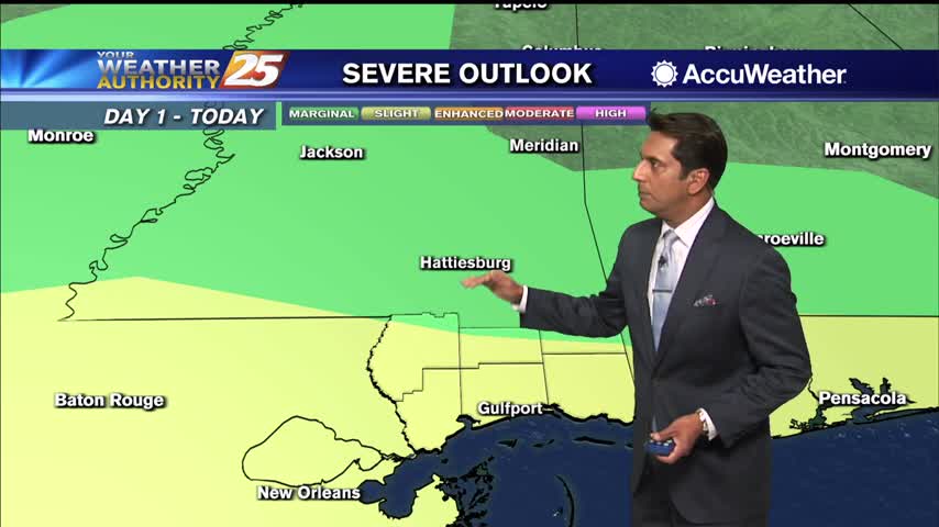
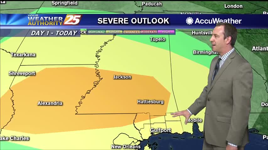
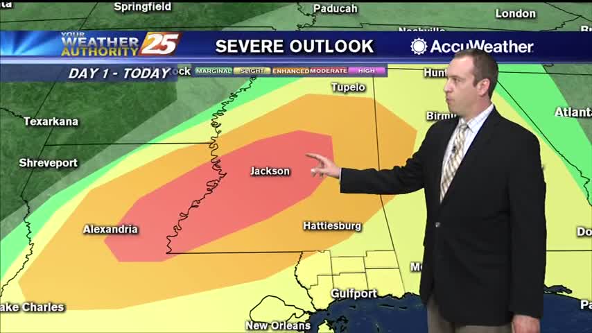
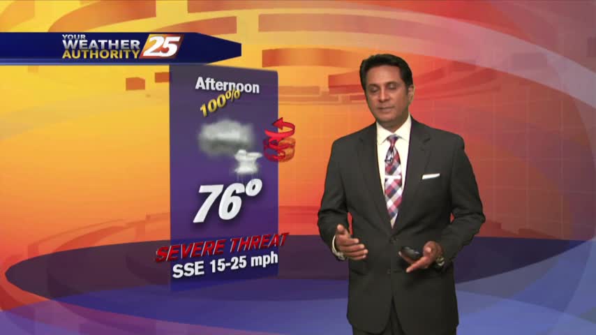
There is a MARGINAL/SLIGHT risk for severe thunderstorms this evening for south Mississippi.
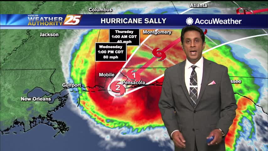
Strong winds and rainfall continue to affect the local area as HURRICANE SALLY is making landfall along the Pensacola area...
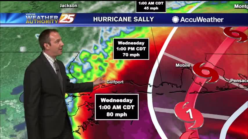
Sally has weakened a bit, but remains a category one hurricane bringing plenty of rain to the MS/AL/FL coastal areas.
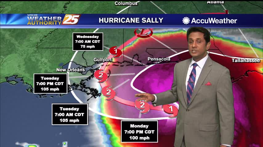
Clouds continue to move into the area as we are focused on HURRICANE SALLY in the Ne'tern GOM...
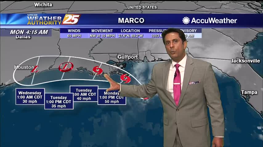
With TS Marco well south of the area, feeder bands of rain and winds are beginning to move into south Mississippi...
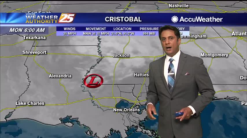
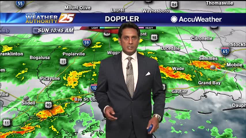
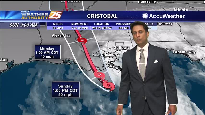
Cristobal now W/NW of Lake Pontchartrain continues to bring HEAVY RAIN and STRONG WINDS to South Mississippi...
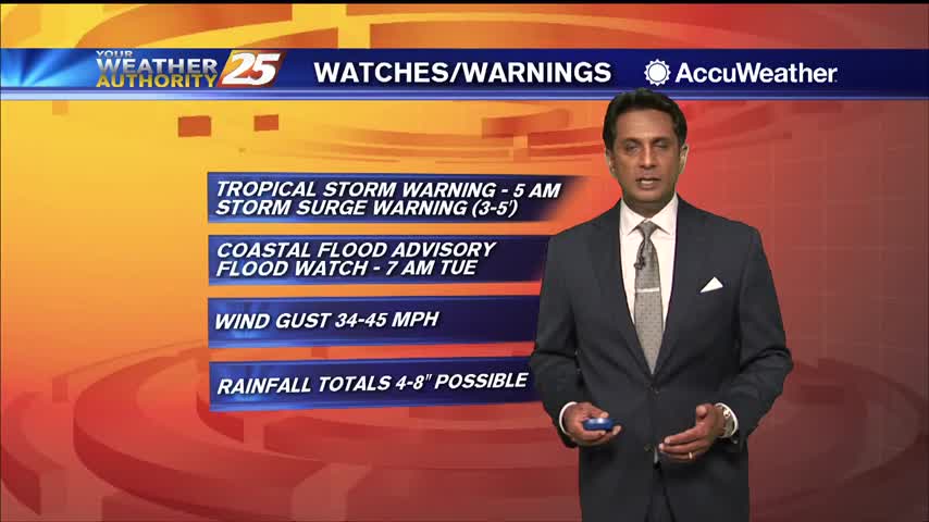
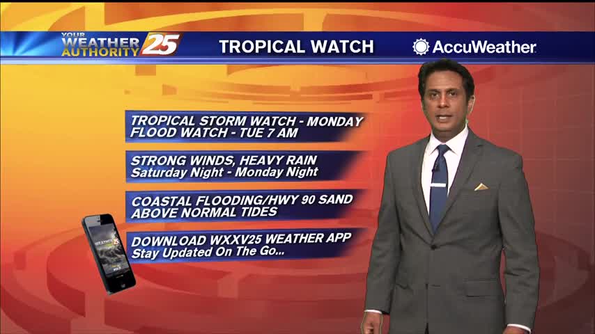
South Mississippi continue to be under a TROPICAL STORM watch...
TS Cristobal continues to move closer to the SE Louisiana coast with landfall a bit earlier than projected...
TS Cristobal continues to move North towards the SE Louisiana coast...
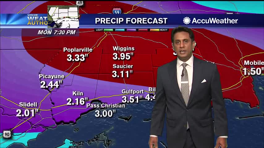
Feeder bands moving across south Mississippi bringing heavy rains and strong winds...
A very HOT day as the humid flow continues to move in from the Gulf of Mexico...
They dry conditions haven't helped in regards to the Canal Road fire, but the humidity is slowly rising and rain is expected overnight and tomorrow.
Expecting showers to get going a little after midnight, but stronger, potentially severe storms are likely before sunrise.
A cold front is moving in and strong thunderstorms are likely overnight before nicer weather moves in.
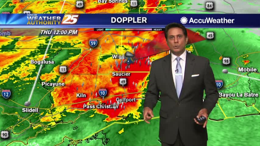
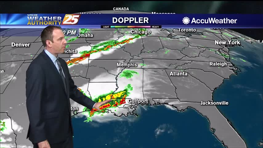
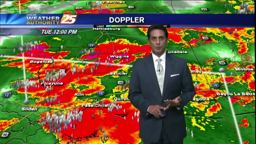
Showers and t-storms continue to move into south Mississippi with a TORNADO WATCH in effect through 3 PM...
A warm & windy start to the day as the system west continues to move east and develop...
After a warm/humid start...showers and t-storms developed with STRONG/SEVERE storms moving across the viewing area...
Another rain-free start but the activity is beginning to build, so expect early morning showers and then t-storms...