
11/10 - Trey's "Stationary Boundary" Friday Evening Forecast
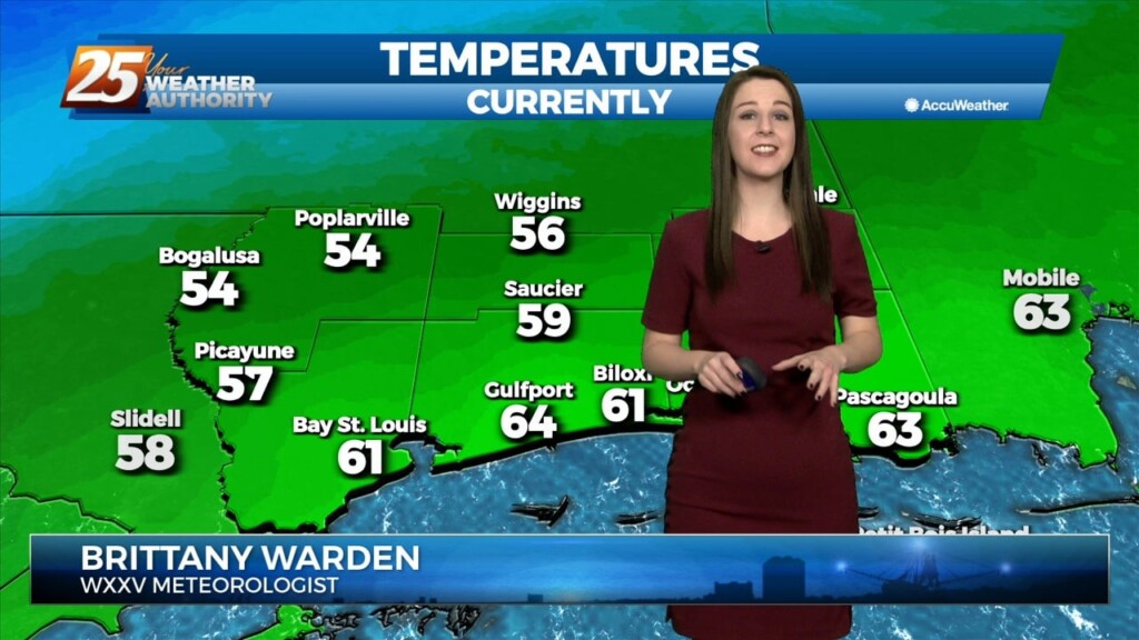
A cold front has been slowly inching its way through the local area today and currently stretches along the I-59 corridor southwestward to near the mouth of…
A cold front has been slowly inching its way through the local area today and currently stretches along the I-59 corridor southwestward to near the mouth of…
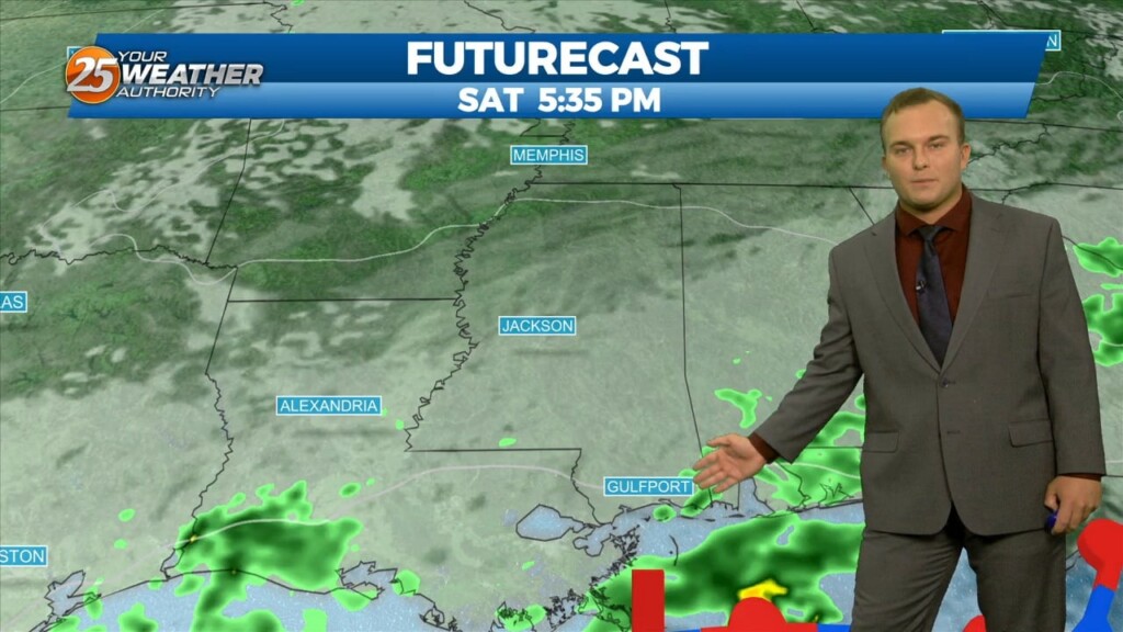
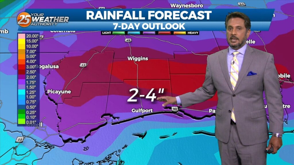
Rain will fill back in this afternoon and especially into this evening. Expect heavy rain at times as a cold front makes its way through…
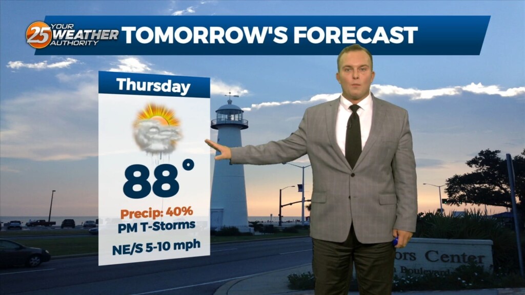
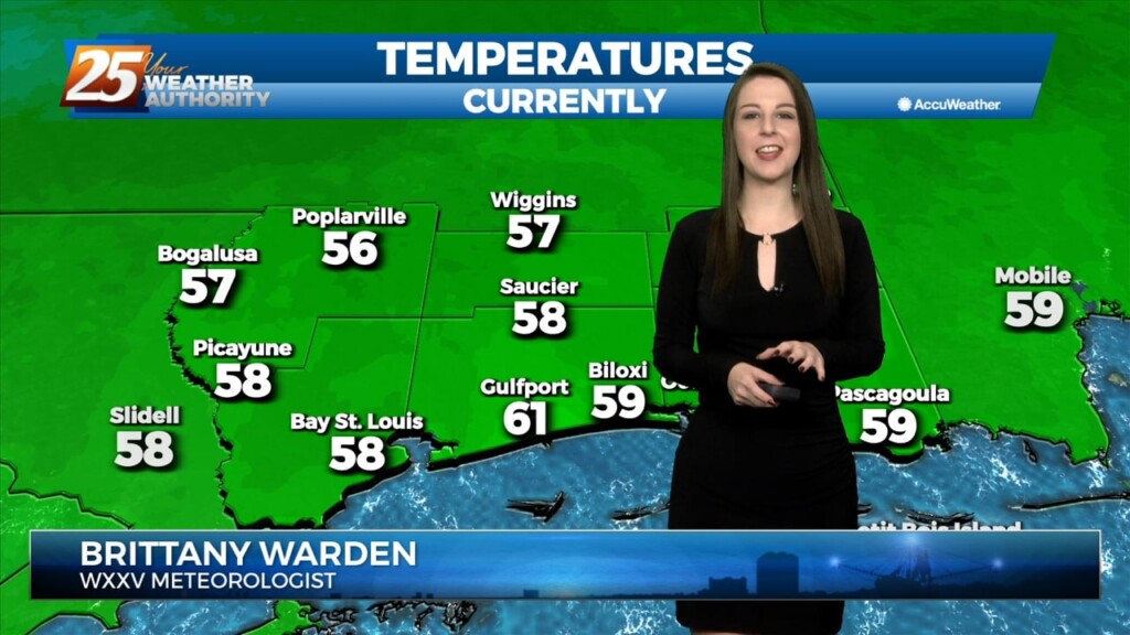
Rain chances will come to an end overnight and skies will clear somewhat towards daybreak. Your Thursday will start off mild and be dominated by cloud cover with…
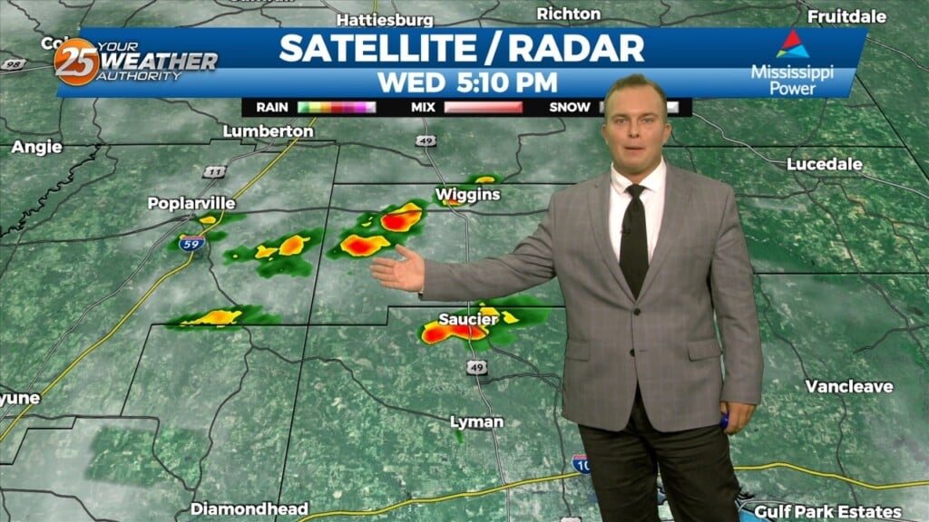
It will remain mostly cloudy through much of the evening. Rain chances will remain at bay for a few hours before isolated thunderstorms chances will be around…
Partly cloudy skies and muggy conditions can be expected overnight. A 20% chance of rain near the beachfront cannot be ruled out around daybreak. Humid conditions will remain…
Clearing has taken place through much of this afternoon. There will still be a 20% chance of rainfall this evening from isolated shower activity. It will…
Upper level high pressure is currently entered over the Gulf of California extending northward through the northern Rockies. Weakness extended from the Appalachians into…
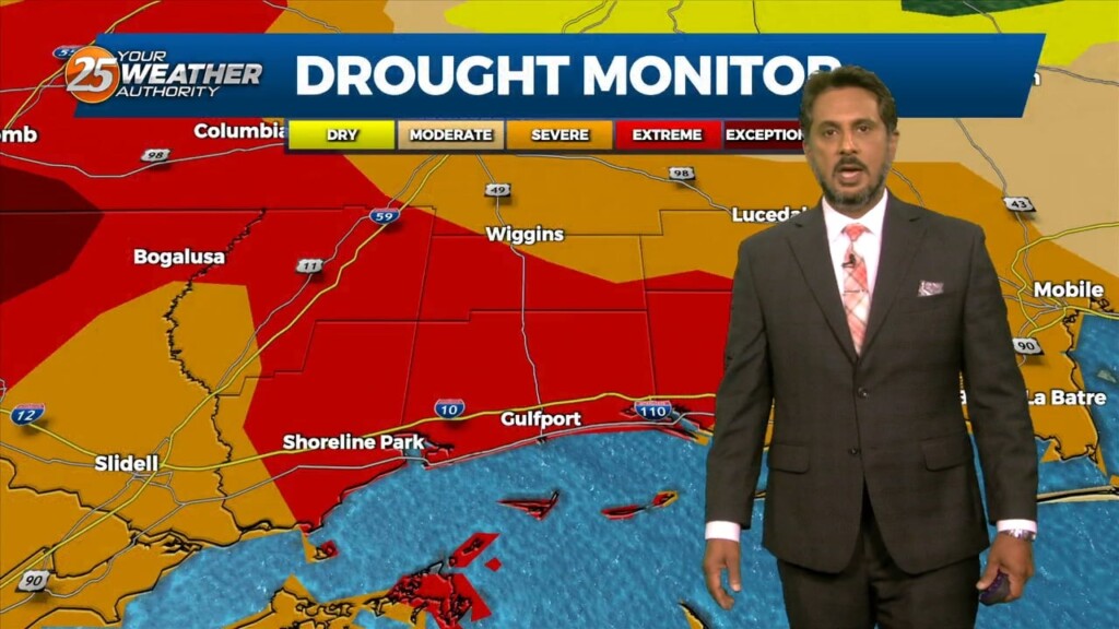
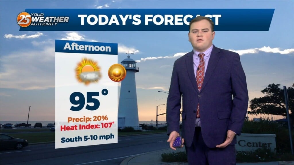
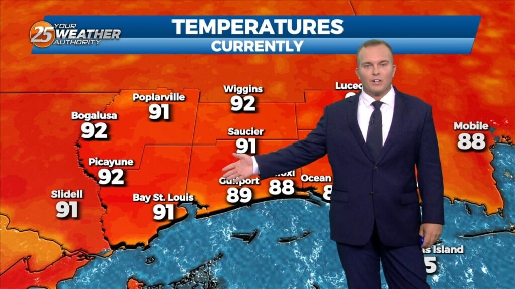
The stationary front in central Mississippi yesterday has retreated well to the north this afternoon with high pressure in the Gulf. A HEAT ADVISORY is in effect until 7 pm for heat indices of 106-114. Any showers or thunderstorms that…
The stationary front in central Mississippi yesterday has retreated well to the north this morning with high pressure in the Gulf. A HEAT…
This afternoon there is a weak stationary front to the north of our area. This front will begin to move closer to the area later this afternoon, before…

This morning there is a weak stationary front to the north of our area. This front will begin to move closer to the area this afternoon, before…
Expect clear skies out the door tomorrow and fairly mild temperatures. Humidity will remain out of the picture for the next couple of days as…
A stationary front moving through our area ushered in a change to the feel of the air. Somewhat drier and milder air is around for the first part…
This morning there is an area of low pressure situated over the AR/LA/TX region with a decaying stationary front north of our area. Out ahead of…
Just like the past couple of days there is as stationary front to the north of our area this morning. In the Gulf of Mexico high pressure…
Currently there is a stationary front to the north of the I-20 corridor with showers and thunderstorms to the south of it. This afternoon will bring partly cloudy…
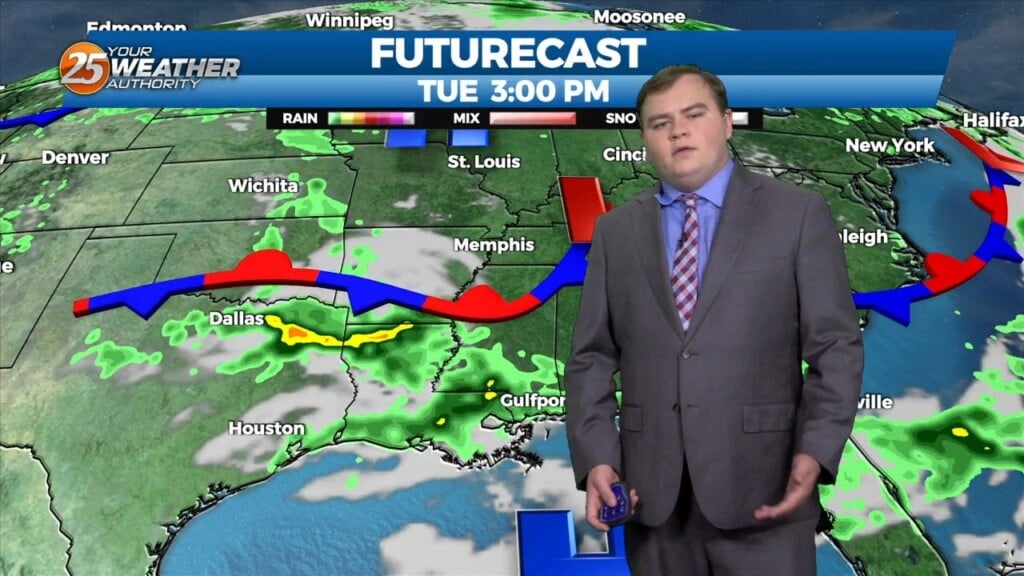
With a disturbance over the Great Lakes, and another disturbance over the northwest, we look to stay in zonal flow for the next couple of days, keeping…
Warm and breezy conditions have been present much of the day with very limited, if any sunshine. Clouds will dissipate slightly this evening only before the clouds…
Today will be much like yesterday with clearing skies and very warm temperatures. Overnight, clouds will build back in and light fog is possible. Things begin to…
No real changes in the thinking regarding the short term forecast. Stationary front near the mouth of the MS River will continue to serve as a focus…
Upper level analysis shows a ridge centered just south of Florida, a broad trough over the northern half of the country east of the Rockies and a…
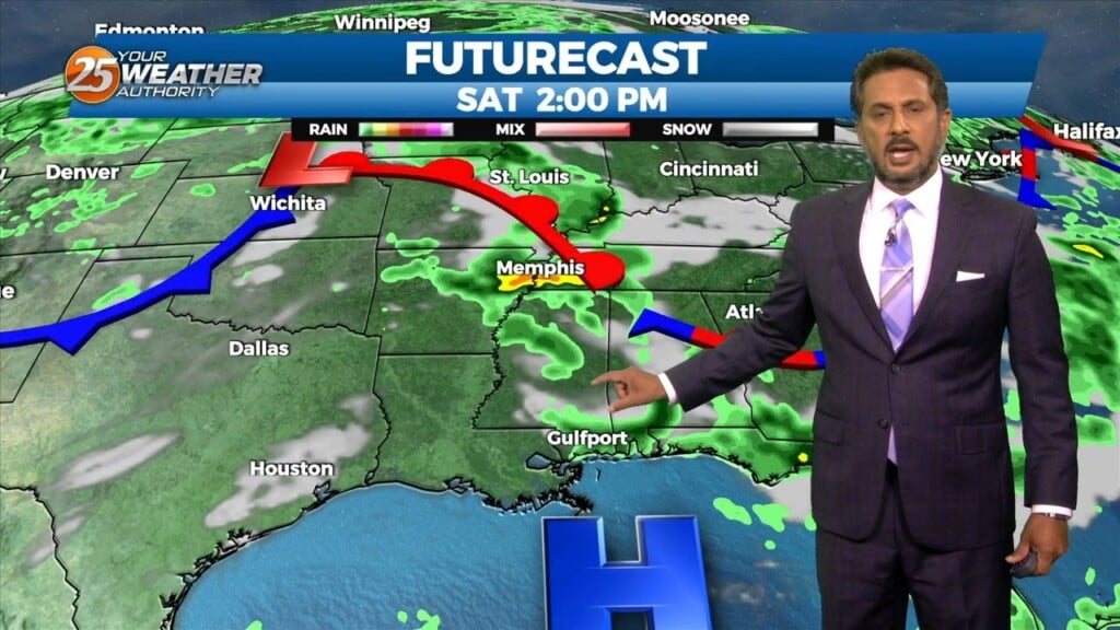
Main concern in the short term will be rain potential the next 48 hours but when will rain actually reach the ground is more of an unknown.…
Going into Friday, the surface high steadily builds east into New England, as we begin to see less in the way of influence over the region. We in turn…
Another pleasant day in the books this afternoon with ample blue skies and warm, yet rather comfortable temperatures. Taking a brief overview of the regional synopsis shows…