05/25 Ryan's "Muggy Night" Monday Forecast
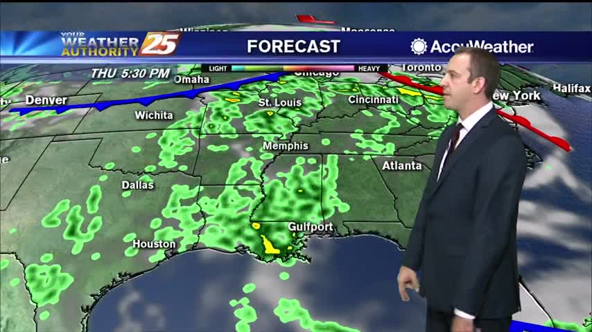
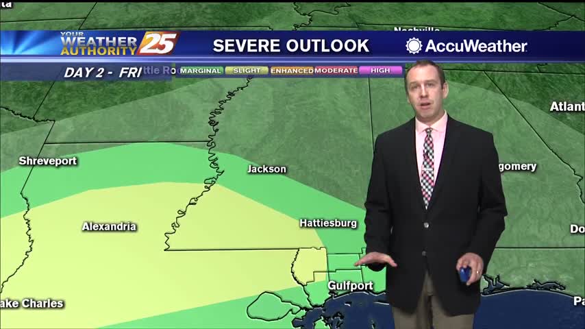
Little more rain tomorrow than we saw today, but not much changes for the rest of the week heat/humidity-wise.

Little more rain tomorrow than we saw today, but not much changes for the rest of the week heat/humidity-wise.
The high humidity isn't going anywhere, so get ready for more of the same, but with more afternoon shower activity.

The afternoon rain has dried up and the clouds are clearing, but they'll be back before long....
Cloudy and dark end to the day today, but we'll see more sun ahead! More rain too though...

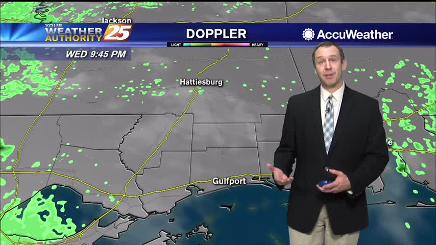
Didn't see much rain in South MS today, but we'll see a little more in the days ahead.
Rain has been hard to come by, but gloomy weather remains in place across the coast.

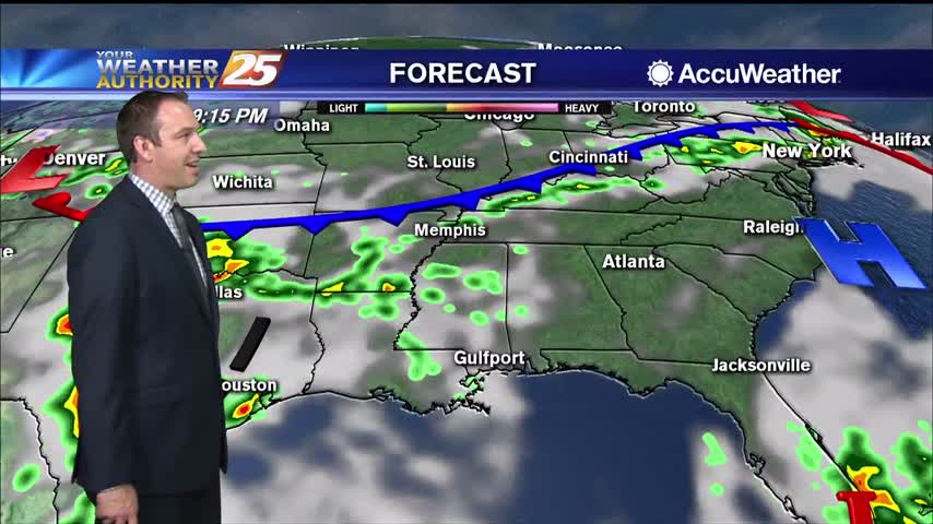
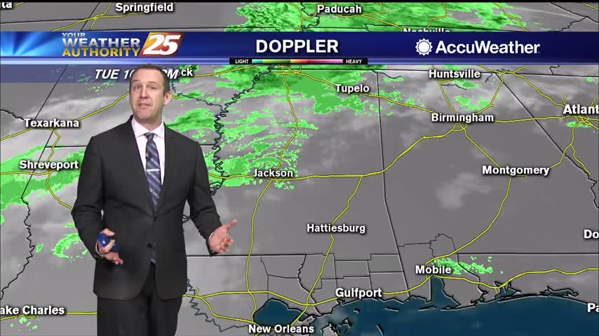
Heavy rainfall has fallen just to the west, but so far very little has moved into South MS. More is on the way though.

Much more cloudy today than recent days and with our first "active" weather in over a week!
Warm and humid like the last few days have been, but now much more cloudy...something that won't change for the rest of the week.
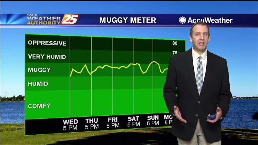
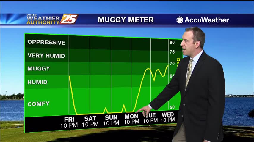
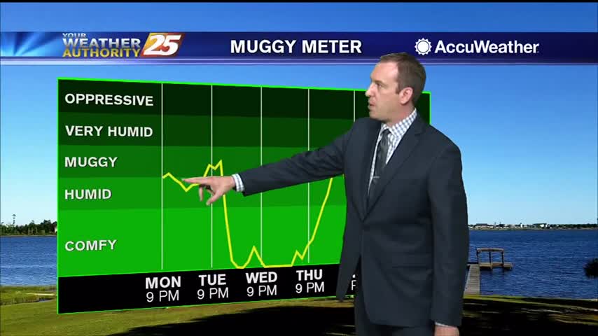
A stiff southerly breeze has increased dewpoints into "muggy" territory, and it doesn't get much better until next week.
Not too bad today or tonight, but the temperatures and humidity levels will steadily rise into next week.
Today was the last day with comfortable humidity we'll see for a while, and it'll only get hotter as well.
Going to be a good bit warmer than it was last night, but the humidity won't increase dramatically until later in the week.
It's warmed steadily through the weekend, but the humidity hasn't risen much. That changes quickly later on this week.
We saw showers and thunderstorms through the evening, but the rain has stopped and even the skies will begin to clear into the weekend.
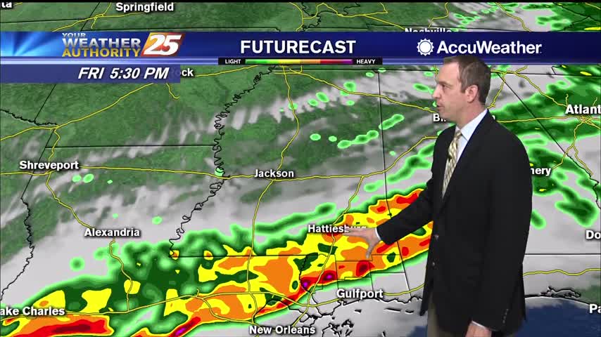
A cold front is bringing a line of storms for the evening, but expect to see clearing through the early morning hours.
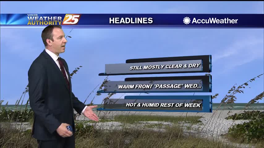
Still clear and dry tonight, but clouds, rain, and higher humidity move in quickly tomorrow afternoon!
Dry air remains in place, but we'll see rapid changes to that and even potential thunderstorms moving in tomorrow.

Hot, dry conditions aren't helping the multiple fires in the South MS area, but showers are on the way...just not immediately.

It's been quite hot over the last few days and still was today, but cooler air is on the way.

Today was one of the hottest we've seen so far, but some slight relief is on the way.

Much hotter today, but some slight relief is on the way as a front moves through.
The weather will remain nice, but heats up tomorrow before a slight cool-down and some end of week rain.

The humidity and temperature have been slowly rising through the weekend, but will rise sharply tomorrow before a slight cool-down.