10/17 - Rob's "Return To Workweek" Forecast
As low-level humidity has been on the increase...areas of PATCHY FOG has developed. A DENSE FOG ADVISORY is in effect through 9 a.m...
As low-level humidity has been on the increase...areas of PATCHY FOG has developed. A DENSE FOG ADVISORY is in effect through 9 a.m...
After patchy fog earlier this morning, we have BEAUTIFUL mid-October conditions to close-out the workweek...

It's another cool start on this Friday morning with temps averaging 60 degrees, and areas of patchy fog...
A mild start to the day with slightly warmer temperatures and areas of PATCHY DENSE FOG this morning...
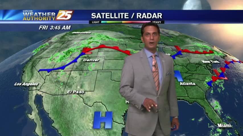
As high-pressure continues to dominate the area, patchy DENSE fog has developed along the southern 6...
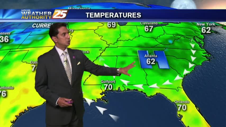
It's a chilly start for your Columbus Day mornings as high-pressure continues to dominate the region. A BEAUTIFUL day is on-tap...
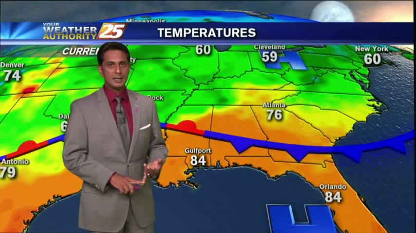
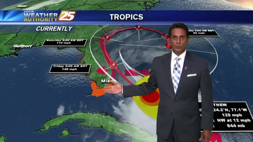
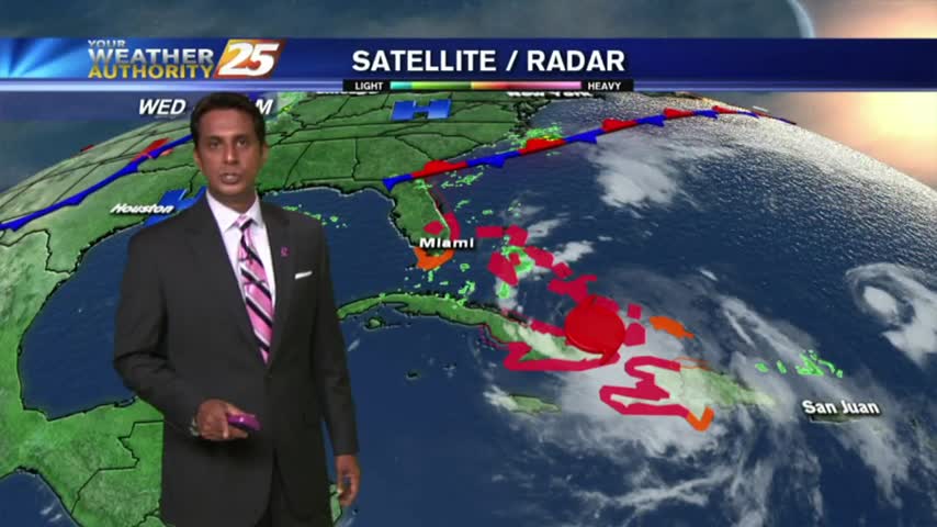
As hurricane Matthew pounds Florida, a dry north wind along the Gulf coast has very pleasant conditions to close-out the workweek...
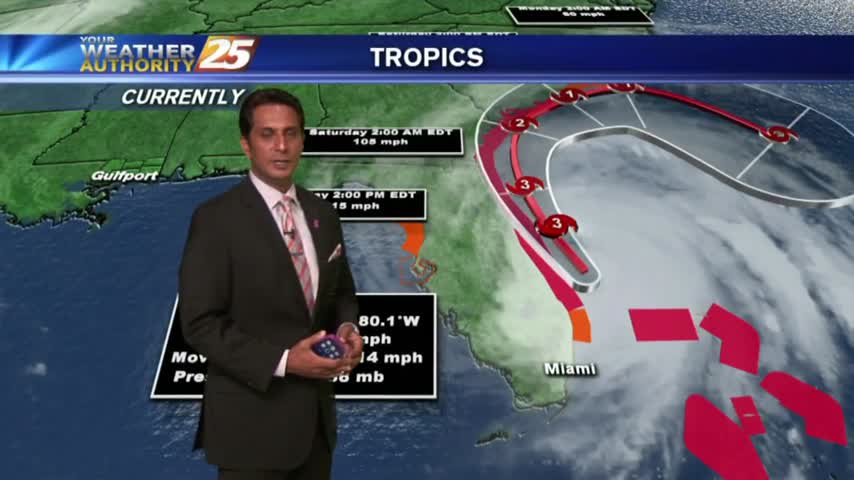
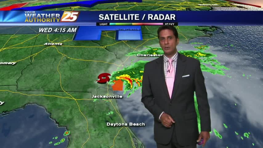
High-pressure dominance continues along the Gulf Coast as MAJOR HURRICANE MATTHEW heads towards the Florida coast...
Another dry but humid start to the day as high-pressure dominance of the Gulf south continues...
Another beautiful start as high pressure and a north wind continues to pool cooler/drier air into the Gulf coast...
After a BEAUTIFUL weekend, warmer and more humid conditions are in the area to kick-off the workweek...
It's an ABSOLUTELY beautiful start heading into the weekend. In the wake of a cold front...cooler and drier continues to move into the gulf south...
It's a BEAUTIFUL start as cooler/drier air moves into the region. Areas of patchy fog has developed along the coastal counties...
As the cold front moves east, a few clouds are in the area with mild temps and decreasing humidity...
As the cold front begins to slow down and stall in central Mississippi, areas of PATCHY FOG has developed along the southern 6...
As a cold front is moving into the region, it's a warm & humid start to the workweek...
Humidity has been on the increase over the past couple day...this afternoon HOT conditions will trigger a few t-storms...
As low-level humidity continue to increase, it's a warm & humid start with areas of PATCHY FOG...

After a southerly wind much of yesterday, increasingly humid conditions have developed with warm temps...
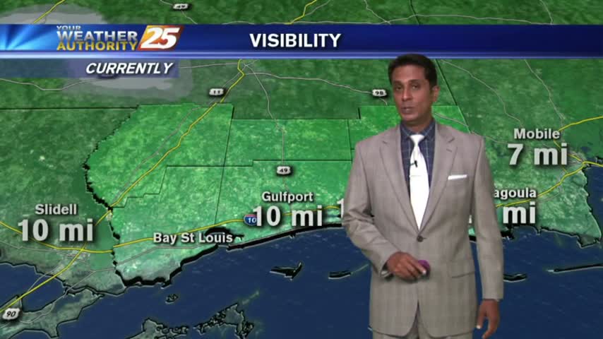
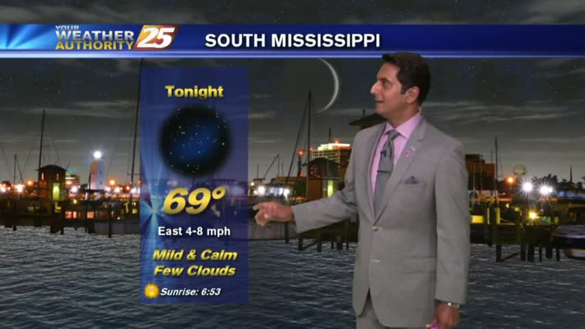
As dry air continues to move into the Gulf coast, temps have fallen into the upper 60s under clear skies...
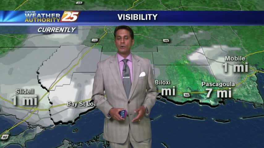
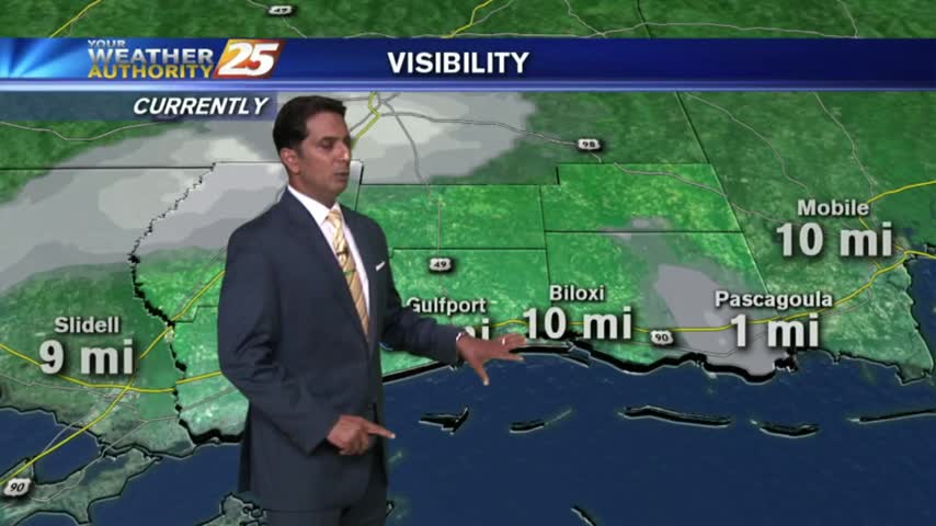
PLEASE BE CAREFUL - Areas of patchy DENSE FOG has developed for your morning commute...
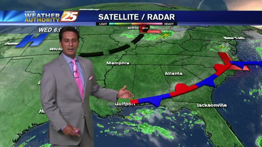
Isolated morning rain is moving in from the Gulf/Sound, with the activity expected to increase...
It's a BEAUTIFUL morning with mostly clear skies, but isolated showers are over the sound moving west...
Early morning showers and t-storms continue over the northern Gulf and sound...moving to the NW.