6/7 - The Chief's "Pleasant Start" FriYay Morning Forecast
The very weak front has finally settled and now stalled in the outer-coastal waters. The drying throughout the column has been achieved bringing rain chances close to…
The very weak front has finally settled and now stalled in the outer-coastal waters. The drying throughout the column has been achieved bringing rain chances close to…
A cold front is currently slowly moving south through the area this morning. This boundary will be very important for this forecast, as it will…
The WIND ADVISORY will continue through this evening before the flow begins to weaken. Breezy conditions will continue overnight with winds around 15 mph…which means the…
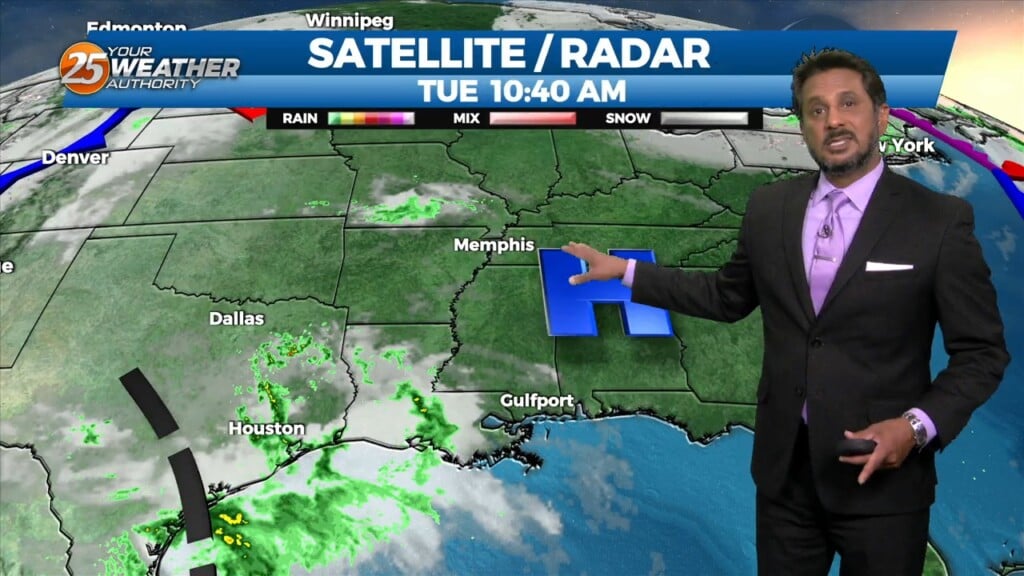
Fog development has been hampered this morning due to the increase in surface winds due to the developing surface low over the central US, this…

High pressure remains dominate over the area and this will remain the case into mid-week. A few showers could tickle the coast from time…
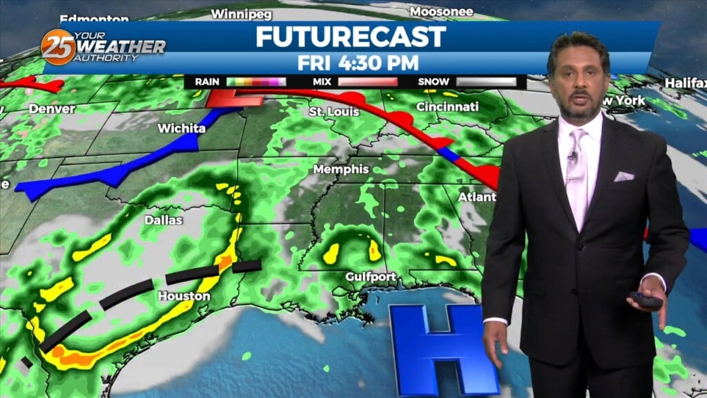
A stalled stationary front just north will push south by early afternoon bringing subtle (nice) changes. This will also keep most activity over the marine areas…
A closed mid-level low pressure system over TX is more of a double barrel low as the eastern portion of the low led to all of…
A weak disturbance moving across Louisiana will move across the local area late this afternoon and tonight. Considering the dry airmass, I don’t anticipate any precipitation,…
Starting out with early this morning, geez it's a bit muggy! Moist, onshore return flow continues to pump low to mid 70 dew-points well north…
A disturbance over extreme eastern Texas will likely continue to drive t-storm development this morning as the boundary continues to sink southward. Expect this boundary to be…
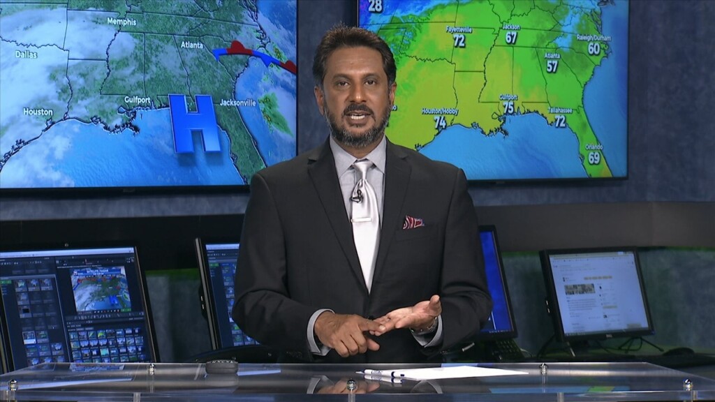
Currently there is an area of high pressure over western Cuba, and a trough extending from the Great Lakes to the central California coast are combining to produce…
High pressure to the NW will continue to move in and shape the forecast into the weekend. With insolation during the afternoon hours, expect temperatures to…
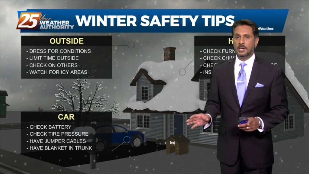
The coldest air of the season is approaching, with a very uncomfortable few days ahead. Current expectation is that cold front will reach the extreme…
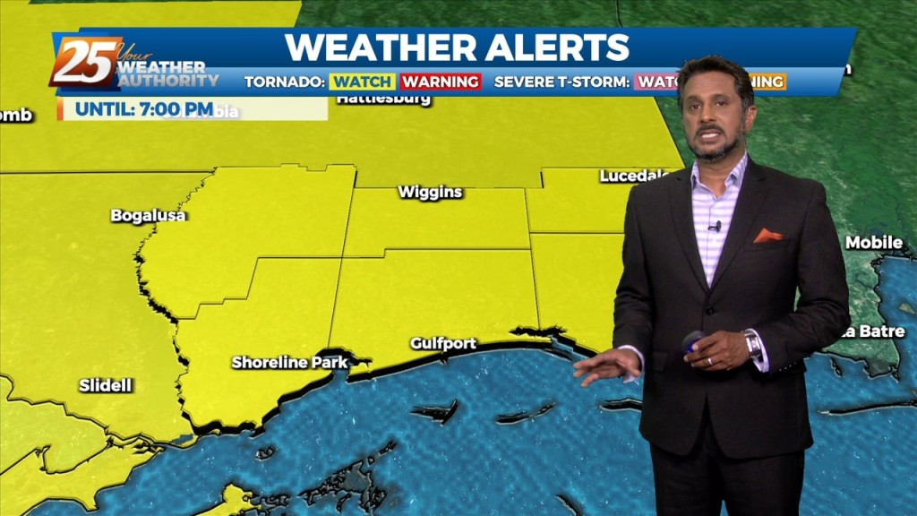
Issued By New Orleans/Baton Rouge - LA, US, National Weather Service Affected Area: Mississippi Sound Description: THE NATIONAL WEATHER SERVICE HAS ISSUED TORNADO WATCH 558 IN EFFECT UNTIL 7…
As the high pressure remains seated over the Bahamas warm and moist air advection continues to be brought in from the Gulf. While there is the possibility of…
Very nice conditions will remain for the next several days. Another cold front will move through the area Wednesday night into Thursday morning bringing a continuation of…