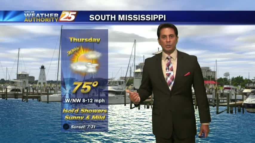
11/19 - Rob Knight's "Return of Seasonal Temps" Morning Forecast
Warmer temperatures this morning with a return to seasonal high temperatures ahead...
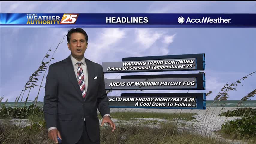
Warmer temperatures this morning with a return to seasonal high temperatures ahead...
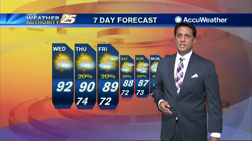
Clear skies on this Wednesday morning with humid conditions and areas of patchy fog...
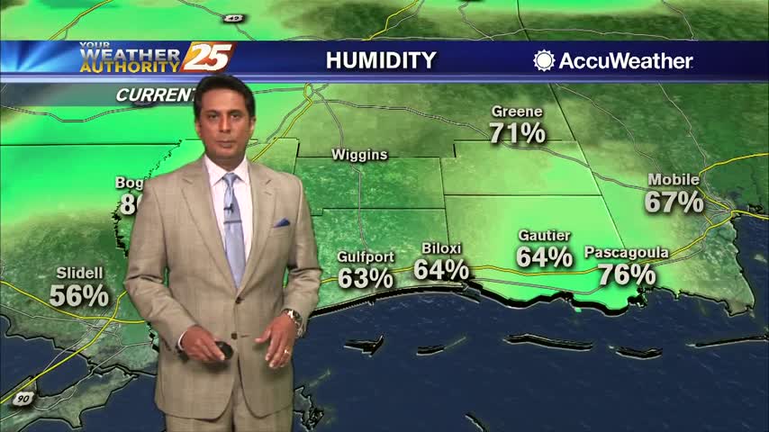
A warmer start this morning as the humid flow has returned to south Mississippi...
Another warm start to the day with just a few upper-level clouds to our W/SW...
As the front from last night continues to move east, you're heading out the door under mostly cloudy skies...
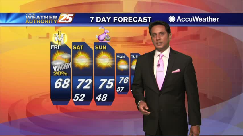
With the colder/drier air mass still in place, it's a CHILLY start on this Final Monday of February...

Another VERY WARM start with elevated humidity and WIDESPREAD DENSE FOG...
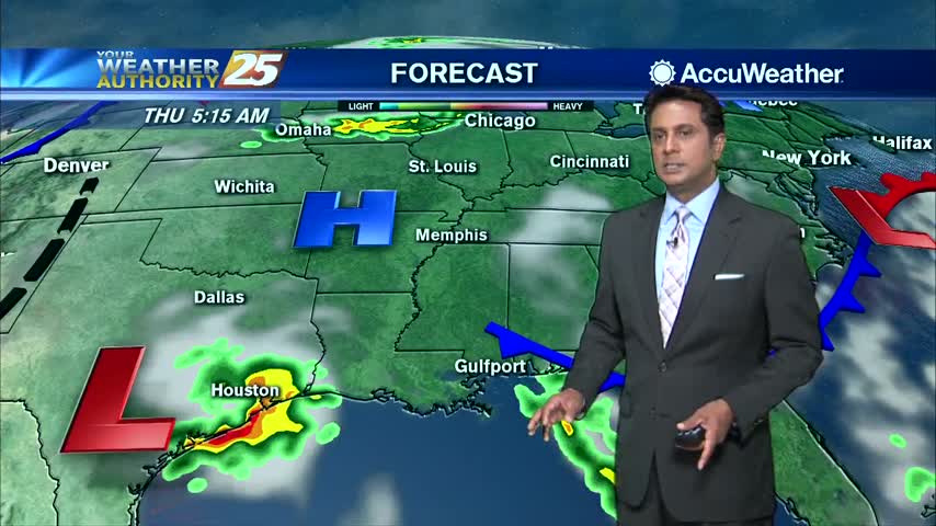
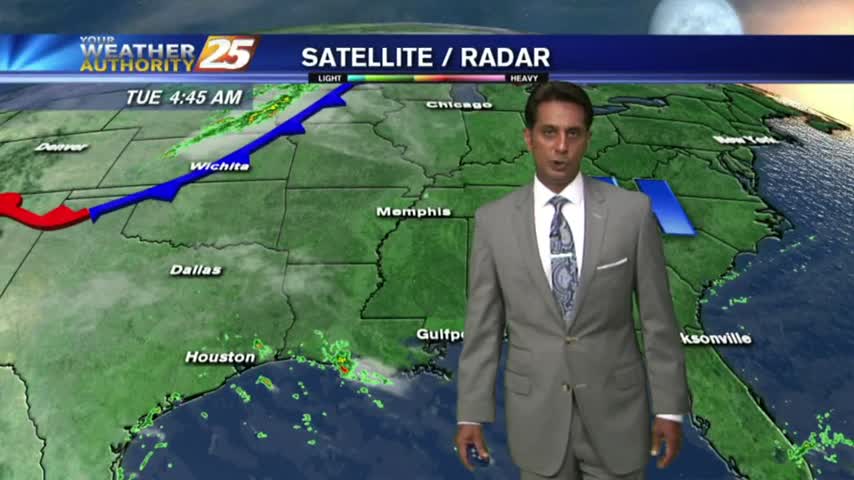
Rain is currently moving across the area as a vigorous cold front overhead is moving east...

A better start this morning with only light fog along the viewing area...
Another WARM/HUMID start as upper-level clouds moving across the area are thinning...
Similar to yesterday morning, isolated showers from the northern GOM, moving NE are dissipating along the beach...
As a weak cold front moves through the area, showers and a few t-storms are in the vicinity...
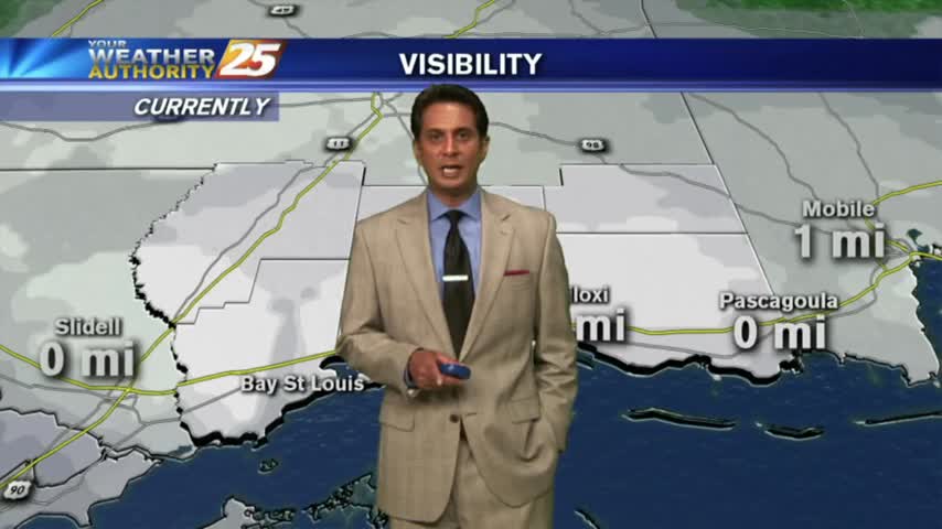
With a VERY warm/humid air mass in place in advance of a cold front, DENSE FOG has developed with an advisory in effect through mid-morning...
The majority of rain including HEAVY RAIN stayed west of our area yesterday, with a rain-free start this morning...

A mild and humid start to the final morning of Summer 2017. The SUMMER-LIKE temperatures will unfortunately continue...