11/12 Ryan's "Another Damp Start" Tuesday Morning Forecast
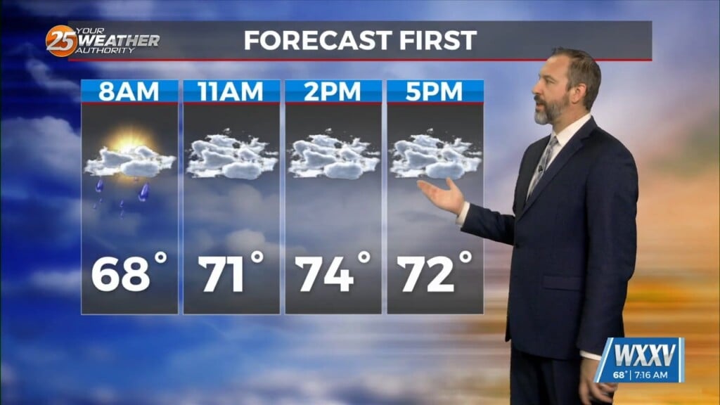
We're off to another damp start today, though unlike yesterday we won't see the sun peaking through this afternoon. I expected we'd see some clearing yesterday as we…
We're off to another damp start today, though unlike yesterday we won't see the sun peaking through this afternoon. I expected we'd see some clearing yesterday as we…

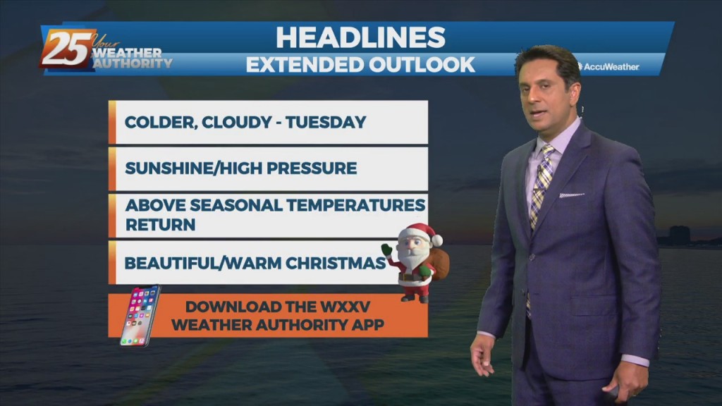
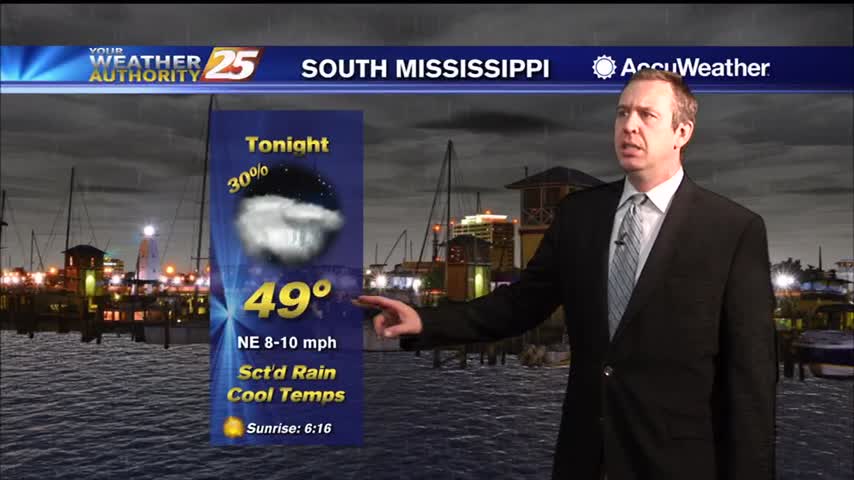
Thursday starts off cool/chilly but it will be milder than the last couple of mornings. Cloud cover will be around through the day tomorrow as an active…
Relatively nice conditions we experienced this afternoon will give way to a cool evening. Temperatures overnight will not be as chilly as this morning and winds will be…
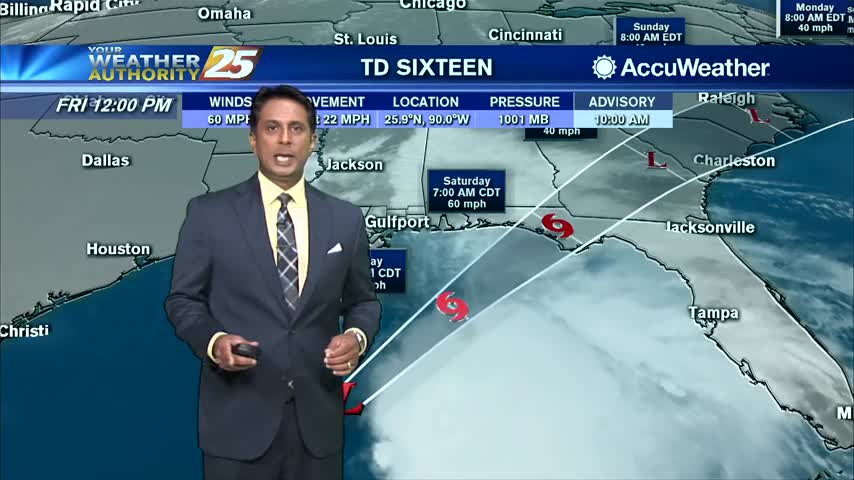
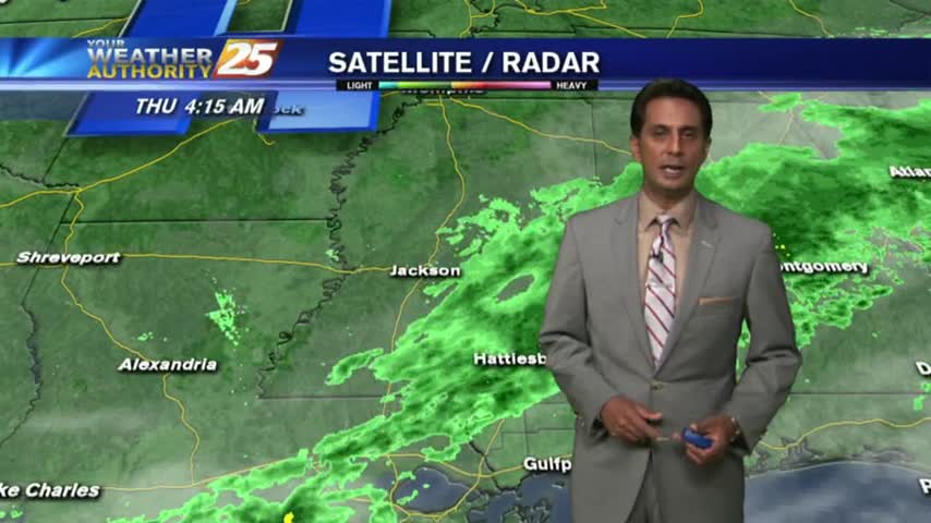
The upper level support for the system to the SW has now moved to the NE. The surface feature is to the south of the…
A fast moving low-pressure system along the northern Gulf will continue to move NE. This trajectory will keep the area on the cooler and more stable side of…
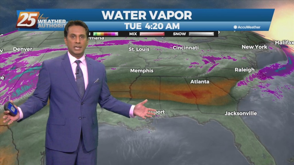
Forecast issue over the next few days will be the location of the current frontal boundary. I don't expect much movement with the front now south…
I expected at least a few heavy showers this afternoon, but so far only a light rain over most of South MS. The light rain will continue, but…
I expected at least a few heavy showers this afternoon, but so far only a light rain over most of South MS. The light rain will continue, but…
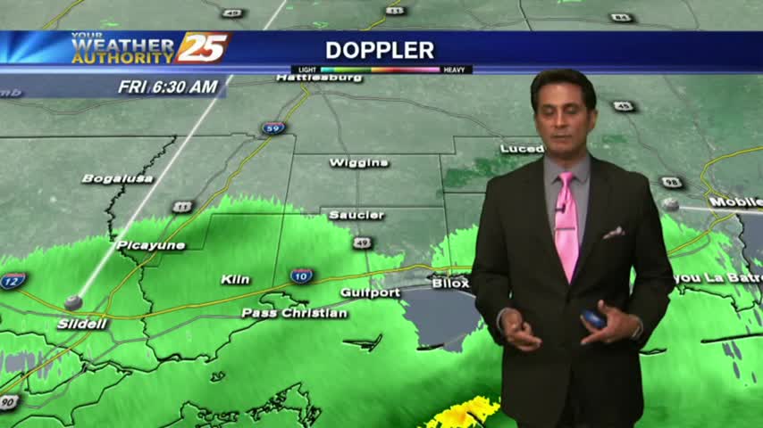
Areas of DENSE FOG affecting south Mississippi with spotty light rain...
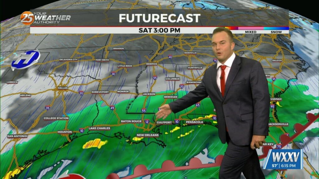
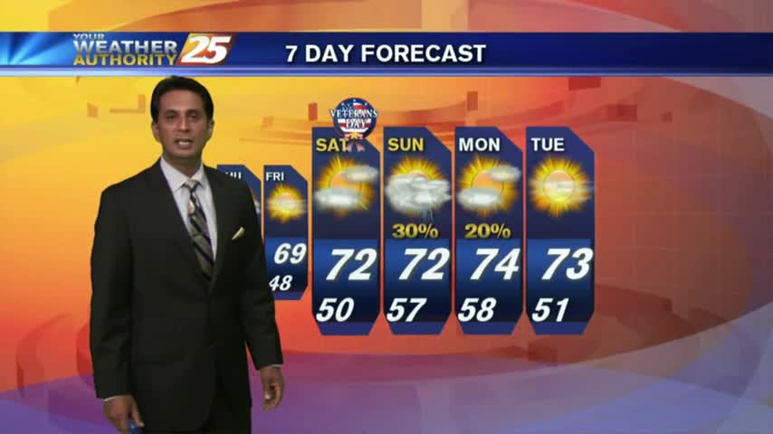
Getting some quick cloud cover and showers out of the way tonight so we can enjoy a beautiful, slightly cooler weekend.
More light rain and cloud cover today, something we can expect to linger for the rest of the week.

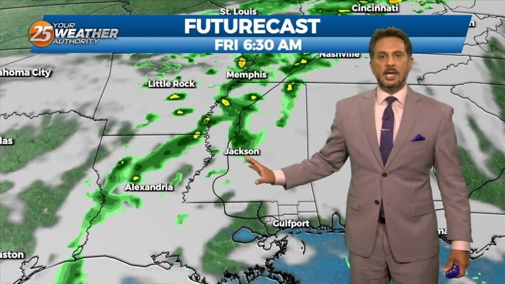
A cloudy and wet start to the day with areas of patchy fog affecting your morning commute...

Cloudy and wet all weekend long, and sadly that isn't changing until almost next week....
Doesn't look like I'll get my video for the evening forecast due to computer issues, but the show must go on!
Sunshine is beginning to peek through the clouds as spotty rain continues...
A warmer start with areas of light rain moving across south Mississippi...
Light rain continues to move in from the south with cooler temperatures this afternoon...

It's been drizzly and grey all day long and while the rain will slack off soon, the clouds will remain for a few days before drier weather moves in....
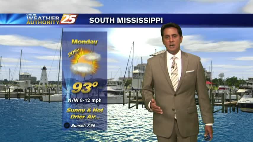
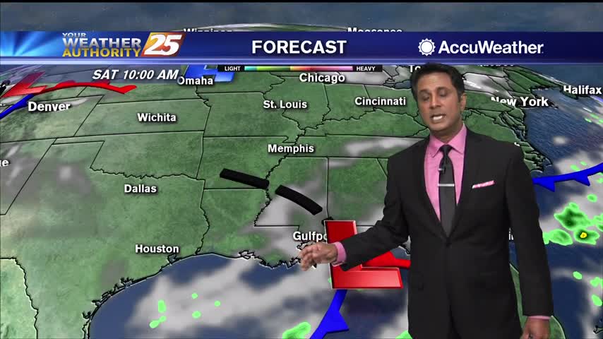
After a VERY HOT weekend, we have light showers from I-20 down to the coast...moving to the south.
Warming temps continue to move into the region. A cold front is now to the south of the viewing area...with rainfall moving NE into south Mississippi..
With cloudy skies and light rain moving across the region, cooler temperatures have moved into the Mississippi Gulf Coast...
Disruptive weather (Fog) continues as a cold front is now overhead...providing for isolated rain through the region.

A warm and humid start to the day as isolated rain moving in from the south is dissipating before hitting the coastline...
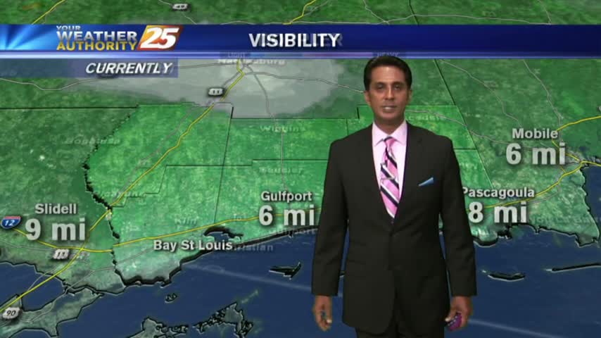
A break from the rain this morning...BUT areas of PATCHY DENSE FOG have developed along the Southern 6...