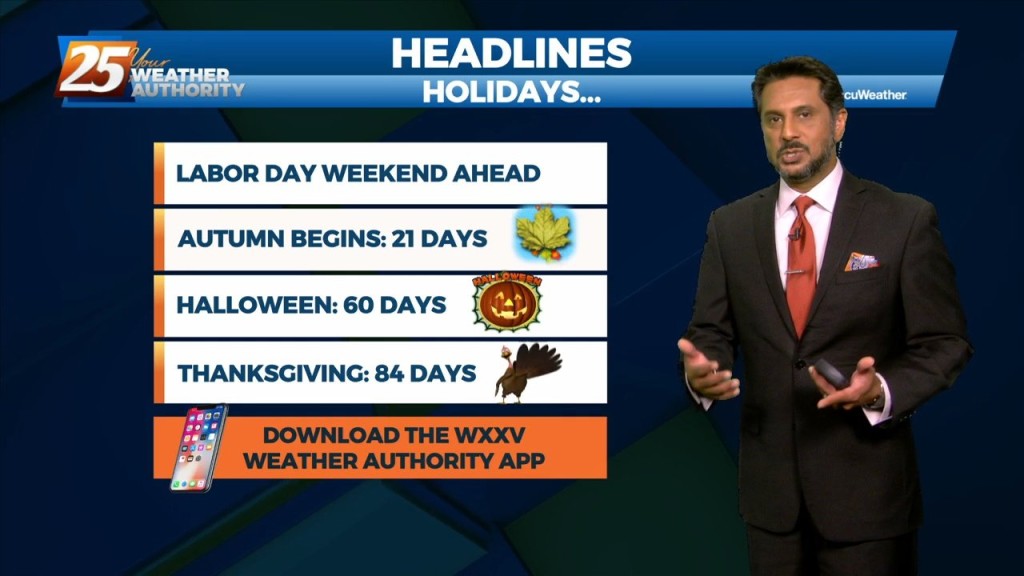
9/1 - The Chief's "Welcome to September" Thursday Morning Forecast
Overall, a fairly quiet day is expected across the area. It should be another lackluster convective day with plenty of dry air aloft. The best potential…
Overall, a fairly quiet day is expected across the area. It should be another lackluster convective day with plenty of dry air aloft. The best potential…
We will tip toe into September Thursday, and some of the area could feel some surface "drier" air filter in. With depth of dry…
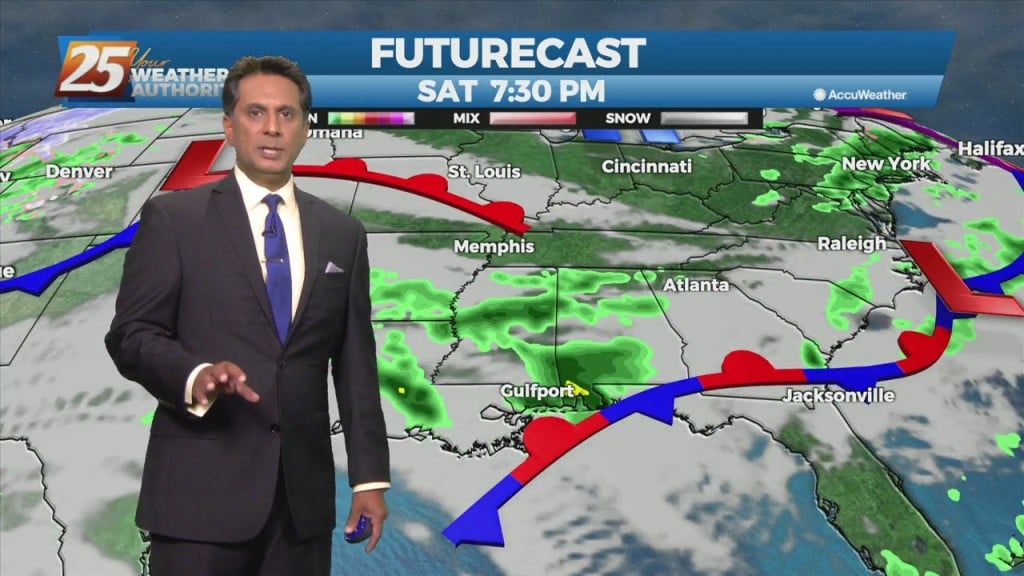
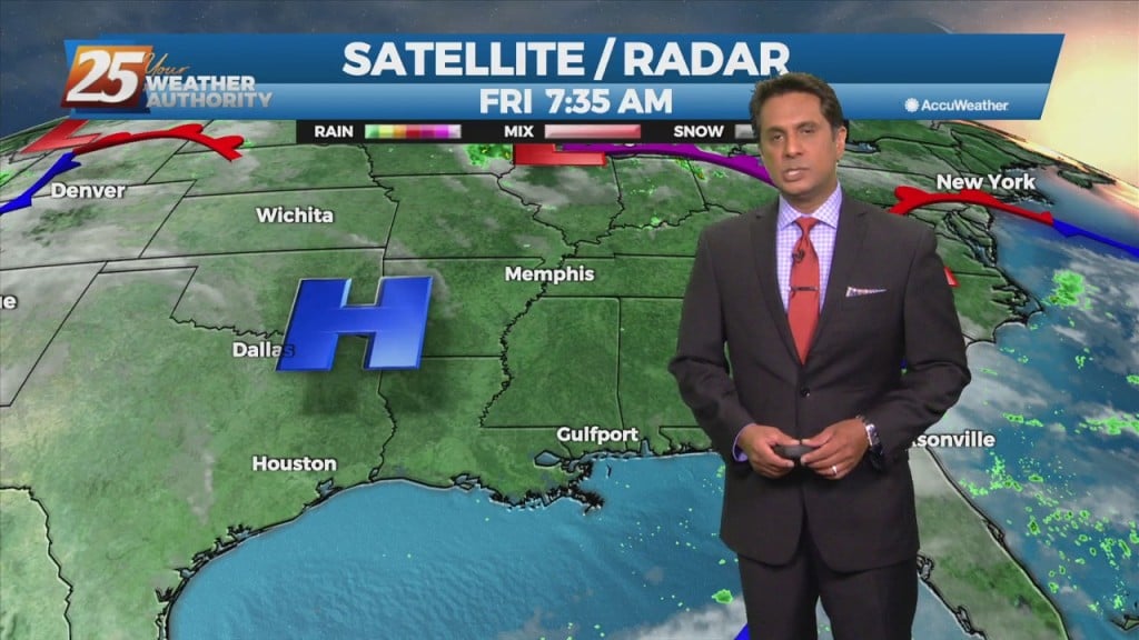
High-pressure will be the main factor shaping the weekend forecast. A weak upper low-pressure system could form in the eastern Gulf of Mexico over…
An upper-level low pressure over southern Illinois this morning will slowly drift off the eastern seaboard tonight into the weekend. High-pressure will be the main factor shaping…
Stepping outside today was quite refreshing compared to the recent high-humidity affair earlier in the week. High pressure will shape the forecast through the area Friday…
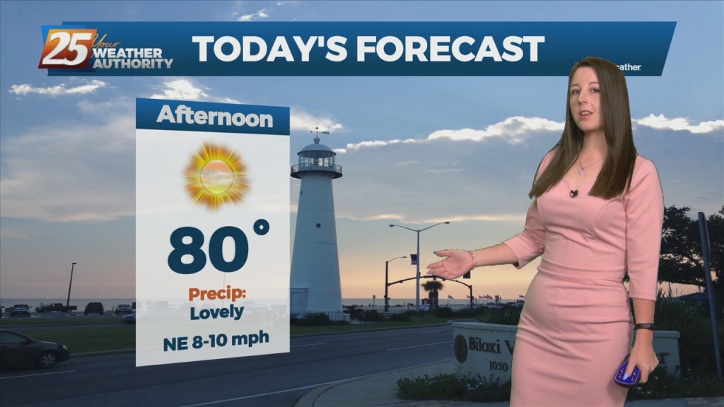
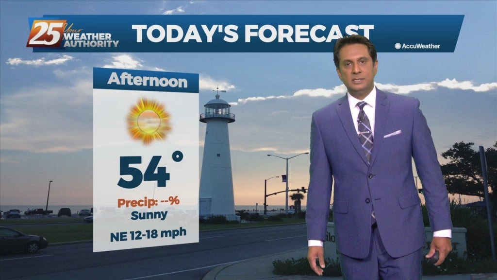
A less humid air mass will make afternoon high temperatures right around 80 degrees rather comfortable. With strong high pressure over the East Coast and a strengthening storm…
High-pressure over the region will provide for clear skies, lighter wind than what we have become accustomed to these past few weeks. A less humid air…
Post front airmass continues to push in today as upper level high-pressure to the NW shapes the short term forecast. This will bring another below normal temperature…
The cold front is now well east of the area as skies have cleared. A less humid flow and sunshine will dominate the forecast ahead, but this will not…

A zonal flow regime will remain in place across the Gulf South both today and tomorrow in the mid and upper levels. In the low levels, a departing high-pressure…
The cold front has moved east of the area but will continue to be a factor in the forecast through the Easter weekend. As the upper…
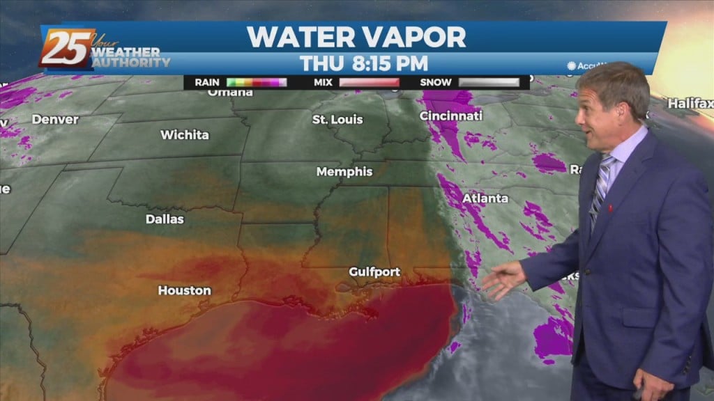
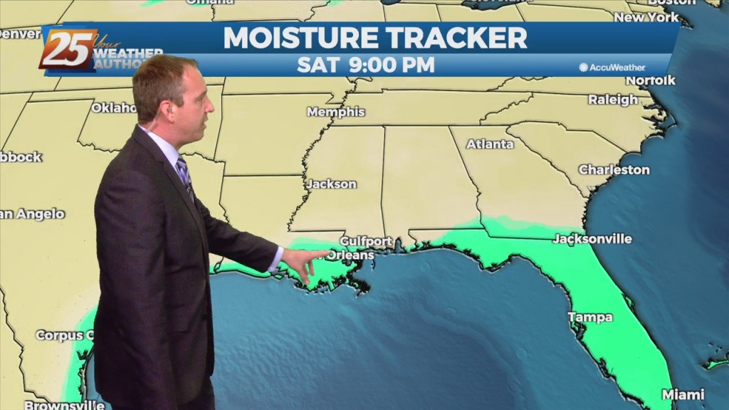
The moisture flow will move slowly eastward over the next day and a half, and may take until about Friday to totally clear the region. Lower levels should…
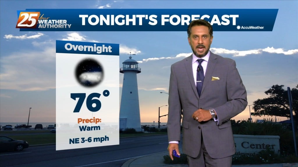
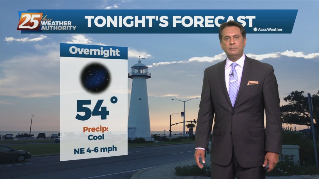
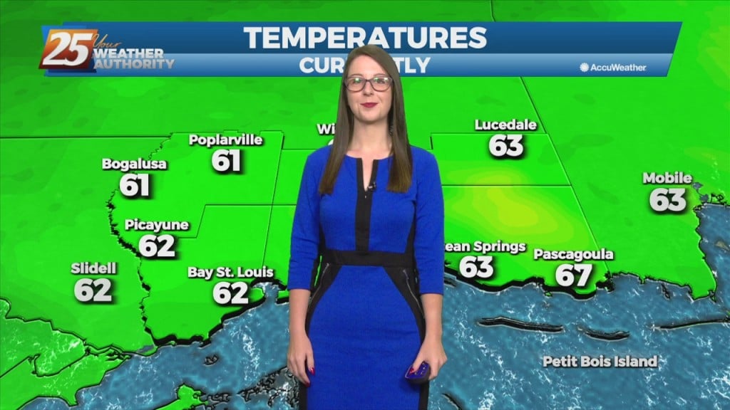
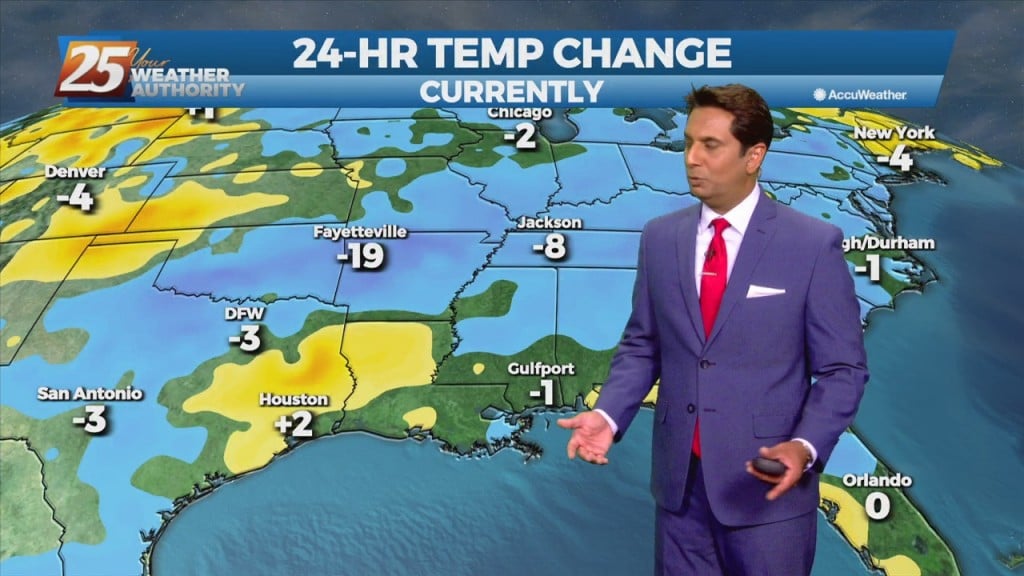
Daytime temperatures today will see almost 20 degree difference from yesterday's temperatures. Tonight temperatures will be chilly once again with lows in the upper 40s to low…
An area of low-pressure rotating over the lower Tennessee valley will be slow to move NE. Cloud cover has been tricky to forecast as there have been…

High-pressure NW will slowly move SE into the region this weekend. This will keep dry weather and lower humidity over the forecast area, although humidity levels/dew-points will be coming up slightly on Sunday to more muggy readings. Diurnal temperatures…
The persistent mid/upper low-pressure over the mid-Mississippi Valley will finally lift northeast to the Great Lakes region through tonight. This will be replaced by an upper level high-pressure building in from the southern plains into the Gulf Coast region. Surface…

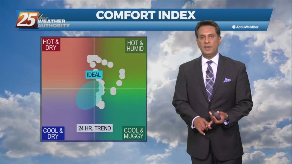
We'll see only the slightest dip in the humidity in the days ahead, but much drier, more sunny days are coming. We saw some of that as early…
Very pleasant and comfortable conditions will continue through the weekend. With the less humid flow, morning low temperatures will continue to be a good 10 to 15 degrees below climatological lows. Afternoon high temperatures will max out in the upper…
The strong cold front from yesterday has already exited the area and is moving further southward into the Gulf. Temperatures as well as dew points have dropped and while there are still some gusty winds currently, that should begin to…
The strong cold front from yesterday has already exited the area and is moving further southward into the Gulf. Temperatures as well as dew points have dropped and while there are still some gusty winds currently, that should begin to…
The next few days may be "fall-ish" with hot days and low humidity, but the nights will be much more "fall-like!" Expect tonight to fall into the mid 60s…
Very low humidity will at the very least be noticeable by most as the relatively dry air will make things feel a bit more comfortable. The comfortable conditions will continue through Saturday before the return flow slowly begins to work…
We will focus more on the less humid flow as a cold front slowly moves to the SE. This will at the very least be noticeable by most as the relatively dry air will make things feel a bit more…
This afternoon will bring hot temperatures in the wake of yesterday's cold front. Temperatures will climb to around 90 degrees but will be rather tolerable a a less humid flow continues to dominate the region. The aforementioned frontal boundary will…