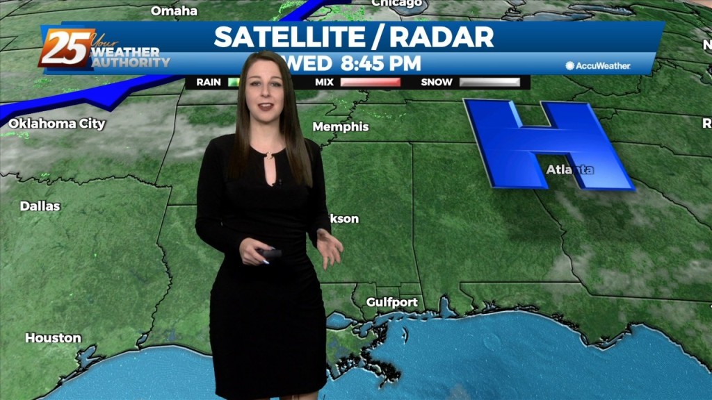
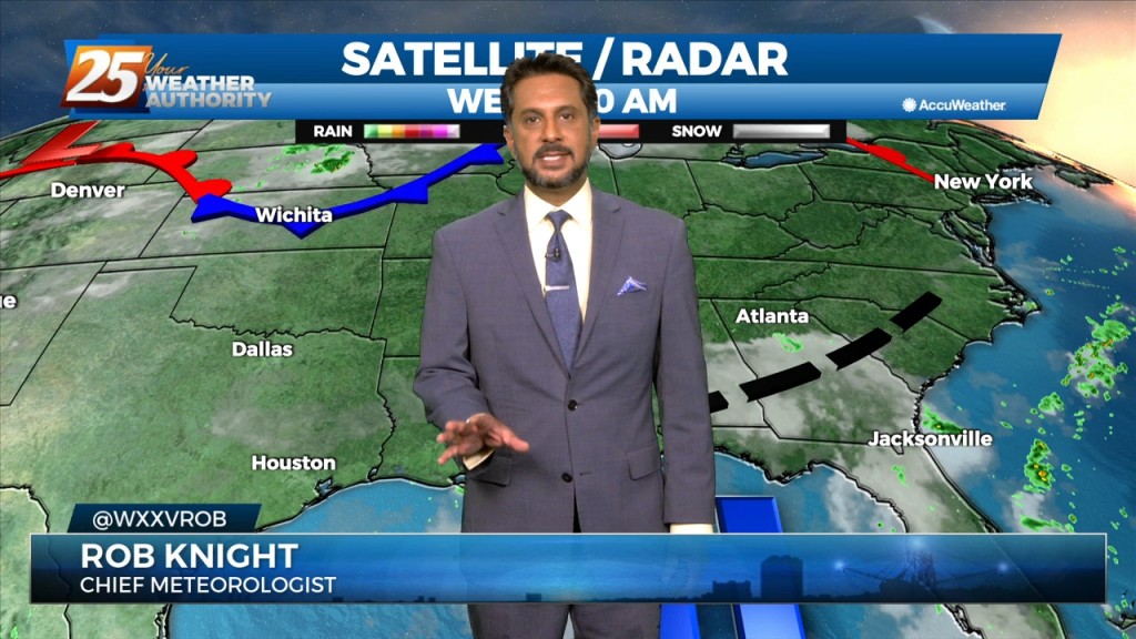
6/12 - The Chief's "Watching The Tropics" Wednesday Morning Forecast
Overall the forecast as a whole is a tale of two scenarios with the first part being: high confidence, mostly dry, and HOT. The second part:…
Overall the forecast as a whole is a tale of two scenarios with the first part being: high confidence, mostly dry, and HOT. The second part:…
High pressure will continue to move downstream over the Mid-Atlantic States through today. As the high moves east, onshore flow will be initiated at the surface.…
A large upper disturbance over the eastern states will continue to move off into the western Atlantic on later today. High pressure albeit fairly weak…will…
The primary forecast concerns through Thursday night will be the prospect of locally dense fog forming each night, the threat of isolated to widely scattered convection…
After mixed clouds yesterday, we have had just a few upper-level clouds today. High pressure has the biggest influence on our weather pattern overnight tonight…

Surface high pressure continues to build in from the north, ushering in post-frontal cool and dry airmass. Observations across the local area show…
A stalled surface low and trough north of the coast will keep a higher risk of showers and thunderstorms in place through Friday. The low should slowly dissipate…
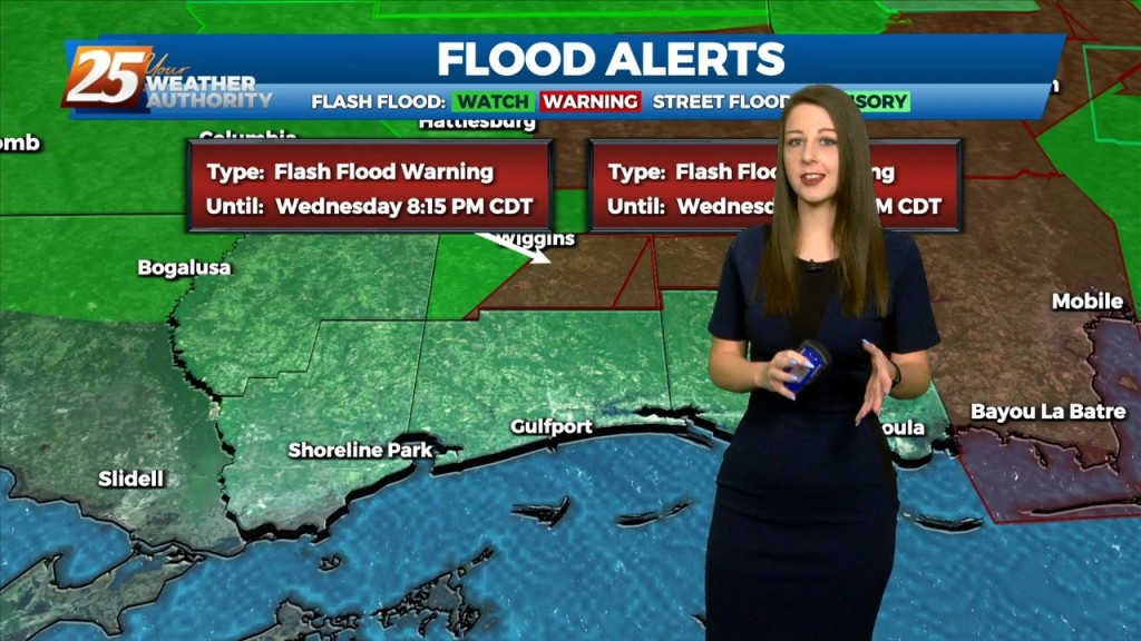
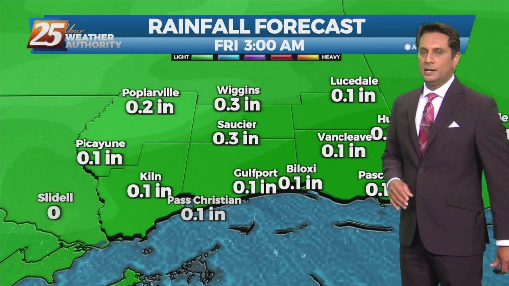
The main concern will quickly shift to the possibility of heavy rainfall once again today. Many parts of the area have seen considerable rainfall over the…
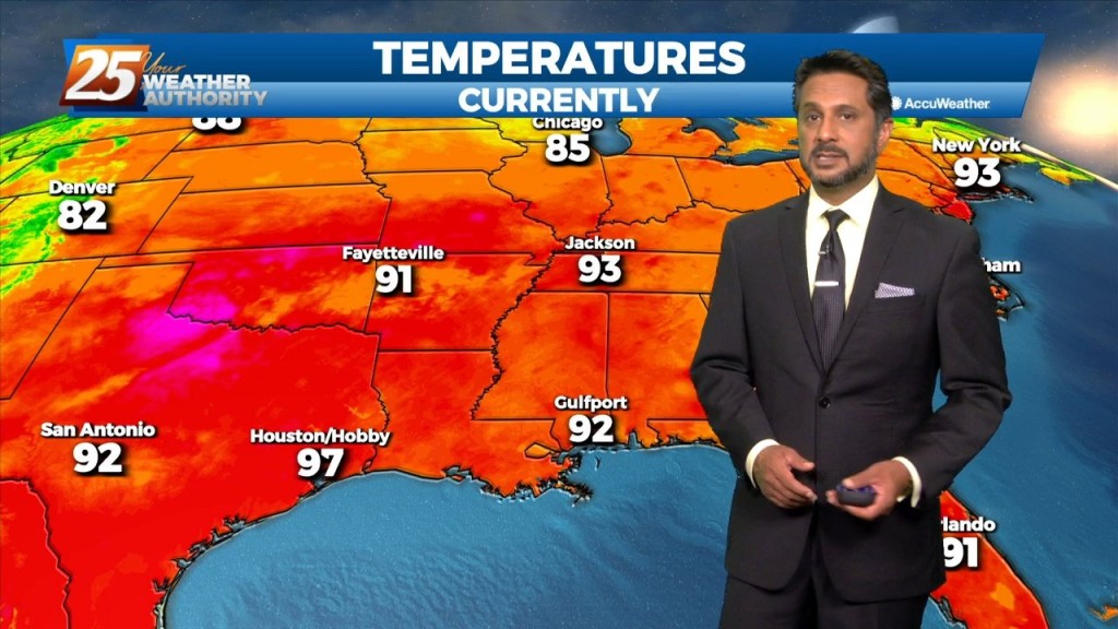
A Heat Advisory is in effect... The upper level high pressure will gradually continue to get stronger from west to east across the region. That and a continued…
At the surface, high pressure is centered pretty much over our area as the disturbance that brought the heavy rainfall to portions of the area yesterday, continues…
An upper level ridge that is centered over Texas and spreads across the Gulf Coast will continue to dominate the forecast over the next couple days. This…

The synoptic pattern will hold through the short-term period with a broad area of high pressure off the Southeast U.S. coast extending westward along the…
Hot and dry pattern continues as high-pressure extends SW to NE from the western Gulf of Mexico to the Great Lakes. This will easily support…

Aside from a normal start to summer and high temps well above normal values, we will throw several thunderstorms on the pile for Thursday…

Surface high-pressure building in from the north and keeping yesterday mild is quickly sliding east. Onshore flow develops today as elevated winds will bring in…
A t-storm complex to the north will continue to move NE and get dissipate later this morning in advance of an approaching cold front. Going into the…
A disturbance along the four Corners will weaken over the next 36 hours as it moves eastward. The Canadian trough behind it will move into…
A minor disturbance to the west will exit the area this afternoon with weak high-pressure building in. This will keep our weather dry through the weekend. Tomorrow morning…
Some scattered showers are possible around the peak daytime heating hours today, but not anticipating any thunder with any precip that forms. Thursday is when a cold front will approach the area; showers could form as the front passes through…
High pressure remains over the area but will be moving towards the northeast. It has warmed up a bit thanks to onshore flow bringing in some modest…
Starting out with early this morning, surface high pressure has built in across the southern MS valley region/NW GOMEX. The high center is just to our west…
This afternoon will be fairly quiet as high pressure remains the dominant feature of the short term forecast for the next couple days. High temperatures today warm back…
High pressure will remain over the area bringing dry conditions with mild days and clear cool nights. A west-northwestly flow will remain in place through the…
Surface high pressure that has been dominating the area will begin to shift off to the east today as an upper level disturbance extends down into our…