05/08 Ryan's "Record Warm" Tuesday Night Forecast
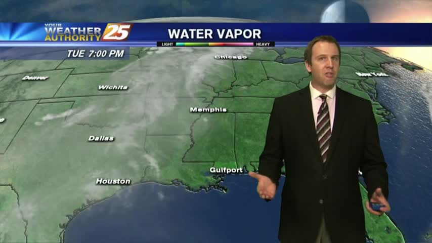
I expect today to be the only day to gave a significant chance at breaking the temperature record as cooler days are ahead, but it warms back into the 90s quickly....
I expect today to be the only day to gave a significant chance at breaking the temperature record as cooler days are ahead, but it warms back into the 90s quickly....
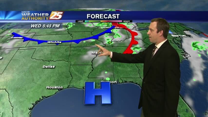
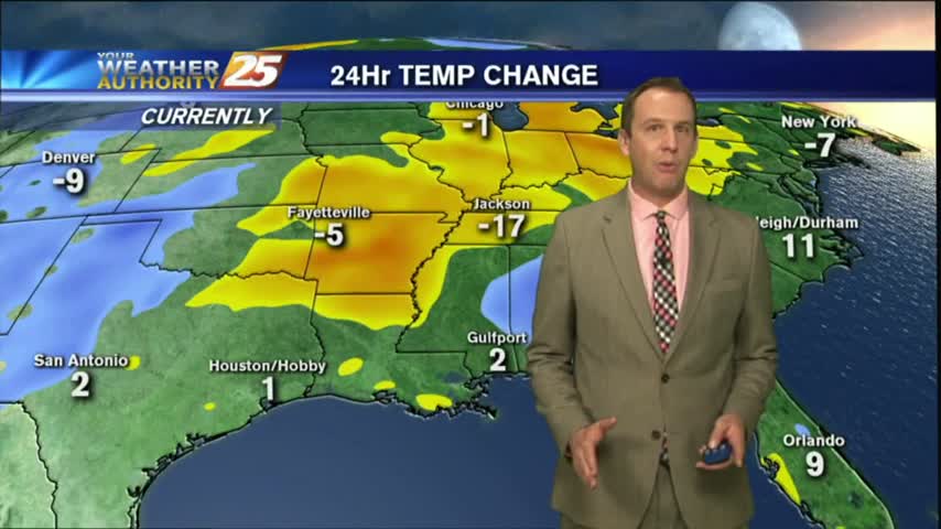
We at least tied our record temperature today, but slight cooling will keep the rest of the week's out of reach....

May the Fourth was certainly with us as we had another nice afternoon today, but a cold front will bring rain tomorrow....
Happy "Star Wars Day" South Mississippi! Clouds will build through the night as a front approaches to bring a little rain tomorrow, but a sunny week is ahead....

Summer-like conditions continue for another day or so, then a cold front moves in but doesn't bring much cooling....

It's been feeling a bit like early Summer for the last few days, and not much will change until the cold front closes in on Saturday....
Skies cleared a bit today as the temperature warmed, and we'll see even clearer weather, warmer weather up until this weekend when our next front will move in.
Expect continued warming for the rest of the week, but otherwise conditions will be sunny and dry!
Clouds and even a few showers moved in this afternoon and you can expect clear skies and sunshine for a while, but not forever....
Happy May Day everyone! A few clouds moved in today, bringing a couple of showers, but much drier conditions are expected for the rest of the week. The weekend however....
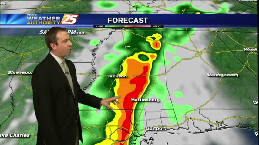
Cloudy skies moved in early this afternoon, and will remain that way until tomorrow's potentially severe storms move through. Great week afterwards though....
Today's cloud cover and temperature increased as expected and severe storms are still moving in for Saturday....
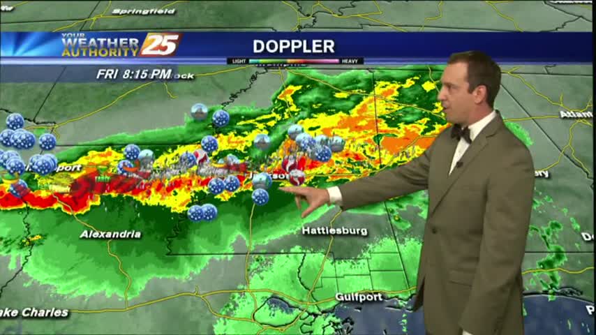
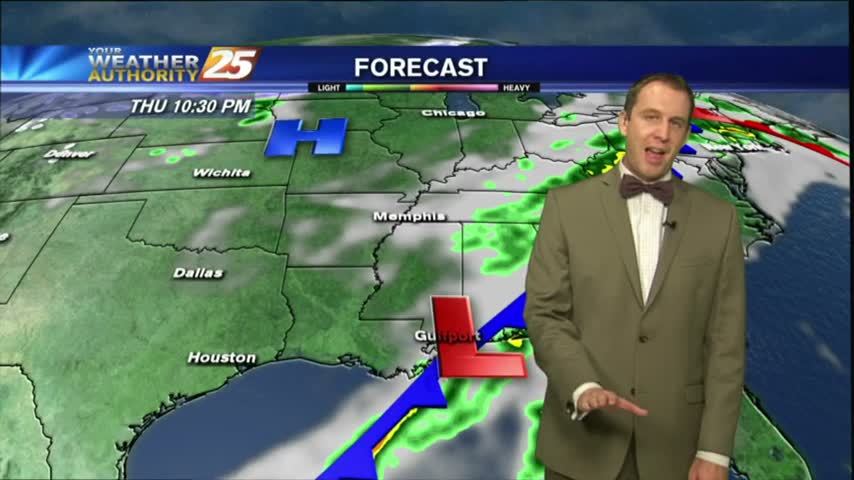
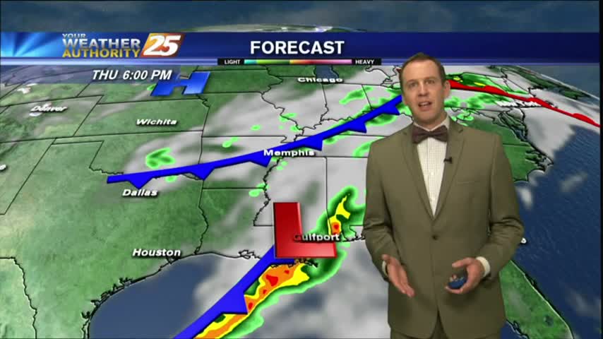
We've yet to see any significant weather moving into the area, but the rain will begin soon, and strong storms early tomorrow....
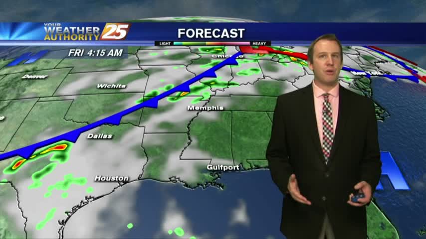
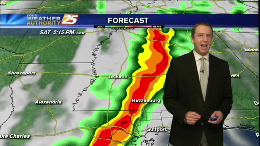
The potential severe weather we've been talking about all week long is almost here, and will be arriving during the early morning hours....
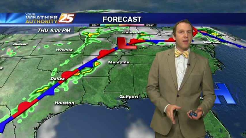
Today's weather was nearly perfect, mild and dry, but another round of potentially severe storms is moving in for the weekend.....
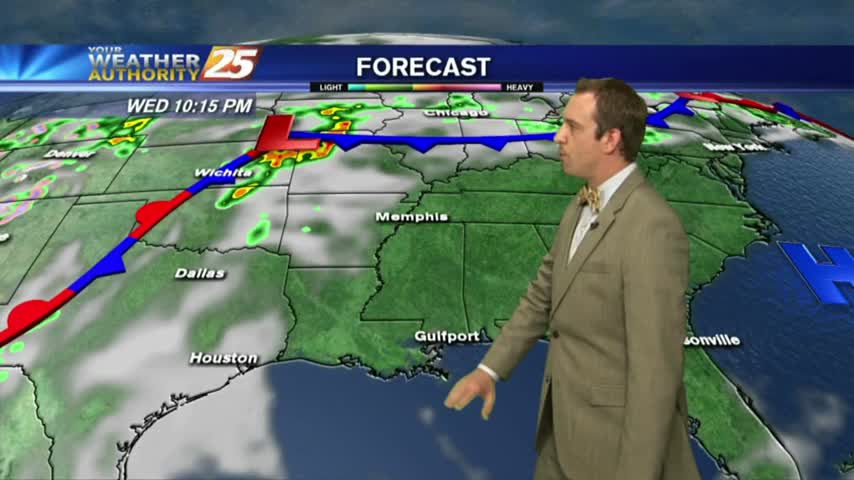
The cooling trend continued this morning, but Southerly winds will begin increasing our temperature and humidity ahead of a weekend storm front....

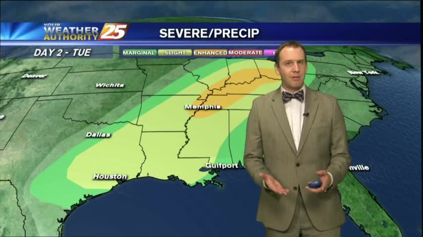
The cold front is still on the way, and while most of the severe weather is still off to the North we may see some early morning activity overnight....

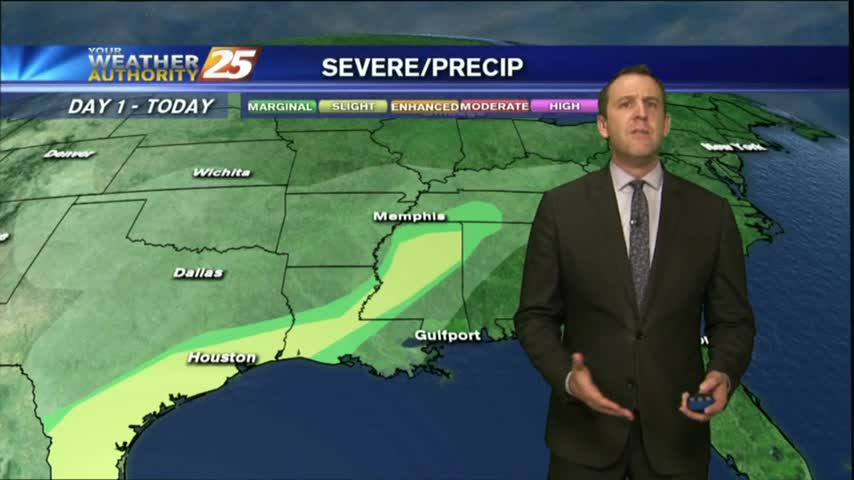
It's much more cloudy today, but will clear quickly tomorrow after overnight storms which bring a slight risk of severe weather to the Coast....
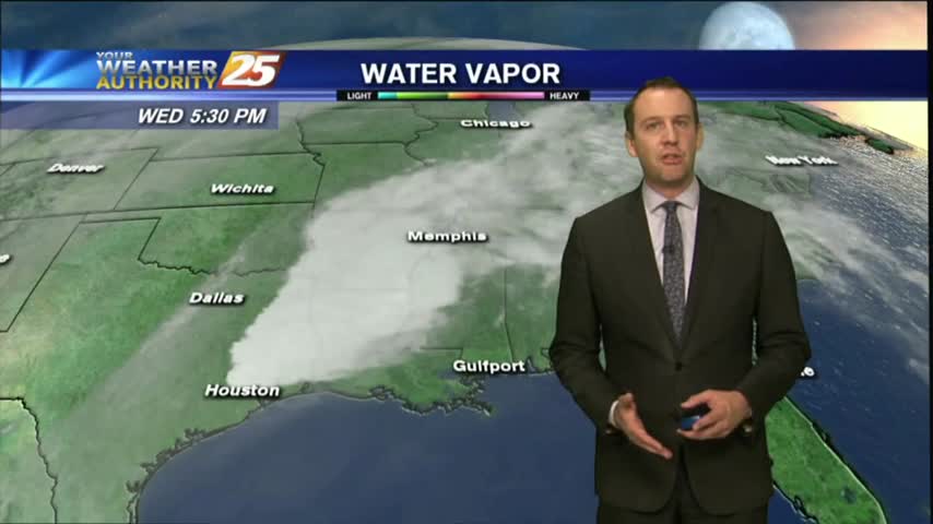
It was a sunny and drier weekend, but we're starting to see more clouds and higher humidity moving in. Won't be long before rain returns too....
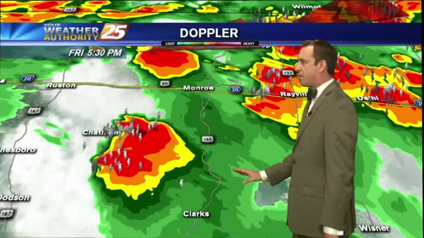
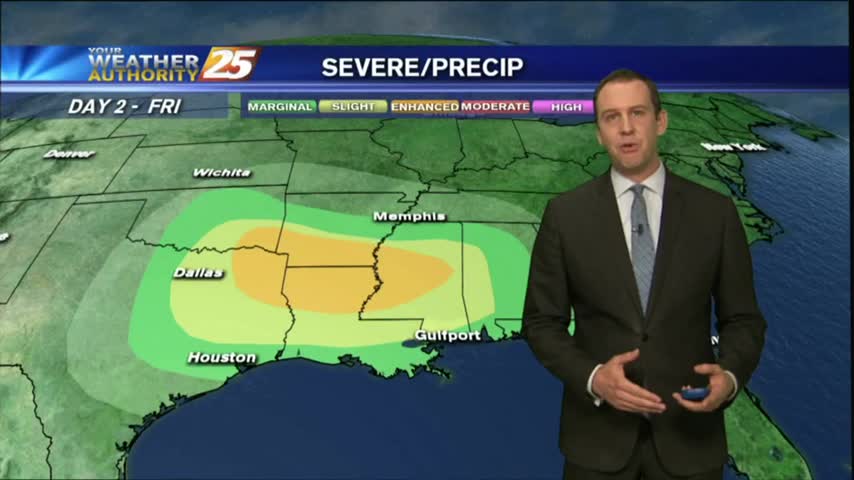
It's still fairly calm now, but a severe weather threat is moving in for tomorrow afternoon....
It remained cloudy and warmed a few degrees as we expected, and the potential for severe weather is still on for tomorrow....
Another warm and humid day down with a few more to go before a sunny and drier Easter weekend....
The humidity and clouds just keep coming for the next few days, but the holiday weekend is looking much clearer....
It was beautiful last week, started getting warm and humid over the weekend, and is now cloudy and humid where we'll stay until rain later in the week....