07/01 Ryan's "Hot & Humid" Wednesday Morning Forecast
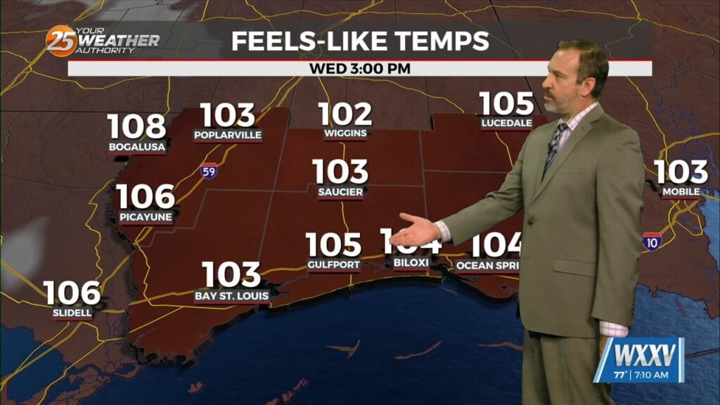
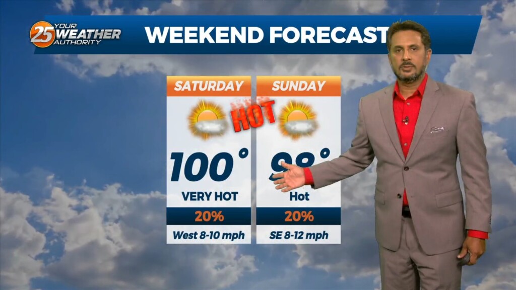
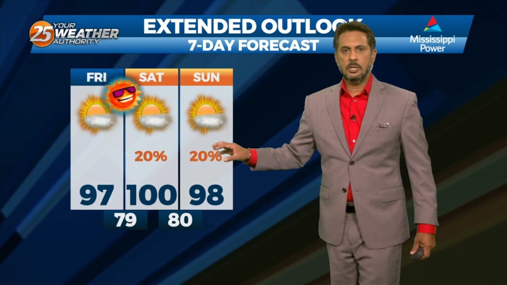
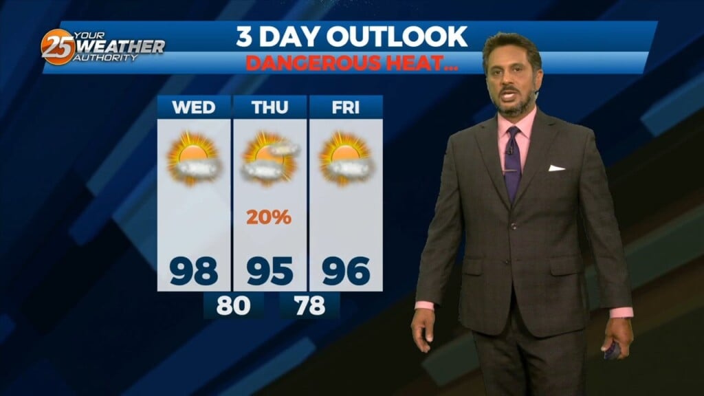
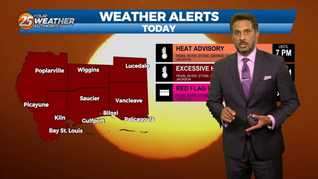
Yesterday was near Heat Warning conditions and while it will technically "cool" a bit today, another dangerously hot one is on the way. Heat Advisories are in…
Yesterday was near Heat Warning conditions and while it will technically "cool" a bit today, another dangerously hot one is on the way. Heat Advisories are in…
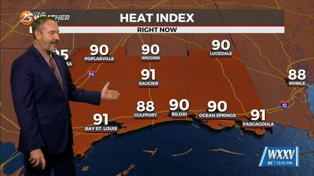
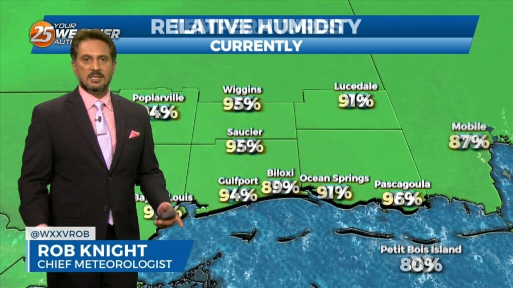
Temperatures didn't change much today, but it may feel that way thanks to it being so humid in South Mississippi. Dewpoints are lingering in the mid 70s…
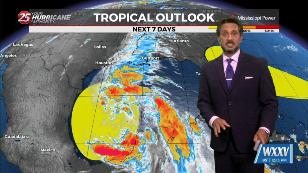
The area of low-pressure over the Bay of Campeche has been designated Potential Tropical Cyclone 1. Still have a fairly significant surface flow between the…
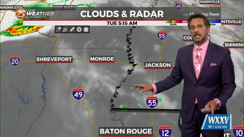
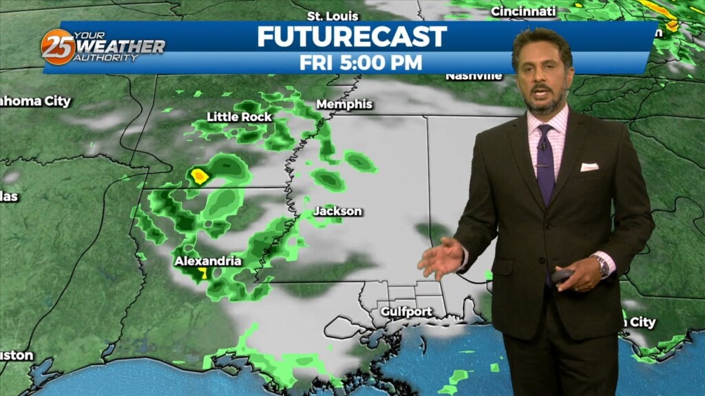
The first 24 to 36 hours of the forecast are somewhat uncertain. Currently we have widely scattered showers that have been developing off the coast along…
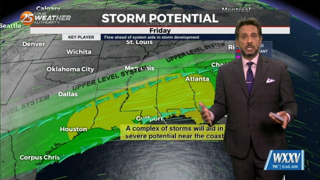
The next complex of showers/t-storms is getting started over central Oklahoma. This will move eastward and then down the same travel path as the one that just…
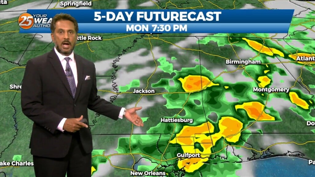
As a stalled boundaries form last week move northward and leave the gulf coast, rain chances will drop off through the weekend. A…

The old front has backed off into central Mississippi which is where showers/t-storms are developing this morning. A few storms are moving NE as they follow this…
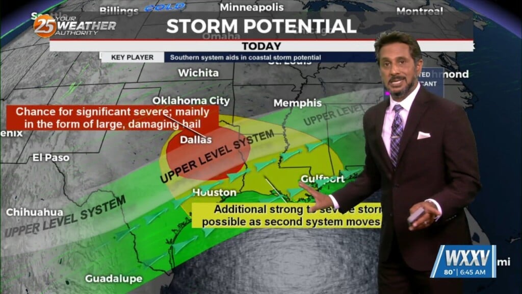
Upper level high pressure near the Bay of Campeche continues to nose up into the western Gulf of Mexico and Louisiana. Energy will…
The fight between a series of fast moving disturbances sliding along the I-20 and further north and high pressure to the E/SE will be the main forecast…
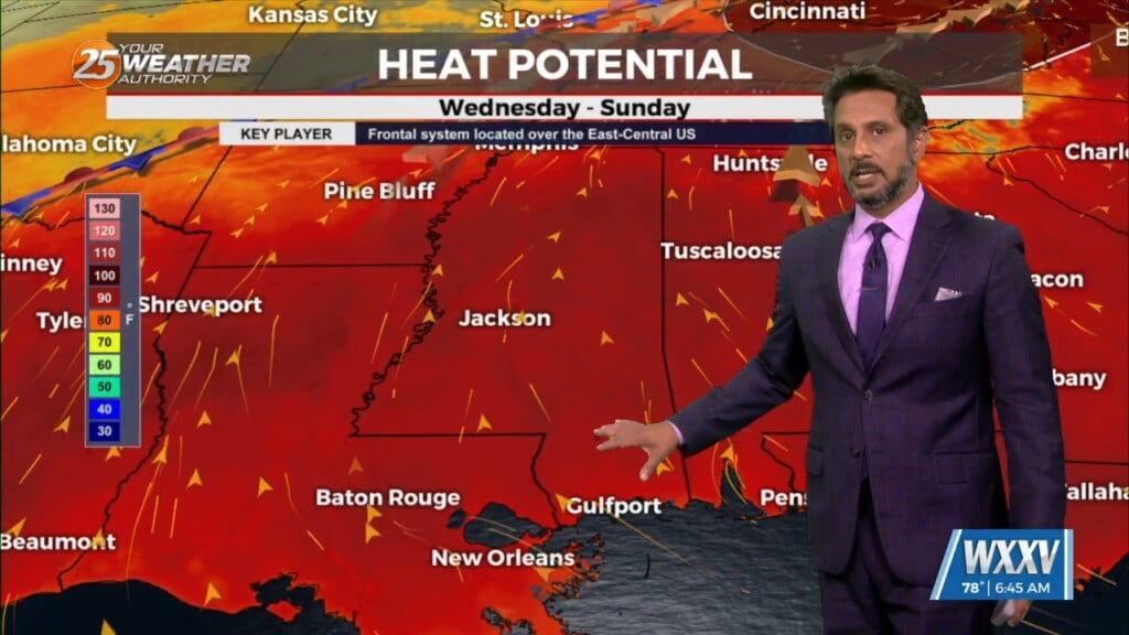
Little change in the ongoing pattern of deep layer high pressure currently in place across the Gulf South is expected through Thursday night. The result will be…
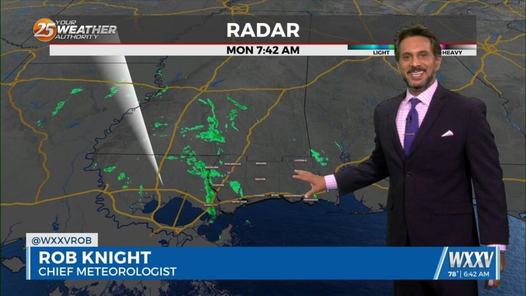
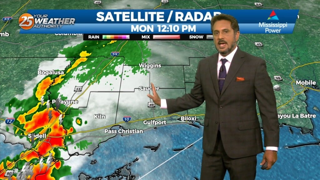
The old frontal boundary is stalled near the coast this morning and drapes inland near Terrebonne Parish westward to Beuregard Parish. The back end of this front…
First things first this morning it appears there could be a few isolated low topped showers develop with the initial impulse moving into NW Louisiana.…
This afternoon high pressure was centered near El Paso, Texas, extending northward through the Plains States. At the surface, high pressure was centered over Florida and the Northern…
High Pressure continues to be centered near El Paso, Texas this morning, extending northward through the Plains States. At the surface, high pressure was centered over…
As we head toward the equinox, the upper pattern is becoming more active across the northern half of the US. Upper level high pressure was noted…
Today most things point to a favorable day for scattered to numerous storms but again obviously current events are highly impacting the thought process. This…
Multiple weaknesses in the overall pattern including an area of low pressure to the west has brought rain chances back to the region. Strong cored…
Upper level high pressure continues to spread eastward through the central MS River Valley and into the southern Appalachians. Basically, in a nutshell, same old same old…
The stubborn high pressure continues to remain centered over the I-35 corridor from Kansas through much of north and central Texas this morning.…
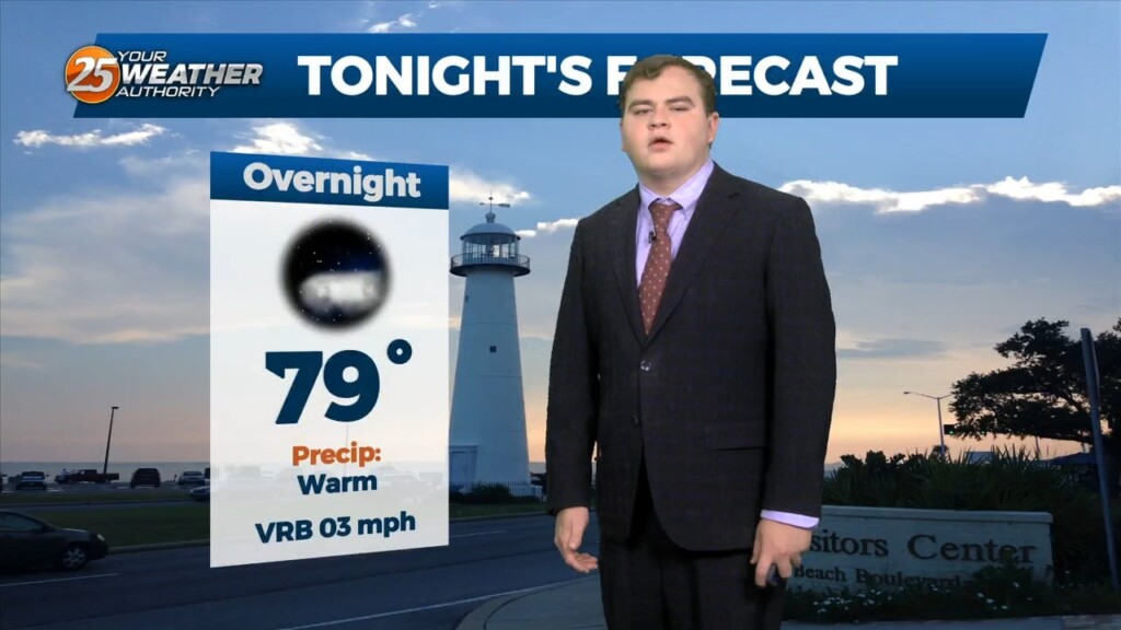
Tonight we will steadily drop into the upper 70s for overnight lows with mostly clear skies. Unfortunately little change in the overall pattern is expected through the end…
Unfortunately little change in the overall pattern is expected through the end of this week as high pressure remains dominant. However currently there is an overall weakness…
At the surface, a very subtle weakness resides across portions of the region, however, this feature hasn’t been as productive as I'd like in terms of…
An easterly wave is currently located from Appalachia Bay FL down to the NE’tern Gulf of Mexico. This wave will also get flattened down on its…
Temps will climb a bit today as dry air will begin to take the place of the departing tropical environment but won’t be too fast…