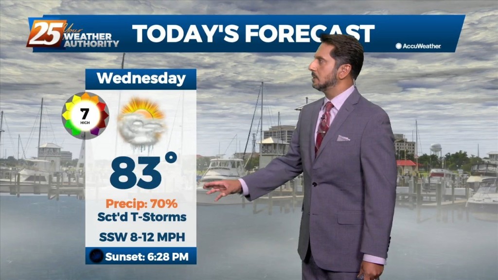
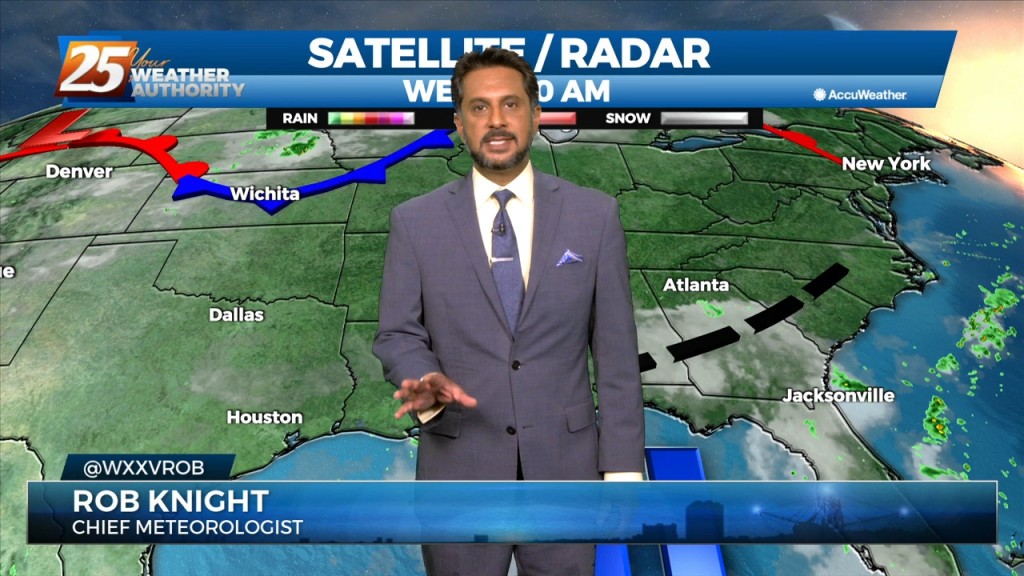
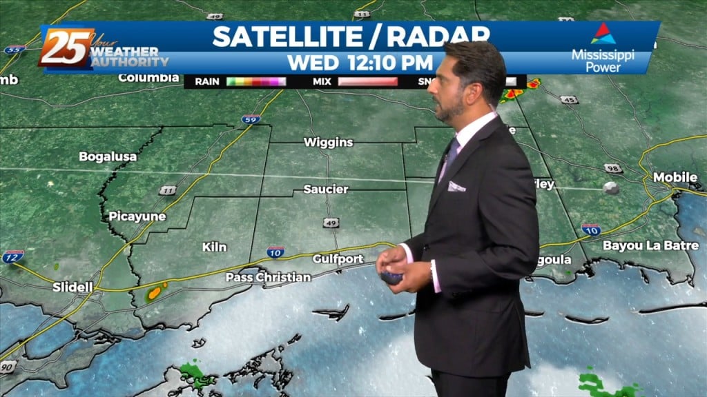
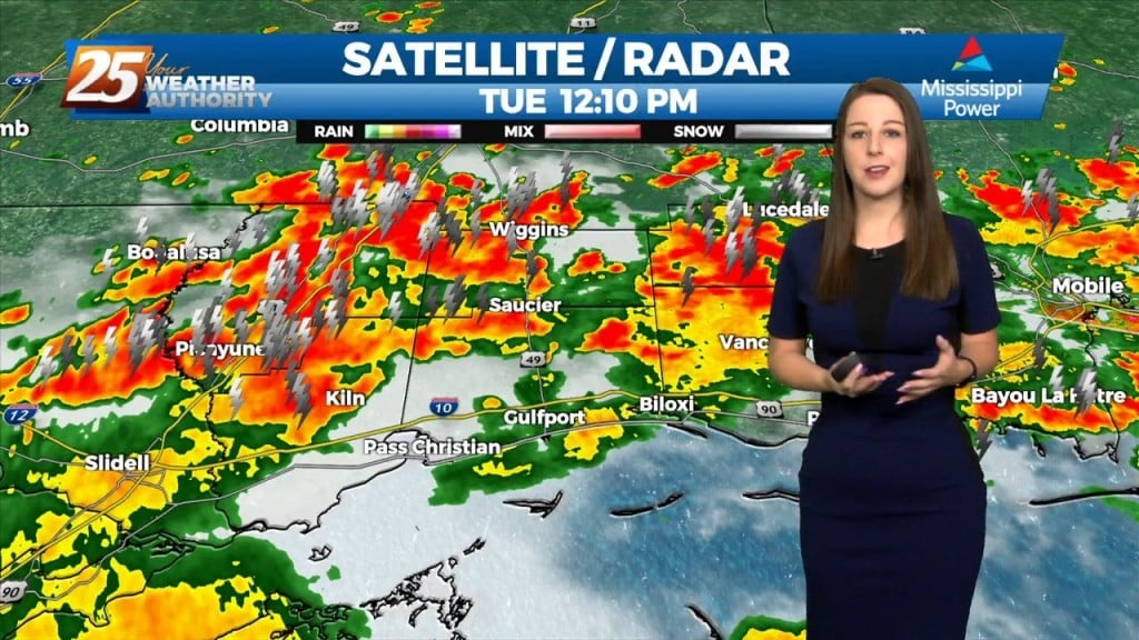
10/12 - The Chief's "Threat For Heavy Rain" Wednesday Midday Forecast
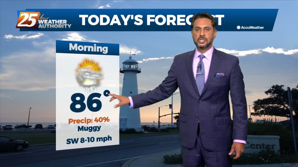
An approaching cold front from the northwest coupled with daytime heating will continue to increase shower and thunderstorm activity this afternoon. Upper level high pressure…
An approaching cold front from the northwest coupled with daytime heating will continue to increase shower and thunderstorm activity this afternoon. Upper level high pressure…
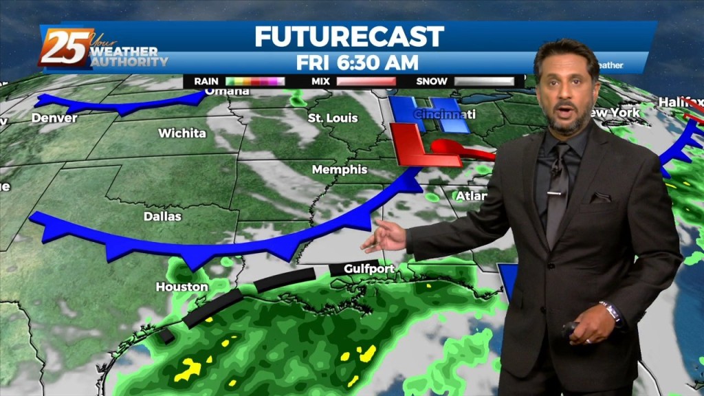
Main focus on the short term is upcoming rain chances today into tonight. A developing upper level disturbance near the Pacific Northwest will dig south and amplifying…
Starting out in the upper levels, a broad ridge centered near the 4- Corners region extends from California to beyond the Great Lakes. A trough sagging southeast…
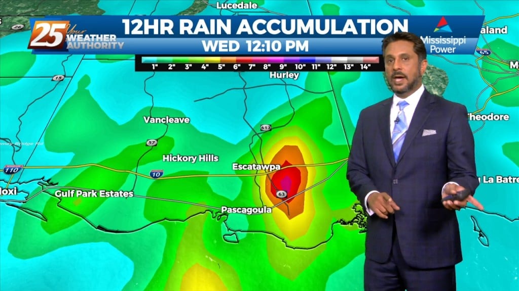
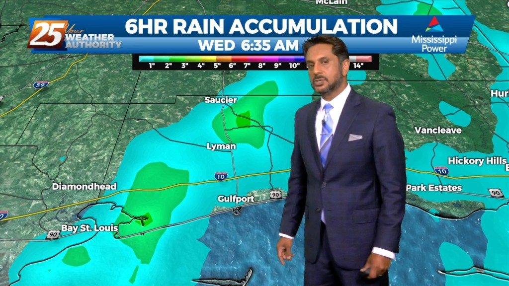
FLOODING ALONG RIVERS; WOLF, BILOXI AND TCHOUTACABOUFFA... A weaker surface low pressure and attendant boundary near or just offshore this afternoon will be the focus for…
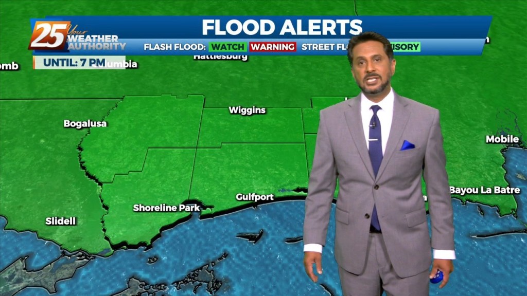
FLASH FLOOD WATCH IN EFFECT - 7 PM... Today through Saturday will continue with the wet pattern. A flash flood watch has…
A strong and persistent meso-low currently over the Arklatex region and broader and weaker shortwave trough in the upper levels will continue to work in conjunction to produce…
High precip chances will remain the topic along with an environment conducive for waterspouts. Rainfall tallies could be robust the farther north one moves though. This…
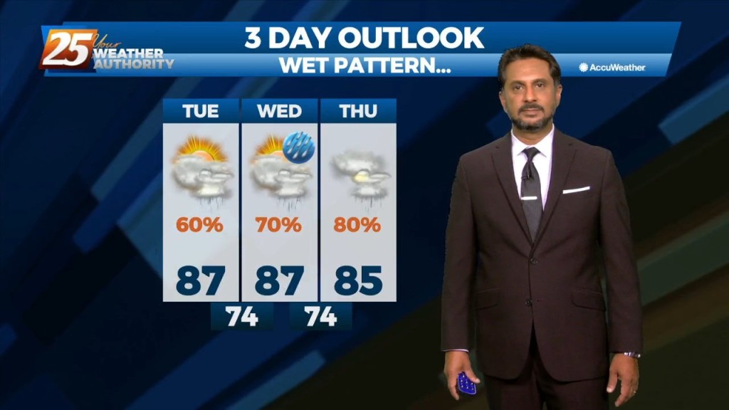
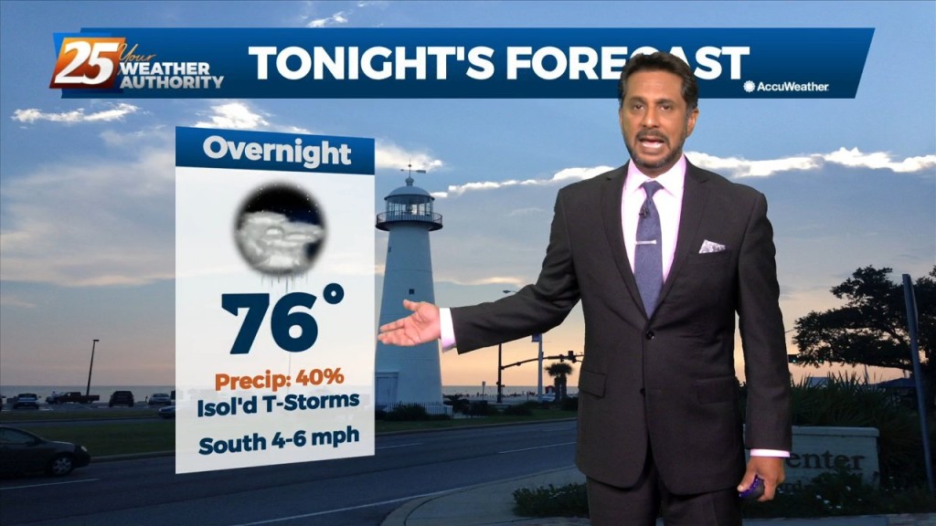
Main concerns over the next few days will be the threat of thunderstorms. Heavy rain will be the point of highest concern, but can`t rule out a few reports…
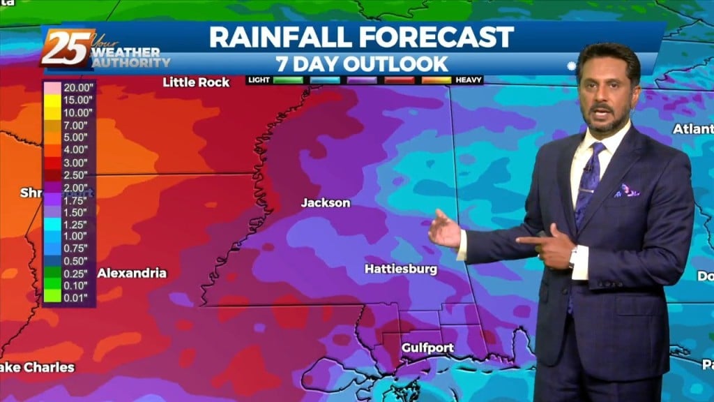
This afternoon will continue to bring showers/t-storms to the area. The main concerns over the next few days will be the threat of thunderstorms. Heavy rain…
Today the flow will shift more northerly as a weakness along the coast continues to amplify activity. At the surface, a weak frontal boundary…
The threat for heavy rain and pockets of FLASH FLOODING continues this afternoon. While it is very likely that some areas see heavy rainfall, the somewhat…
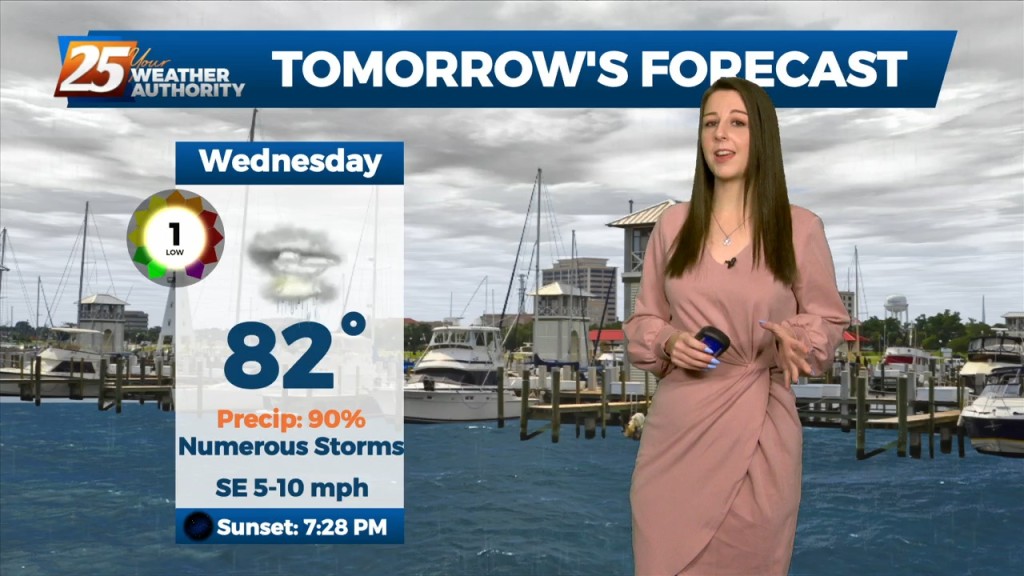
At the risk of sounding repetitive, another day of high rain chances is on tap for the area. Once again, these storms can easily produce hourly…
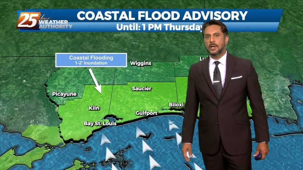
A COASTAL FLOOD ADVISORY is in effect through midday Thursday. High pressure over the western Atlantic will keep the area in a period of…
In a near carbon copy of last week, rain chances will once again continue to be high through the period. High pressure over the western Atlantic…
A weakness/subtle mid-level inverted trough over the northern Gulf continues a slow retrograding motion towards the WSW along the outer periphery of a mid-level high pressure…
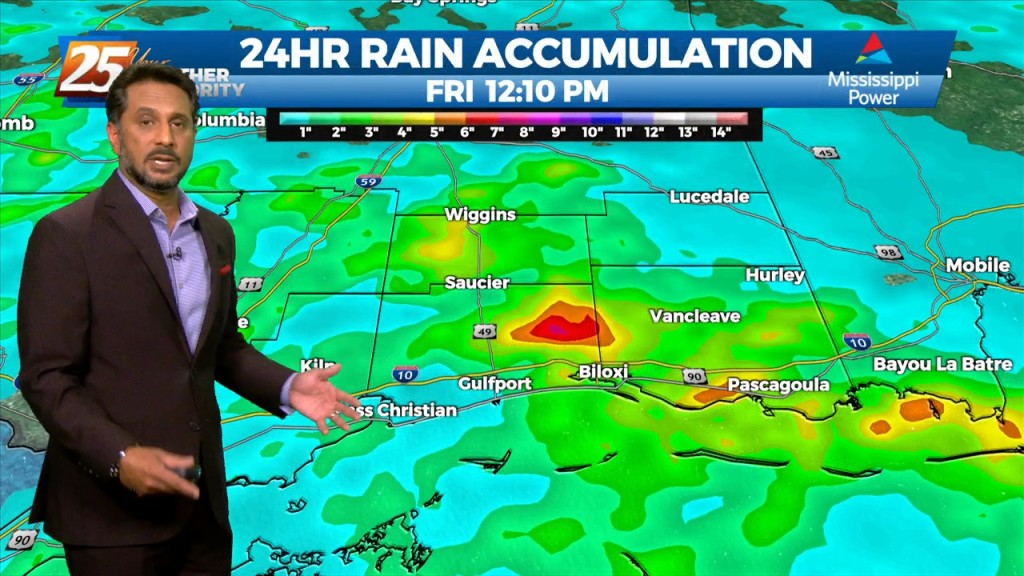
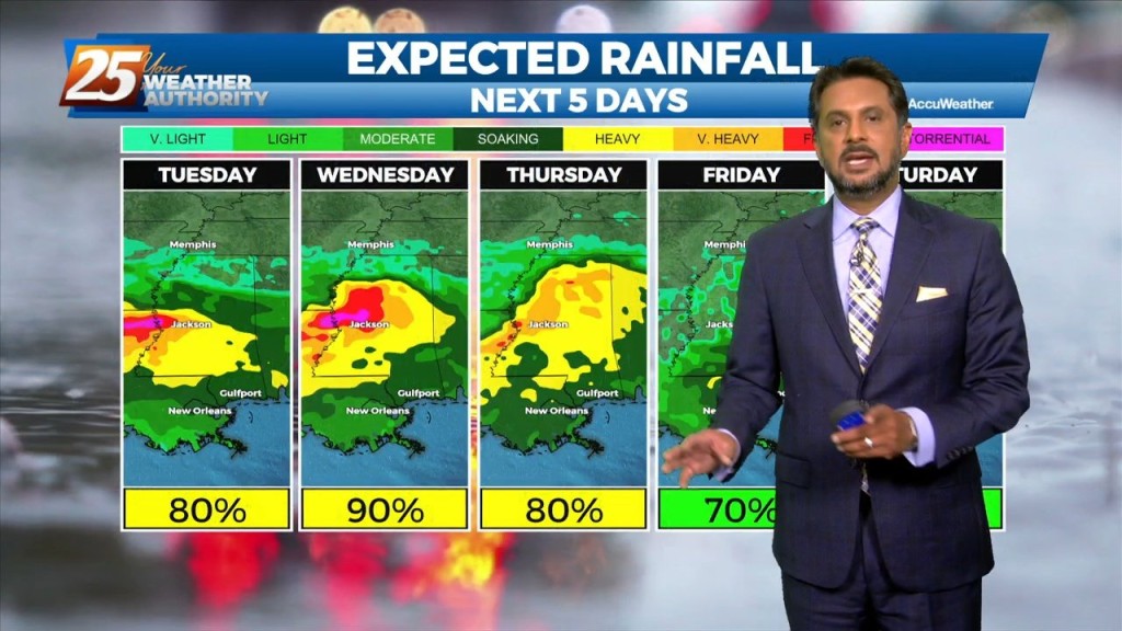
Many parts of the area have seen considerable rainfall over the past several days with a few locations having had measurable rainfall for quite an extended period. While…
The main concern will quickly shift to the possibility of heavy rainfall once again today. Many parts of the area have seen considerable rainfall over the…
Today will bring more of the same as yesterday as numerous showers and thunderstorms are expected to develop. Deep moisture from the Gulf of…

Over the short term period a wetter period will begin today as general weakness in the overall patter to the north of Hattiesburg slowly moves into…
The Bermuda high pressure extends into the far eastern Gulf of Mexico and a weakness between it and the ridge to the west. Abundant moisture exists…
A broad upper level high pressure system is centered near the 4-Corners region extends from Mexico to Canada and CA to around MS. This eastern portion of…

An upper level high pressure system centered near the 4-Corners region extends to the east coast north of Florida. This eastern portion of the ridge is rapidly eroding…

A stationary front along the coast will undulate north and south for several days, providing for rainfall and the potential for HEAVY RAIN. If…
An easterly wave noted in the pattern will move westward across the area this afternoon/tonight, enhancing t-storm development. Areal coverage over land this afternoon/tonight should be fairly…