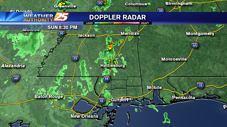
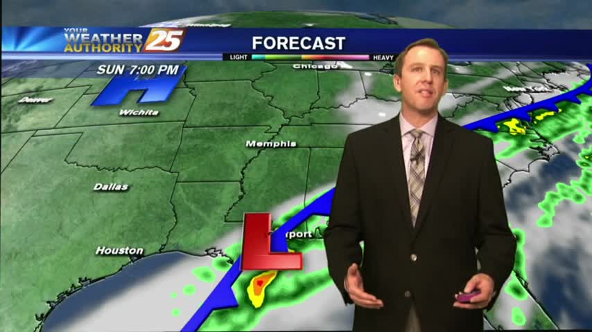
01/01 - Steve's Soggy Sunday Night Forecast
Rain and thunderstorms will affect the area through Monday, when some storms could be severe. With all the rain, there are river flooding issues and that will continue over the coming days.
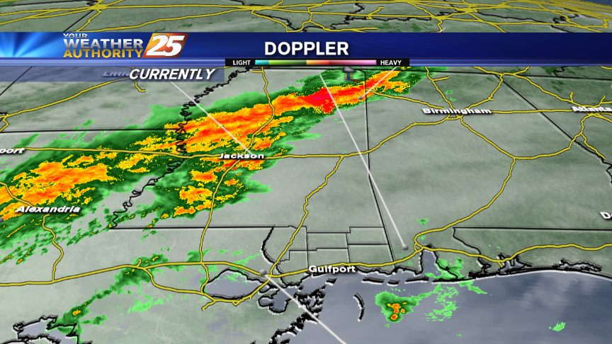
Rain and thunderstorms will affect the area through Monday, when some storms could be severe. With all the rain, there are river flooding issues and that will continue over the coming days.
It was clear and cool today, but cloudy and warm conditions will begin building immediately. Forecast details within.
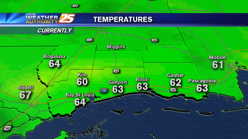
After a CHILLY start to the day, temps have warmed into the 50s with continued warming into and through the New Years celebration...
The humid air and foggy conditions are out of the area temporarily, with COLD and CLEAR start to the final Friday of the year...
Chilly and (actually) seasonable weather on-tap for the Coast tonight. Rain is back in abundance on the holiday weekend.
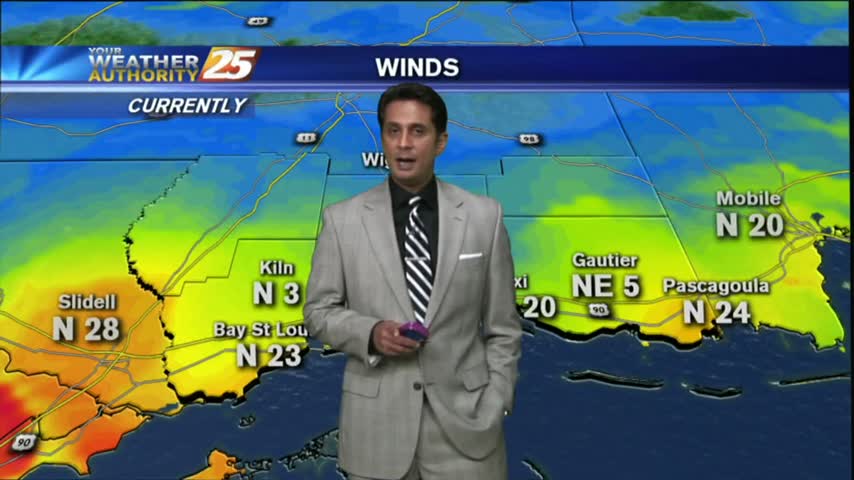
After a few showers associated with frontal passage earlier this morning...clearing skies have begun with VERY WINDY CONDITIONS.
Rain and thunderstorms are possible tonight through early Wednesday. We also talk about a very wet holiday weekend coming up.
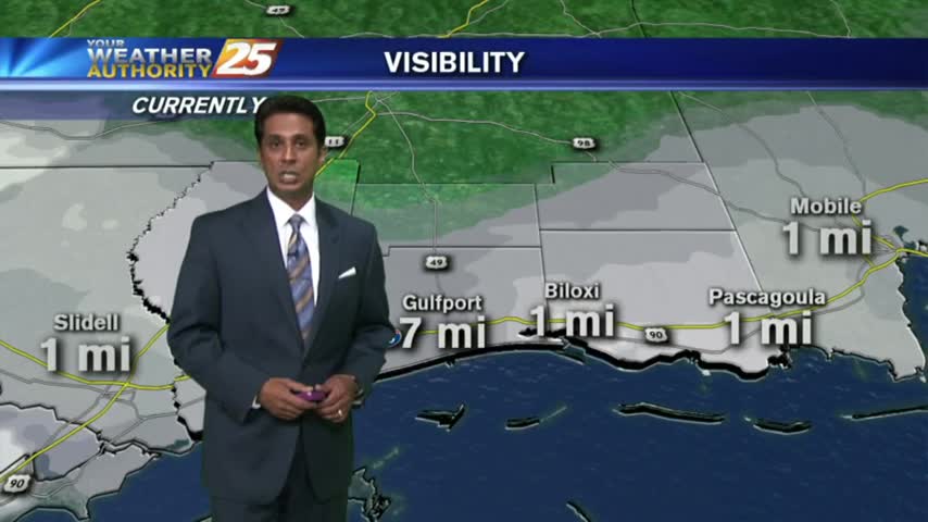
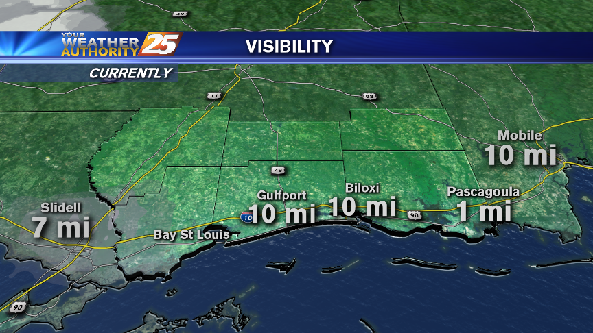
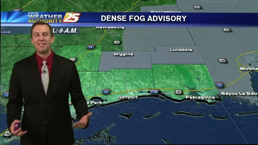
As the southerly flow continues in advance of an approaching cold front...DENSE FOG is in the area with an ADVISORY through this afternoon.
There is a Dense Fog Advisory for all Coastal counties tonight, lasting through Noon Wednesday. There are also a few thunderstorms rumbling in the area tonight.
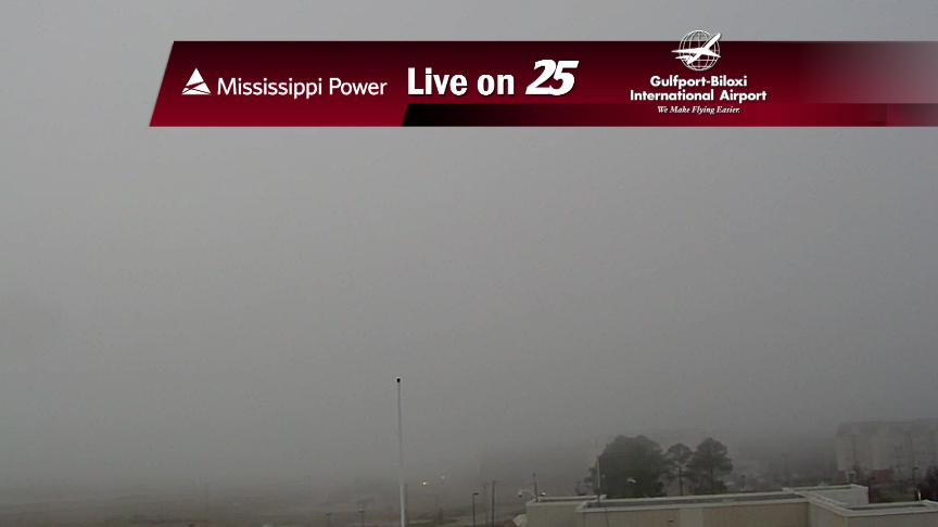
There's a Dense Fog Advisory tonight for the Mississippi Gulf Coast. There's also a LOT of rain in the forecast for the upcoming weekend.
Slight rain chances are in store through Tuesday. Much cooler weather is likely later this week.

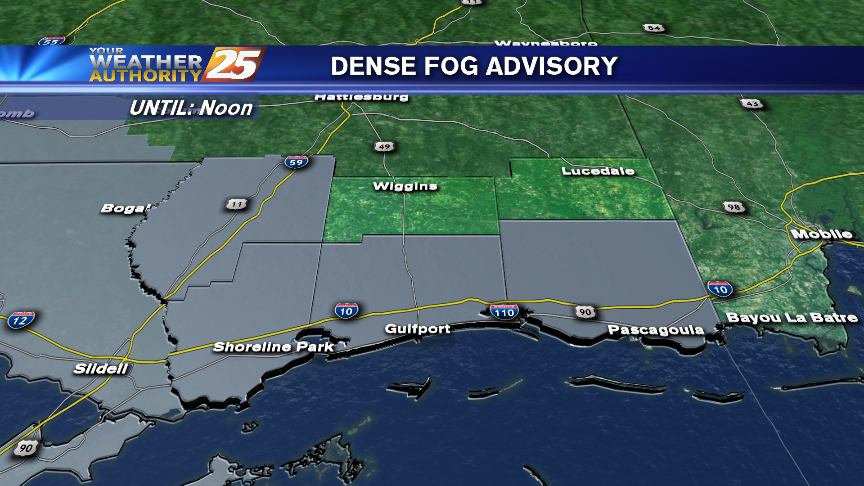
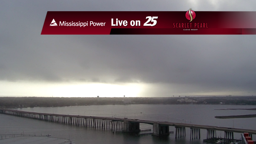
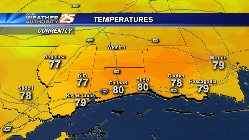
Good Evening and Merry Christmas! Unseasonably warm weather is forecast for the Coast through early week. There's a DENSE FOG ADVISORY in effect through mid-morning Monday.
There's a Dense Fog Advisory for the Mississippi Gulf Coast tonight. Fog will also be an issue through the rest of the Holiday Weekend.
There will be areas of fog tonight on the Coast, which may be dense at times.
Rain showers dotted the area earlier today. Tonight, though, fog will be of primary concern across the area.
Tonight, mild weather blankets the Mississippi Gulf Coast. There's a chance for patch fog that will be most bothersome Thursday morning.
Today started our gradual warm-up, and we'll continue to see some slightly higher temperatures tomorrow afternoon and night, but then things cool down a bit. Watch for details.
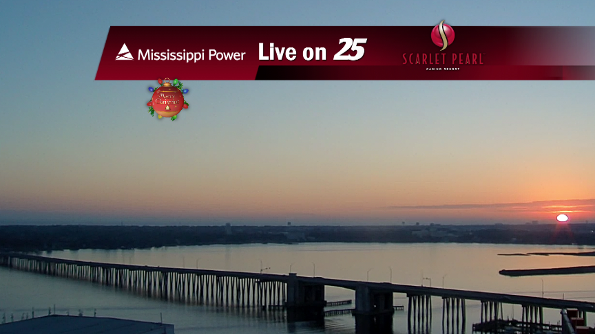
Excellent and seasonable weather is forecast moving into the Holiday weekend.

We'll see some freezing temperatures around South MS tonight, but the "winter" weather won't stick around long...even for the official start of Winter on Wednesday.

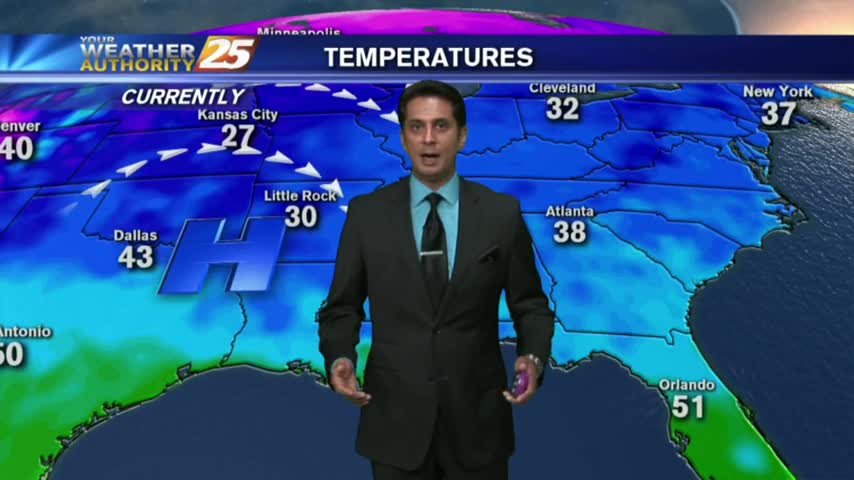
Very cold wind chills are forecast for tonight. Some readings will dip into the mid-teens before sunrise Wednesday.
Light rain is still possible overnight while cold northerly winds will make it feel like it's in the twenties.
It warmed up considerably today as expected, and that will continue into tomorrow, bringing our afternoon high into the mid to upper 70s. Doesn't last forever though, so check out the forecast for details.
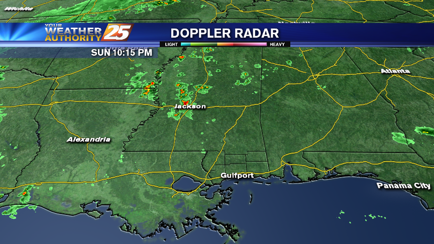
Heavy thunderstorms will be possible across the area on Saturday night and Sunday morning!
While severe weather is not expected on the Coast this weekend, we'll be in close proximity to some that is expected to occur over SE Louisiana on Saturday. Dense fog is possible Friday night and Saturday.