2/1 - Rob Knight's "February Weather Pattern" Forecast
As the warm/humid air from the GOM continues to move in...high pressure is suppressing the atmosphere with patchy morning fog...
As the warm/humid air from the GOM continues to move in...high pressure is suppressing the atmosphere with patchy morning fog...
Fair weather is the rule for South Mississippi this afternoon and for the next couple of days.
Expect a warmer and clear night after today's nearly perfect afternoon, but these great conditions won't last forever. Check out the forecast for details.
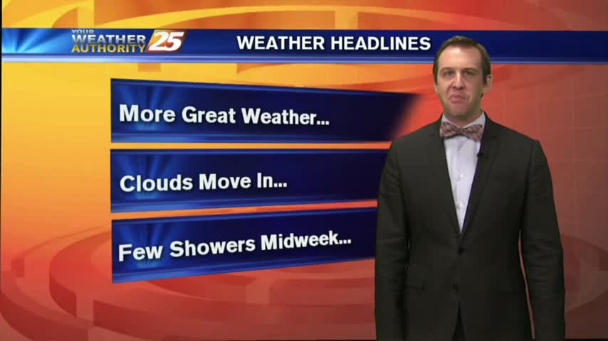
Boring weather is good weather, and you can expect it to be boring for a few more days. We'll see some changes as we head into the weekend though, watch forecast for details.
Excellent weather is ongoing for south Mississippi. This forecast also warms us up some more.
Crisp and clear conditions are in store for the Mississippi Gulf Coast tonight. There's a warming trend to start the week, too.
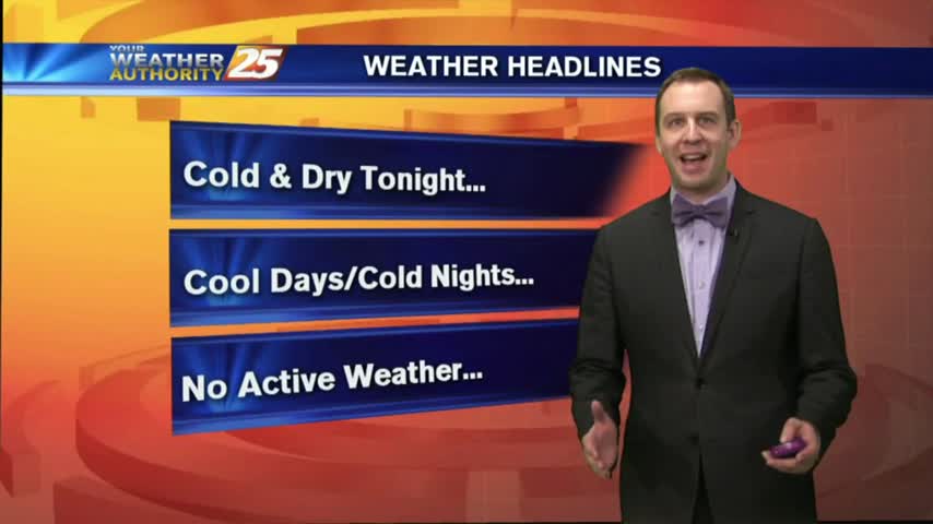
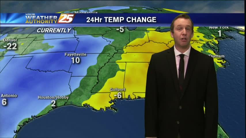
Much colder tonight, but still above freezing in South MS. Some light frost possible in some of the more inland areas tonight and tomorrow night though. Details inside.
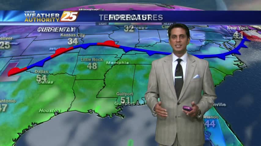
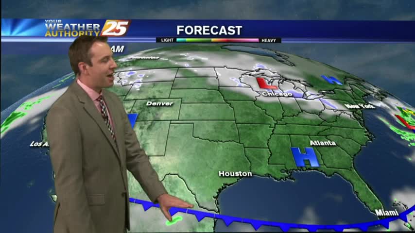
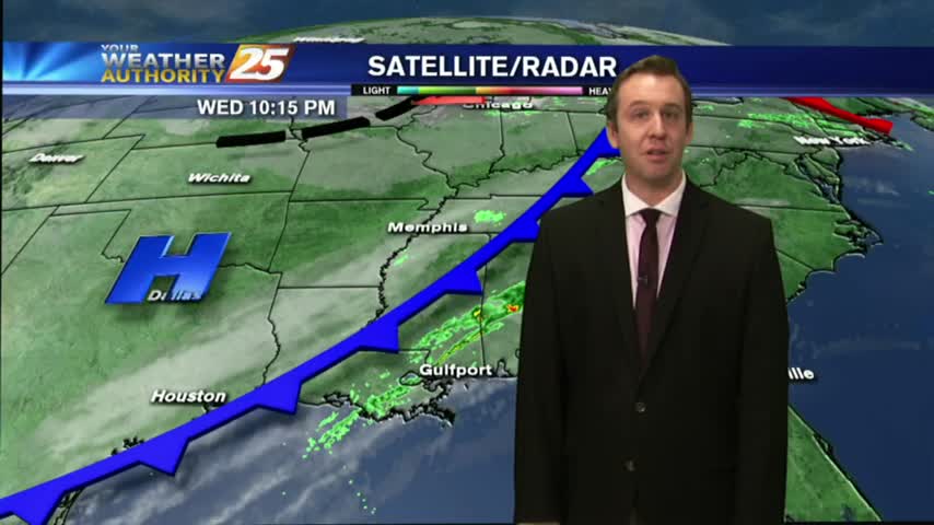
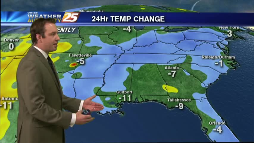
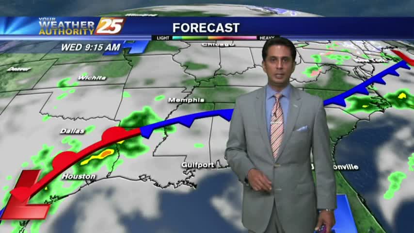
Rain has ended across most of the Southern States and more seasonable weather lies in its wake.
A cold front is slowly marching through the area, expect a few showers over the next few hours, but clear, cool, and dry weather afterwards. Full forecast details inside.
A few showers and storms will be moving through the area between now and midnight, bringing dry & sunny weather to the Gulf Coast. Watch for details.
A few showers will be possible through this afternoon and evening here in southern Mississippi.
Still warmer than "average," but cooler temperatures are on the way...just not until after tomorrow's low 70s. Details inside.
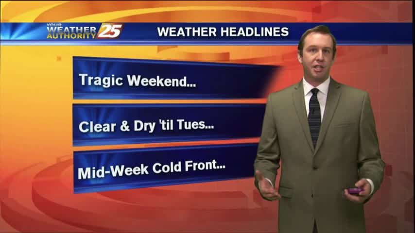
A tragic severe weather weekend may have soured weather for many, but this week's conditions will be markedly more clear and dry. Click for forecast details.
Still breezy this afternoon, but winds will begin calming overnight. Expect "above-average" temps to continue for the short term, details inside.
Rain is over for the area and more seasonable temperatures are expected this week.

Rain and storms are gone, replaced by (actually) seasonably-normal weather on the Coast.
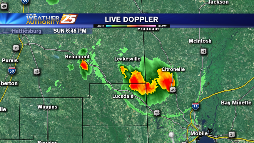
After sunshine this afternoon, t-storms are beginning to pop to our SW...moving NE into the area...
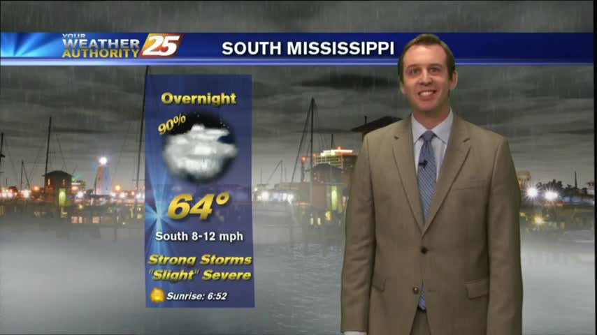
After a pleasant day, we'll see a strong round of storms tonight. Details within, updates to come.
Today's afternoon weather passed through as expected, but more severe weather is ahead for the weekend. Forecast details inside.
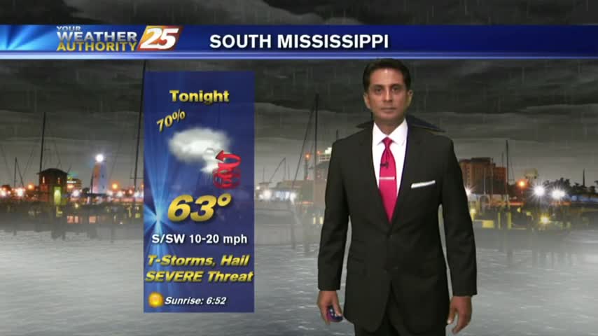
There's a Flash Flood Watch through this afternoon and a Slight Risk of Severe Storms, as well.
More fog ahead tonight, but we'll finally see a pattern change tomorrow. Unfortunately, it's because some strong and potentially severe storms are moving through. Details within.
Showers and heavy thunderstorms are possible for the Coast on Thursday with widespread severe weather expected this weekend.
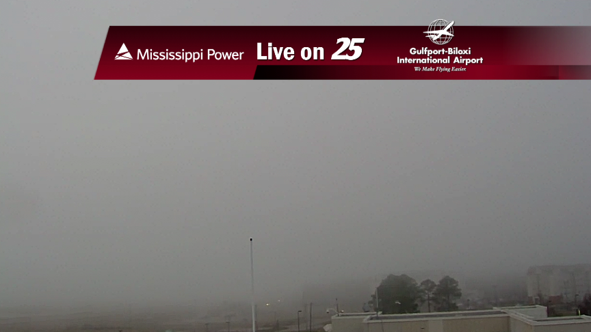
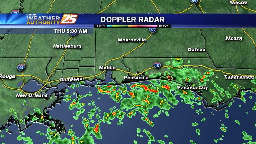
A warm/humid start with DENSE FOG and HORRIBLE VISIBILITY. Please USE CARE WITH YOUR MORNING COMMUTE.

The dense fog moved in earlier tonight than it did last night, so visibility will be dangerously limited until late tomorrow morning. Full forecast inside.