8/28 - Brittany's "Pleasant" Sunday Evening Forecast
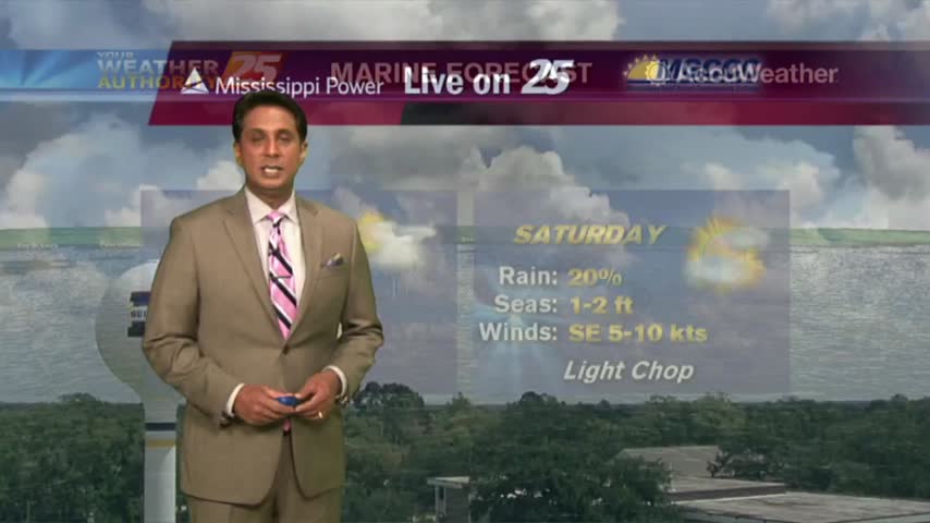
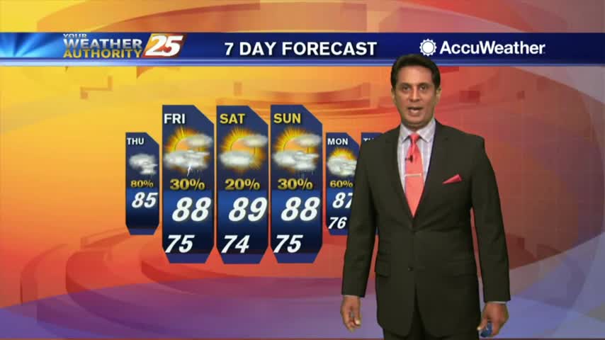
A broad ridge of high pressure will remain over the northern gulf through the week promoting onshore flow with showers and thunderstorms expected each day. Starting out the new…
A broad ridge of high pressure will remain over the northern gulf through the week promoting onshore flow with showers and thunderstorms expected each day. Starting out the new…
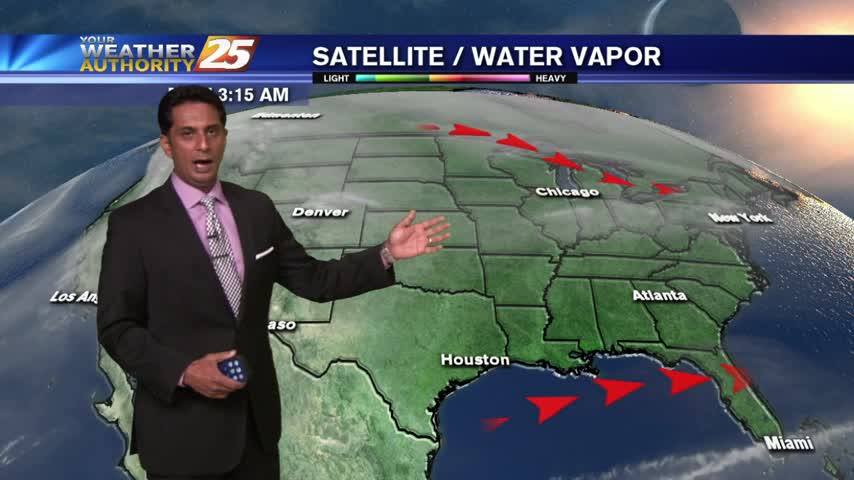
The upper level pattern across the country, and somewhat locally, is starting the transition process that will begin to finally lower rain chances for the northern Gulf Coast.…
The area is currently still between high pressure to our west and and the Bermuda high pressure to our east and a weak mid level inverted trough…
A warm and humid start to the day with areas of light patchy fog...
It's been a beautiful morning thus far with plenty of sunshine: Only a few t-storms on-tap this afternoon...
TD Gordon is well in our rear-view mirror with a few showers coming in from the Gulf of Mexico...
A very mild start to kick-off the weekend as drier air continues to affect the region...
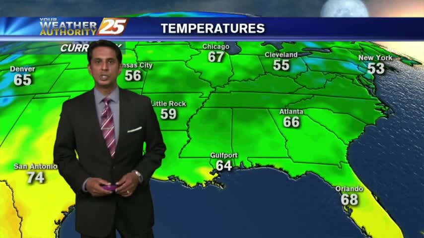
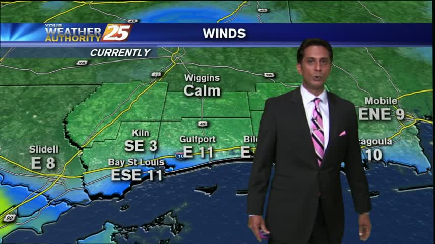
A pleasant start to the day with several reporting sites in the mid/upper 60s, under clear skies...
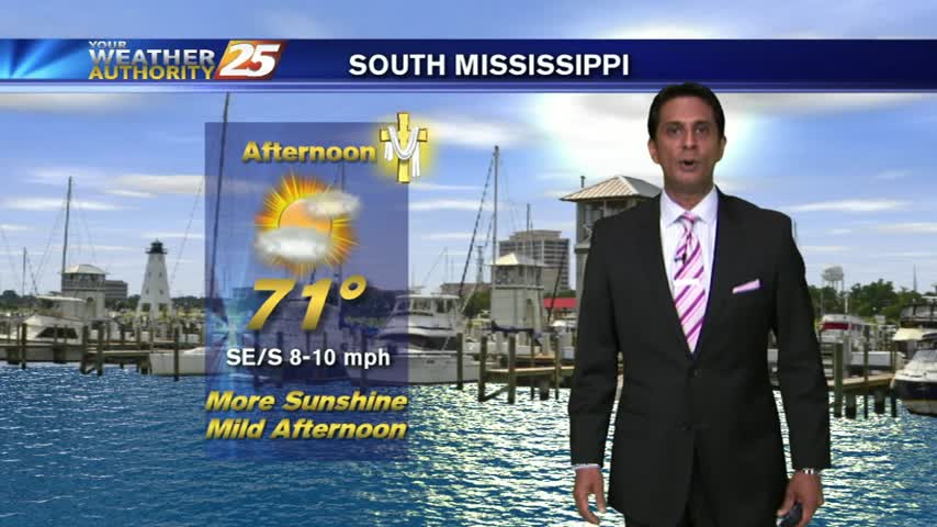
The beautiful weather will continue into the weekend as high-pressure to our north continues to shape our forecast...
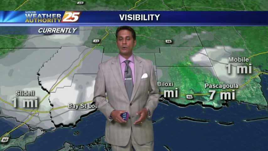
PLEASE BE CAREFUL - Areas of patchy DENSE FOG has developed for your morning commute...
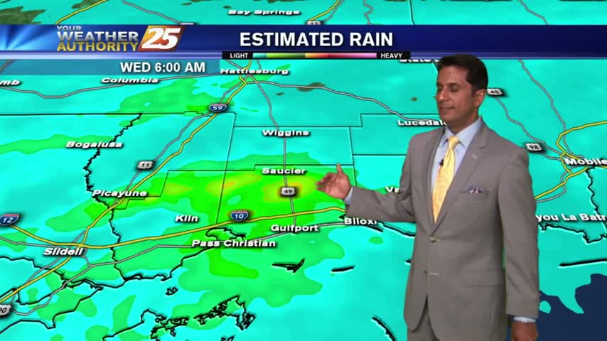
After a batch of HEAVY rain earlier we now have plenty of sunshine, but more rain is on-tap...
A DISRUPTIVE morning as areas of DENSE FOG has developed...
As the stationary front to the south begins to dissipate, rain potential have decreased dramatically...

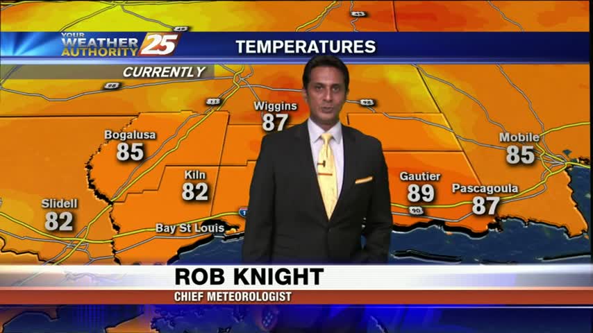
A MUCH DRIER start along the Mississippi gulf coast...
After a sunny weekend, it's a clear start with chilly and dry conditions...

As the cold front moves east, drier air moving into the area continues to dry the clouds leaving sunny skies...
A cloudy but drier start as a NW wind will continue to clear skies later this morning...