11/16 - Rob Knight's "Colder Air" Monday Mid-Morning Forecast
A very COLD start to the day as a Canadian air mass continues to move in...
A very COLD start to the day as a Canadian air mass continues to move in...
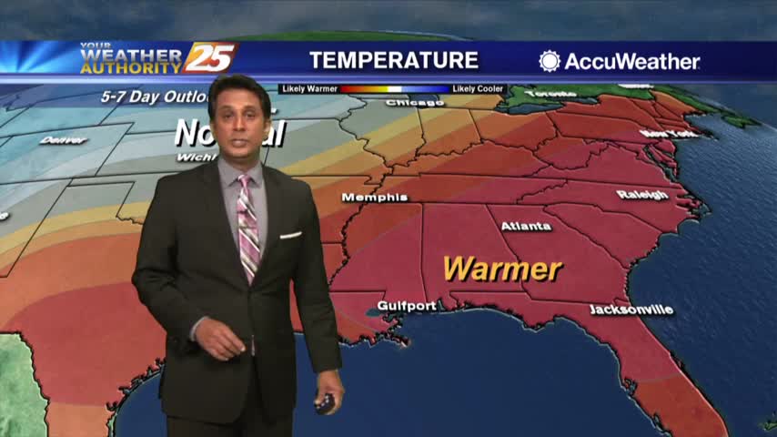
Another very cold start to the day but the warm up will begin later this afternoon and through the weekend...

A COLD start under clear skies...
A VERY COLD start to the day with clear skies and lighter winds from yesterday...
A very cold start to the day as the cloud coverage continue to clear to our east...

A cold and clear start to the final morning of winter with an area of high-pressure to our west...
With a VERY COLD air mass north of our state, cold air is filtering in with frigid temps heading out the door...
Under clear skies and a northerly flow last night, it's a FRIGID start with a FREEZE WARNING in effect through 8 a.m...

Another VERY COLD start to the day, but the warming trend has begun...

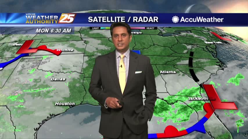
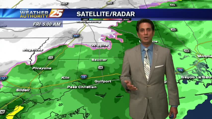
A COLD start to the day as the rain shield is moving slowly to the east...

Another FROSTY start to the day...but the warm-up will begin later this afternoon...
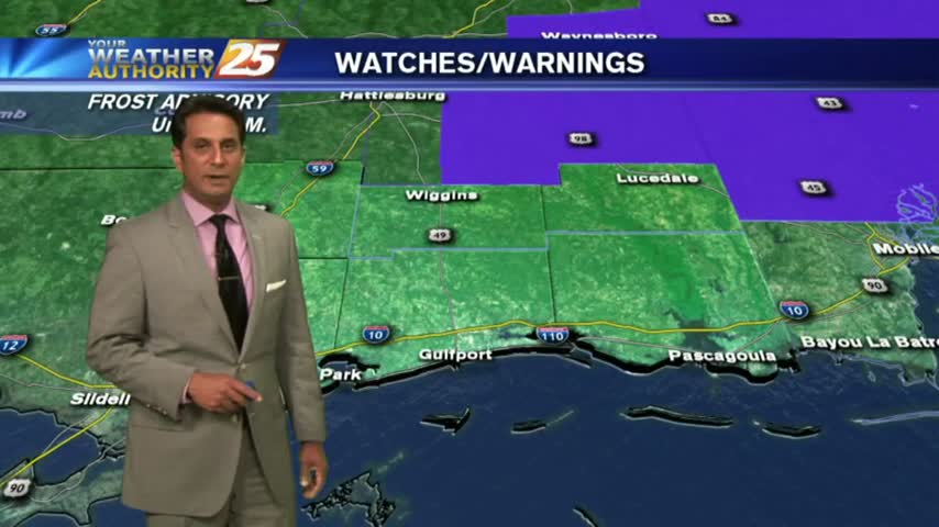
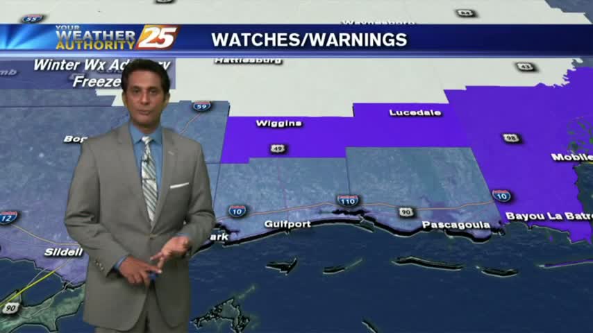
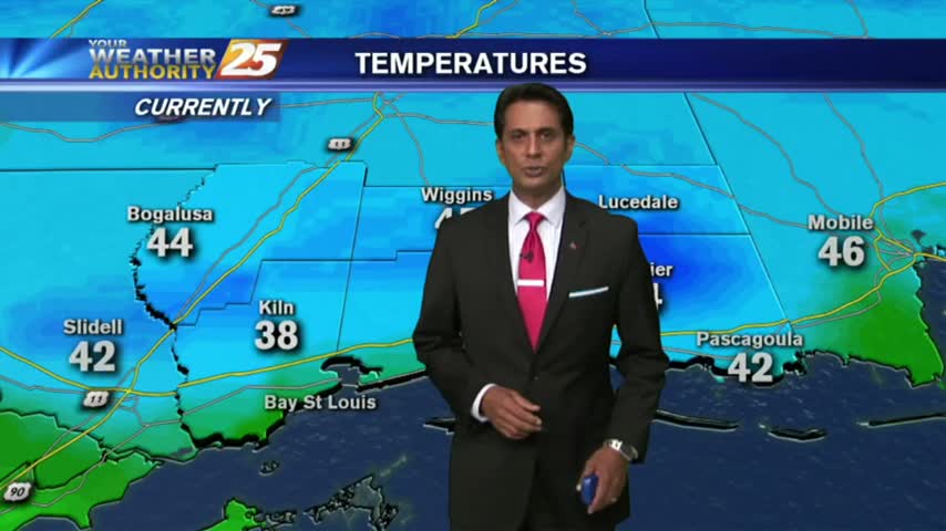
A COLD start with several locations inland below the freezing mark. A FROST ADVISORY continues though 9 a.m...

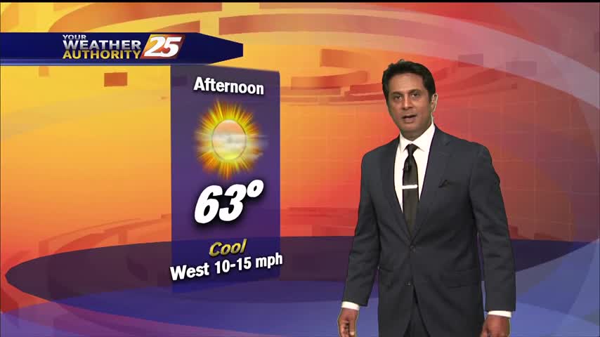
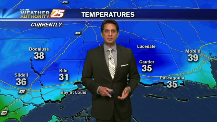
A clear and COLD start to the day with temps in the low/mid 30s inland, mid/upper 30s along the coast...
It's another COLD start heading into the weekend with inland areas under a FROST ADVISORY...
Thin upper-level clouds are moving into the area from the NW, with COLD temps as a few locations are in the low 30s...

It's another cold and cloudy start to the day with light/spotty rain moving across the viewing area...
A VERY cold start to the day as clouds are increasing from the west as a warm front south of the area slowly moves east...
A VERY COLD start to the day with many locations below freezing, even in the mid/upper 20s...
A COLD start with rain along the Southern 6...but the "SNOW LINE" is moving in from the NW...
A COLD start with rain along the Southern 6...but the "SNOW LINE" is moving in from the NW...
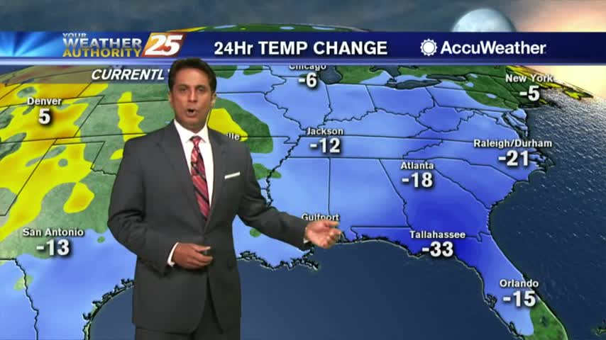
A weak cold front moved through the area Saturday night, bringing some COLD temperatures to kick-off the final week of November...

Changes through the weekend with frontal passage now has FRIGID temperatures along the Mississippi Gulf Coast...
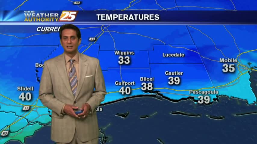
Clear skies last night with a north wind has brought COLD number to the area this morning...in the upper 30s to low 40s...
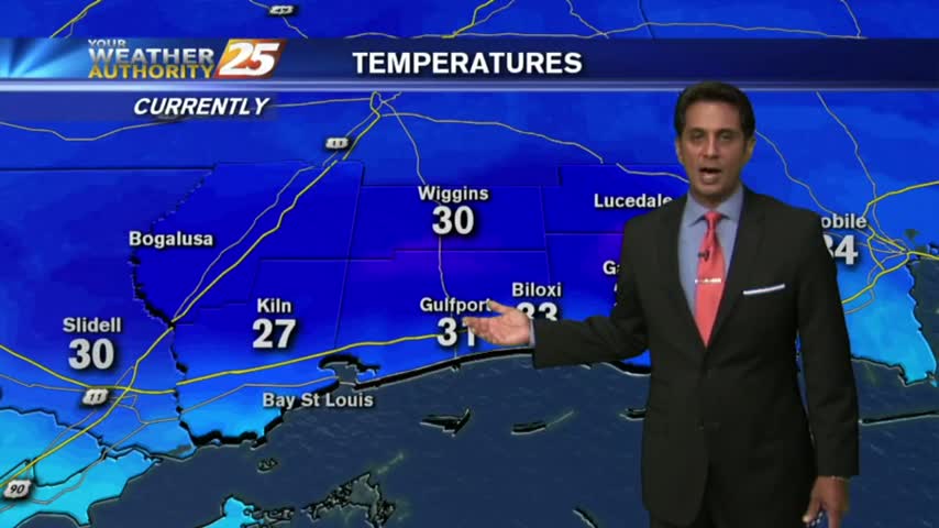
With clear skies and a north wind overnight, some of the COLDEST temperatures of the season thus far has settled along the Mississippi Gulf Coast...