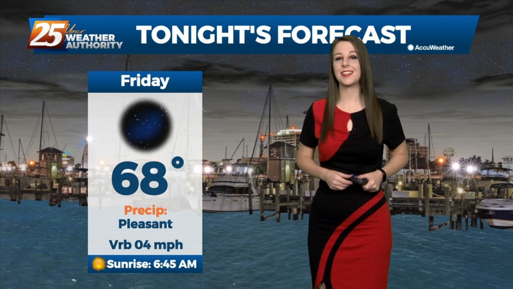
9/23 - Brittany's "Pleasant" Friday Night Forecast
The big news of the short term is still the hot and dry conditions that we have been seeing lately. Although we did see a "cold front" this morning,…
The big news of the short term is still the hot and dry conditions that we have been seeing lately. Although we did see a "cold front" this morning,…
Upper ridging over Texas will be in the process of getting suppressed southward by Saturday night and Sunday as a strong trough digs through the Great Lakes. This will…
High pressure will hold on one more day on Saturday, with high temperatures pretty similar to Friday. Another disturbance will move across much of the eastern half of…
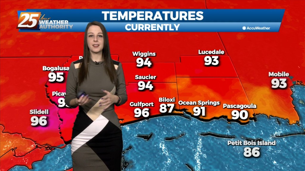
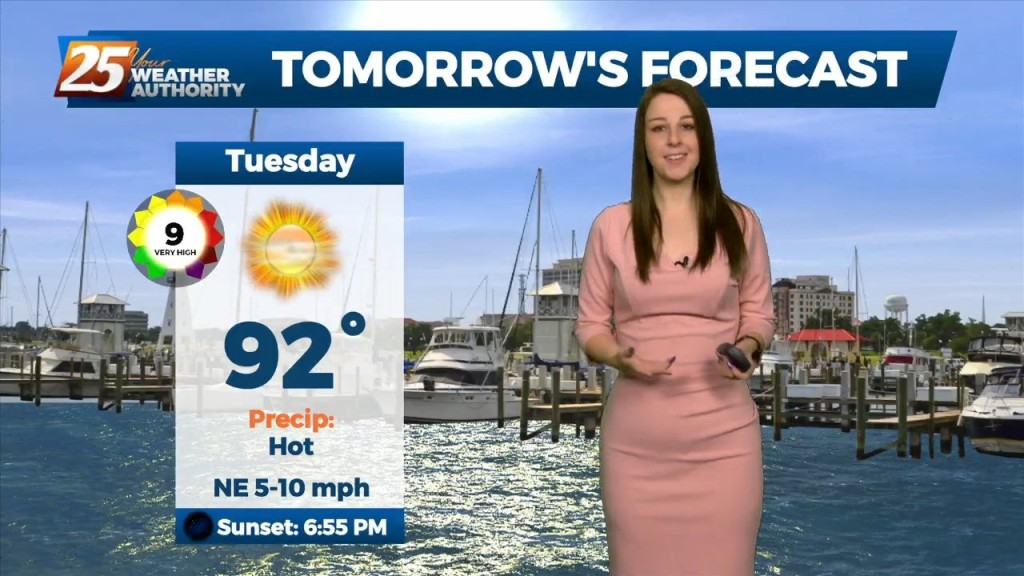
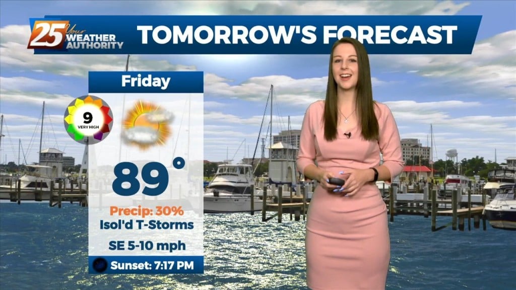
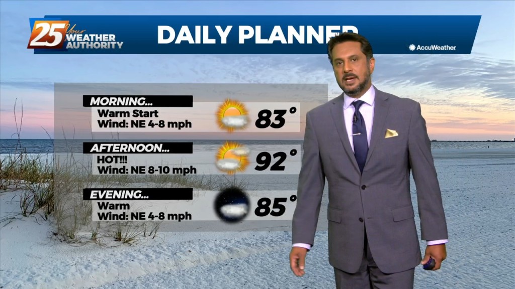
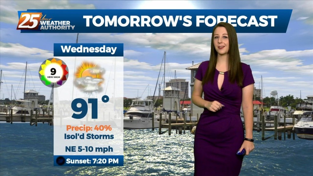
Tomorrow is expected to be the hottest day of the week, even reaching near or at record in some areas, with temperatures forecast in the mid to…
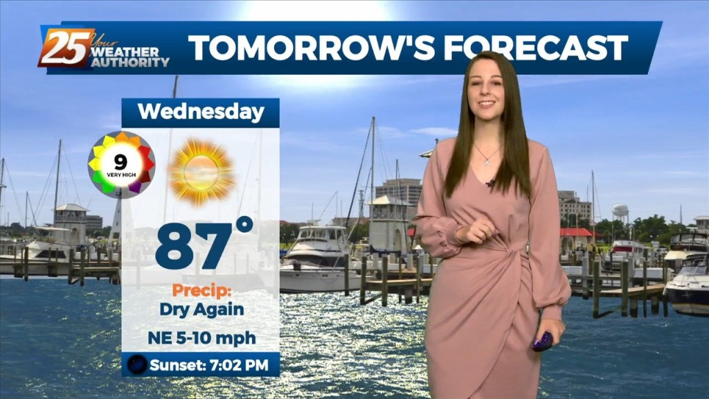
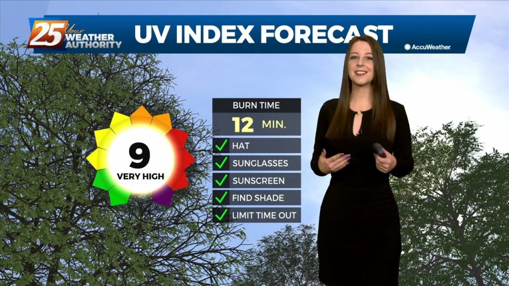
We will remain in a high pressure and ridging pattern through the period. This has been keeping conditions hot and dry the last couple days and this will continue…
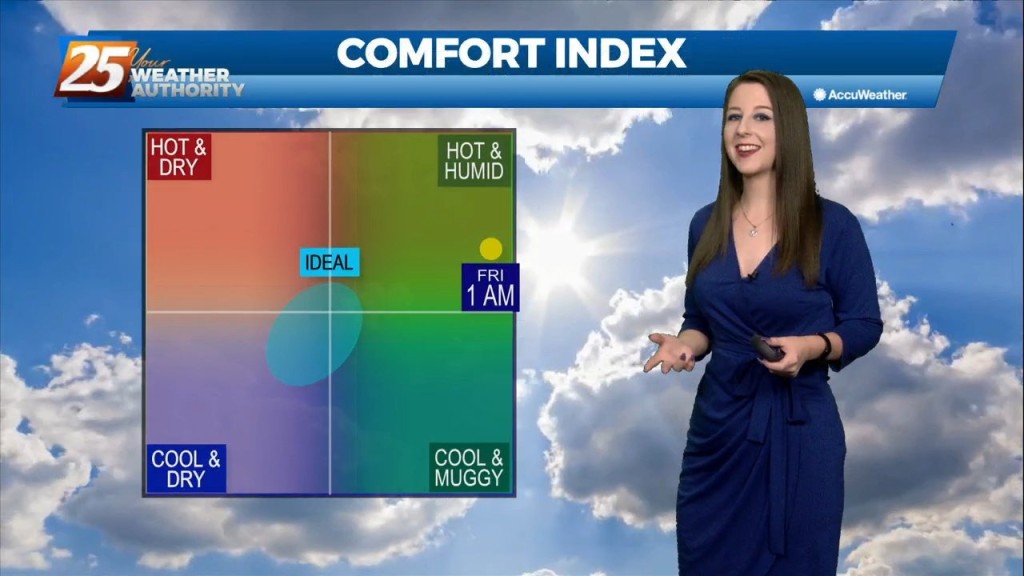
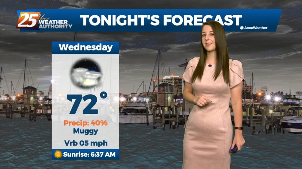
This evening will be quiet and cool with lows averaging in the low 70's. The rain free conditions will continue. The heat continues to build mid-week through late week,…
This evening, temperatures will quickly cool with the loss of daytime heating. As the surface high pressure settles in just to our north, winds will decouple across most of…
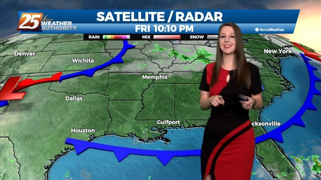
A cold front will continue pushing through the area this evening with noticeably drier air behind it. Surface ridging will build in behind it which will allow…
Early this morning, we will continue to see decaying showers over coastal Mississippi, with a remnant boundary possibly leading to a few re-developing isolated showers…
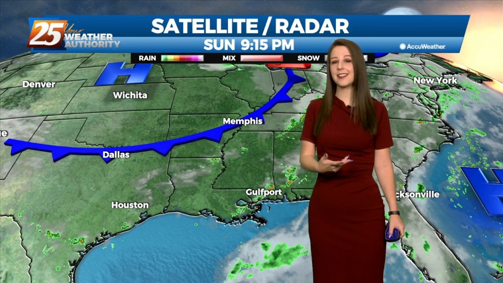
The main headline for the short term is a front is actually coming to the Central Gulf Coast! This cold front is currently located upstream of the…
Tomorrow will be quite similar as the overall pattern shows little change. The upper low will still be in place overhead, but likely weakening at this point. Model suggests…
We could see some lingering showers and thunderstorms this evening. Heading into tomorrow, an upper low will be completely closed off at this point and meandering around…
Tonight, some scattered showers and storms will be possible,especially in the northernmost areas. Through the end of the week, an upper level low is expected to influence…
The dry conditions have been nice for a short time, but the rain will return over the weekend as the pattern changes. Southerly surface winds will act to…
Mid level dry air will remain in place today. This will help cap the environment, making it harder for thunderstorms to get started. There will be some…
A frontal boundary is expected to move into the area late tonight and stall over the area by tomorrow afternoon. This front will bring stout mid-level dry air into…
A frontal boundary is expected to move into the area late tonight and stall over the area by tomorrow afternoon. This front will bring stout mid-level dry air into…
The broad upper level analysis shows a ridge centered over the Rockies which expands over at least 2/3 of the country and trough digging across the northeast CONUS.…
Tonight through Tuesday, an approaching frontal boundary mixed with Gulf moisture influx will enhance rain chances for our area tonight. And a lingering boundary will set up…
A cold front sagging into our area is expected to stall through the weekend before slightly retrograding. Isolated/scattered showers/t-storms are expected today especially with daytime heating.…
The main concerns are for heavy rain in the first 36 hours of the forecast...or in other words, today and Thursday. as showers…
The next trough in line, starting out farther south than the Monday one, begins digging south and east over the southern Rockies on Tuesday. At the same…
High pressure continues to shape the forecast. Clear skies are area-wide with comfortable spring conditions. As we head into the new workweek though, changes are ahead. We will…
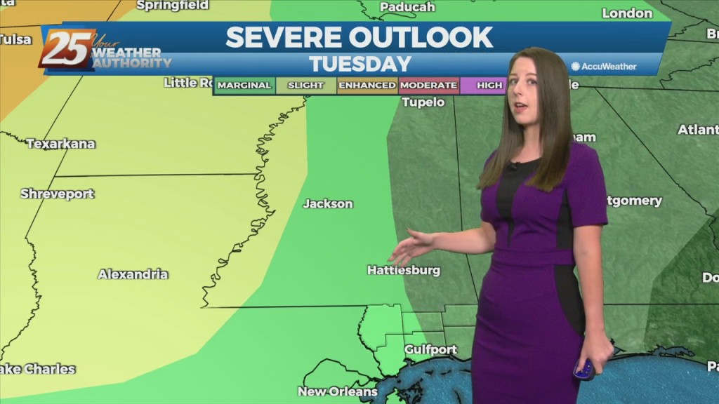
The area is under an ENHANCED/MODERATE threat for severity...especially noon through midnight WATCHES/WARNINGS include: Wind Advisory, Flood Watch, Coastal Flood Advisory & Small Craft Advisory. Some prefrontal…