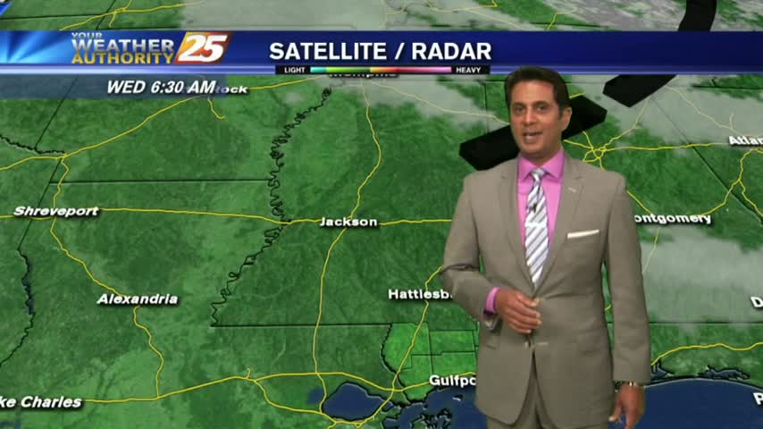
4/19 - The Chief's "Sunny & Warm" Wednesday Morning Forecast
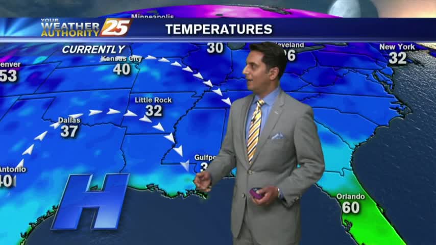
There is upper troughing over the northwest and northeast corners of the country with high pressure over the northern Mississippi River Valley. The shortwave that moved…
There is upper troughing over the northwest and northeast corners of the country with high pressure over the northern Mississippi River Valley. The shortwave that moved…
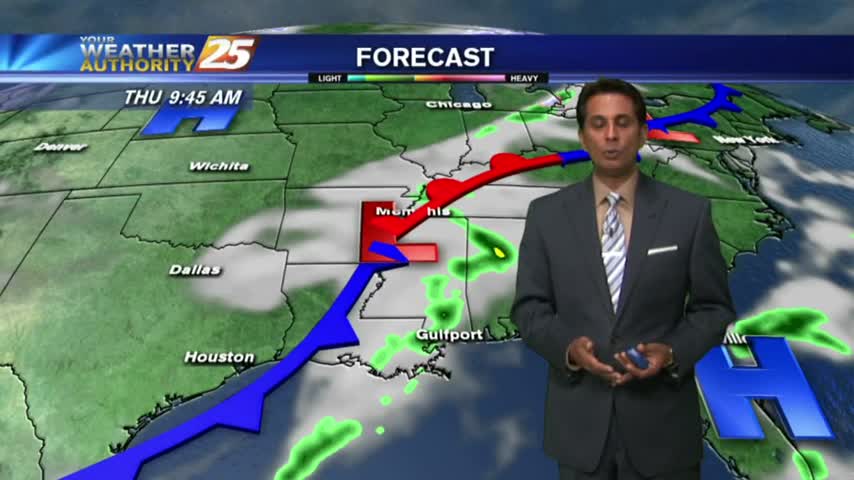
High pressure continues to dominate the short term forecast period ahead of the front. Surface high will begin to shift off to the east tomorrow as an upper…
A chilly start to the day as cloud coverage will begin to increase...
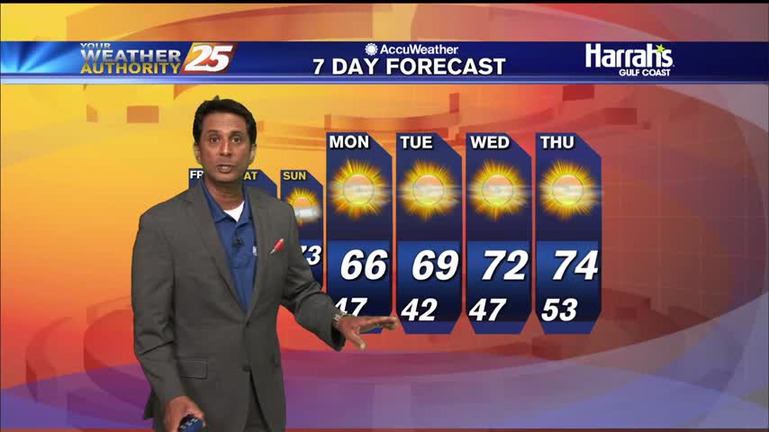
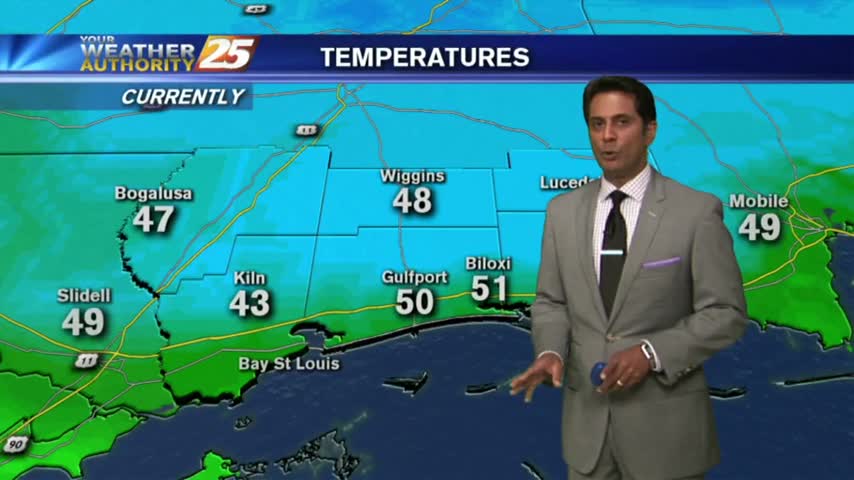
Today’s highs look to remain on the cool side with upper 40s/lower 50s interior to the lower half of the 50s for coastal sections. If clouds hold in longer than expected today, then a lower adjustment to highs will be…

Another chilly start as high-pressure centered to the NW brings in the colder air mass...
A chilly start to the day with temperatures in the upper 40s/low 50s...

A CHILLY start to the day as strong high-pressure moves in from the NW...

A chilly start this morning with the COLDEST of the air mass still to the NW...
With the colder/drier air mass still in place, it's a CHILLY start on this Final Monday of February...
In the wake of last night's cold front, it's a chilly start to the day with the winds beginning to increase...
Another CHILLY morning but major changes ahead as an area of high-pressure overhead begins to move SE...
It's a CHILLY start on this 1st FULL day of Spring with clear skies...

Another cold start to the day under cloudy skies, with improved conditions for your Mardi Gras...
A COLD start to the day with MUCH WARMER temps the final few days of November...
A CHILLY start to the day but warming temperatures will begin moving into the region...
Another CHILLY morning along the Gulf Coast...but major changes on the way will bring the warm-up to the area beginning this afternoon...
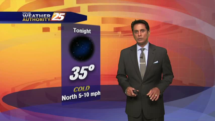
After a chilly night, COLDER air is on the way with a dry front overhead moving east. A reinforcing shot of COLD/DRY air will begin moving into the area...
Another CHILLY morning as a COOLER/DRIER air mass begins to move into the region...
With high-pressure, clear skies and a drier air mass...it's a CHILLY start with temps in the upper 40s to low 50s...
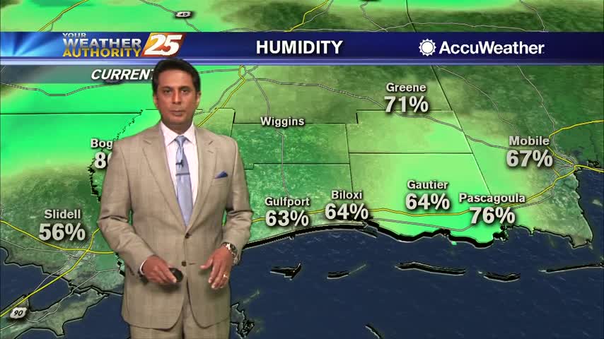
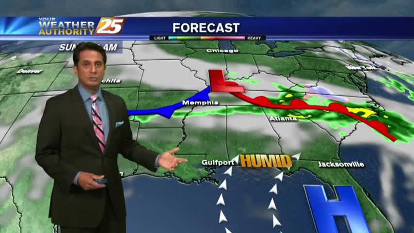
Another CHILLY start to the day with a SW wind which will bring increased humidity to the region...
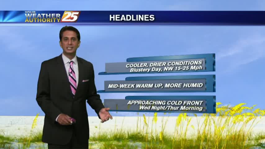
In the wake of yesterday's cold front, a cooler/drier air mass is moving into the area as BREEZY conditions continue...
Its a BEAUTIFUL start to the day with chilly temperatures, low humidity and clear skies...
After the clouds cleared yesterday afternoon...clear skies and light winds overnight brought CHILLY temps to the area...
Windy conditions tapered-off yesterday evening with light winds and clear skies overnight. After a CHILLY start, today will bring changes...