12/23 - Brittany's "COLD End To The Workweek" Friday Night Forecast
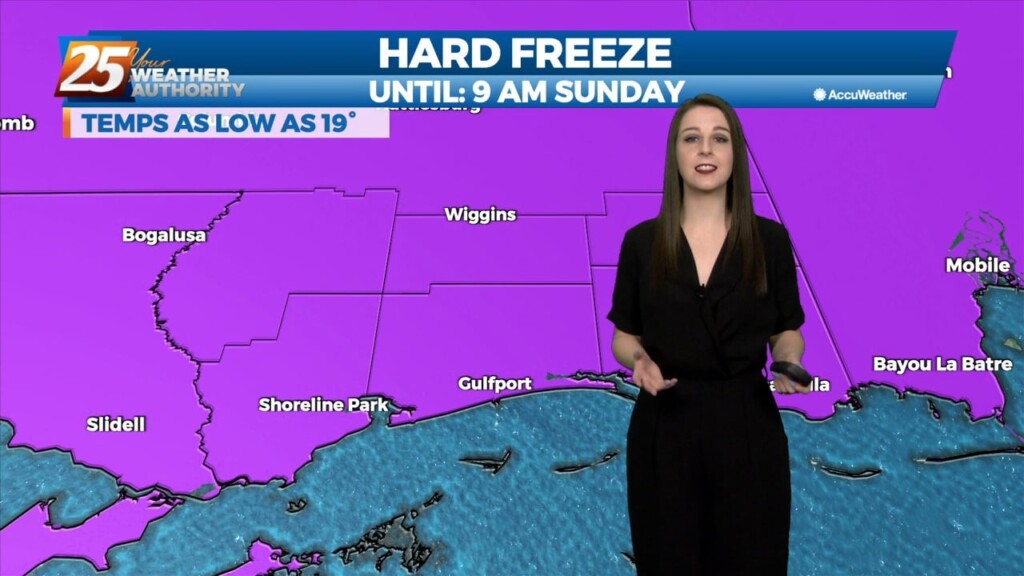
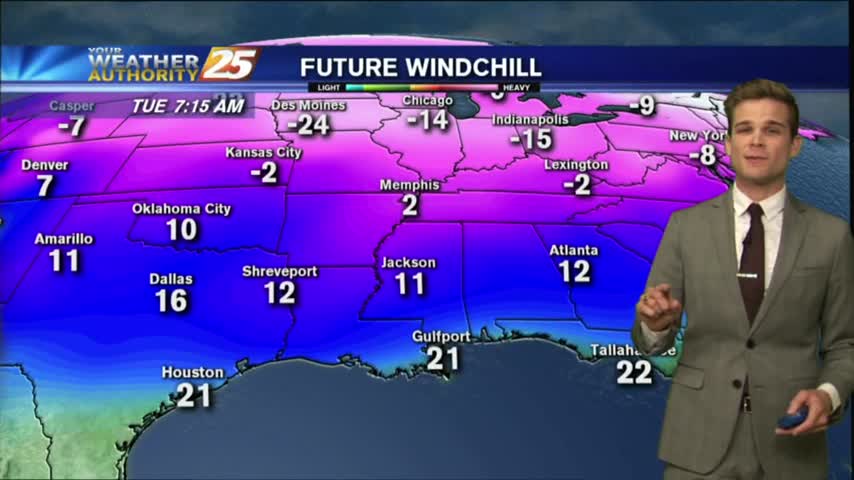
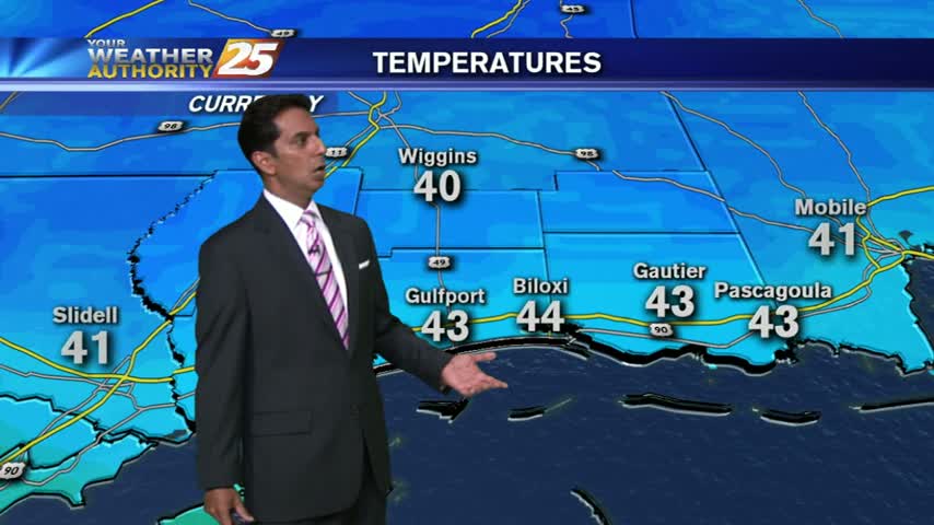
The very VERY COLD Arctic air mass brought bitter cold conditions to the region last night, with high temperatures earlier today only maxing out in…
The very VERY COLD Arctic air mass brought bitter cold conditions to the region last night, with high temperatures earlier today only maxing out in…
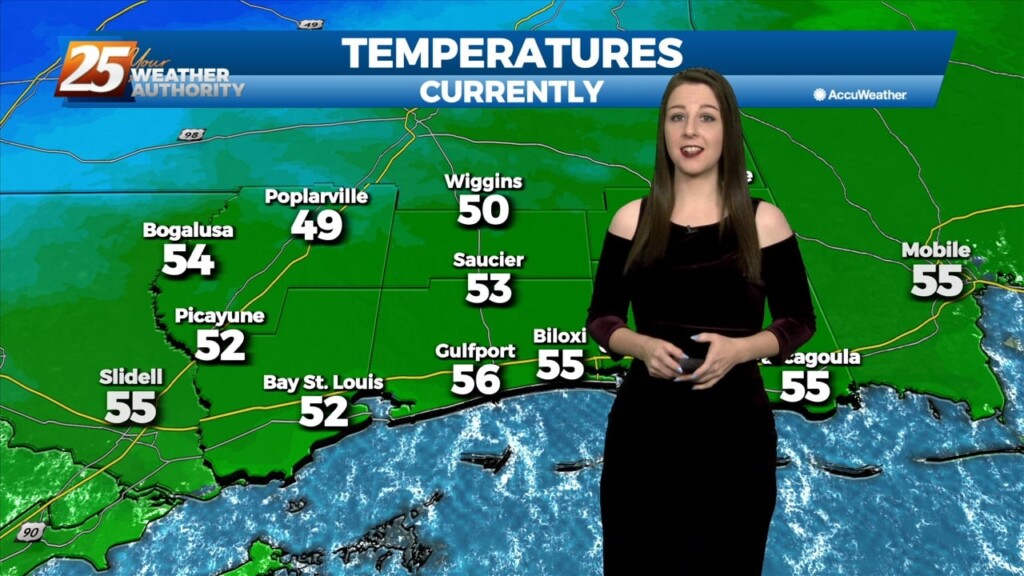
Temperatures are still moderate by the 10 o clock hour but an approaching cold front will push through our area by midnight and it'll usher in…
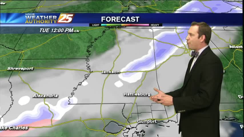
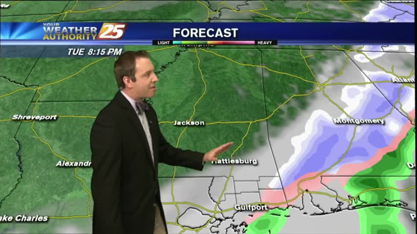
Through tonight, the residual rain/convection should begin to exit the forecast area stage east as much drier air aloft begins to work its way into the…
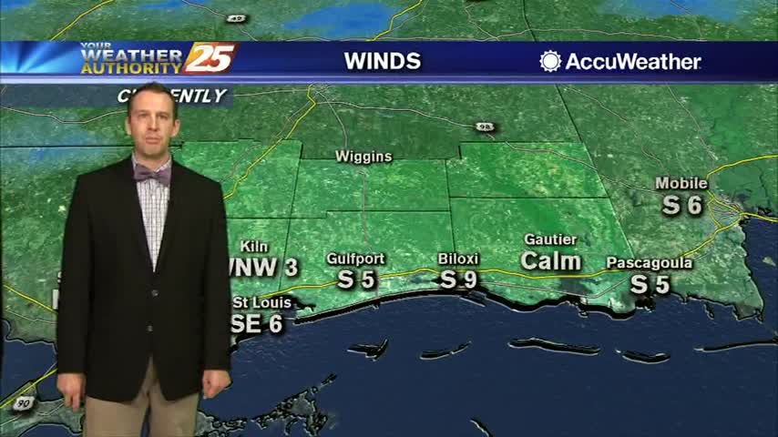
A cloudy and cool start to the day as winds are starting to elevate...
Warm and humid conditions have dominated our days and nights since last weekend, but a front brings sudden changes tonight....
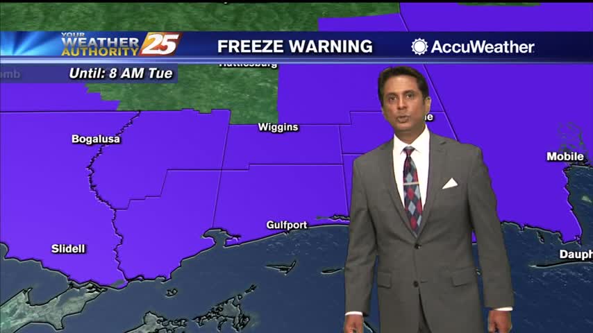
Mostly clear and cold tonight, but an Arctic front is moving in that will bring even colder air and even some possible winter weather! Click the forecast link for the latest information.
After a warm and humid start to the week we'll see some drastic changes as another Arctic front pushes into South MS, bringing the slight chance of wintry weather. Click the link for the details.
The rain has finally moved out of the area, and now sunny conditions are headed our way...along with Arctic air.
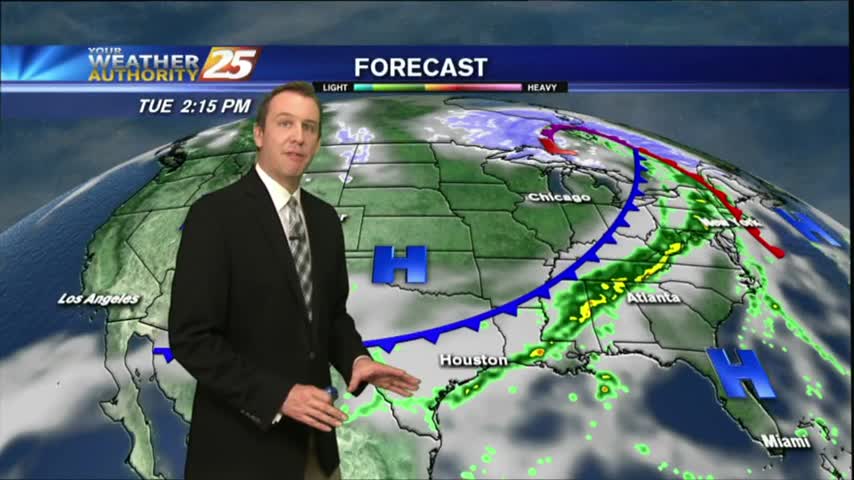
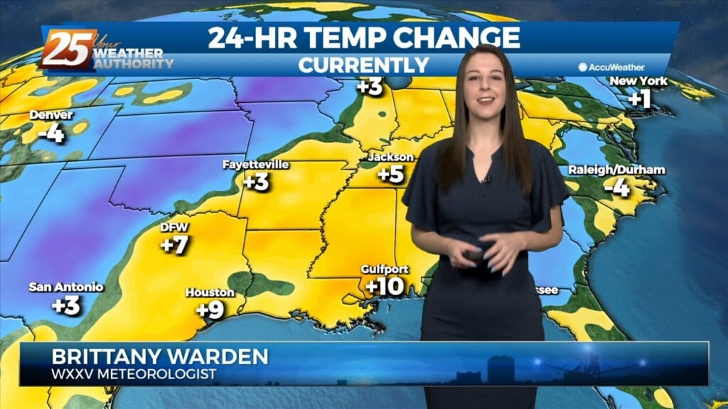
It remained warm and humid through the weekend and into this afternoon, but a strong cold front will bring drastic changes by the end of the week. Read and watch the full forecast for the details.
A cold start with a few clouds departing the area to the east...