8/22 - The Chief's "Even HOTTER Temps Ahead" Tuesday Afternoon Forecast
Temps will climb a bit today as dry air will begin to take the place of the departing tropical environment but won’t be too fast…
Temps will climb a bit today as dry air will begin to take the place of the departing tropical environment but won’t be too fast…
An area of low pressure over-southern Minnesota will move to the Mid-Atlantic states by Tuesday night, dragging the trailing frontal boundary into the local area during…
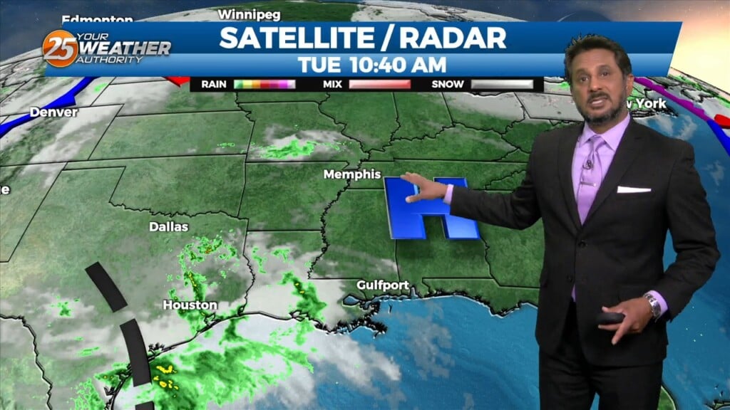
With little in the way of upper level support across the central Gulf States, expect only limited rain chances through mid-week…with another hot afternoon ahead. Models…
Not much in the way of anything to help showers/t-storms get started today and relatively low chances will continue over the next several days. But some…
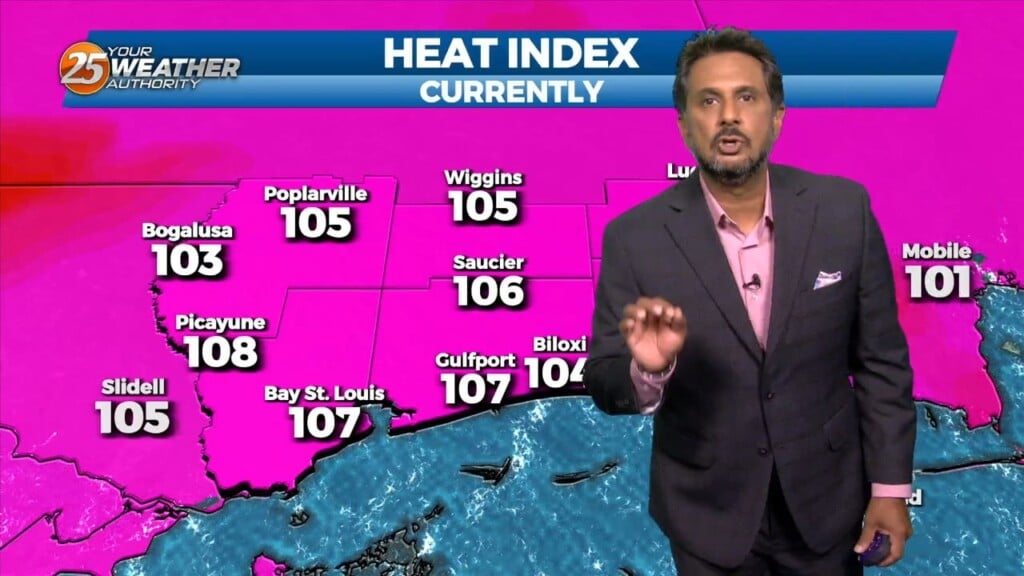
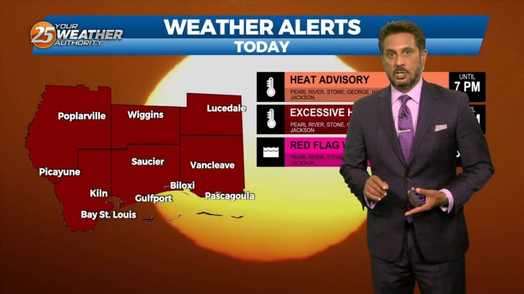
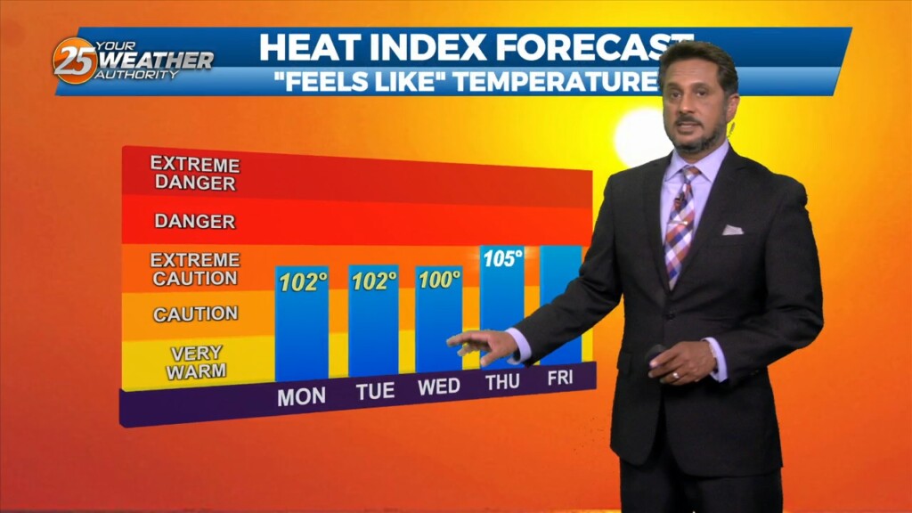
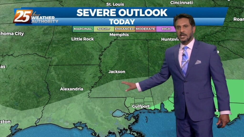
A HEAT ADVISORY is in effect once again this afternoon with heat indices between 106-112 degrees expected. Synoptically, the region remains under the influence of a large…
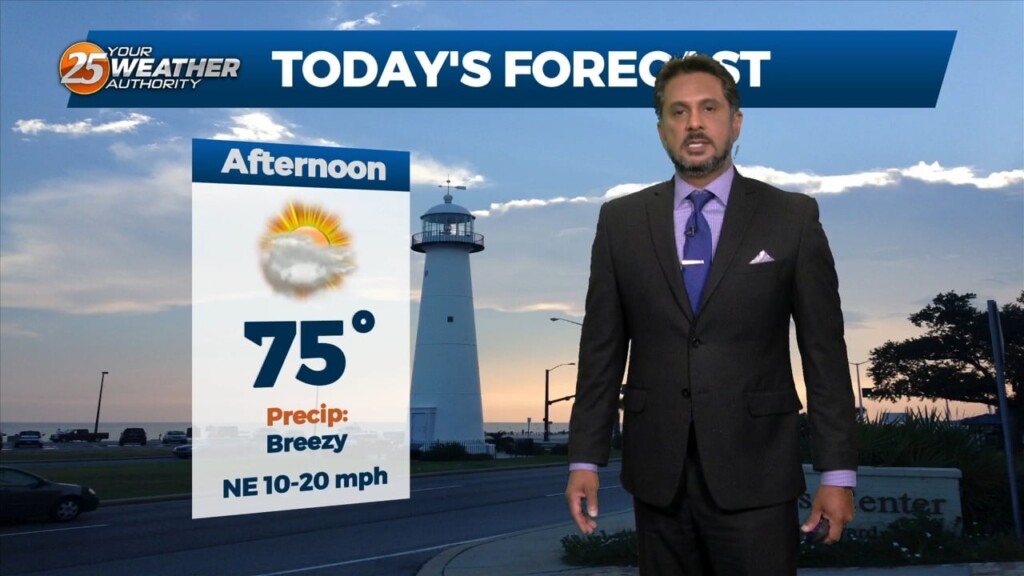
This afternoon temperatures will be in the low 90s, however heat indices will remain below advisory level. This is due to sea-breeze activity that will form coupled with daytime heating especially to the south of I-10 this afternoon. Activity will…
Showers/t-storms will once again ramp up this afternoon with daytime heating. High pressure is still in place but there has been just enough of a weakness…
With a weak cold front overhead and drier airmass, showers and thunderstorms will pop a little later this afternoon. The activity will get started farther NW and…
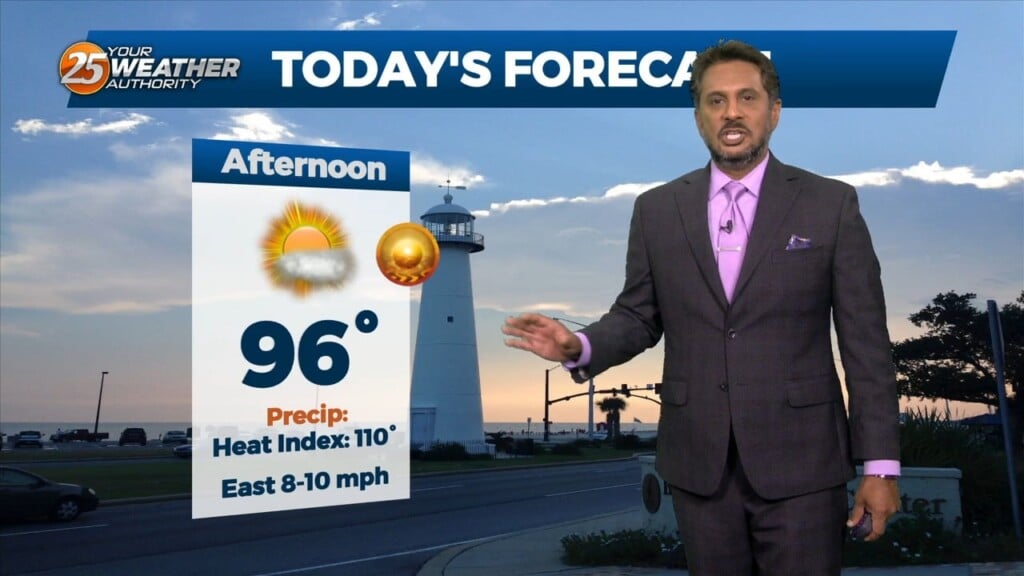
Very HOT temperatures ahead this afternoon as the HEAT INDEX will top the 100 degree mark. A stationary front coupled with daytime heating will pop afternoon showers/t-storm.…
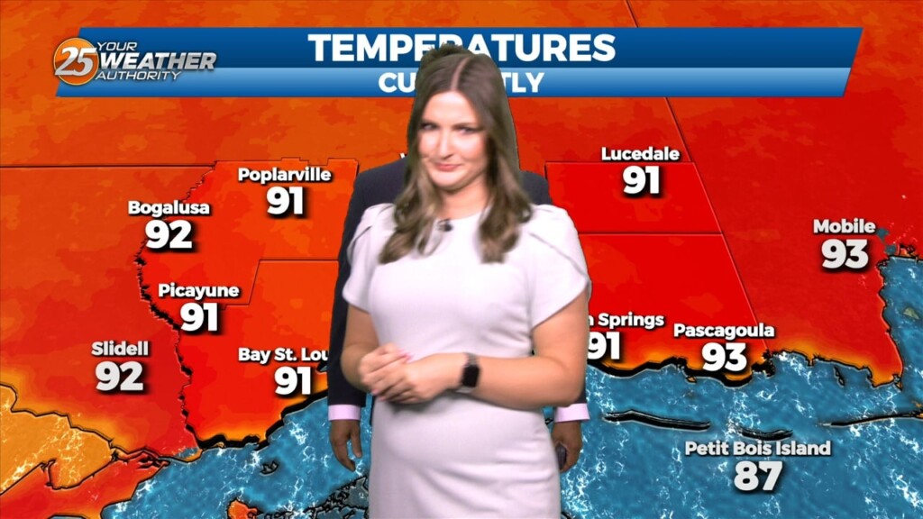
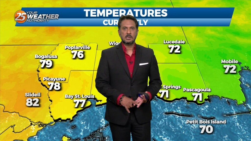
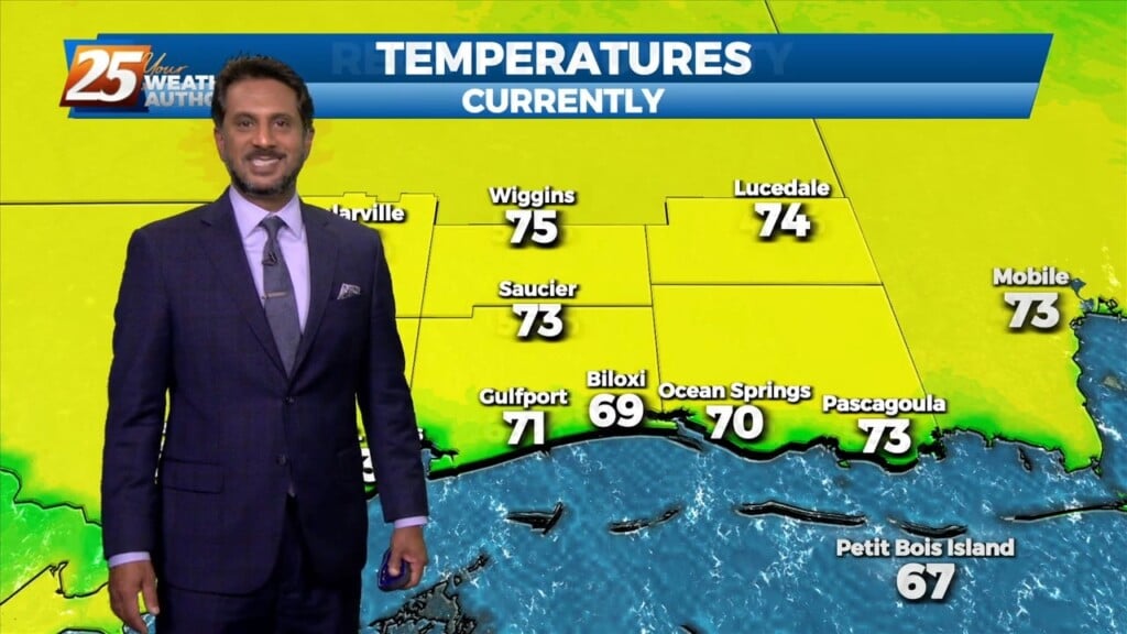
There is a surface boundary running northwest to Southeast across the area. We are seeing temperatures this afternoon 3-5 degrees warmer than yesterday at this time. Considering today and yesterday are very similar, we still…
A very weak disturbance was seen this morning just off the coast, which provided just enough instability combined with the sea breeze to produce isolated showers/t-storms…
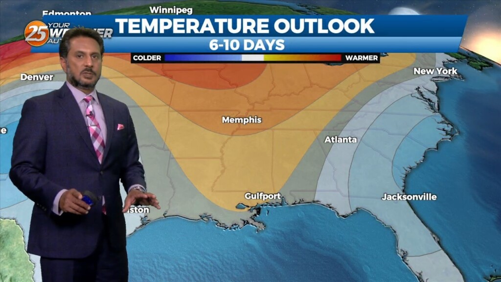
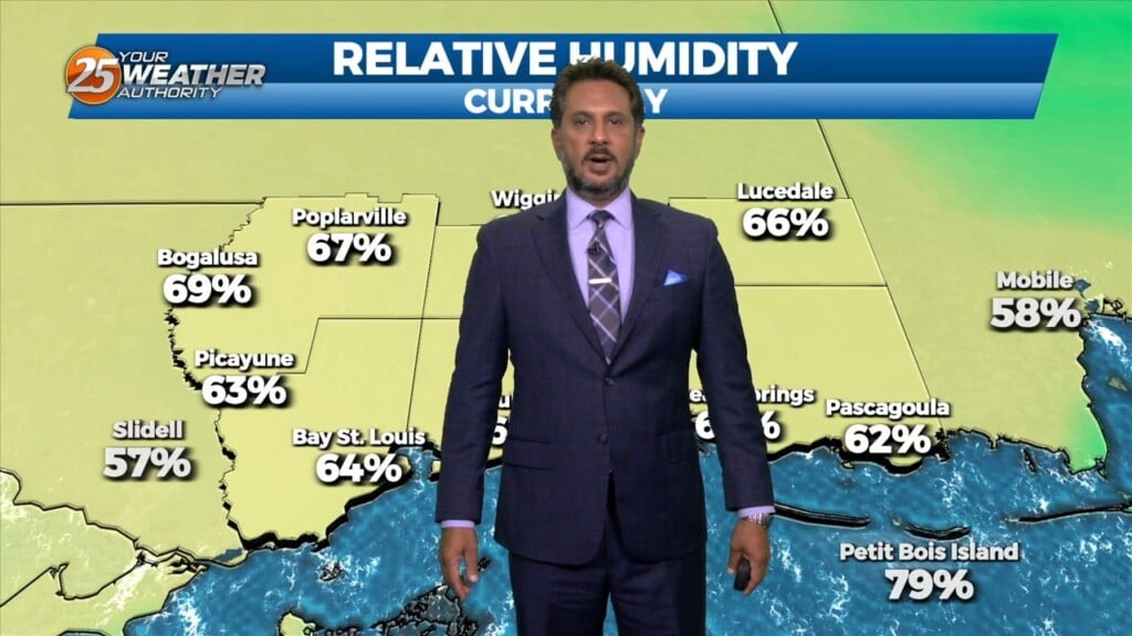
Relative humidity has been rather low the past few days…and that trend will continue heading into the weekend. The current weak upper low pressure over…
With the cooler upper levels and amplifying disturbance, expect a continuation of lower end rain chances despite being on the drier side with upper level flow becoming…
Despite the frontal passage overnight, temperatures will actually be slightly warmer today given the drier mid-levels holding down afternoon convective development. Rain chances will be lower…
Light westerly flow ahead of the weak surface front will favor initiation of thunderstorm activity on the eastern side of Lake Pontchartrain and coastal MS earlier…
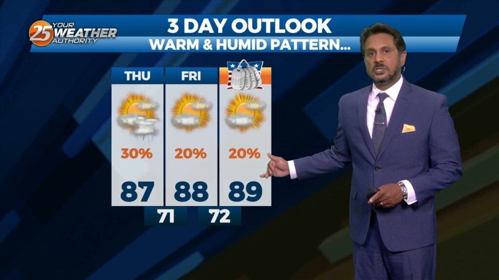
This pattern will be in place today through Sunday. This onshore flow regime will advect in a substantially more humid airmass into the area today and…
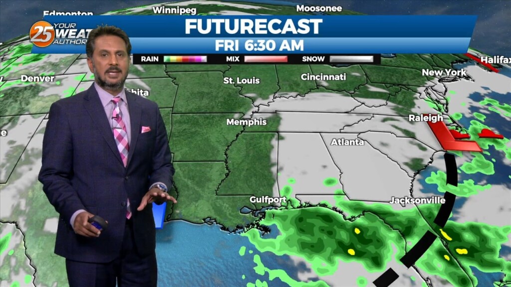
A strong upper level low pressure system is currently located over the Ohio Valley and moving into New England is holding some influence interacting with…
As an area of low pressure continues to drag a cold front through the region, isolated t-storms will continue this afternoon but begin to diminish late afternoon.…
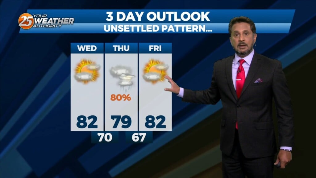
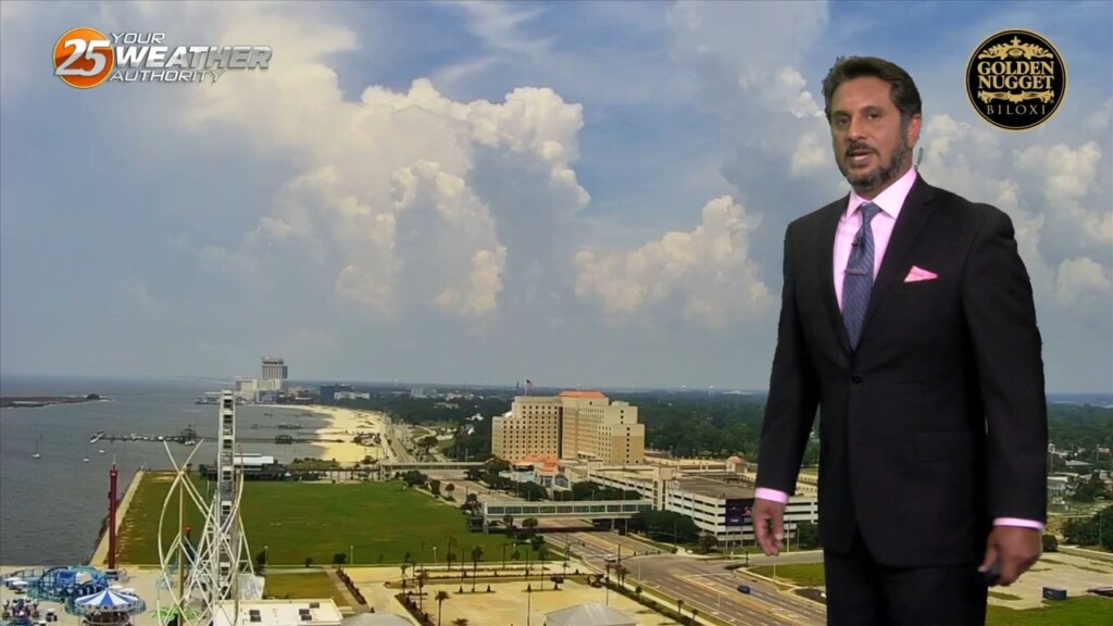
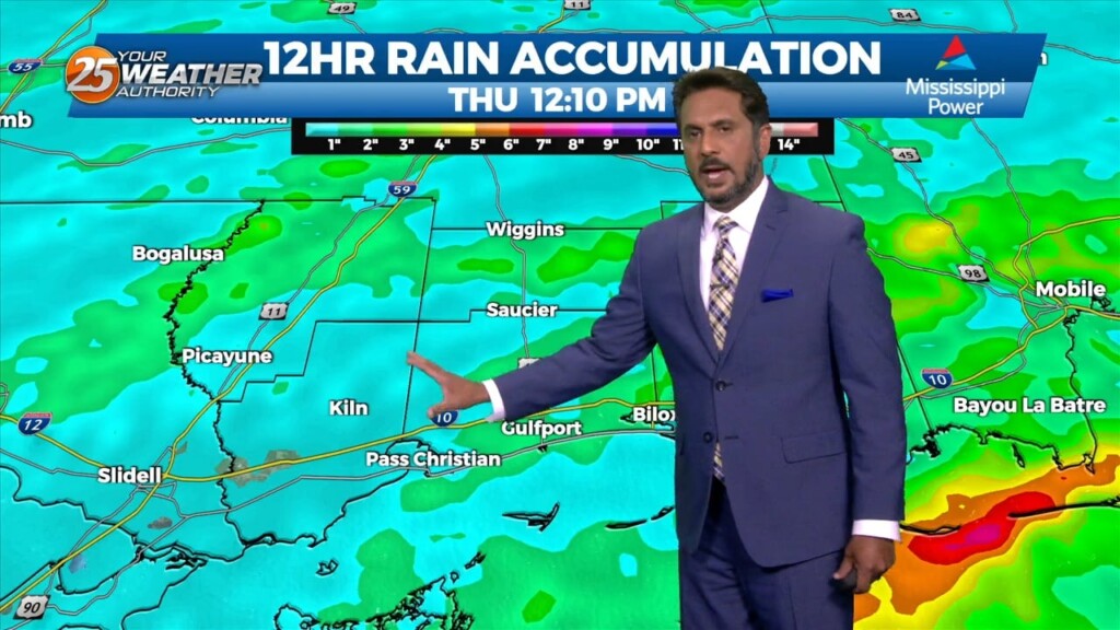
This afternoon will bring pleasant conditions as sky condition will vary between partly/mostly cloudy skies. Much of the focus is on Thursday as severe weather seems…
Starting on Wednesday, a disturbance over the northwest is expected to eject over the southern plains. This will pick up a stalled front over the coast and…
High pressure over the northern Rockies is setting up a quasi-zonal flow across the southern third of the country. At the surface, a reinforcement of drier…
A weak disturbance moving across Louisiana will move across the local area late this afternoon and tonight. Considering the dry airmass, I don’t anticipate any precipitation,…
A disturbance over extreme eastern Texas will likely continue to drive t-storm development this morning as the boundary continues to sink southward. Expect this boundary to be…
Fog will become an issue tonight but winds should stay too high nearest the coast and a cloud deck at 2k` starts to move in…