4/26 - Rob's Tuesday Morning Forecast
A WARMER more humid start a a southerly wind continues...
A WARMER more humid start a a southerly wind continues...

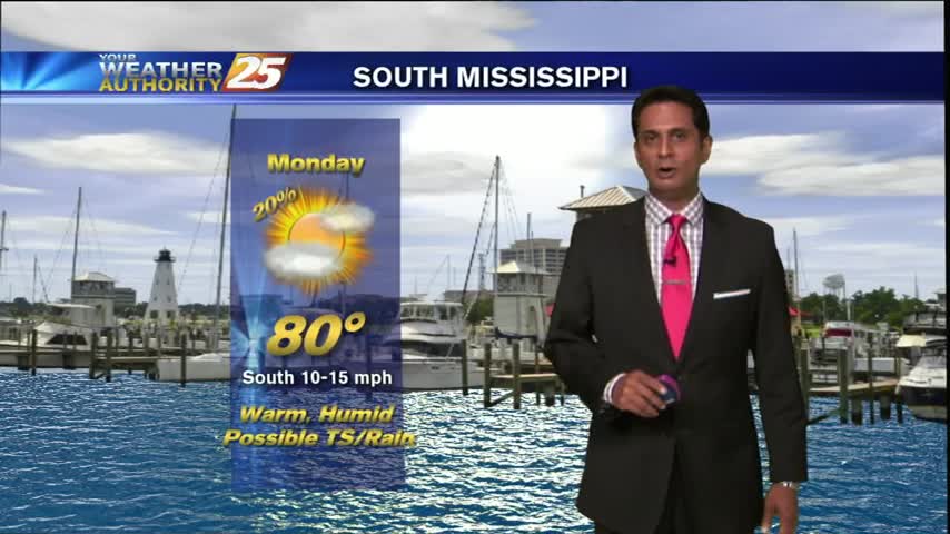
Monday night's forecast isn't drastically different from this afternoon's, but I am considering upping the rain chances which move in mid-week. Tomorrow (Tuesday) will see a warm start to the day, low near 68, with patchy fog developing in calm…
I have to admit, I spent some time outside today and it is starting to border on uncomfortable with all the sunshine and humidity we've had on this Tuesday afternoon. Temperatures remain in the low 80s, but are increasing slowly…
Daytime heating has thinned the clouds with temps around 80 degrees...
Your Monday starts off with mostly cloudy skies with mild and humid conditions...
This morning started out with cloudy skies and a few showers popping up across the area, but Friday night's forecast calls for much more sun in the coming days. Tonight will be cooler than we've seen the last several nights,…
Much more beautiful conditions than we had last night, as severe storms moved through the Gulf Coast. Tonight's forecast, a clear and calm night lasts throughout the evening leading to a practically perfect and a beautiful start to the weekend…
skies continue to clear as the cold front moves out of our area...

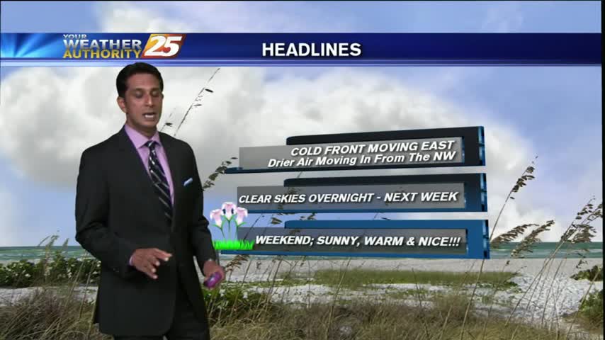
Another mild and humid start with the cold front overhead moving east...

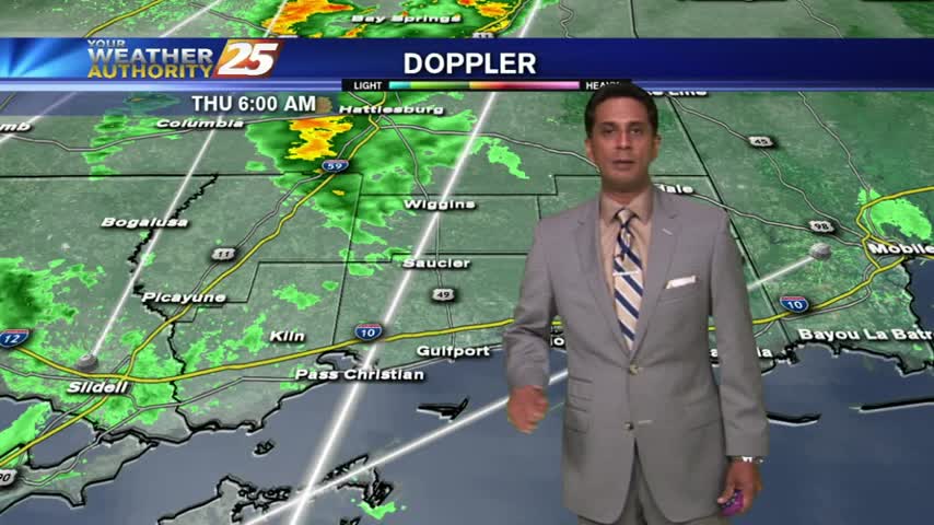
The forecast for Thursday night calls for more of the same in terms of what we've been seeing for the last day or so. Expect scattered showers and isolated thunderstorms moving across the area tonight, with similar conditions lasting into…
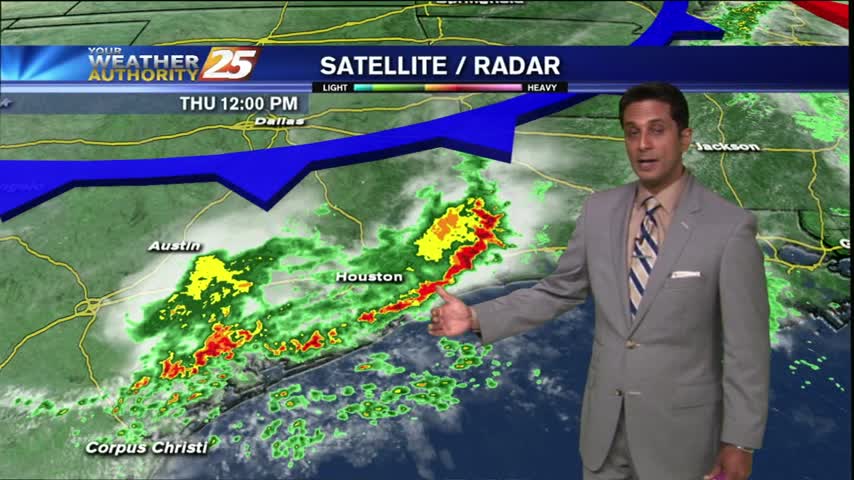
We've had our share of rain over the last few days in South MS and today was no different. Strong storms raced throughout the state earlier today, with nearly 30 hail reports as it moved across the northern central parts…
The clouds have been on the increase with isolated t-storms beginning to pop...
A mild and humid start with light rain moving into our NW viewing area...
It has been a warm and increasingly cloudy Wednesday night so far, and we still have a slight chance of some showers popping up around South Mississippi. The shower chances increase as we head into tomorrow (Thursday), with a 40%…
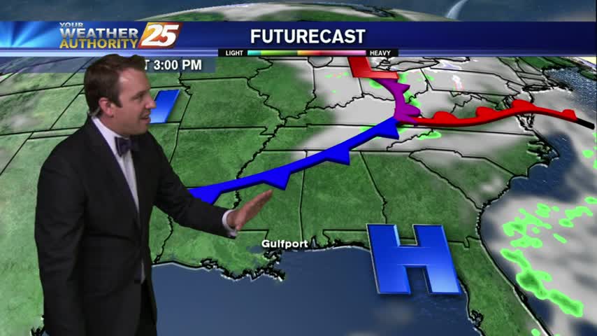
Mostly cloudy skies and just a few isolated showers describes our Wednesday, but we'll see an increase in both of those factors moving forward. The cold front which has pushed through the area will remain just over the coastline, darkening…

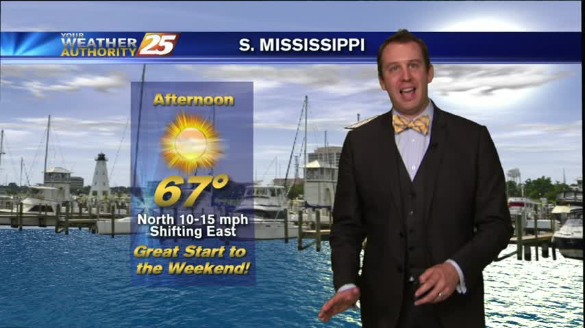
A nice afternoon with warm temps, partly cloudy skies and lower humidity...

Tuesday Night is looking a little warm and muggy, with cloudiness continuing to increase, but mostly clearing out by tomorrow (Wednesday). Expect a mostly sunny day for Wednesday, with clouds early in the morning and 20% chance of light showers…

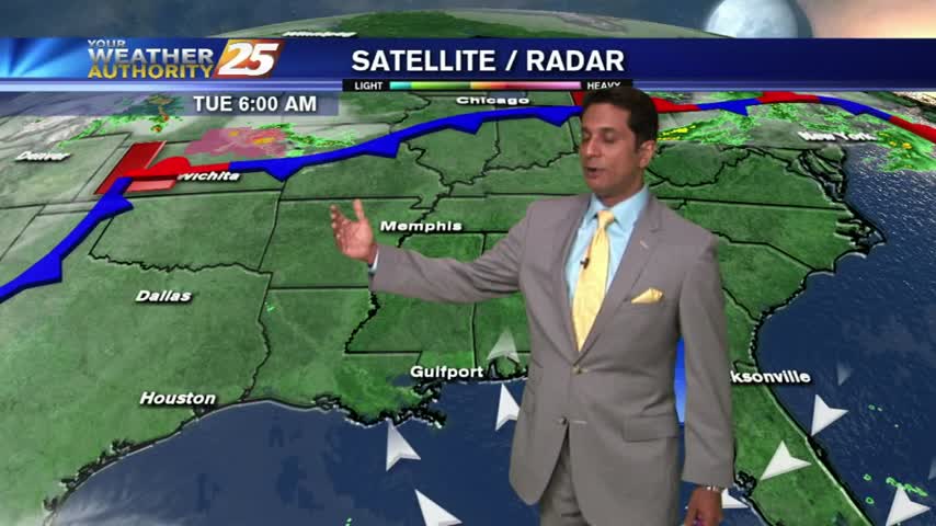
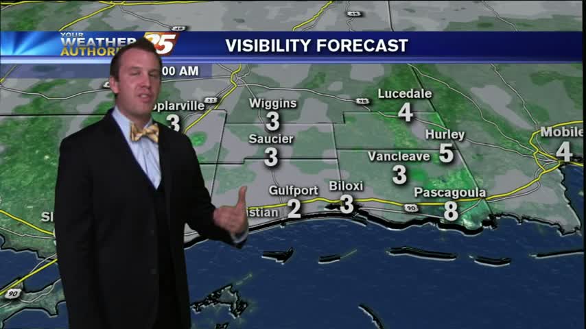
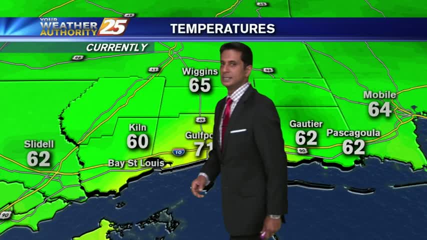
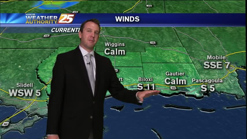
We are continuing to see strong southerly winds bringing an excess of Gulf moisture here on Tuesday night, which causing the formation of convection fog near coastal areas. Many fronts are primed to move through South MS, but it seems…
Upper-level clouds continue to move across the area with warm & hazy conditions...
Upper-level thin clouds continue to move across the gulf south...
Clear skies have continued with thin upper-level clouds invading from the west...

Today, a group of local kids learned how weather affects their daily lives from a very special guest. Our very own Ryan Mahan talked to Mrs. Melanie Flowers’ kindergarten class at Quarles Elementary in Long Beach about basic weather before…
As the stationary front to the south begins to dissipate, rain potential have decreased dramatically...

A MUCH DRIER start along the Mississippi gulf coast...