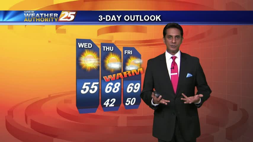
2/17 - Rob Knight's "Hump Day" Forecast
A cool start under clear skies and light winds from the north. High pressure will strengthen and dominate through the weekend...

A cool start under clear skies and light winds from the north. High pressure will strengthen and dominate through the weekend...
As the cold front continues to make it's way off the eastern sea-board, cool temps and patchy DENSE fog has developed along the Gulf coast...

News 25's Shelby Myers is live in Gulfport with a look at today's weather.
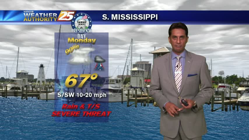
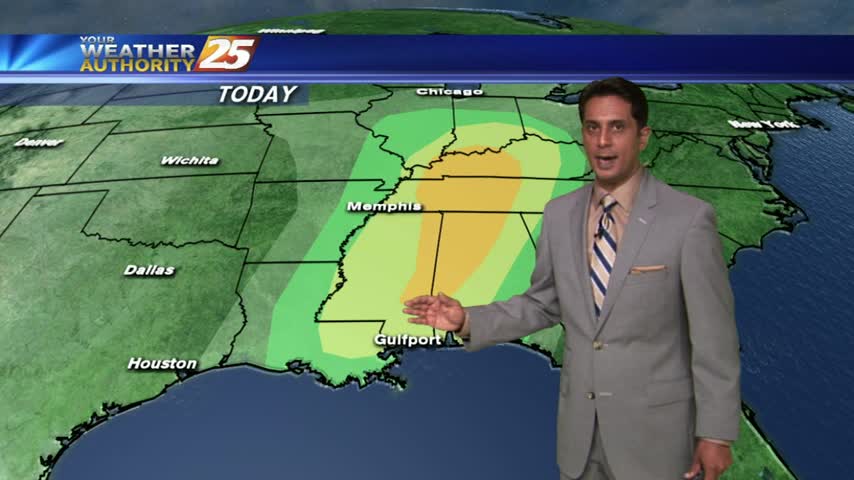
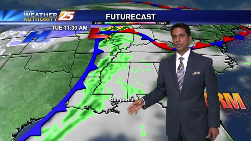
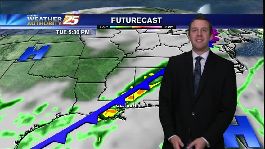
Light rain has been moving into the area since prior to sunrise. This activity will increase through the day with the potential for SEVERE STORMS this afternoon...
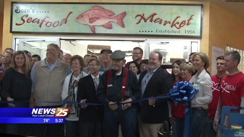
Sixty years of po’boys, shrimp sandwiches and catfish were celebrated at Bozo’s Seafood and Deli in Pascagoula this morning. A crowd filled with family, friends and city officials honored the third generation seafood hot spot with a ribbon cutting ceremony.…
It's a MUCH WARMER start this morning as a SW wind continues to increase both humidity and the temperature...
Another FREEZING start...but major changes will occur today with MUCH WARMER temps ahead...
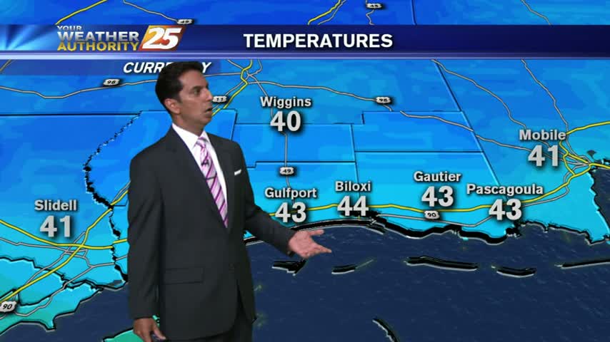
It's a COLD start with many locations in the viewing area at or below freezing...
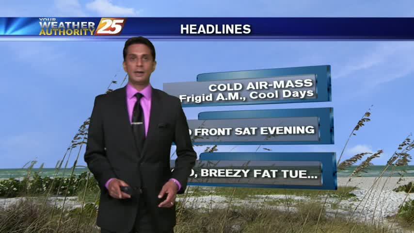
After a cool weekend, a cold front moving through the area will bring a reinforcing shot of cold air and WINDY conditions.
A VRY COLD start as temps are in the upper 20s to low 30s...
A cold start with a few clouds departing the area to the east...

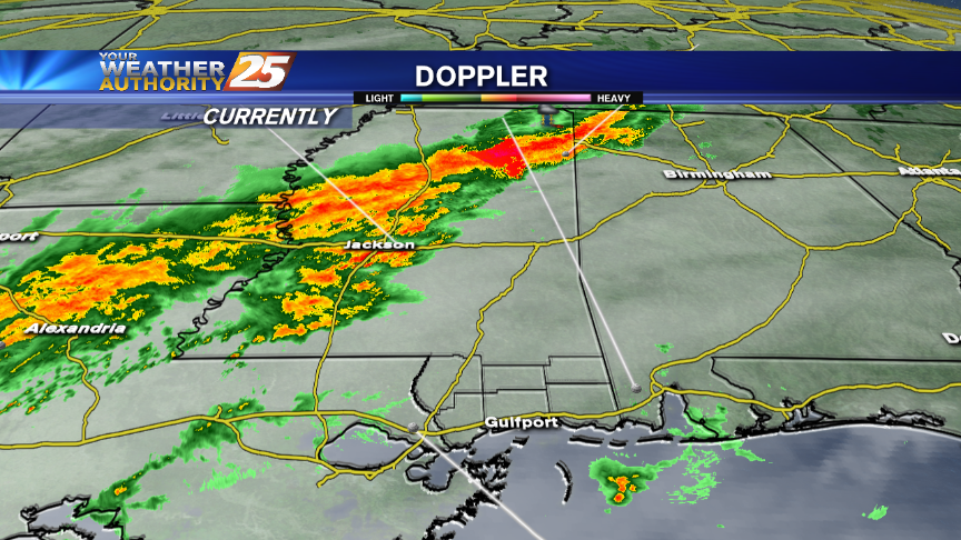
Clean-up will continue after a series of tornadoes tore across Mississippi and Alabama Tuesday afternoon. This video comes from Collinsville, Mississippi where a homeowner caught one of the tornados on camera. The severe storm, which brought lashing rain and powerful…
A gloomy and rainy start with t-storms now to the east...
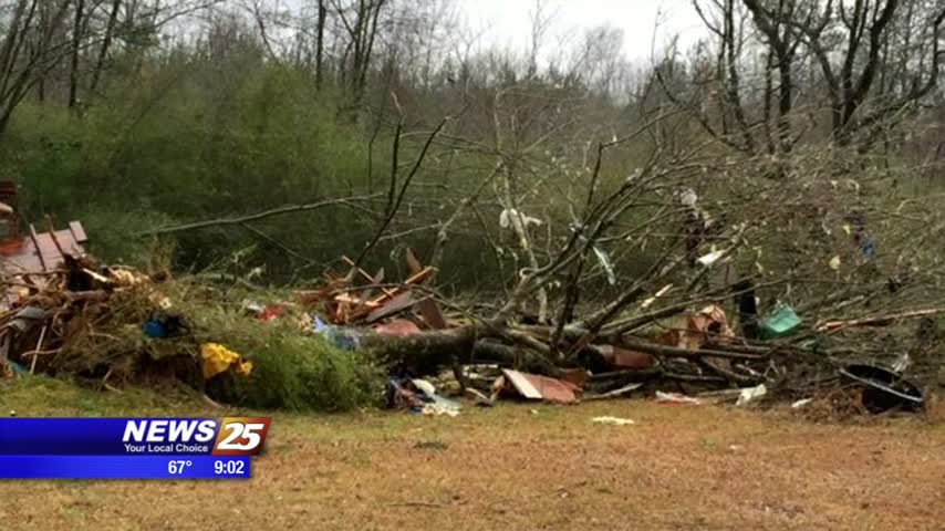
Parts of eastern Mississippi have already been damaged by a tornado sweeping through the area today. Strong winds have caused trees to collapse over homes, schools and roadways in Newton and Lauderdale counties. That’s where most of the damage has…
A WARM and HUMID start with patchy dense fog along the coastal counties...
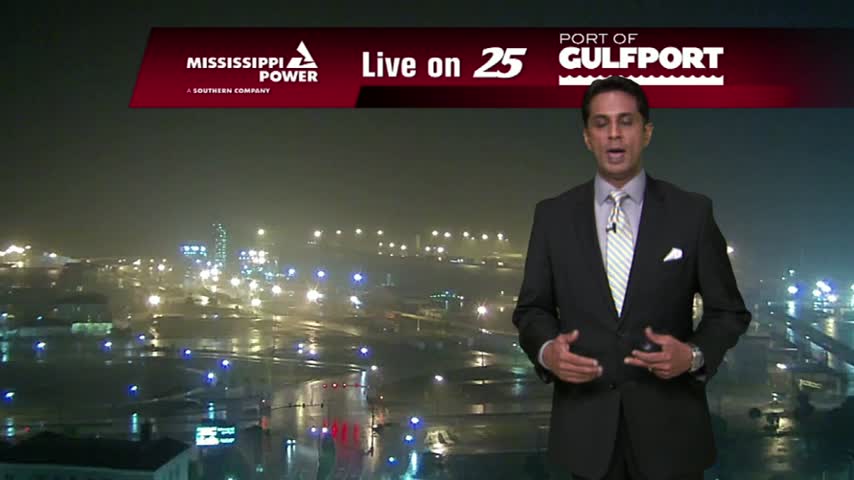
It's a little hard to see down on the waterfront right now, so be sure to be careful moving around South of I-10. This fog will stick around for another night before storms will push everything along.
As WARM & HUMID conditions from the weekend continues, DENSE FOG has developed in the area...
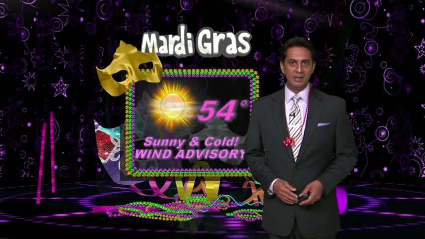
It's a COLD start with pleasant conditions ahead...FANTASTIC conditions for the parades this weekend...

It's a cool start with the clearing line working it's way towards south Mississippi...
A cloudy start with light rain moving east...
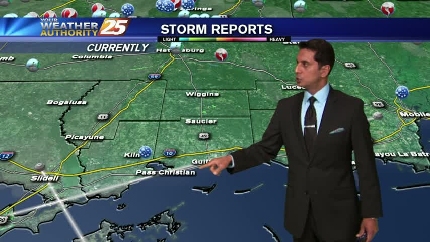
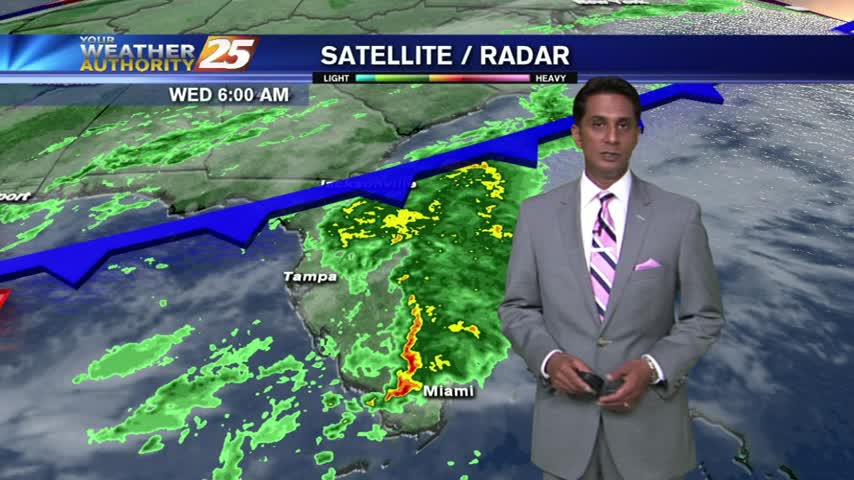
Showers and thunderstorms moved through the area this evening, dropping up to an estimated 2 inches of rain in some of the inland coastal counties. Light to moderate showers will continue through the night and into tomorrow, but will continue…
After a WARM start...a cold front will affect the area through Wednesday...
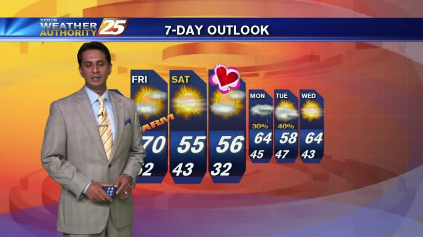
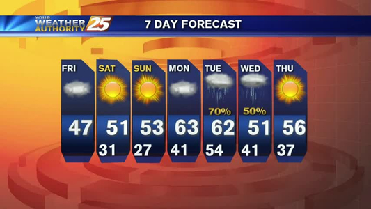
Last night's storms have continued to push eastward, and is now becoming less of a thunderstorm threat and more of a winter storm threat. Areas from Tennessee to Pennsylvania are experiencing blizzard and winter storm conditions. Locally, have brisk winds and and cold temperatures are continuing to fill the area vacated by the storms. The entire coast will be below freezing levels, and with the average wind staying near 20 mph, we'll see "wind chill" indices in the mid to low 20s for several hours. Skies will be clear throughout tomorrow for the Ocean Springs and Biloxi parades, but the high will max out near 48 with breezy conditions, so wear a coat. Saturday night will be one of the coldest nights we've seen this winter, air temp near 27
COLD but NICE this weekend!