08/29 - Steve's Midday Forecast and Tropical Update
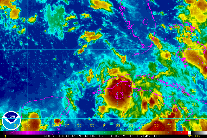
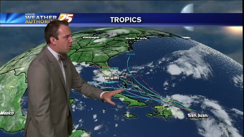
The latest information on Tropical Depression Nine !!!

The latest information on Tropical Depression Nine !!!
Meteorologist Steve Taylor's thoughts about our tropical situation.
After a cloudy and rainy Sunday, it's a mostly clear start as TD #9 is now in the SE/tern Gulf...
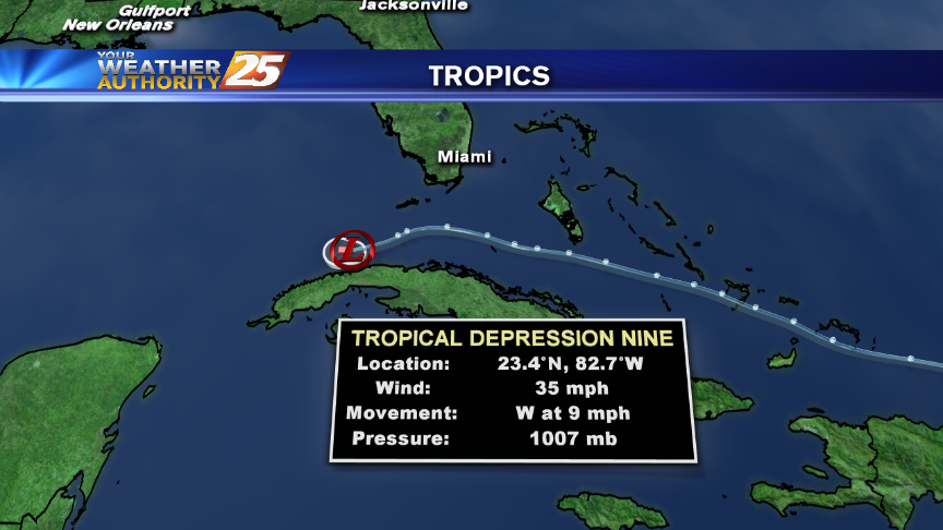
The latest on Tropical Depression Nine in the southeastern Gulf of Mexico.
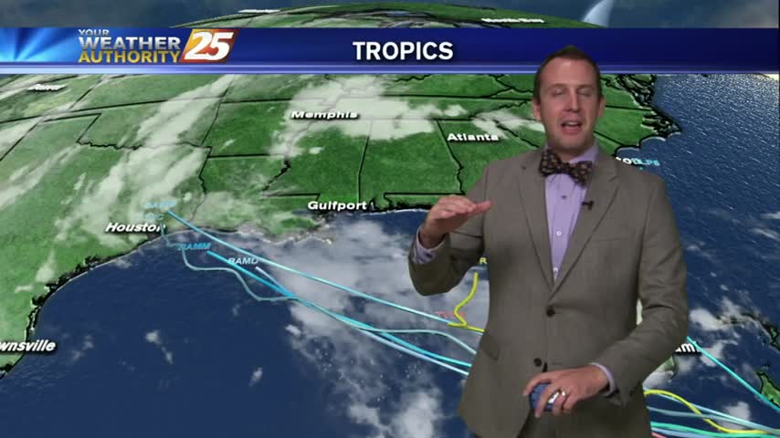
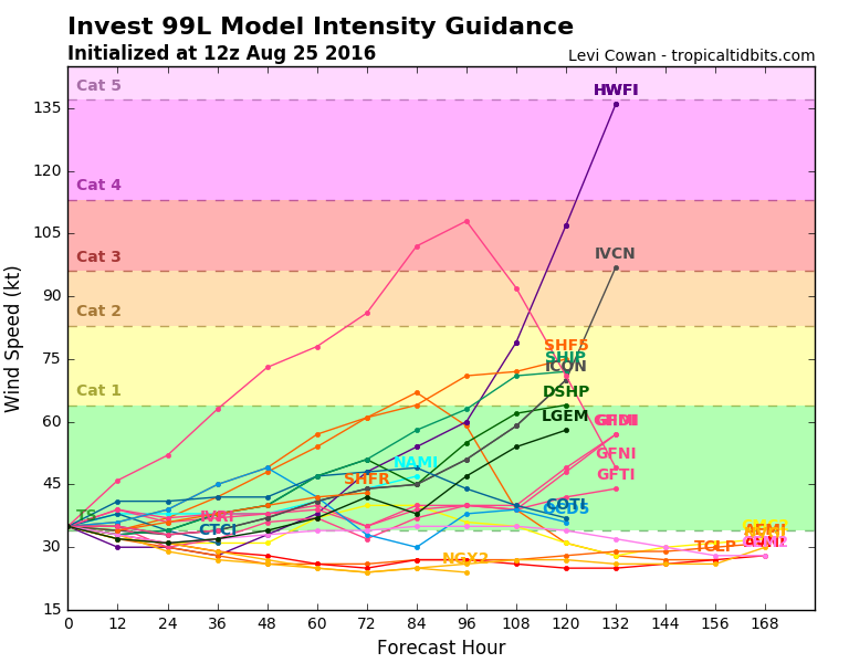
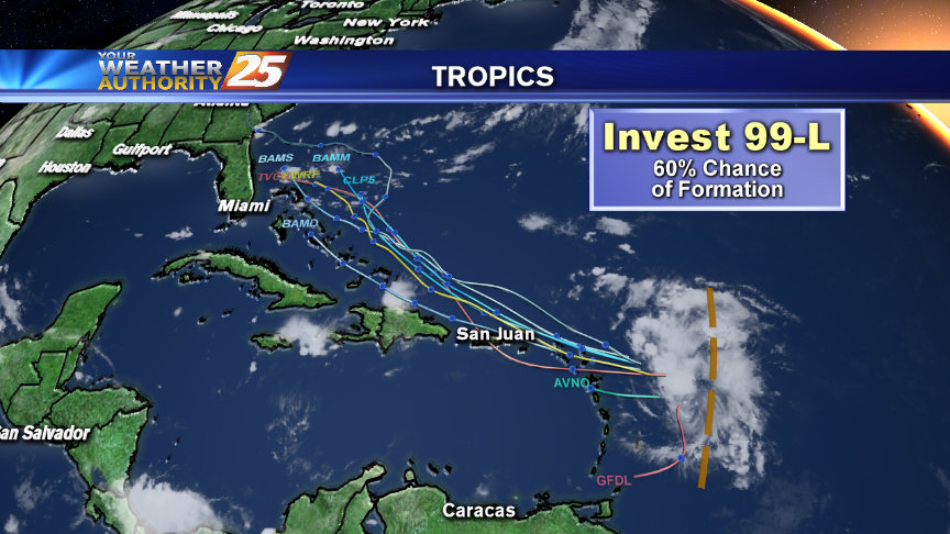
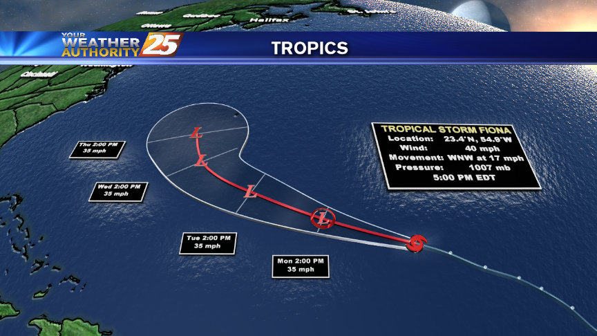
More developments in the tropics but still no growth to invest 99L. Tropical forecast details inside.
Warming temps with low-level moisture heating into a cloud deck...

A drier stat this morning with a BEAUTIFUL sunrise and just a few thin upper-level clouds...
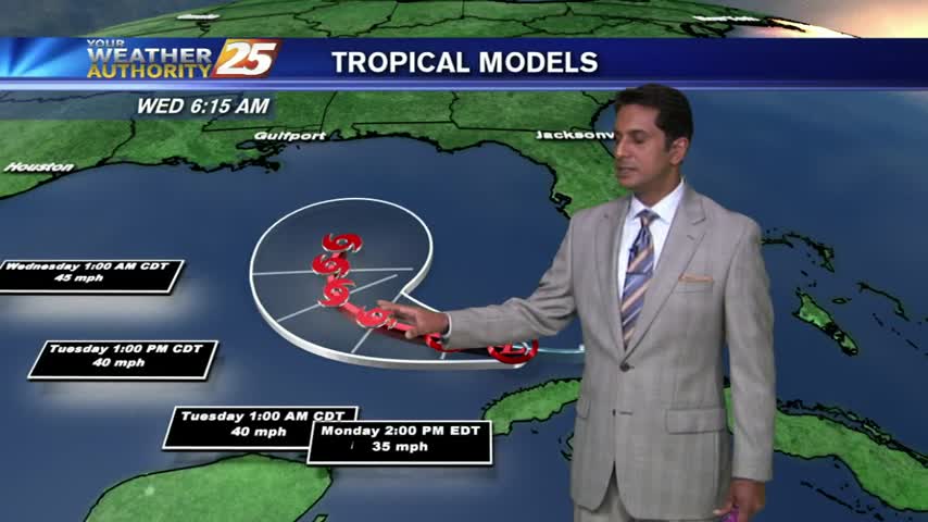
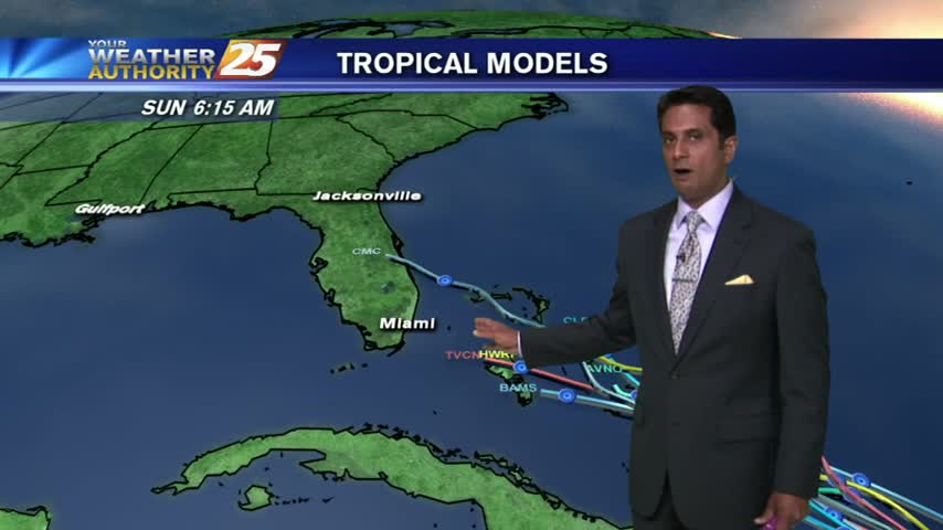
No answers from the Tropics today, but models have continued to bring a developing Tropical system into the Gulf. Details inside.

Coastal communities continue to play the waiting game with the tropics, get the latest inside.
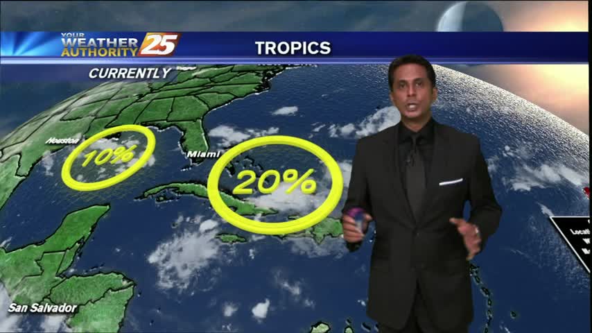
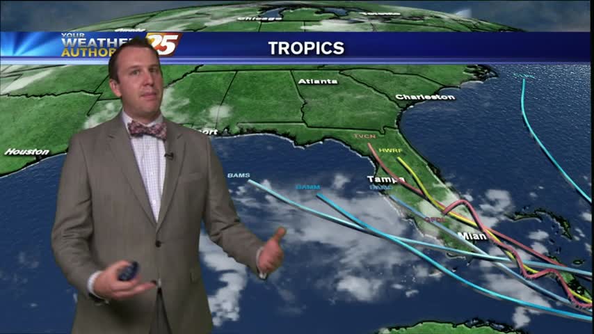
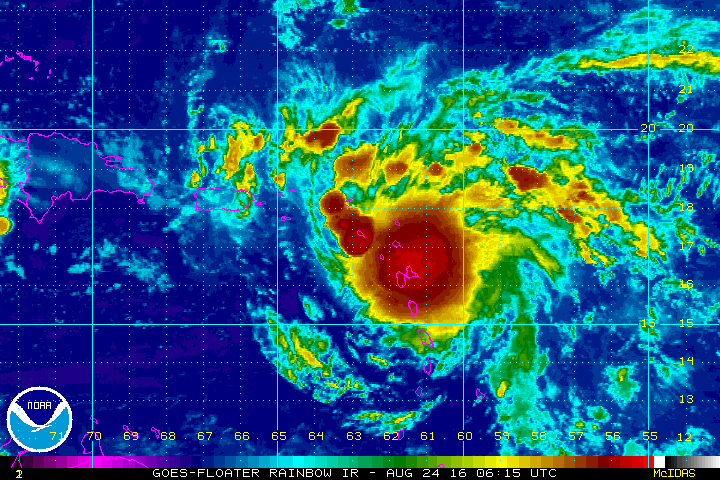
The latest we can tell you about Invest 99-L
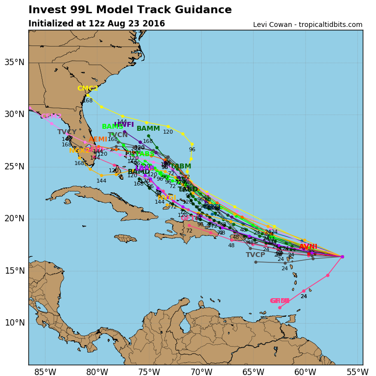
Thursday, August 25, 2016 INVEST 99-L Good morning, Coastians! Let's start on Invest 99-L with the latest observations from the National Hurricane Center. Here's from this morning's 0800 Tropical Weather Outlook: "An area of low pressure associated with a tropical…
It's a sunny start this morning with a few thin upper-level clouds moving across the area along with areas of light patchy fog...
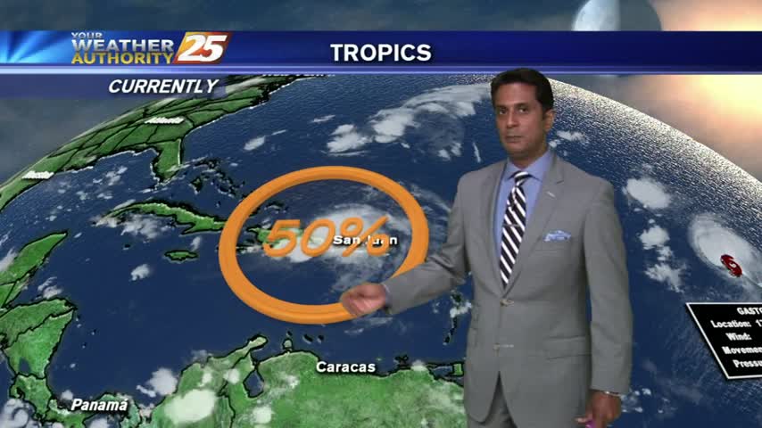
I start off with the tropics today to try and quell some fears, but some concern is warranted. Check out the forecast for details.
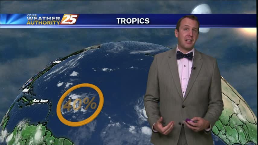
Seems to be some "social media" confusion on how likely a hurricane will be over the next week or so. There is a chance, but it's likely not as high as you heard. Details inside.
Meteorologist Steve Taylor's thoughts about Tropical Invest 99-L and its evolution.
A mild and humid start this morning as high-pressure to the south moves to our SW...
Hot & humid conditions continue locally, but new action in the tropics causes a stir. Details inside.
A look at tropical possibilities and a very warm forecast for the Gulf Coast.
Meteorologist Steve Taylor's regular musings on the current weather and forecasts, useful science and technology news, interesting weather terminology, and more.
With a stationary front lagging in northern Mississippi, this morning brings a pleasant north wind...
Very few showers out there today and you can expect more hot and humid days ahead. Find out more inside.
We have areas of patchy DENSE fog for your morning commute and to kick-off the workweek...
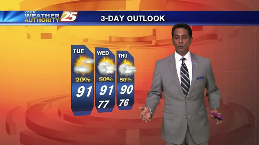
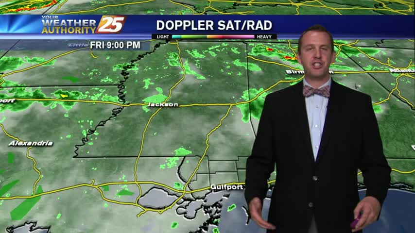
Rain chances ramp up early this week and we take a very close look at the tropics in Steve's Forecast.
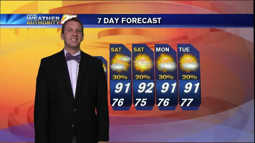
Another much drier day today with only a few showers popping up, check inside to see what you can expect for the weekend.