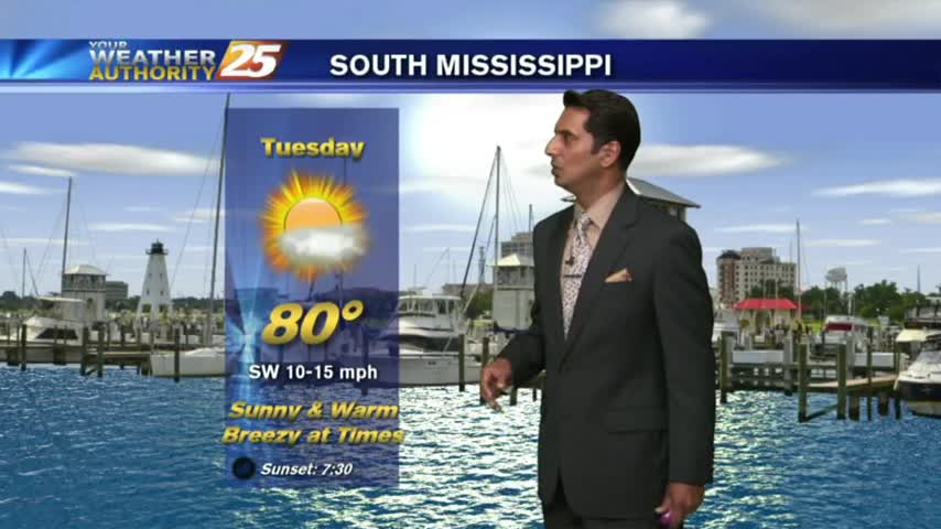
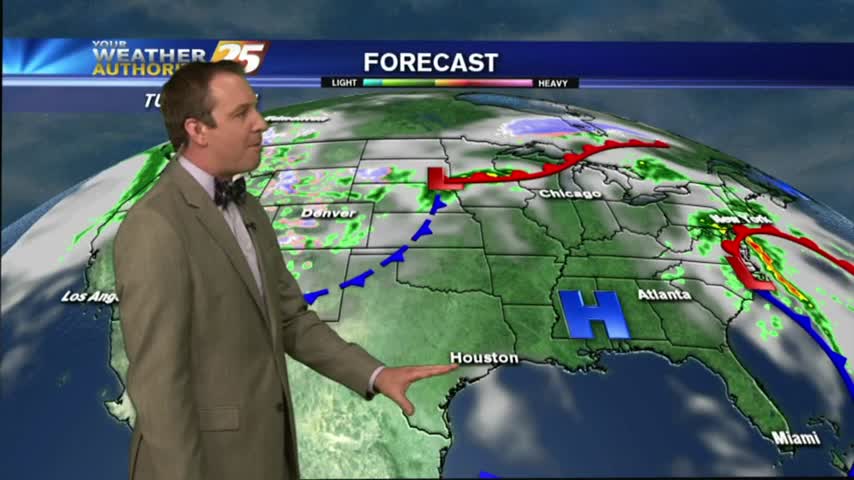
5/2 - Rob's Tuesday Morning Forecast
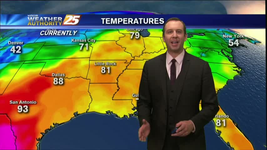
With high-pressure, clear skies and a drier air mass...it's a CHILLY start with temps in the upper 40s to low 50s...
With high-pressure, clear skies and a drier air mass...it's a CHILLY start with temps in the upper 40s to low 50s...
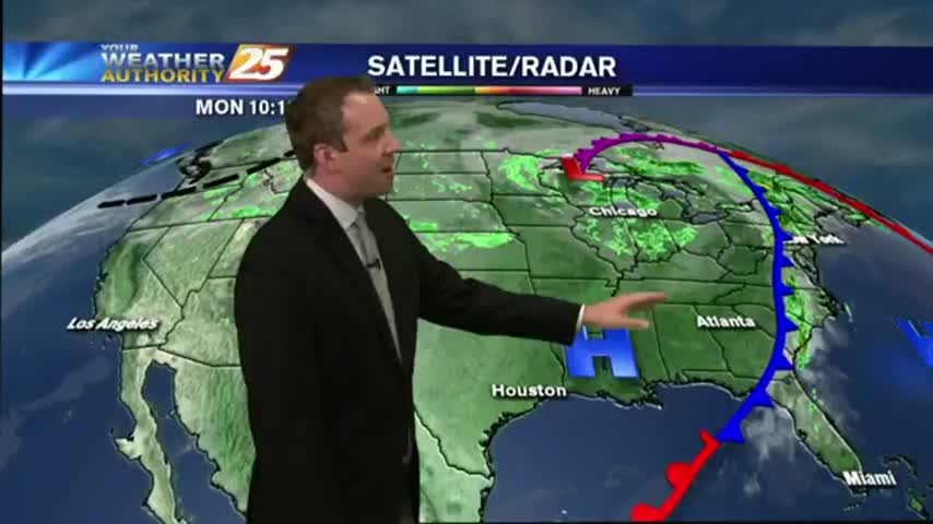
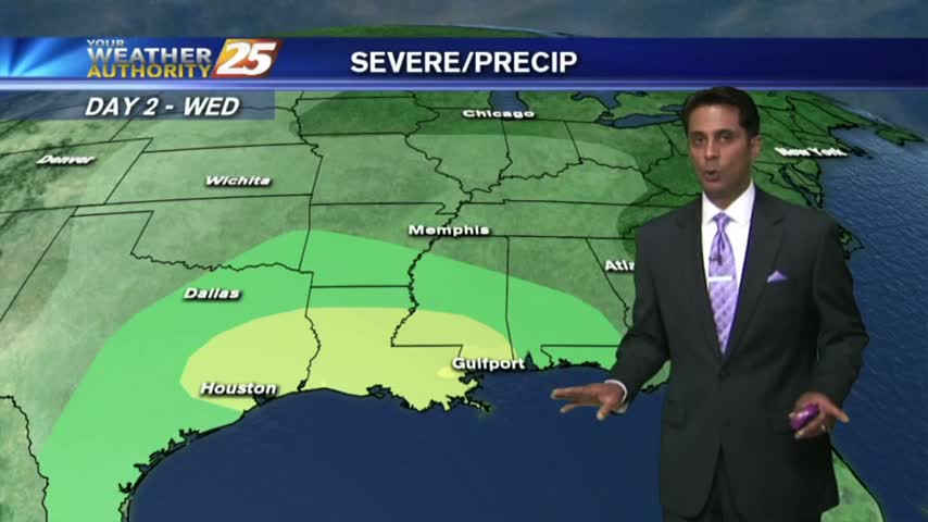
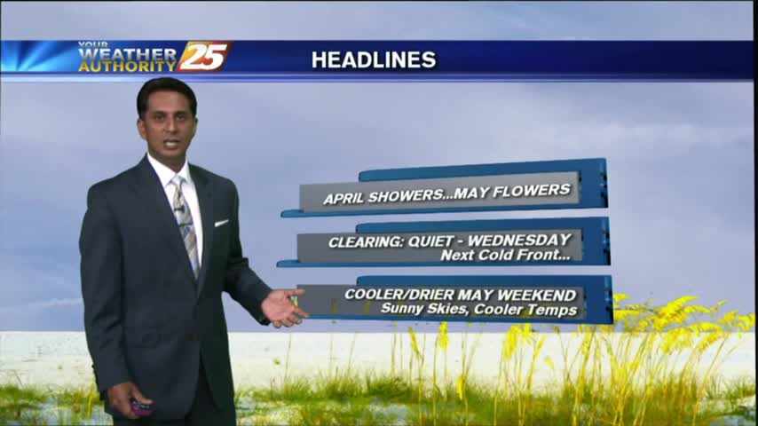
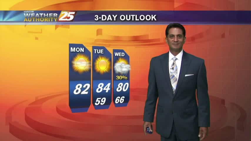
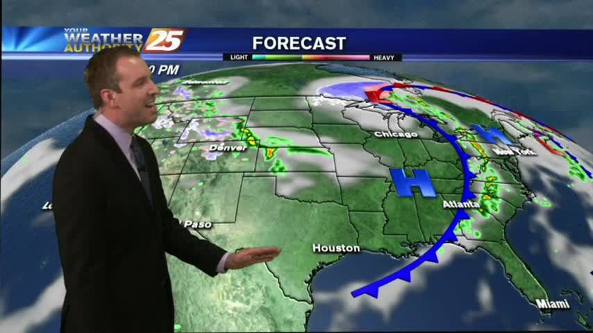
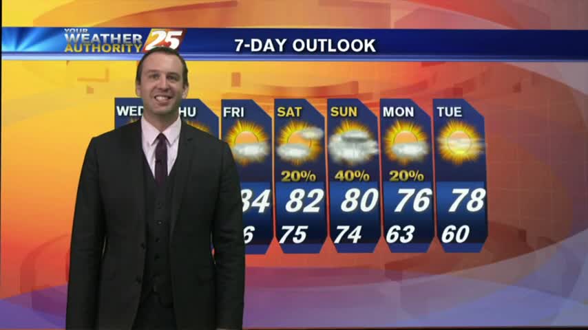
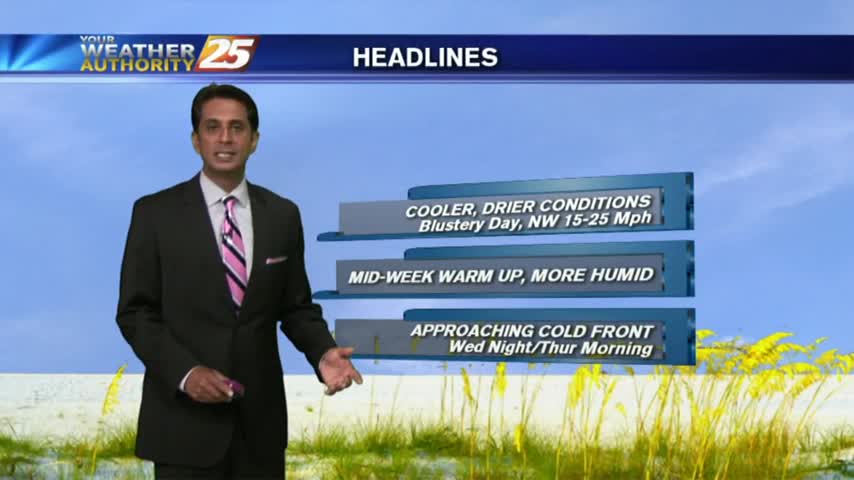
Beautiful cool & dry weather moved in after yesterday's front, and will linger in South Mississippi for another day or so. Expect another round of rain before the weekend though, watch the full forecast for details.
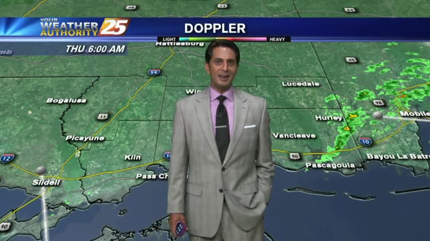
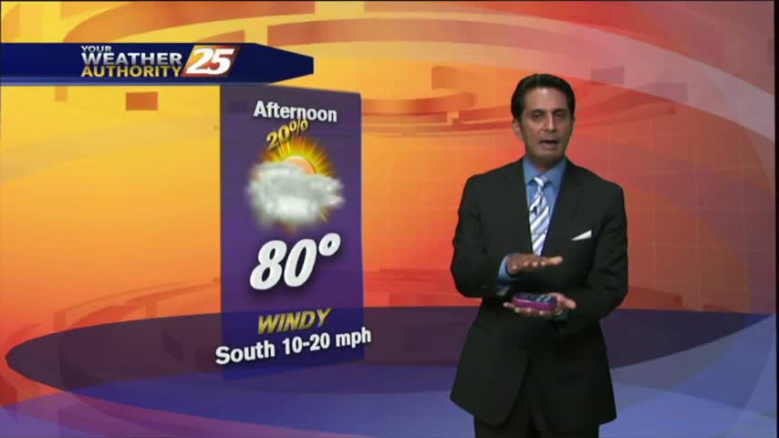
As the cold front from yesterday continues to move further away from the area...we are now under an abundance of sunshine...
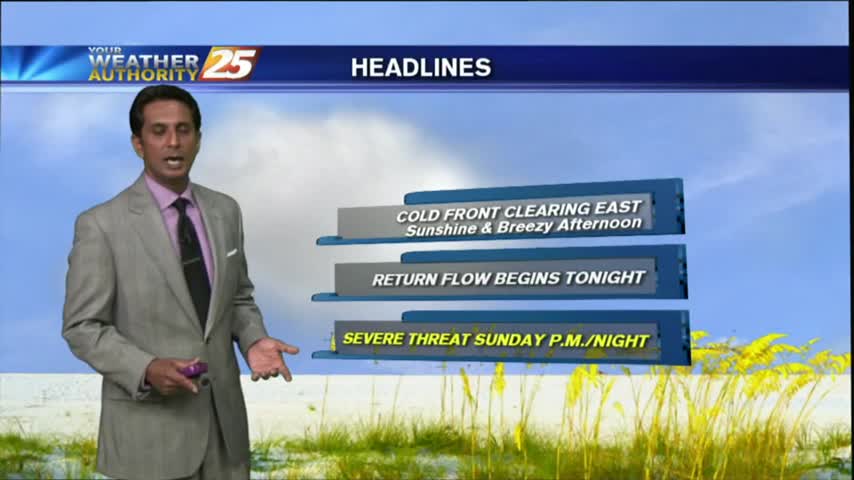
After HEAVY RAIN and some BUMPY weather yesterday, the cold front and associated weather continues to move east of the area...
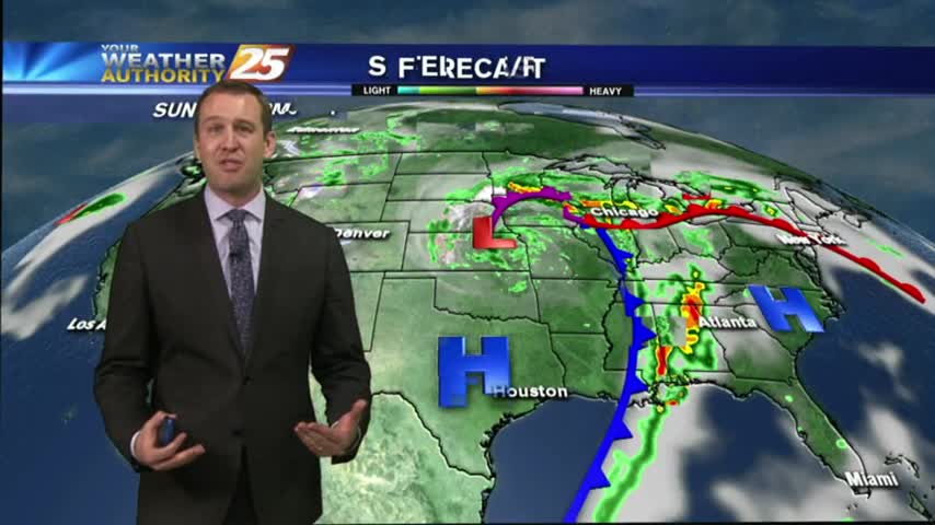
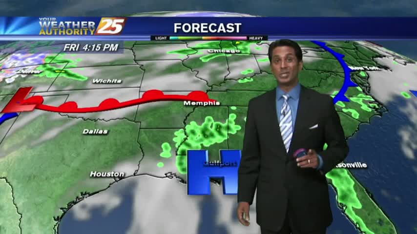
Strong storms moved through earlier today, but have now moved off towards the East. A cold front will pass through overnight leading to some cooler & drier air, so be sure to watch the full forecast for details.
It may feel like a tropical rain-forest now, but it'll keep getting worse until a strong cold front moves through Sunday night. Watch the full forecast for details.
A warm front developed this morning with a few light sprinkles, now under warm, humid and breezy conditions...
As a warm front develops north of the area, a few light showers have been moving in from the GOM...
A cold front may have passed through overnight, but temperatures warmed today. Expect a few days of calm weather before another potential severe threat. Watch the full forecast for details.
After a CLOUDY morning...drier air moving in has cleared skies with temps warming into the 80s...
Isolated showers associated with a very weak cold front has now moved east...
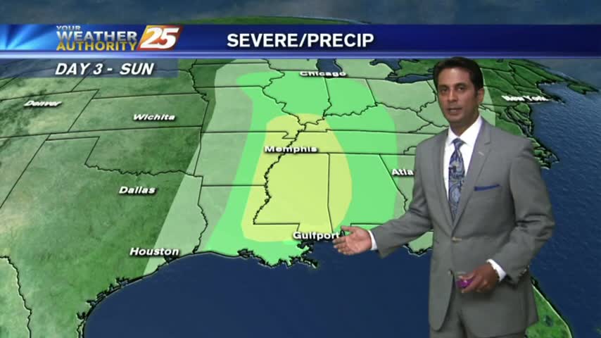
Storms are beginning to creep in from the NW, and despite our "marginal" threat for severe weather, conditions are trending for weaker storms in South MS. Watch the full forecast for more details.
Warm, humid and breezy conditions continue in advance of an approaching cold front...
It's a warm, humid and windy start to the day in advance of an approaching cold front to the NW...
I hope you enjoyed our two mild days and cooler evenings, because a warming trend begins tonight and doesn't stop until the beginning of next week. Watch the full forecast for details.

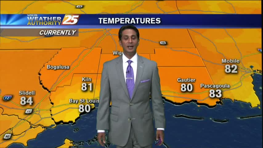
After another CHILLY start, a SW wind from the GOM continues to elevate humidity which will bring WARMER temps to the area...
Another CHILLY start to the day with a SW wind which will bring increased humidity to the region...
This afternoon's cooler and drier weather carries over into tonight, but we'll see higher temps and humidity as we head through the week. Watch the forecast for details.
High pressure settled in over the area leading to clear skies, drier, air, and slight cooling. We'll begin seeing changes as a front approaches the area tomorrow night, so watch the forecast for details.
After a CHILLY start to the day, temps have been warming nicely under cloud-free skies...
In the wake of yesterday's cold front, a cooler/drier air mass is moving into the area as BREEZY conditions continue...
Saturday's cold front brought some stronger storms to the area than anticipated, but severe weather stayed away. The cooler and drier condition didn't stay away, and they'll continue into tomorrow. Watch the forecast for details.
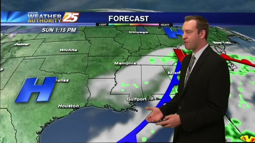
We're finally going to see our "boring" weather streak coming to an end, but not until after one more sunny and humid afternoon. Showers and thunderstorms begin moving in by sundown, so be sure to check out the forecast for details.
After areas of PATCHY DENSE morning fog, we have BEAUTIFUL afternoon conditions with a few clouds...