4/24 - Rob's Monday "Midday News" Afternoon Forecast
After a CHILLY start to the day, temps have been warming nicely under cloud-free skies...
After a CHILLY start to the day, temps have been warming nicely under cloud-free skies...
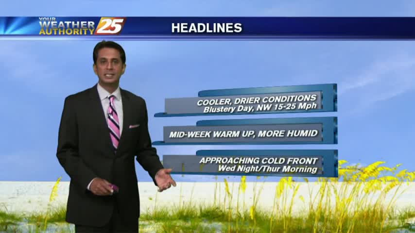
In the wake of yesterday's cold front, a cooler/drier air mass is moving into the area as BREEZY conditions continue...
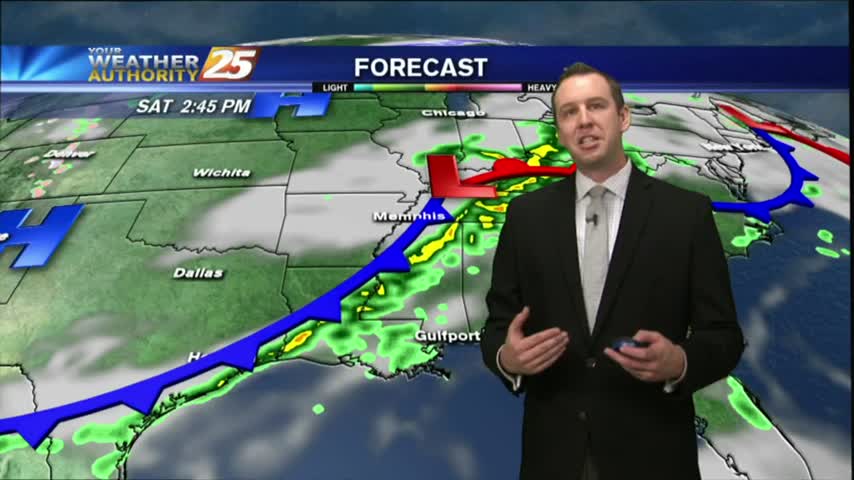
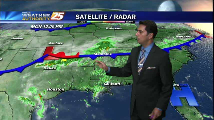
Saturday's cold front brought some stronger storms to the area than anticipated, but severe weather stayed away. The cooler and drier condition didn't stay away, and they'll continue into tomorrow. Watch the forecast for details.
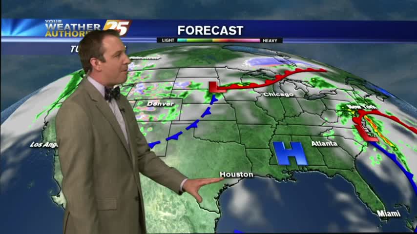
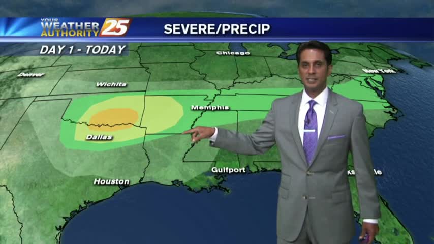
We're finally going to see our "boring" weather streak coming to an end, but not until after one more sunny and humid afternoon. Showers and thunderstorms begin moving in by sundown, so be sure to check out the forecast for details.
After areas of PATCHY DENSE morning fog, we have BEAUTIFUL afternoon conditions with a few clouds...
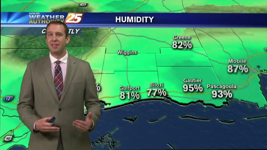
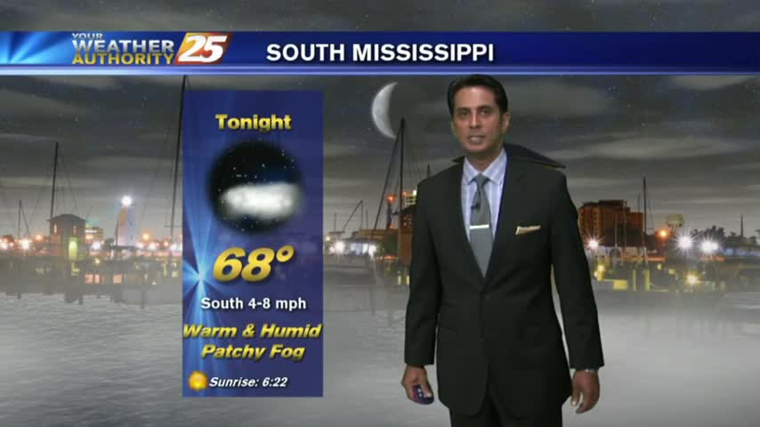
Another WARM/HUMID morning with areas of VERY DENSE fog along the coastal counties...
Last night's clouds have moved on, so things should cool by a degree or so, but will remain warm and humid with overnight fog. Click the forecast link for more details on this weekend's weather.
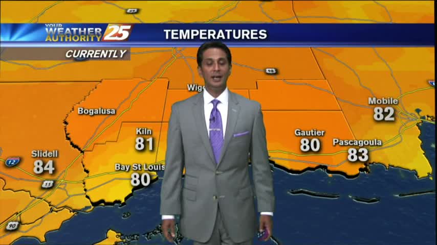
After VERY DENSE FOG earlier this morning, we now have partly cloudy skies and warming temps into the 80s...
Another morning of continued southerly flow has areas of PATCHY DENSE FOG along the Southern 6...
After another beautiful Spring day, you've got to be expecting the "other shoe to drop" soon right? Well, it does, but not until after a few more great days. Click the forecast link and find out when the rain arrives.
The rest of the week will be dry, sunny, and beautiful, but "active" weather moves in for the weekend. Watch the forecast for details.
After light fog and mostly clear skies earlier this morning, clouds continue to move into and develop in the area...
As the moisture flow continues, this morning brings light winds, a few clouds and areas of LIGHT FOG...
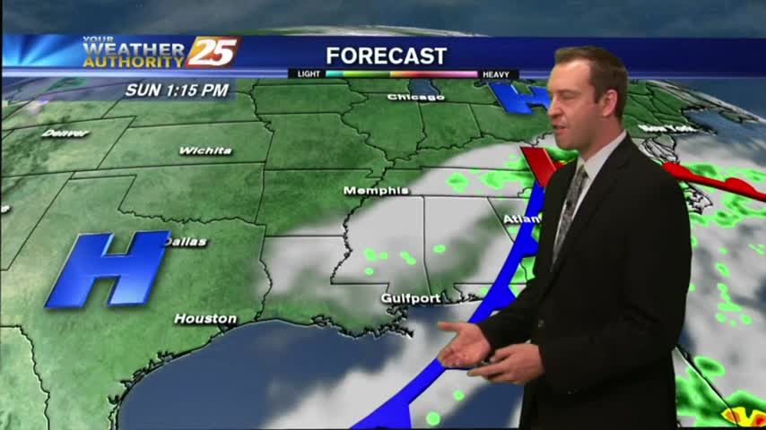
So far the forecast from last weekend has held up well. We continue to see gradually warmer and more humid conditions, but now the clouds will begin clearing, leading to a few sunny and dry days. Forecast details inside.
After a warm/humid start with patchy fog, warming temps continue to bring drier conditions to the area...
A WARM/HUMID flow from the Gulf of Mexico has areas of PATCHY FOG along the Southern 6...
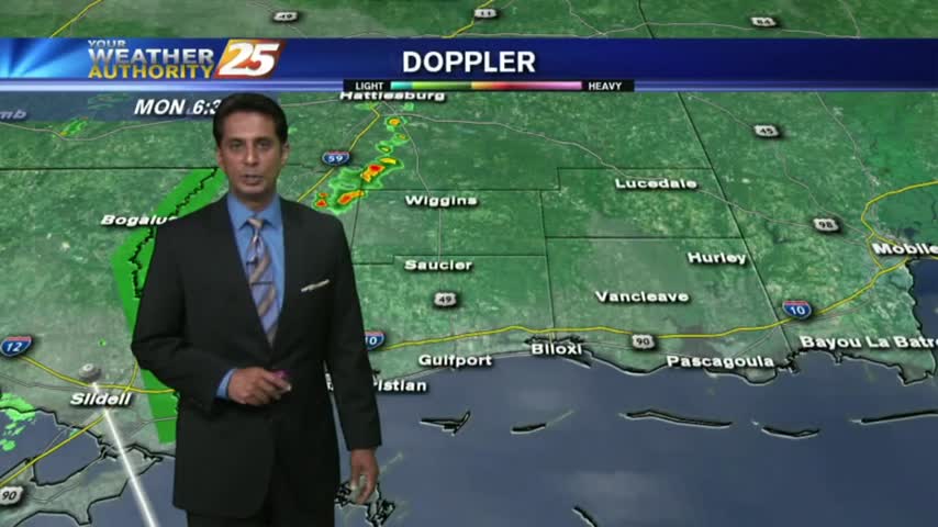
The clouds are beginning to clear from the area, but we'll retain the small chance of an isolated t-storms in the afternoon. Watch the full forecast for details.
With a VERY HUMID air mass advecting in from the Gulf, isolated showers continue to move in from the south...
As moisture flow continues from the GOM, areas of PATCHY FOG has developed along the viewing area...
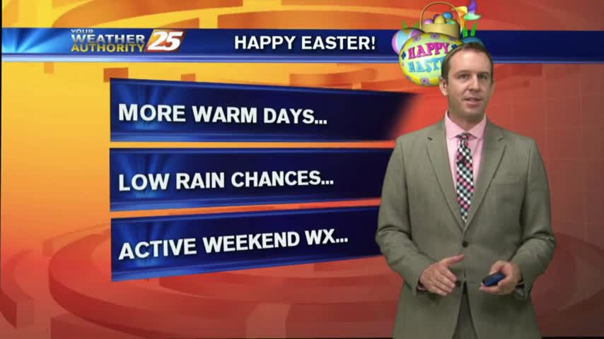
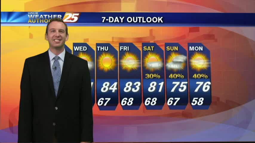
I hope everyone enjoyed their cloudy, but otherwise pleasant, Easter weather! We've more beautiful days ahead, though it looks like stormy weather will move in late Saturday. Watch the forecast for details.

Expect a few clouds and humid conditions tonight, though the stronger winds will limit any fog production. Afternoon showers could begin popping up over the next few days though, so watch the forecast for details.
After a humid start with areas of PATCHY FOG, warming temps has decreased humidity along with partly cloudy skies...
As moisture flow returns to the region, "Good Friday" morning has brought areas of patchy FOG the the viewing area...
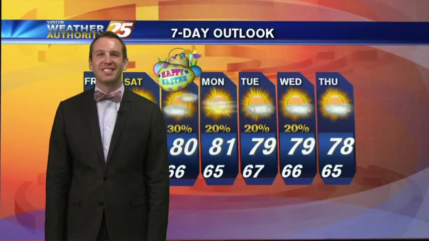
Another mostly clear and calm night ahead with a few warm, sunny, and dry days ahead. Easter is right around the corner though, so be sure to watch the forecast for details.