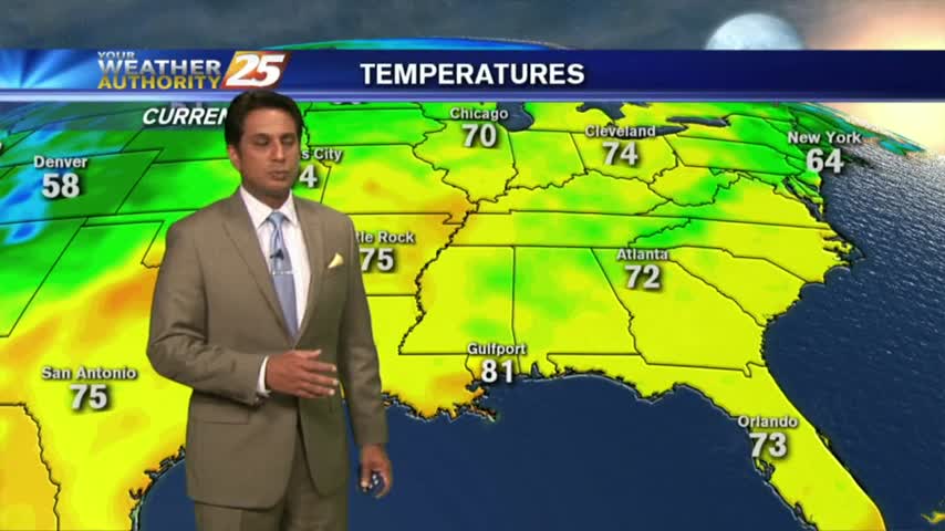
6/1 - Rob's HOT Friday/Weekend Forecast
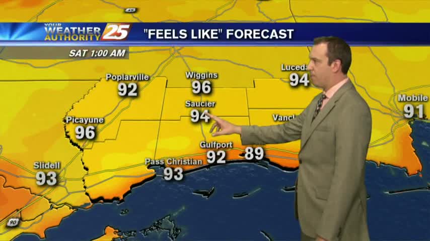
Another WARM start to the day with very high HEAT INDICES in play for the weekend...
Another WARM start to the day with very high HEAT INDICES in play for the weekend...
We've already experienced some hot days and nights, but it's going to get even hotter into the weekend....
Today was as hot and humid as expected with even higher temperatures and the way and not rain to cool us off....
After a mostly clear start, low-level clouds continue to develop along with a possible afternoon shower/t-storm ahead...
It's a rain-free morning with very warm and humid conditions on this final day of May...
Not expecting any rain for the rest of the week, but it will be increasingly hot and humid....
We saw a few showers this afternoon, but going forward I'm expecting dry and sunny days with high humidity....
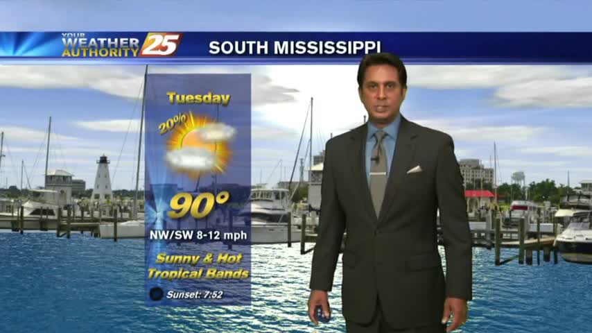
Best rain chances are today, but heat and humidity will be on the increase.
Heavy showers and a few thunderstorms this morning, but more heat and humidity in the forecast.
Last week brought a considerable amount of afternoon showers and storms, but I'm expecting much drier days ahead....
Alberto moved toward the East through Memorial Day, ushering in drier conditions for South MS for the rest of the week...
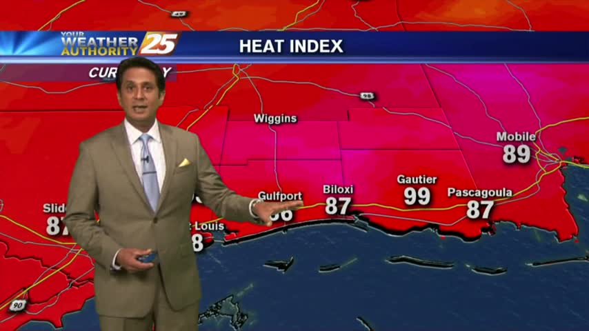
Heat and humidity will be the story as we head into this week.
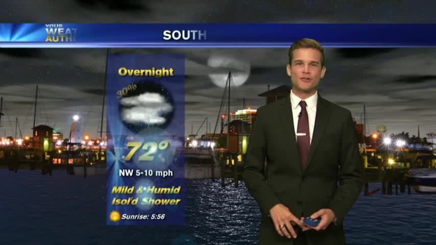
A mild start to the day with just a few mid/upper level clouds...mainly to the east.
Hot and humid today, and that's not going anywhere anytime soon...
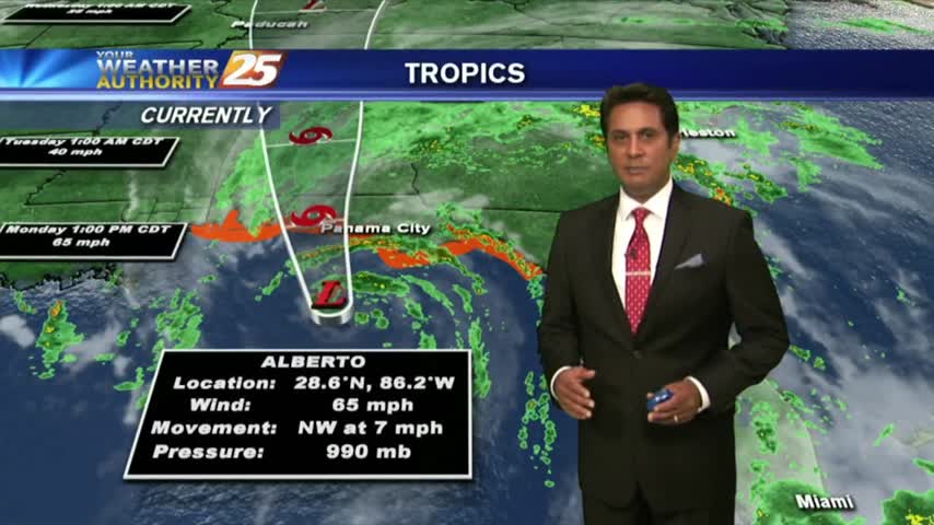
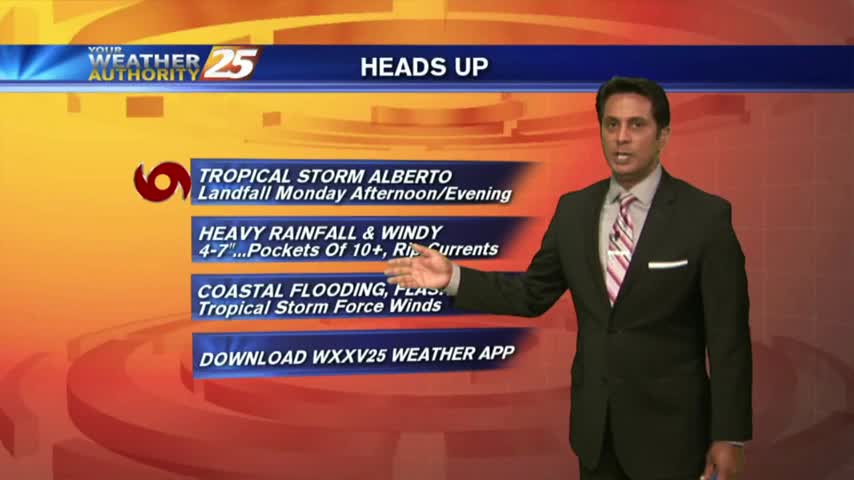
Alberto officially made landfall this afternoon near Laguna Beach, Florida.
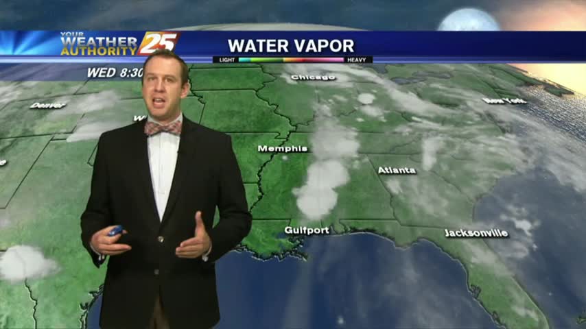
A mild start on this Memorial Day morning with cloud coverage and light rain moving in from the east/STS Alberto...
Alberto continues to strengthen, but the worst will stay off to the east.
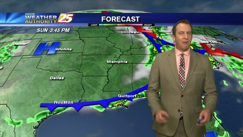
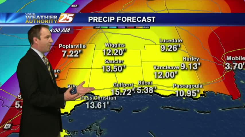
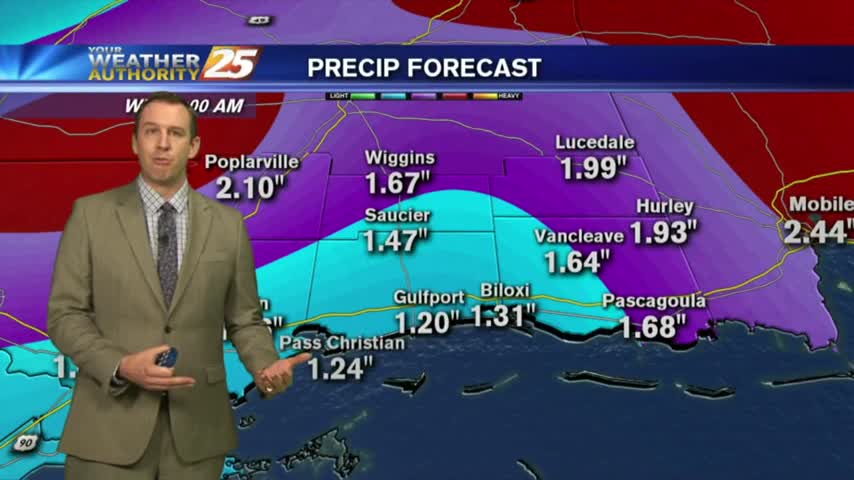
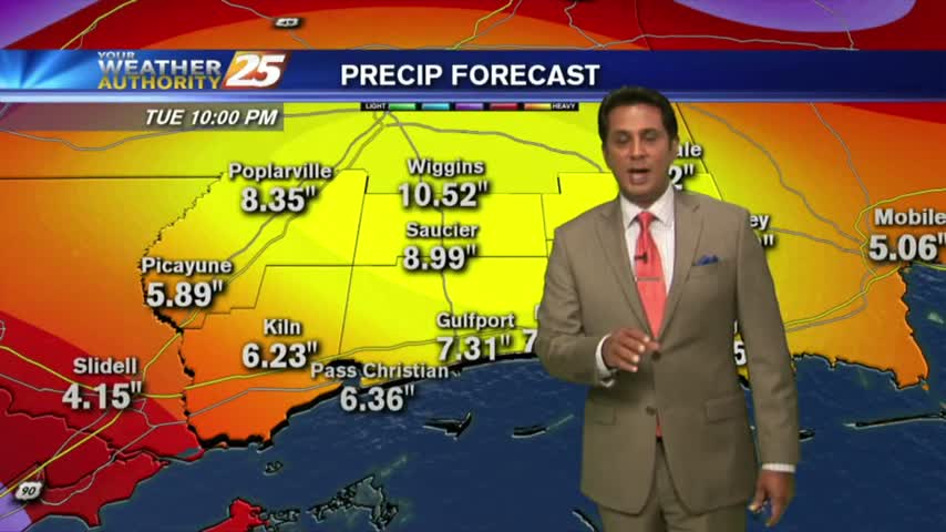
The latest update brings good news regarding the path of Alberto, but we're still expecting several inches of rainfall through the weekend and into next week....
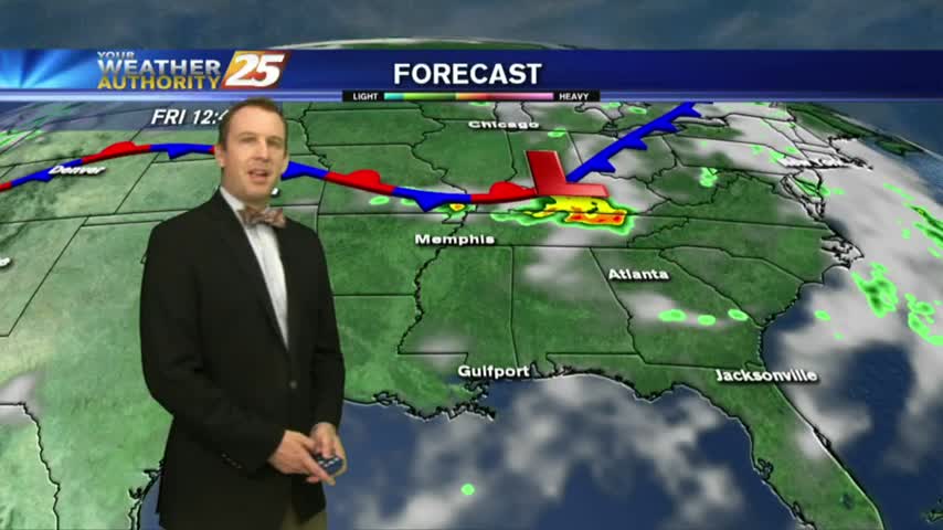
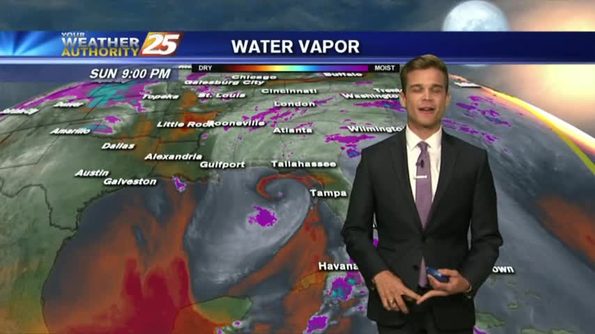
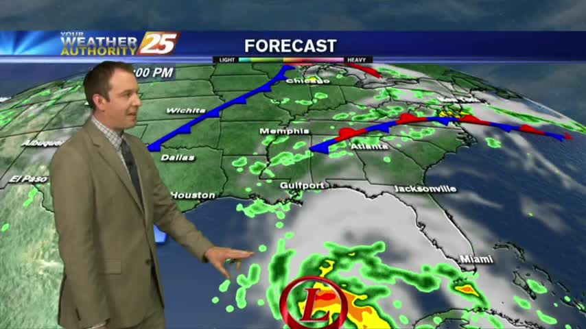
Outside of any tropical influences, we're still expecting showers and thunderstorms through the weekend before Alberto moves in though its path is still uncertain.
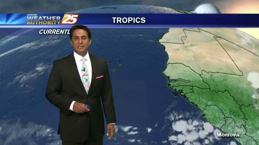
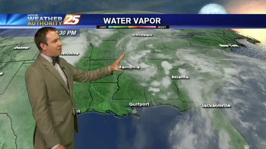
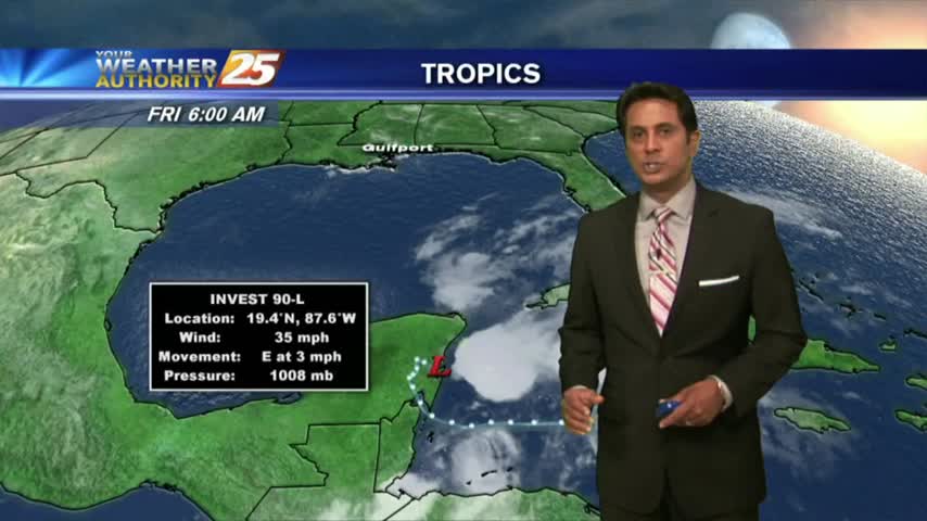
Sunrise activity diminished but starting to pop through the viewing area as daytime heating continues. TS ALBERTO is now in the Caribbean sea...
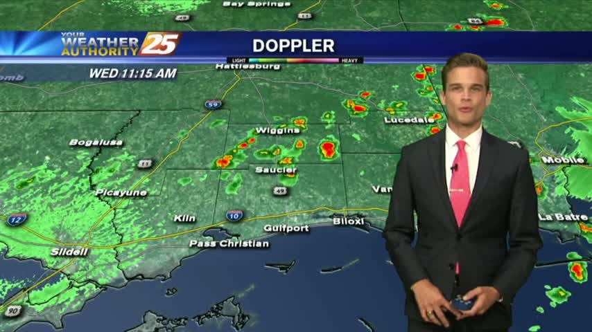
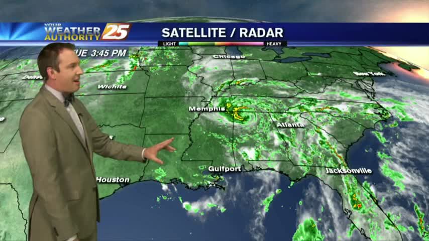
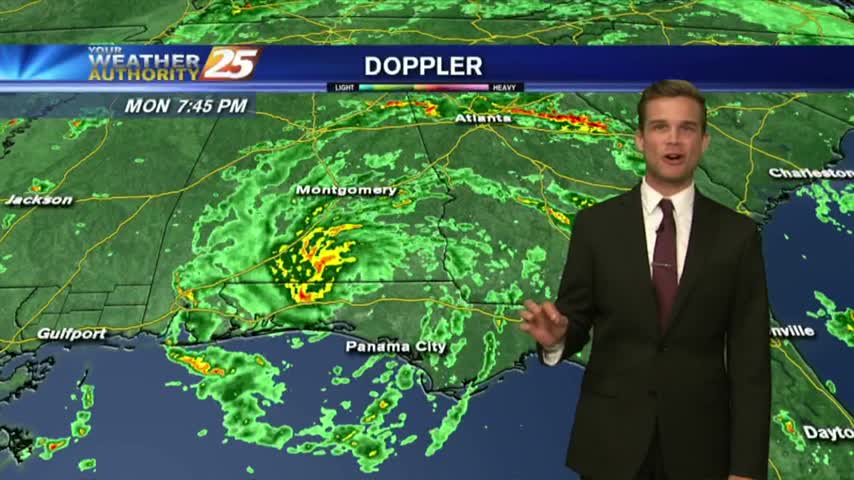
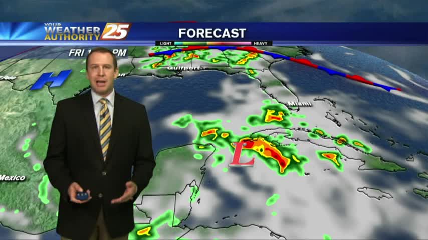
Isolated showers & t-storms to our south moving north and closer to the coastline...
We've already seen several days in a row with afternoon showers and storms, and it seems a tropical system may arrive just in time for the holiday weekend.....
We'll finish off the week with more random, afternoon showers, but heavier, more organized rain will move in with a developing tropical system....
Isolated showers/t-storms are beginning to pop with more activity this afternoon...