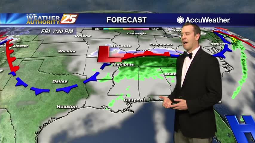
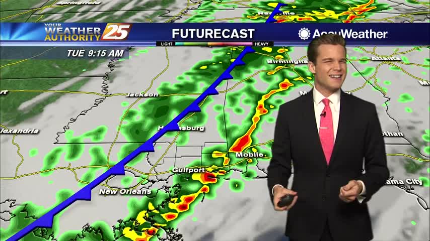
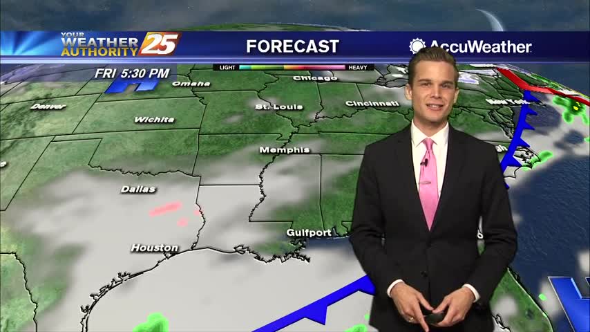
02/15 Ryan's "Heavy" Friday Night Forecast
Gloomy days are here and aren't going far through the weekend, but things get much rainier as next week rolls around....
Gloomy days are here and aren't going far through the weekend, but things get much rainier as next week rolls around....
The gloomy days are here to stay, but organized rain holds off just a bit longer....

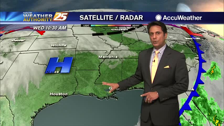
Cloudy skies continue with a few spots of very light rain across the Southern 6 counties...
Extensive cloud coverage continues through the region with MUCH WARMER temperatures than yesterday morning...
Today had a few more clouds than yesterday and was a bit more humid, but we'll see much more of both in the days ahead....
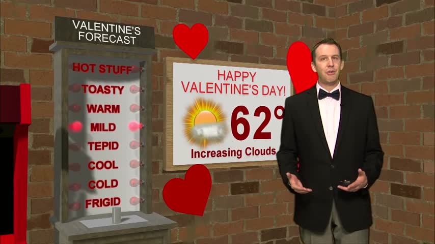
It was a beautiful Valentine's Day afternoon, so it seems appropriate the grey skies are moving in as the day ends....
A warm and cloudy Valentine's Day.

A COLD start to the day with a lot of upper-level clouds streaming across the area...
Today was the clearest and coolest day we'll see until next week as things get warmer and more cloudy through the weekend....
Yesterday's cold front is responsible for today's clear and sunny skies, but it doesn't last long....
Beautiful blue skies continues as temperatures warm...now in the mid/upper 50s...
Major changes this morning with a colder/drier air mass moving into the region in the wake of yesterday's cold front...
The last few days have been humid, warm, and foggy, but cooler and drier air is moving in quickly....
It's been warm and humid the past few nights, but today's cold front finally brings significant changes....

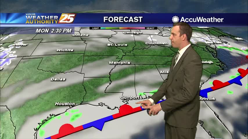
Showers continue through the afternoon, then colder by tonight.
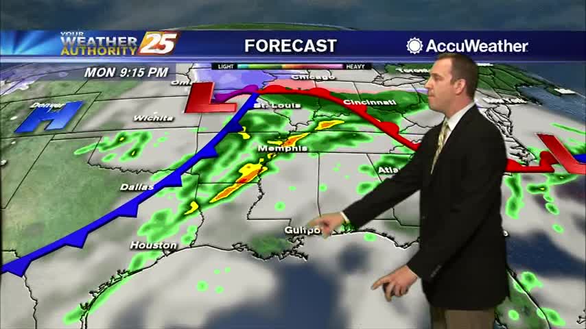
A foggy and wet start to the day as a cold front is moving into the area from the west...
Spring-like conditions have returned to the Gulf Coast after a short weekend reprieve, but they won't last long....
After a short period of drier and cooler weather, warm and humid conditions have moved back in...
Gloomy, gray, gross...today's weather.
A warmer start to the day with areas of light fog and light rain moving in from the south...
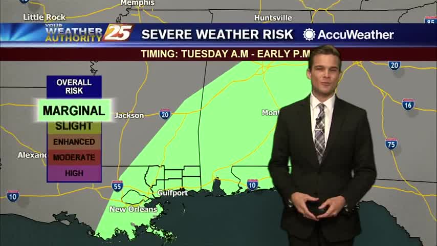
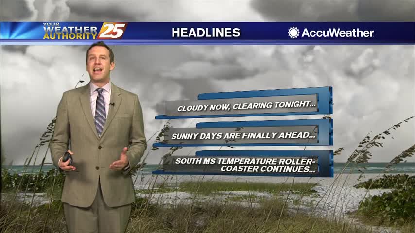
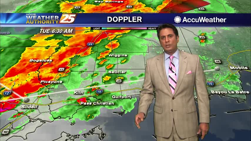
Fog, severe weather and a cool down all in the forecast.
Bundle up tonight! Winter has returned.
Winter has returned...at least for a short time.
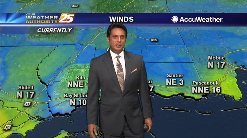
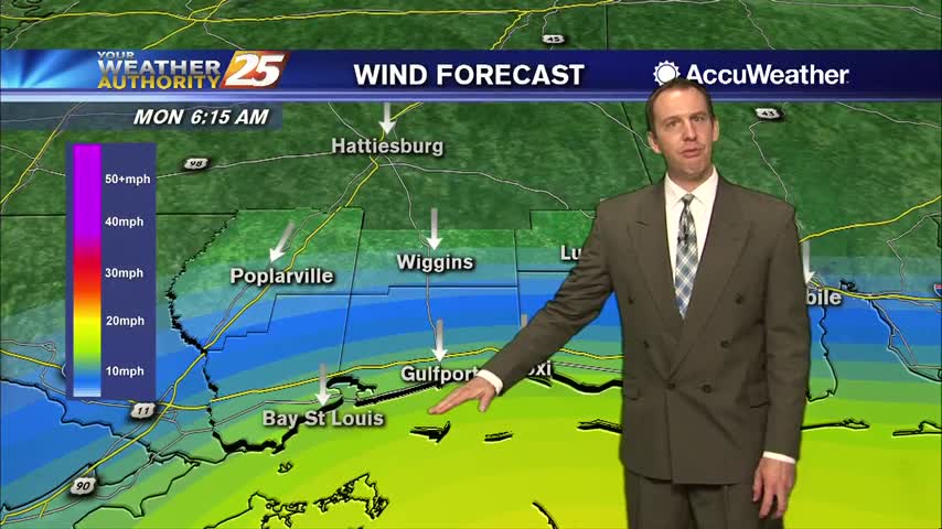
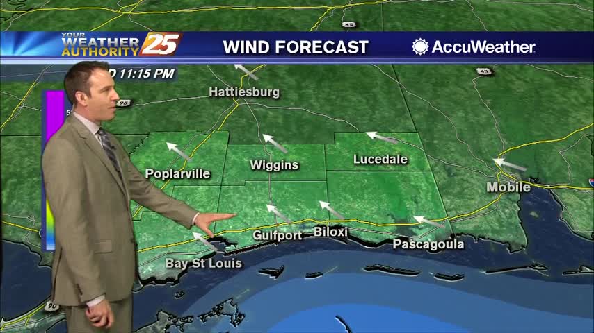
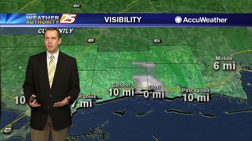
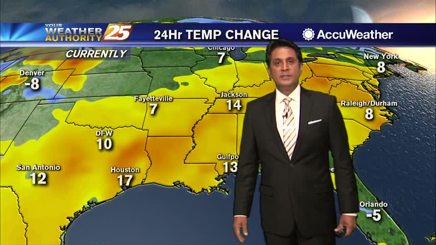
Cloud coverage is still in the area as winds continue to gust into the upper teens to low 20 mph range...