02/19 Ryan's "Overnight Rain" Wednesday Evening Forecast
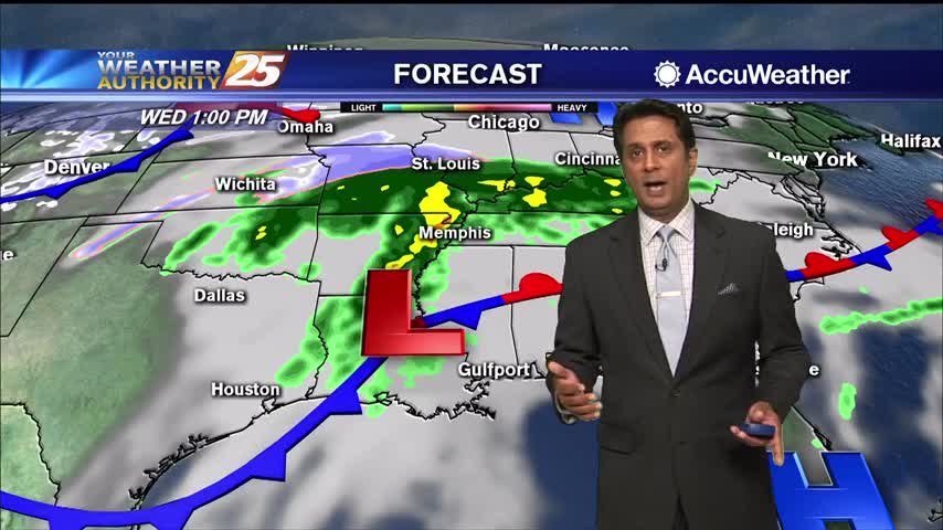
We've seen some subtle changes to our pattern since yesterday, but we're still in for another round of rain before any clearing begins.

We've seen some subtle changes to our pattern since yesterday, but we're still in for another round of rain before any clearing begins.
Scattered showers are popping up across the Gulf Coast this afternoon as temperatures warm into the mid 70s. Temperatures will likely stay in the lower to mid 70s along the coast with inland locations, mainly north of I-10, remaining in…

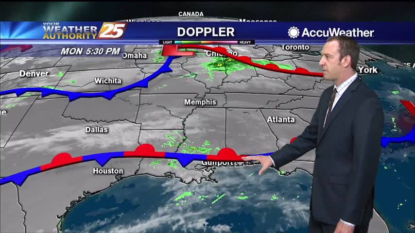
Dense fog will continue this morning then patchy fog through tonight. Showers will move east through the area today as a weak disturbance rides eastward out ahead of a stronger disturbance Thursday. Spotty rain can be expected through tonight with…
Starting off with another foggy night, but looking like a favorable wind shift will bring some cooler, slightly drier air.
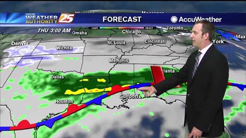
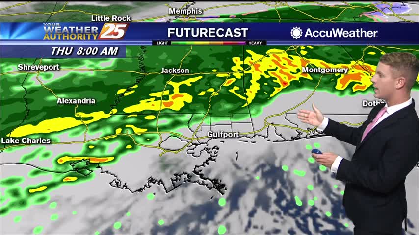
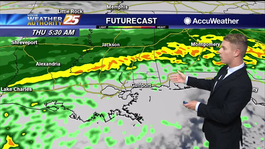
The front has moved a little closer, so rain chances are rising and dense fog remains on the coastline.
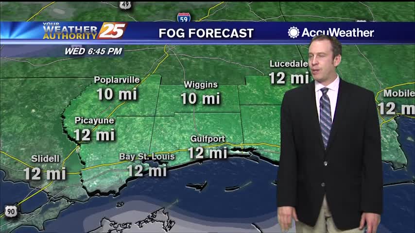
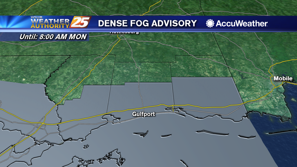
A Dense Fog Advisory has been extended for Pearl River, Hancock, Harrison, and Jackson Counties until 6:00 a.m. Wednesday. It will be warm today with high temperatures reach the mid 70s and overnight lows only dropping to around 60 degrees.…
Another morning with DENSE FOG as an advisory is in effect through mid-morning. Surface low currently over east New Mexico will track east and northeast today; after the low passes east, the associated cold frontal system will drop south into…
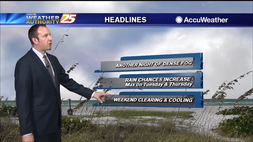
A familiar pattern as we start off the week cloudy, wet, and humid, but end sunny and drier.
The weekend was nice, but clouds began to move in pretty early Sunday and grey, wet weather is expect for most of the week.
A cloudy and mild Presidents' Day afternoon...
A disruptive start to Presidents' Day with widespread DENSE FOG in the area...
The clouds are moving in again after our sunny and drier weekend, so get ready for another grey, dreary week ahead.
Cuddle-friendly weather moves in for Valentine's Day night as temperatures fall into the 30s along the coast!
The muggy, cloudy weather we've suffered through all week long has finally cleared, and the weekend is largely looking pleasant...largely.

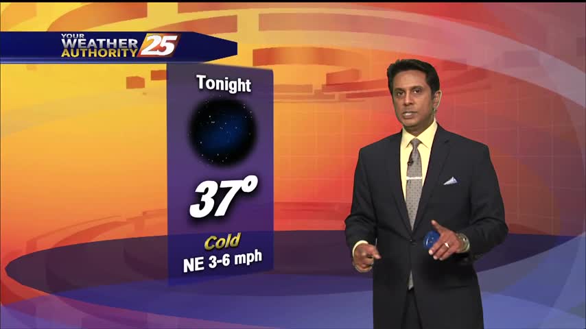
After a COLD start to the day the mercury hasn't climbed that much as clear skies continue...
The majority of clearing occurred overnight with a few clouds linger this morning, along with cold temperatures...
Clouds remain for now, but will slowly clear through the night. Expect a sunny and dry weekend ahead, but clouds return soon after.
After a stormy start to the day, lingering cloud cover will slowly clear through the night as colder, drier air moves in.
Mostly cloudy skies will persist through the afternoon, with a high near 62. North winds will be breezy around 15 mph with gusts up to 20 mph. Tonight expect cloudy skies, then gradual clearing toward daybreak, with a low around…

Rain will end from west to east this morning with the exception of the sound and northern Gulf that may have several showers move across through the day. The fog will also come to an end this morning. But the…
We've had a few showers throughout the day, but overall it's been hard to come by in South MS. That changes overnight, and we'll start seeing improving conditions after lunch.
The warm and humid weather hasn't been in any hurry to leave, but a cold front will force changes later tonight.
Dense fog continues across the coast of South Mississippi and over the marine areas. A Dense Fog Advisory for Hancock, Harrison, and Jackson Counties has been extended until 2:00 p.m. Areas that are not dealing with fog are still dealing…
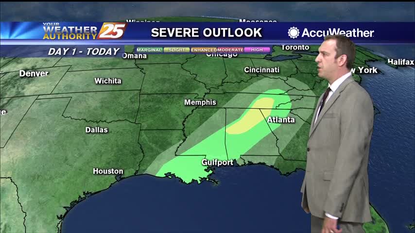
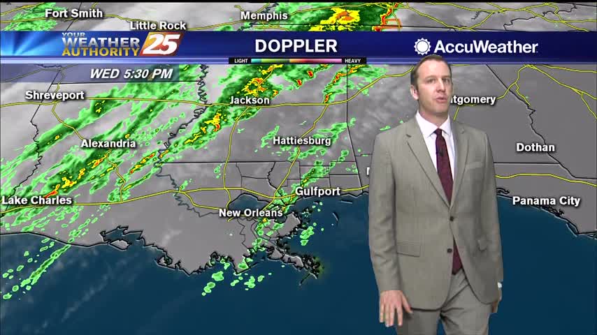
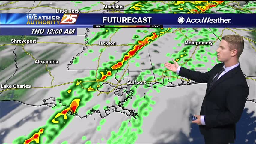
A cold front will finally move slowly through the area tonight into Thursday morning. The air mass ahead of the front will initially be cool/stable, but gradual destabilization will occur by late afternoon and evening with daytime heating. A threat…