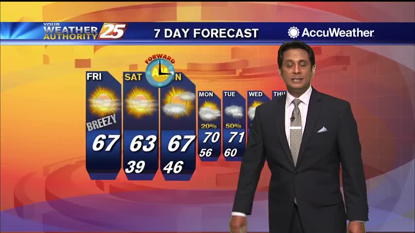
3/6 - Rob Knight's "Sunny & Breezy" Friday Morning Forecast
A cold start to the day with a few upper-level clouds clearing to the SE...
A cold start to the day with a few upper-level clouds clearing to the SE...
We're heading into a nice weekend after a grey, muggy week, but a few chilly nights lie ahead.
Active weather has moved on, so expect changing improving conditions heading into the weekend.
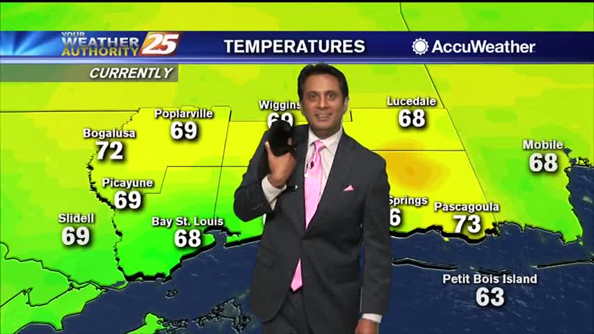
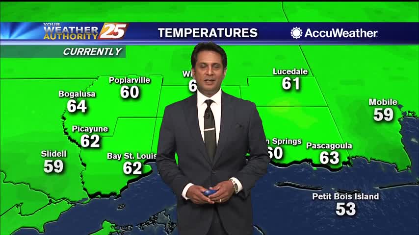
Cloudy skies continue to blanket the Gulf Coast this afternoon with temperatures in the lower to mid 60s. The cloud cover will begin to break apart this evening with clear skies by late tonight. Sunny skies are expected Friday with…
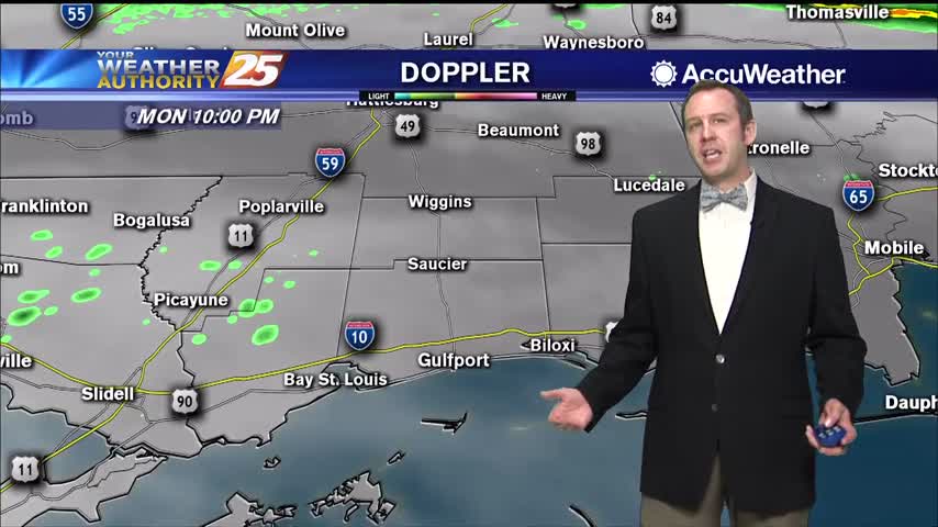
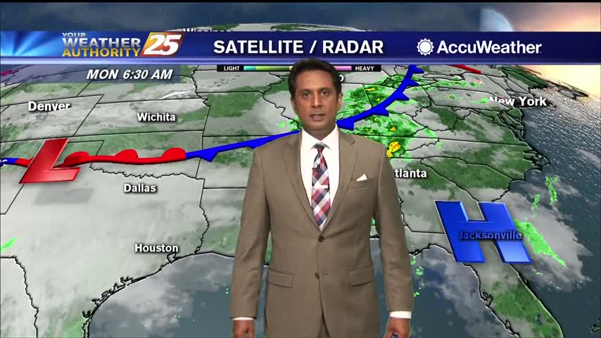
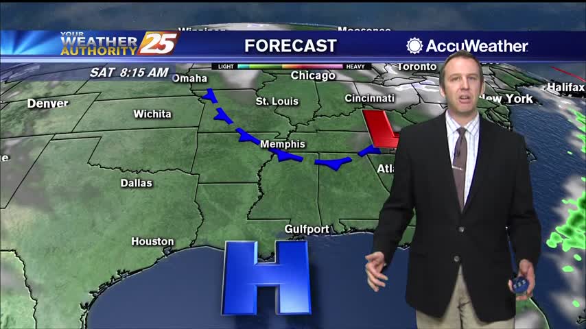
The upper and surface low pressures that have brought rainfall to the area are currently passing through and quickly racing east. Radar depicts this as well, with only scattered light showers on the scope and even those are trying exit…
System is weakening, but rain and potentially thunderstorms are still expected overnight.
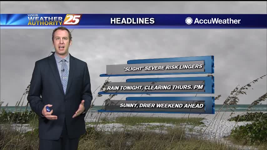
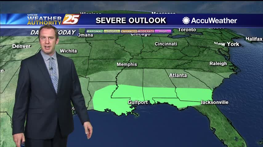
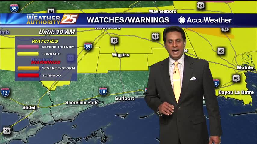
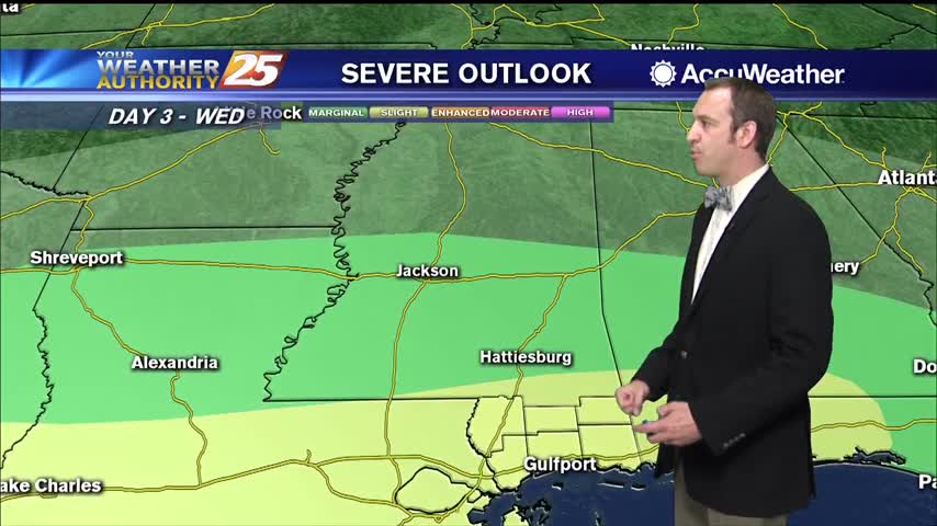
Slight risk of severe weather lingers in South MS though all the activity so far has been to the north.
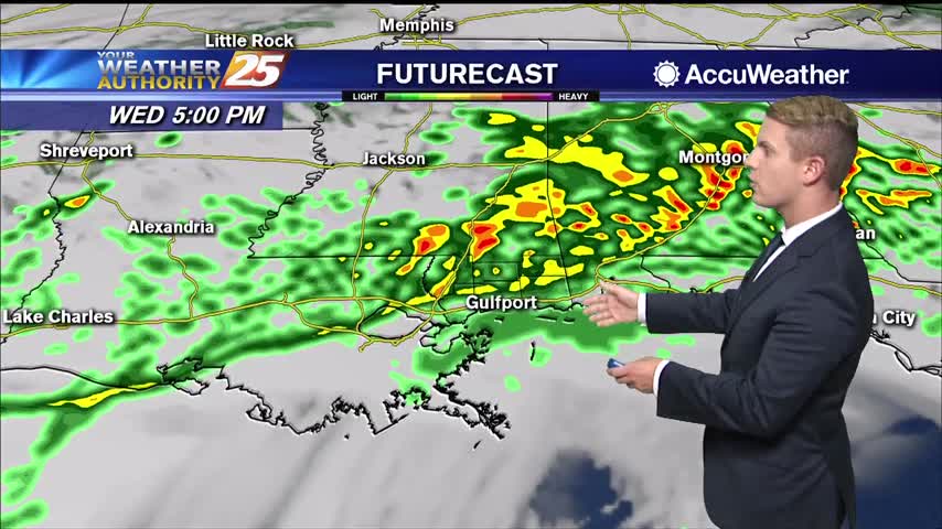
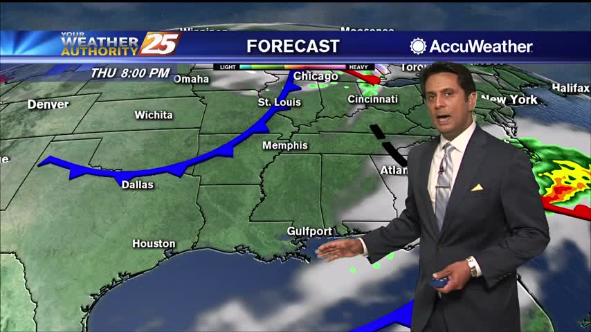
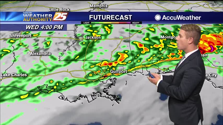
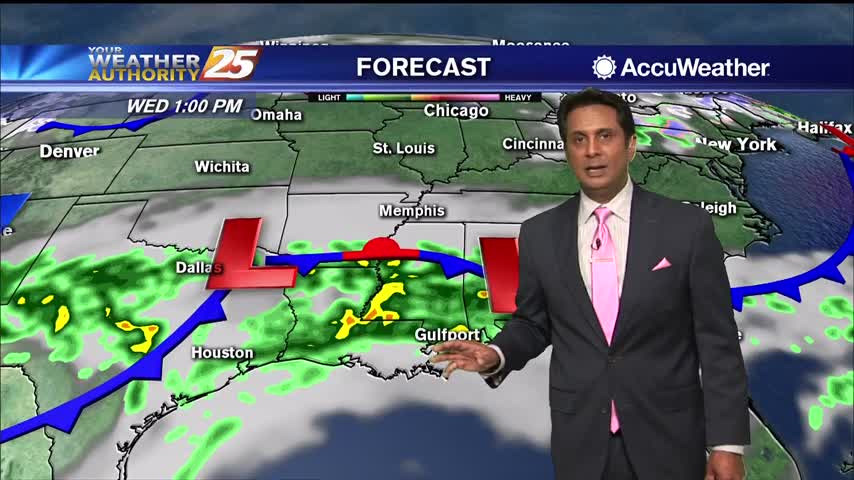
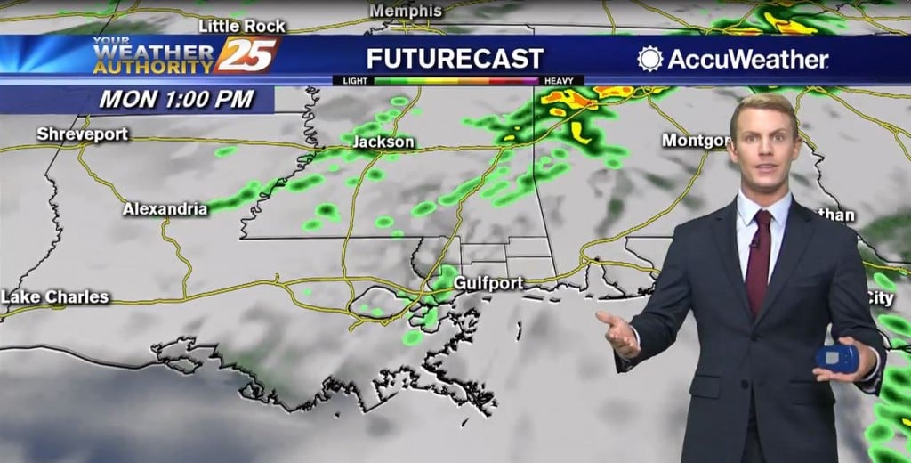
Wednesday afternoon and evening, everyone in South Mississippi will likely see showers and thunderstorms. Some thunderstorms may produce heavy rainfall, gusty winds, and an isolated tornado or two. The most likely time of arrival for any strong to severe storms…
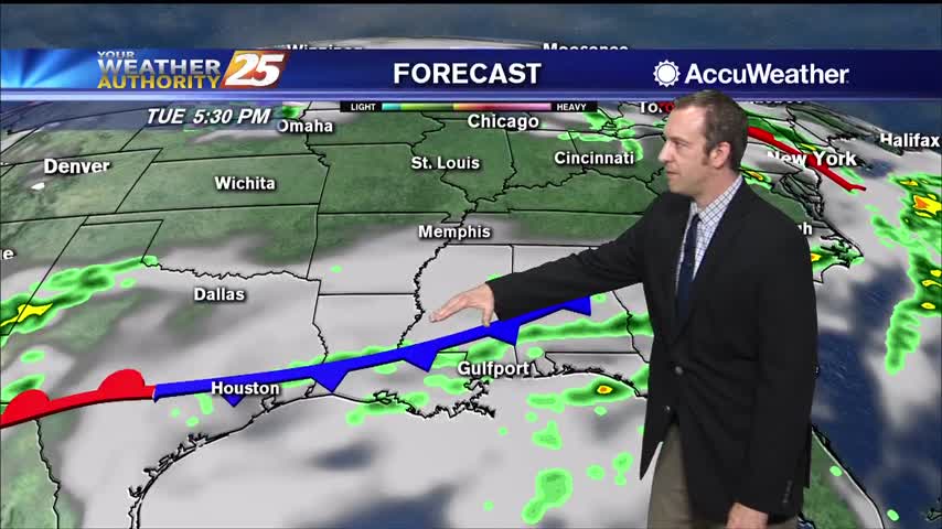
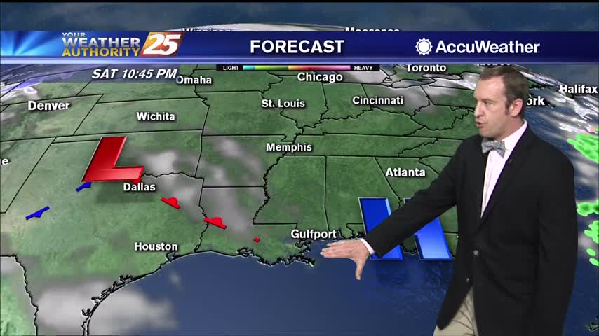
What will likely be the most impactful weather of the week is expected take place over the next 24 hours. An upper-level low pressure system is currently tracking across northern Mexico. A frontal boundary that moved into the region yesterday…
Active, potentially severe weather is moving in for all of Wednesday, but will clear quickly before the weekend.
Nasty, grey looking weather remains, but very little rain has fallen. That will change heading into tomorrow.
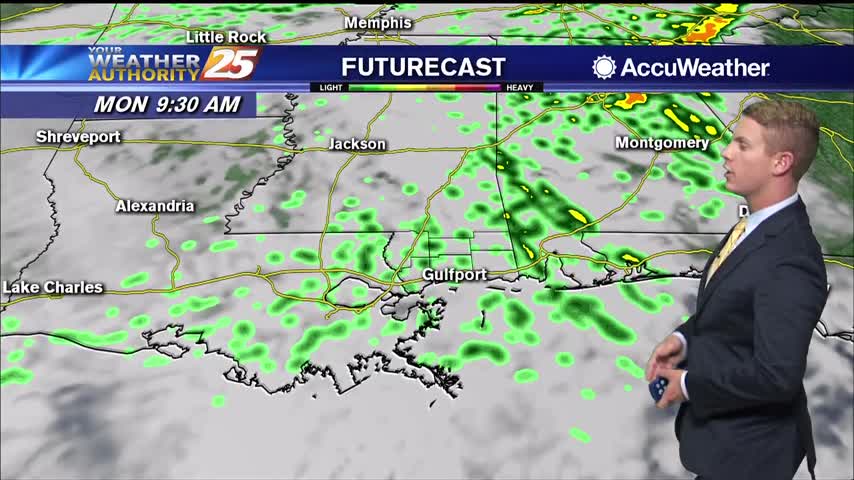
A few showers will be possible Tuesday afternoon as temperatures remain warm, reaching the upper 70s in several locations across South Mississippi. Rain chances are at around 40 to 50 percent. Rain chances increase overnight to around 60 percent. Overnight…
A visit from the Humane Society of South Mississippi...
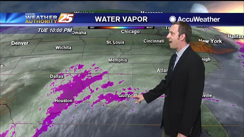
The current upper level pattern shows a weakness extending across the upper Mississippi Valley and a close low near Baja California. The disturbance that brought rain the local area yesterday is quickly racing east while the disturbance to the north…
Last week's sunny and drier weather broke us of a pattern we'd been stuck in for upwards of a month, and that pattern seems to be returning for this week.
This time last week we were getting ready for freezing temperatures, but tonight's low will be double that as warm, moist air lingers.
Today, scattered to numerous shower development will be possible in the afternoon and early evening. Regional radars are already showing these showers already tracking over the area. Expect this to continue throughout the day. At the same time, temperatures should…
A cloudy start this morning with spotty light rain moving NE...
High pressure will persist through Tuesday, limiting the rain chances for tonight and tomorrow to around 30 to 40 percent. Southerly surface winds will be in place through Wednesday, allowing for more warm air and moisture to move into the…

We've warmed over the last few nights, but even more warm, moist air is moving in over the weekend.
Not much changes from today's sunny, warmer weather through the weekend, but active weather moves in not long after.
After a chilly start, temperatures have warmed nicely into the 60s...

Another very cold start to the day but the warm up will begin later this afternoon and through the weekend...
Get ready for another cold one, but I expect it to be slightly (a degree or so) warmer than last night. Warming increases into next week, into the low 70s by Tuesday.