4/14 – Rob Martin’s “Into Easter Weekend” Forecast
Last night’s cold front has moved offshore and weakened, but it won’t go far. Skies will at least partially clear tonight with lower humidity. Expect a comfy night…
Last night’s cold front has moved offshore and weakened, but it won’t go far. Skies will at least partially clear tonight with lower humidity. Expect a comfy night…
The cold front has moved east of the area but will continue to be a factor in the forecast through the Easter weekend. As the upper…
The cold front has moved east of the area but will continue to be a factor in the forecast through the Easter weekend. We could still be…
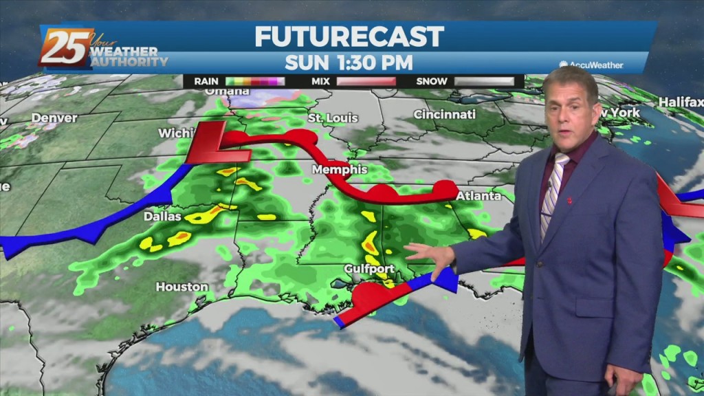
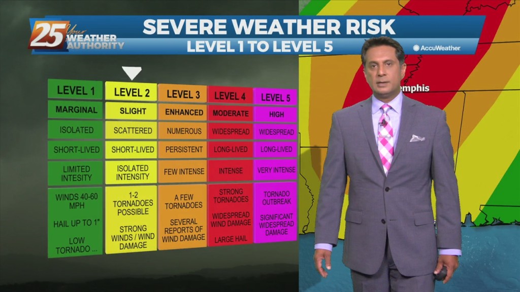
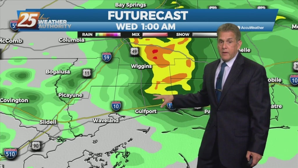
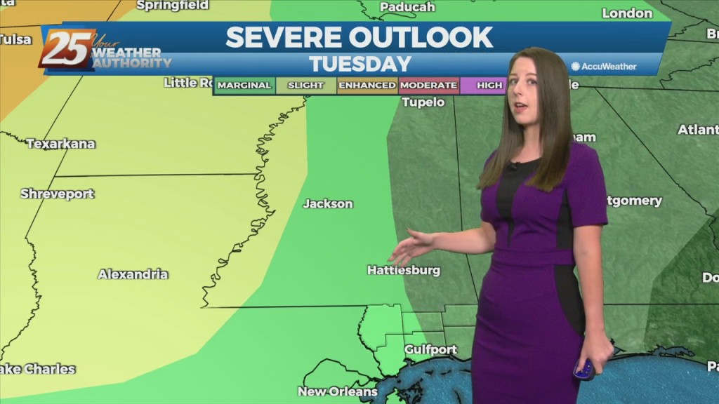
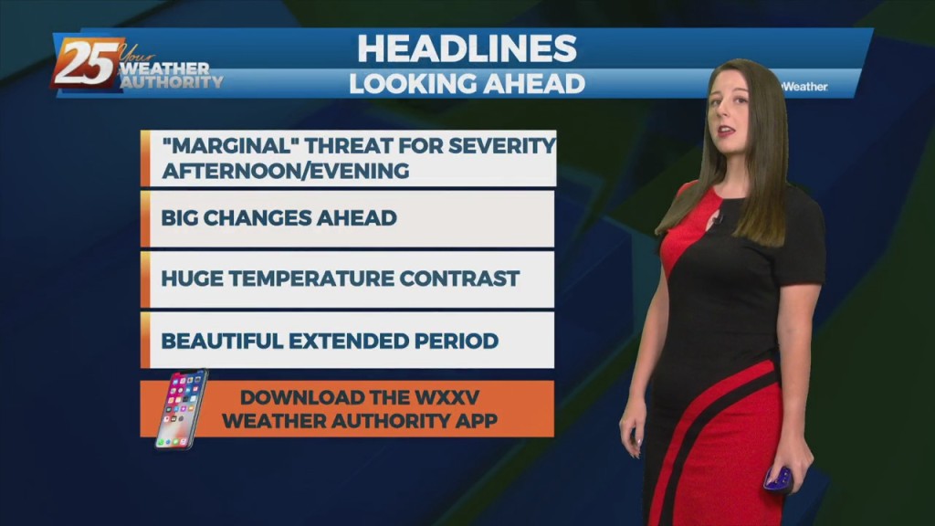
We remain under a “slight” risk (level 2 of 5) for severe storms this evening and tonight. Although the main line isn’t expected until after 9 PM,…
A t-storm complex to the north will continue to move NE and get dissipate later this morning in advance of an approaching cold front. Going into the…
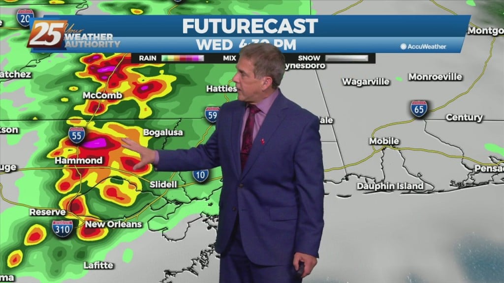
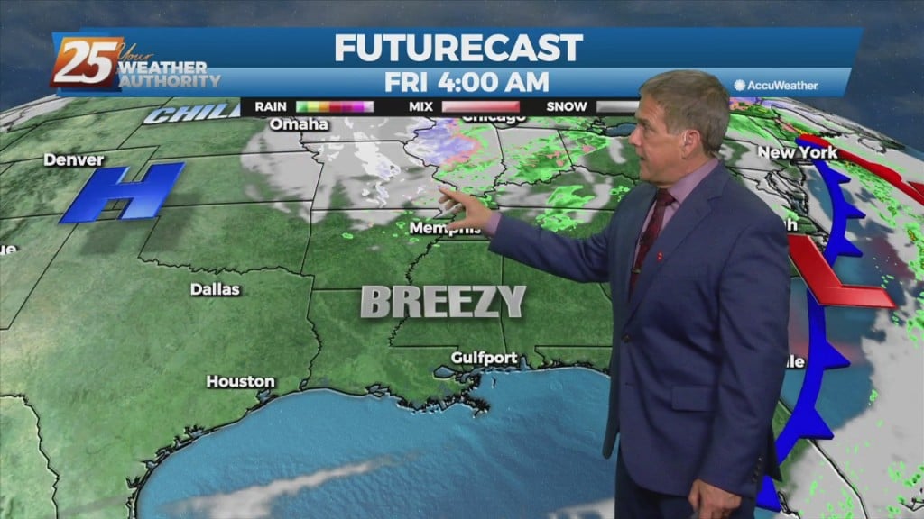
Heavier showers to our west will weaken as they make their way through our area tonight. It’ll stay breezy off the gulf and the warm…
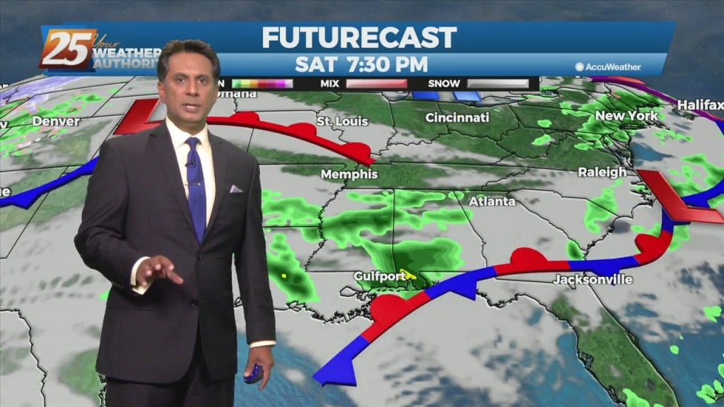
After some late-afternoon showers, more will arrive late tonight and could be heavy just to our west and northwest. They will weaken as they swing…
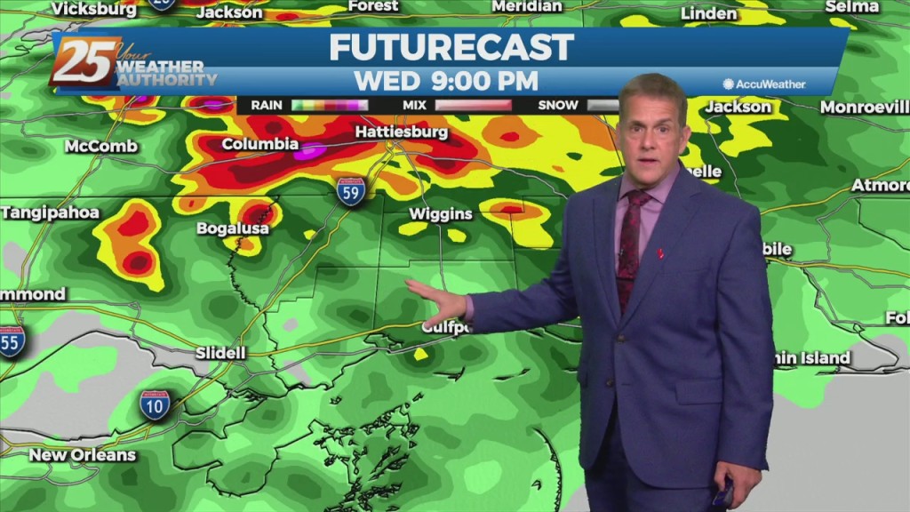
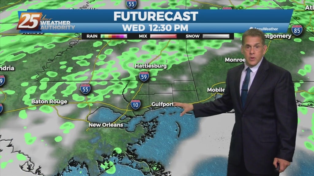
Today looks to remain quiet for the first half of the day but storms could begin to fire just to the west and southwest during the early…
A southerly flow will keep cloud cover, humidity, and spotty showers around Tuesday, mainly late-afternoon and evening. No severe weather is expected during this time,…
A southerly flow will keep cloud cover, humidity, and spotty showers around through Tuesday, mainly afternoon and evening. No severe weather is expected during this time.…
Today, southerly surface winds will help advect moisture and warm air into the area. Low level convergence will help to enhance lifting in the environment.…
The next trough in line, starting out farther south than the Monday one, begins digging south and east over the southern Rockies on Tuesday. At the same…
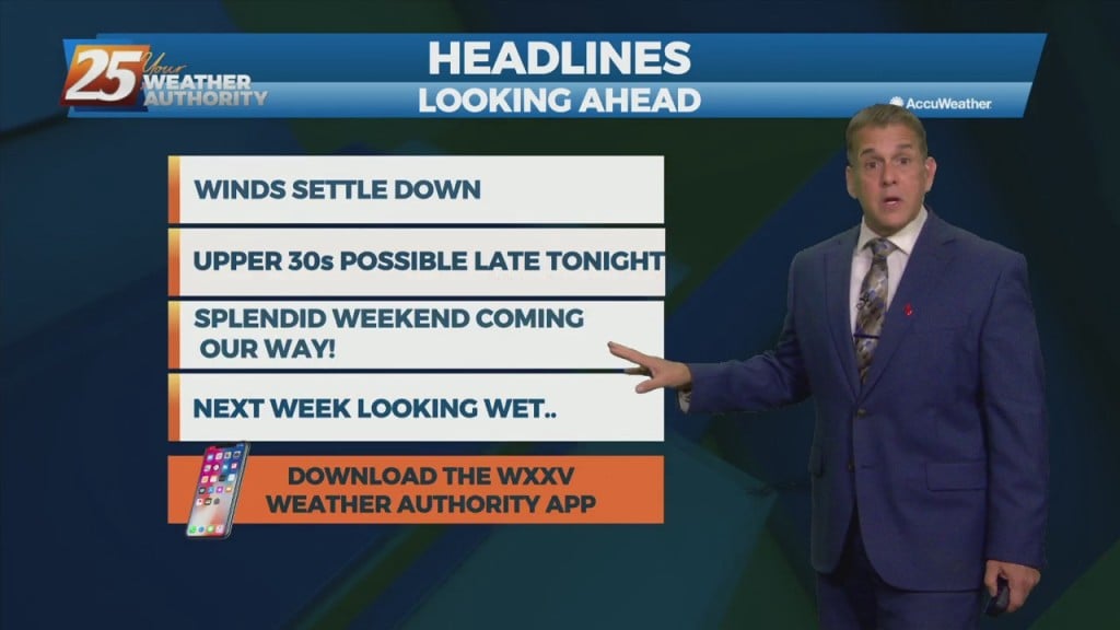
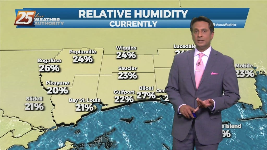
Great news in the near-term! Our red flag warning and wind advisories have expired. However, humidity will remain very low through Saturday, so outdoor…
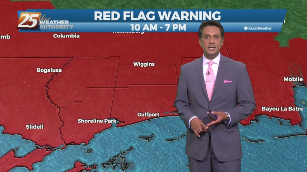
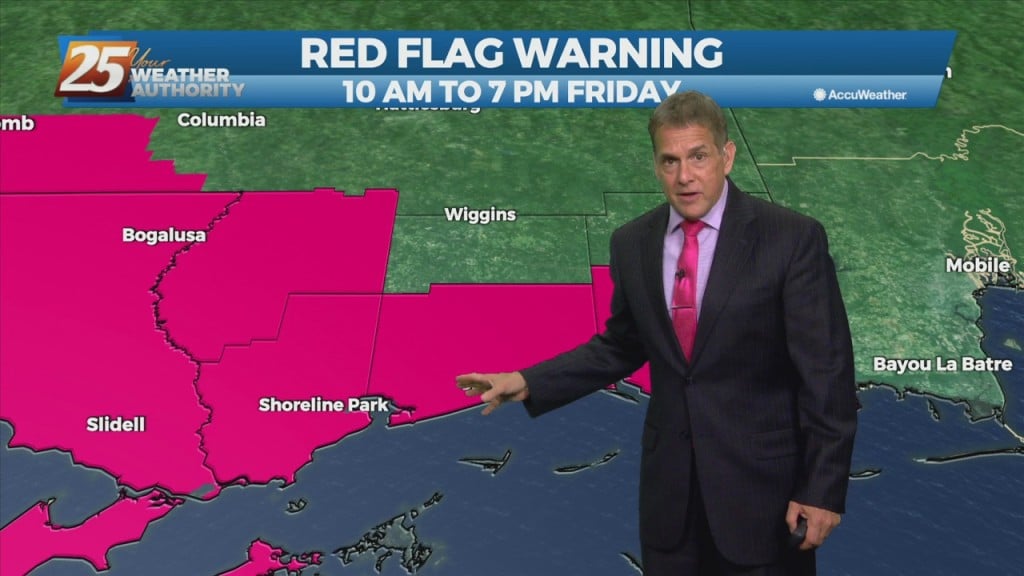
A RED FLAG WARNING and WIND ADVISORY are in place until 7 PM this evening. Outdoor burning is discouraged with these gusty winds and very low…
Surface high pressure that is edging into the Great Plains this morning will continue to shift eastward, crossing the local area on Saturday, and be centered over Florida…
An area of low-pressure remains near Lake Michigan, with upper level high-pressure to the NW. Any cloud cover associated with the upper low is well to the north…
A sustained north to northwesterly flow will continue to reinforce surges of cool, dry air into the region over the next 24 hours.This mean several…
A sustained north to northwesterly flow will continue to reinforce surges of cool, dry air into the region over the next 24 hours. The only real…
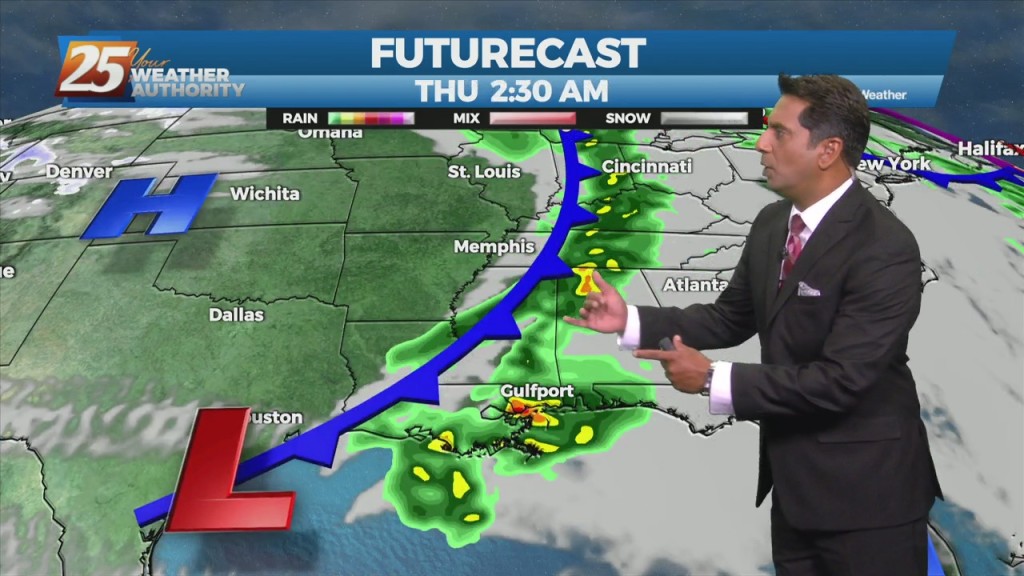
An upper low-pressure is going to move only very slowly eastward over the next several days, from the Mid-West, reaching Maine on Sunday. A minor disturbance rotating…
An upper low-pressure is going to move only very slowly eastward over the next several days, from the Mid-West, reaching Maine on Sunday. A minor disturbance rotating around…
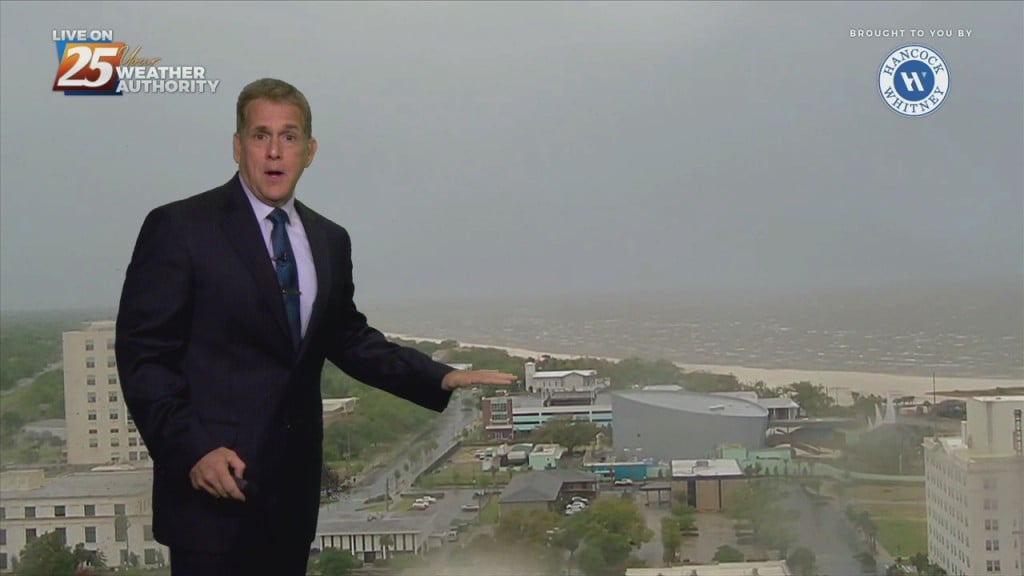
Wednesday was an interesting day for temperatures. First, the Gulfport-Biloxi airport only got down to 74 degrees before daybreak, setting a new record-warm reading…
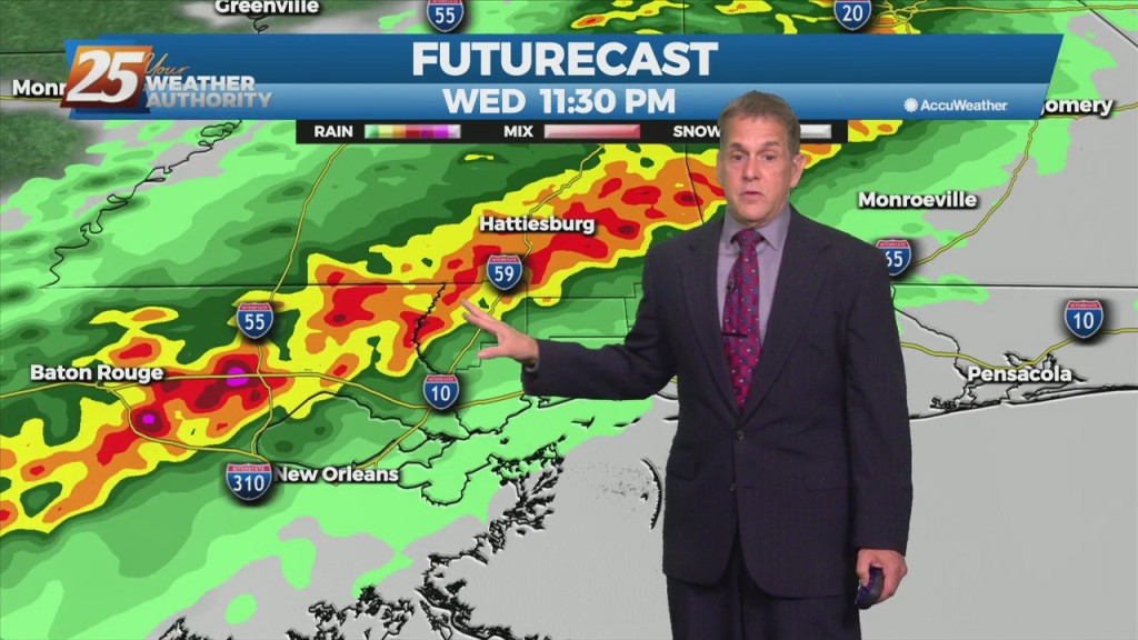
A few afternoon showers/t-storms will be possible including this evening as a cold front moves through the area. If the lift can be realized and overcome the dry…
A weak upper disturbance will move across the region later this morning with the actual cold front pushing through in the evening. Showers and a few…
Outside of isolated showers, we’re looking good through the rest of Tuesday night and into early Wednesday morning. It’ll be a warm, humid night as temperatures…