9/8 - Rob Knight's "Cold Frontal Passage" Thursday Morning Forecast
Through the end of the week, an upper level low is expected to influence the area, enhancing rain chances for the region. There are still some…
Through the end of the week, an upper level low is expected to influence the area, enhancing rain chances for the region. There are still some…

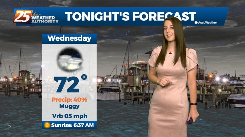
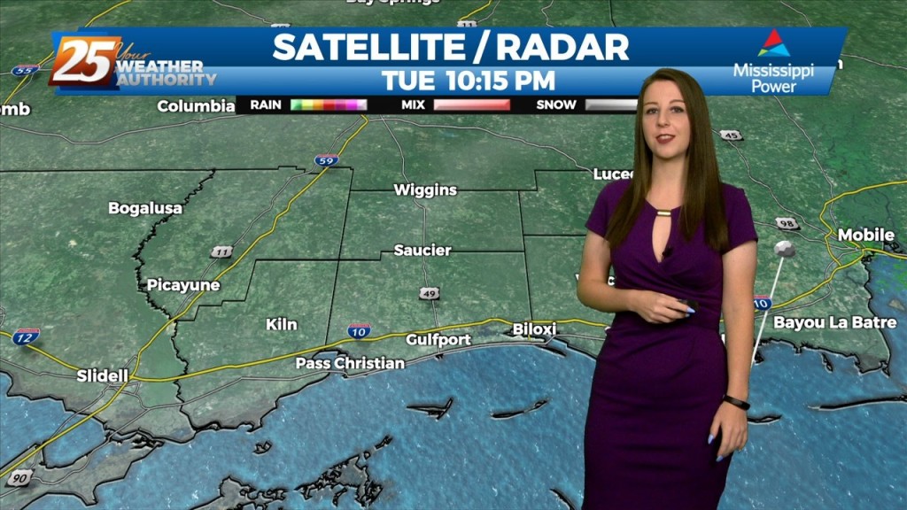
Tonight, we're seeing some lingering showers, mainly west of highway 49. Through the end of the week, an upper level low is expected to influence the area, enhancing rain…
Tonight, some scattered showers and storms will be possible,especially in the northernmost areas. Through the end of the week, an upper level low is expected to influence…
A trough of low pressure along the NW'tern Gulf of Mexico will slowly push SE as an upper low pressure system and training cold front moves through…

Why is Rob Knight eating CANDY CORN on air??????????
The area is still under the influence of upper level weakness which is slowly moving east while further west has a large area of high pressure with…
Mississippi is still under the influence of upper level troughing which is slowly moving east while further west has a large ridge with a cutoff low. This trough…
Mississippi is still under the influence of upper level troughing which is slowly moving east while further west has a large ridge with a cutoff low. This trough has…
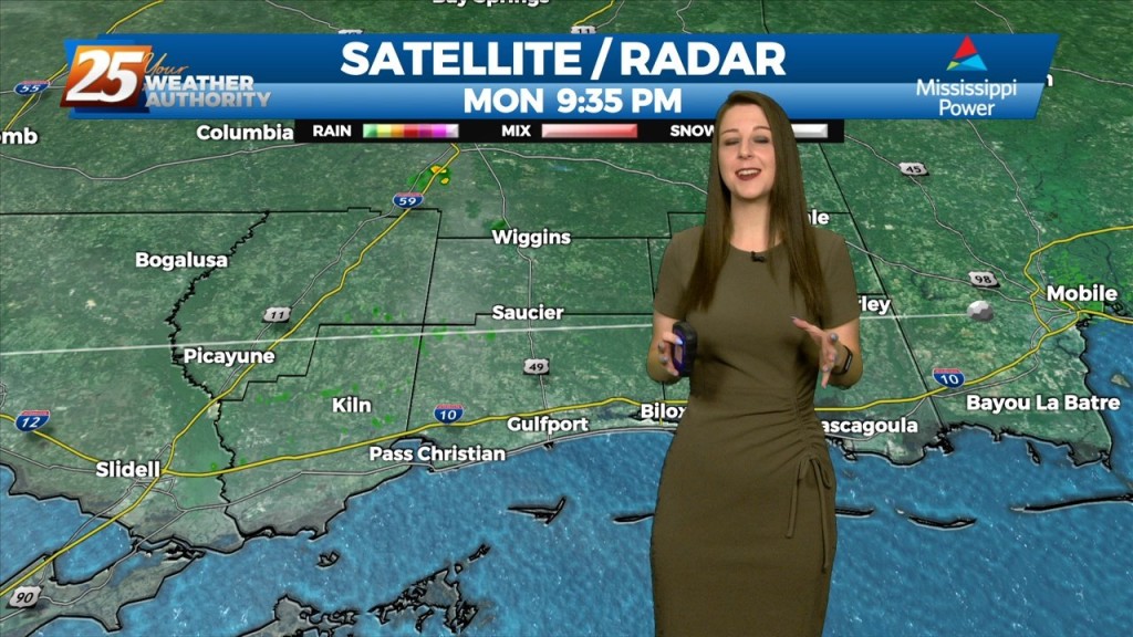
Winds will shift to a more light to moderate southerly direction by later today. This flow will help spread abundant gulf moisture back into the region and should allow…
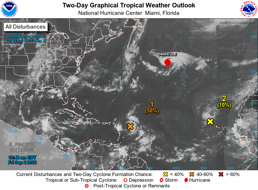
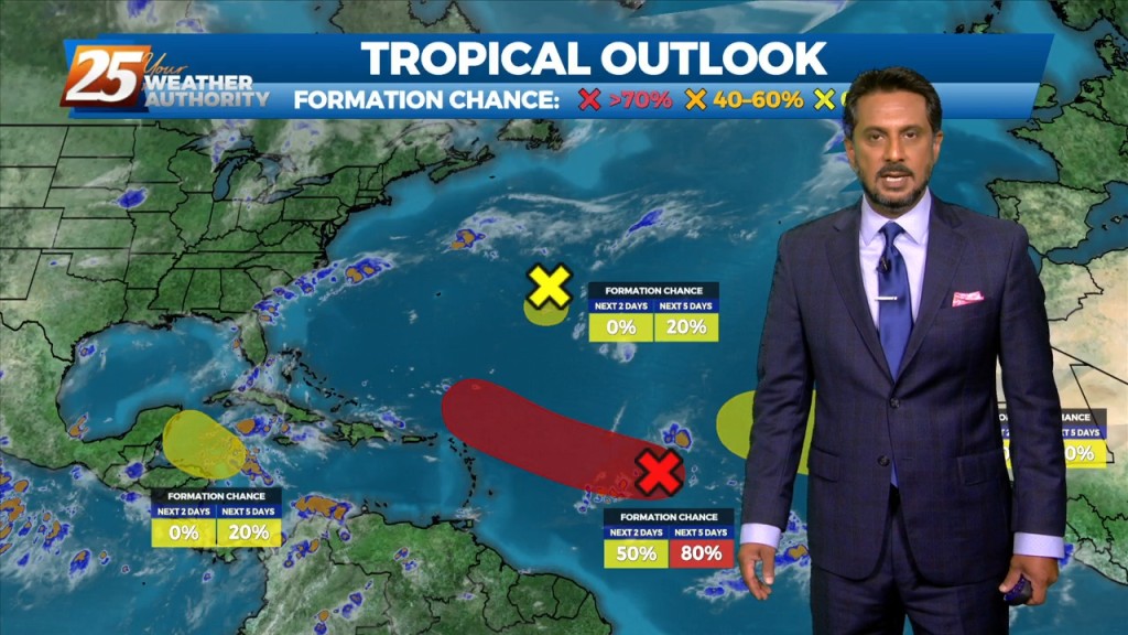
MIAMI (AP) — Tropical Storm Danielle strengthened into a hurricane Friday morning — the first of an unusually quiet storm season. The storm is not currently a threat to any land. The storm’s maximum sustained winds were clocked at 75 mph…
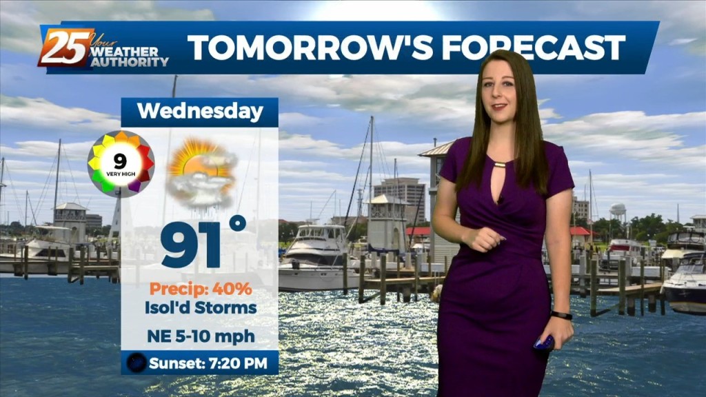
Going into Labor Day weekend, the general thought is that the dry pattern we’ve enjoyed (although hotter) will likely come to an end this weekend. Aloft,…
The dry conditions have been nice for a short time, but the rain will return over the weekend as the pattern changes. Southerly surface winds will act to…
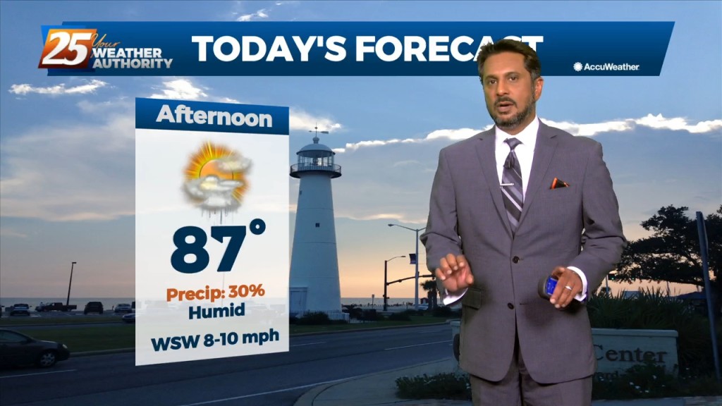
The best potential for rainfall, similar to Wednesday looks to be again along and west of the I-55 corridor later this afternoon. With the…
Overall, a fairly quiet day is expected across the area. It should be another lackluster convective day with plenty of dry air aloft. The best potential…
Mid level dry air will remain in place today. This will help cap the environment, making it harder for thunderstorms to get started. There will be…
Mid level dry air will remain in place today. This will help cap the environment, making it harder for thunderstorms to get started. There will be some…
We will tip toe into September Thursday, and some of the area could feel some surface "drier" air filter in. With depth of dry…
Mid level dry air will remain in place today. This will help cap the environment, making it harder for thunderstorms to get started. There will be some…
A frontal boundary is expected to move into the area late tonight and stall over the area by tomorrow afternoon. This front will bring stout mid-level dry air into…
A frontal boundary is expected to move into the area late tonight and stall over the area by tomorrow afternoon. This front will bring stout mid-level dry air into…
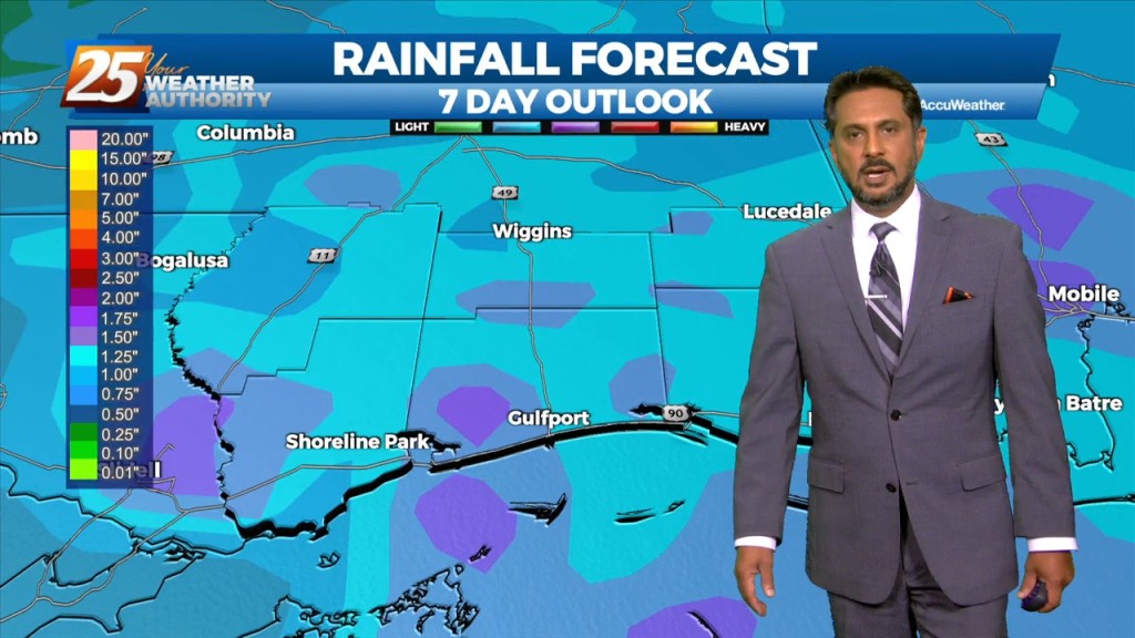
Heavy rainfall wording will remain with us as rates up to 4"/hr will be possible but most of this activity will be moving, so without lingering over an area or training, flooding will be less of an issue. But what could…
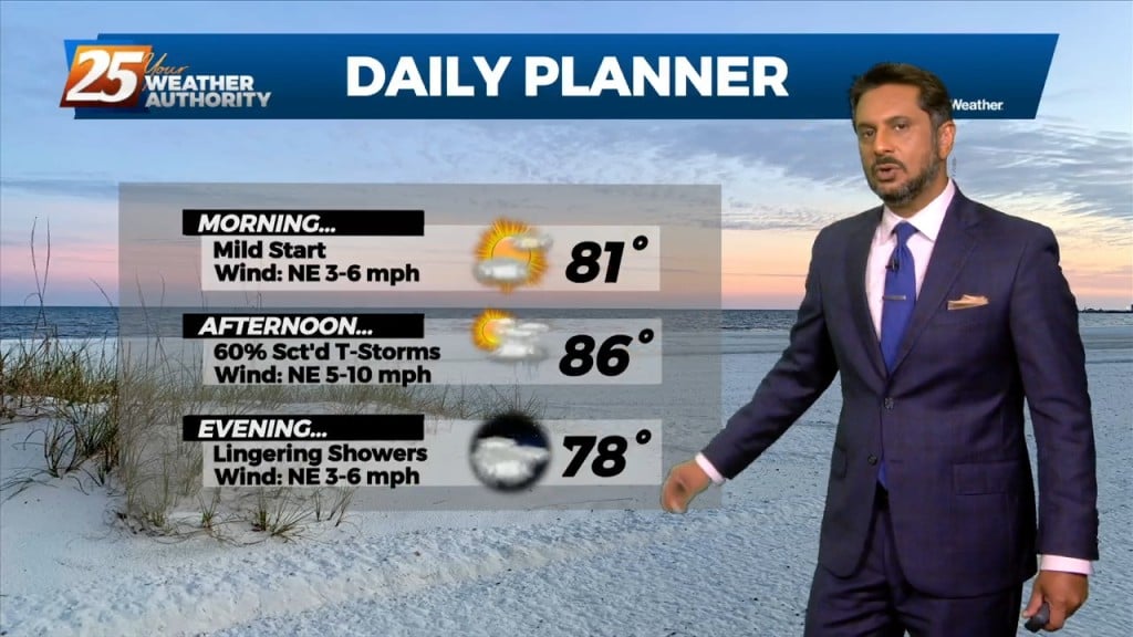
A broad ridge of high pressure will remain over the northern gulf through the week promoting onshore flow with showers and thunderstorms expected each day. Tonight through…
A broad ridge of high pressure will remain over the northern gulf through the week promoting onshore flow with showers and thunderstorms expected each day. Tonight through…
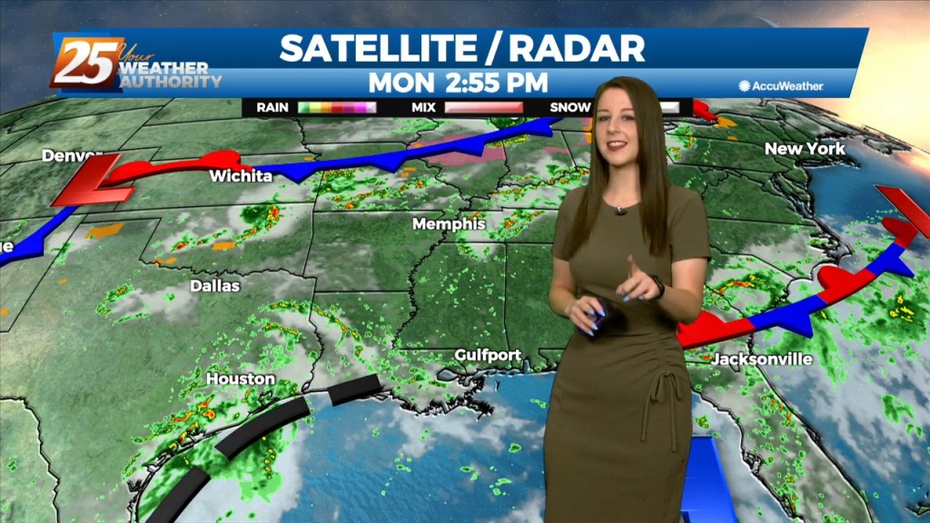
A strong surge of tropical moisture and upper diffluence is approaching the north central and NW gulf this morning. The deepest moisture surge will be…