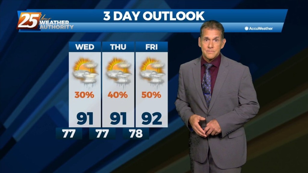
7/27 - Rob Martin's "Rain Chances Ramp Up" Wednesday Evening Forecast
A stagnant summer pattern has set up this week, with rain chances dependent upon an oscillating high pressure area and variations in the daily sea…
A stagnant summer pattern has set up this week, with rain chances dependent upon an oscillating high pressure area and variations in the daily sea…
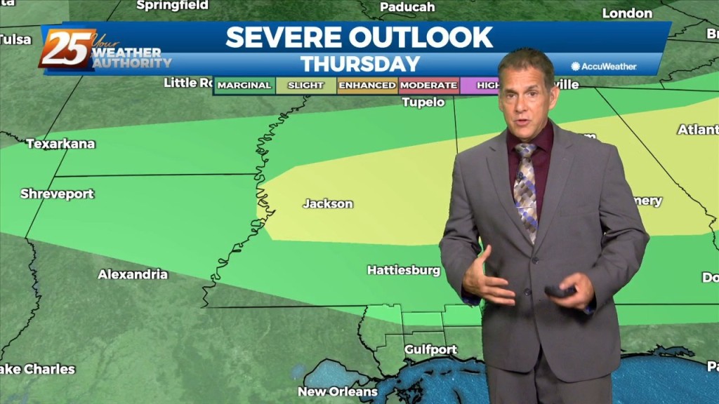
Very moist air along with erratic thunderstorm development thanks to sea-breezes and the like could run into a similar issue as yesterday where intense rates…
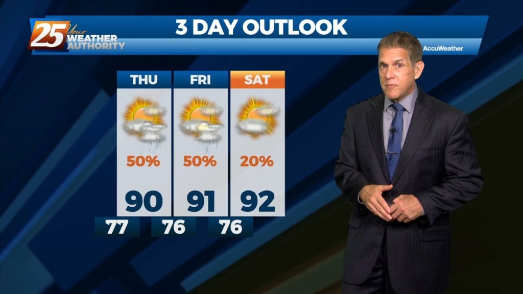
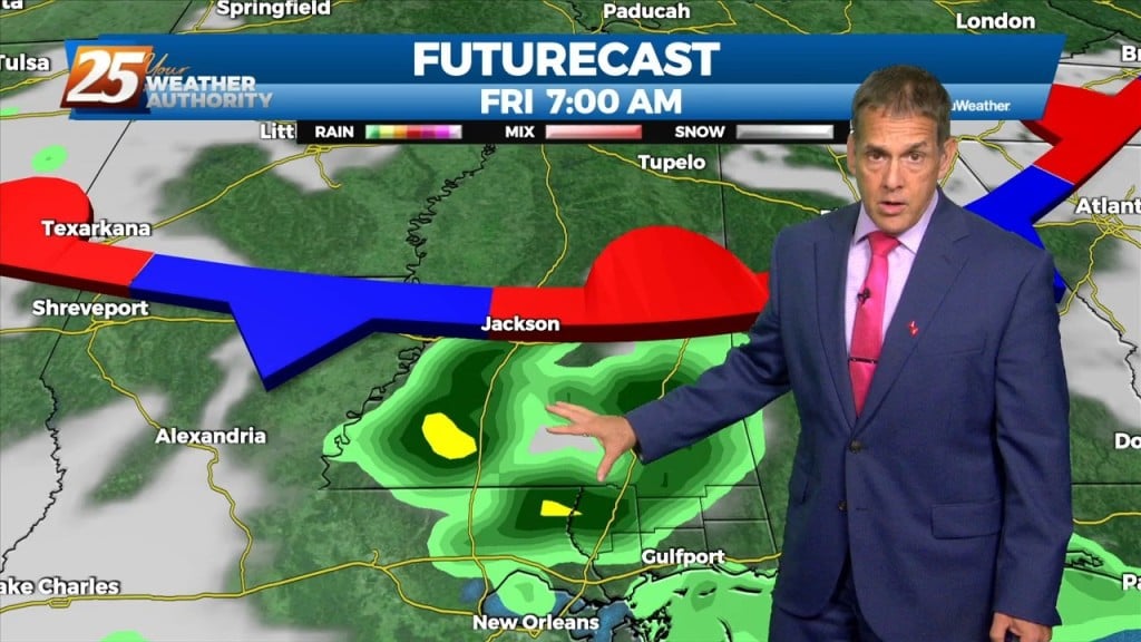
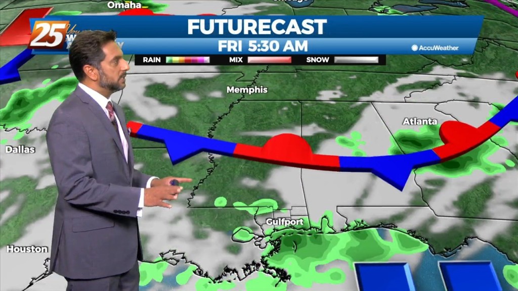
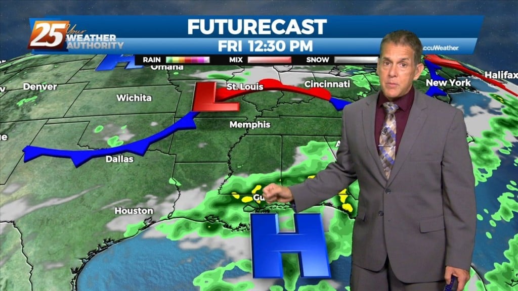
Today through Friday, the current pattern continues with the upper level high pressure and daily showers and thunderstorms in the afternoon. Very moist air along with erratic…
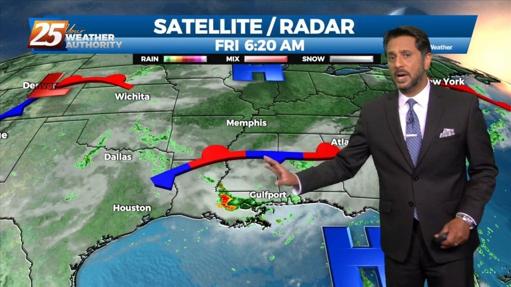
Another quiet night expected here along the Gulf Coast as the earlier showers fizzle out. Persistence is the call with the forecast Wednesday, as all systems…
More sunshine today bumped to those real-feel temperatures above 100 again. The diurnally-driven storms will continue each day, primarily driven by sea-breezes that converge with flows over…

Scattered showers and t-storms earlier have moved inland and begun to dissipate. The daily diurnally driven convection will continue each day primarily driven by sea-breezes or outflow boundaries…
The broad upper level ridge stretching across the CONUS is the main pattern the area will be in for the short term (and majority of the long…
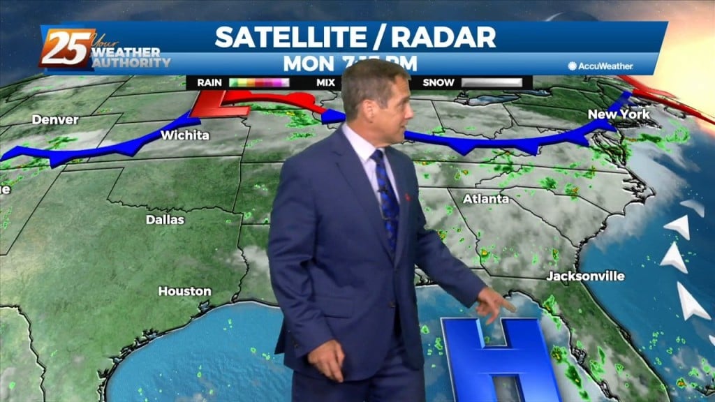
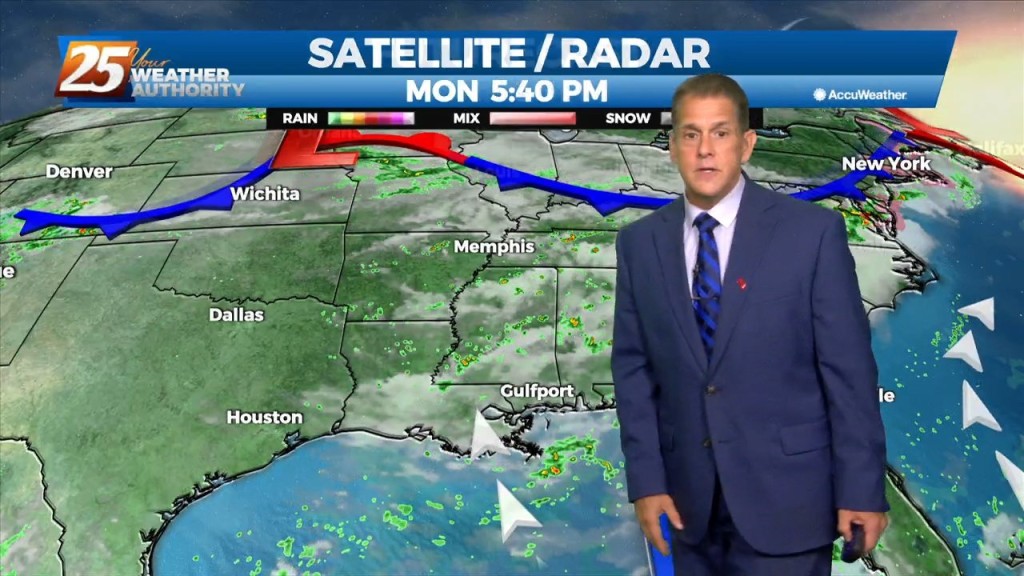
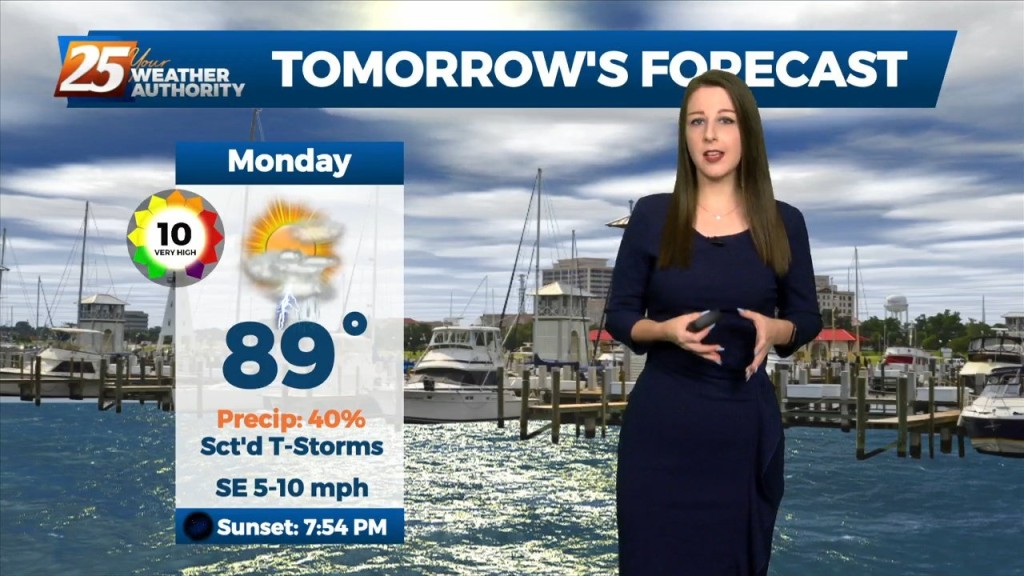
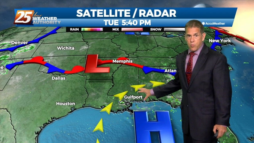
After some morning downpours it’ll be a quiet Monday Night. Our Bermuda High Pressure zone will dominate the forecast through the week as it oscillates…
The typical extension of our Bermuda High Pressure zone will dominate the forecast through the week. That extension of course doesn’t necessarily mean dry weather,…
The area will continue to be dominated by the mid-level high pressure with the more difficult part of the forecast today is coverage of storms. High pressure…
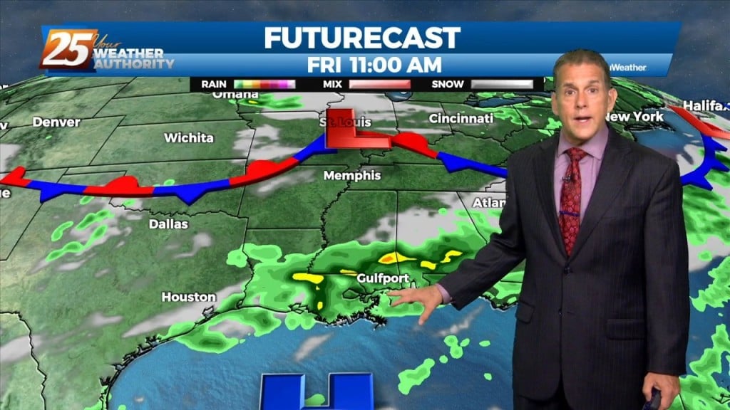
Through Tuesday, the upper ridge flattens as low pressure systems move through southern Canada. With ample moisture in place, and only weak influence of the upper ridge, generally scattered…
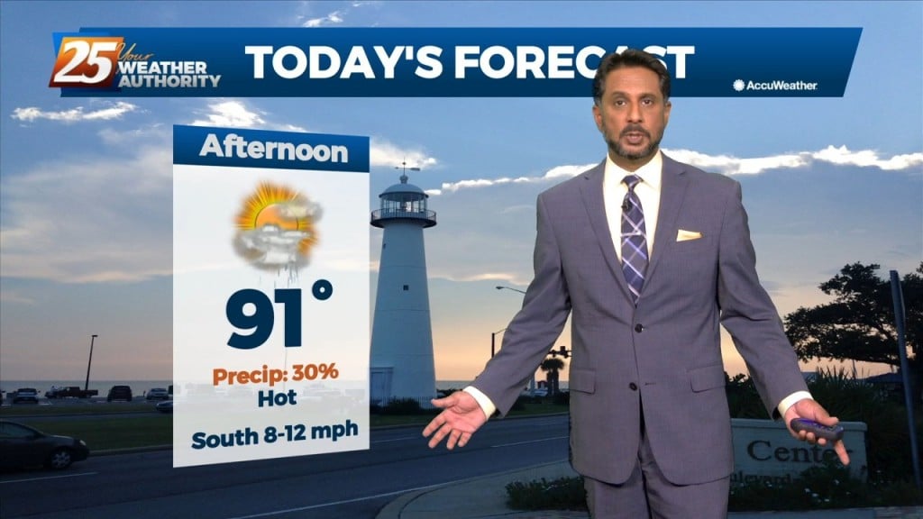
After record-warm overnight temps this week, some relief finally arrived today, as some rain came in early-morning and again this afternoon. However, we’re not quite done…
Relief at last today, as some rain came in early morning and again this afternoon. However, we’re not quite done with the heat. We’ll be…
Today we will be between two areas of high pressure that will try to merge across the entirety of the southern CONUS leaving us in a…
Today will be the most active day over the next 3 days. Today we will be between two areas of high pressure that will try to merge…
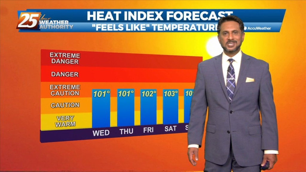
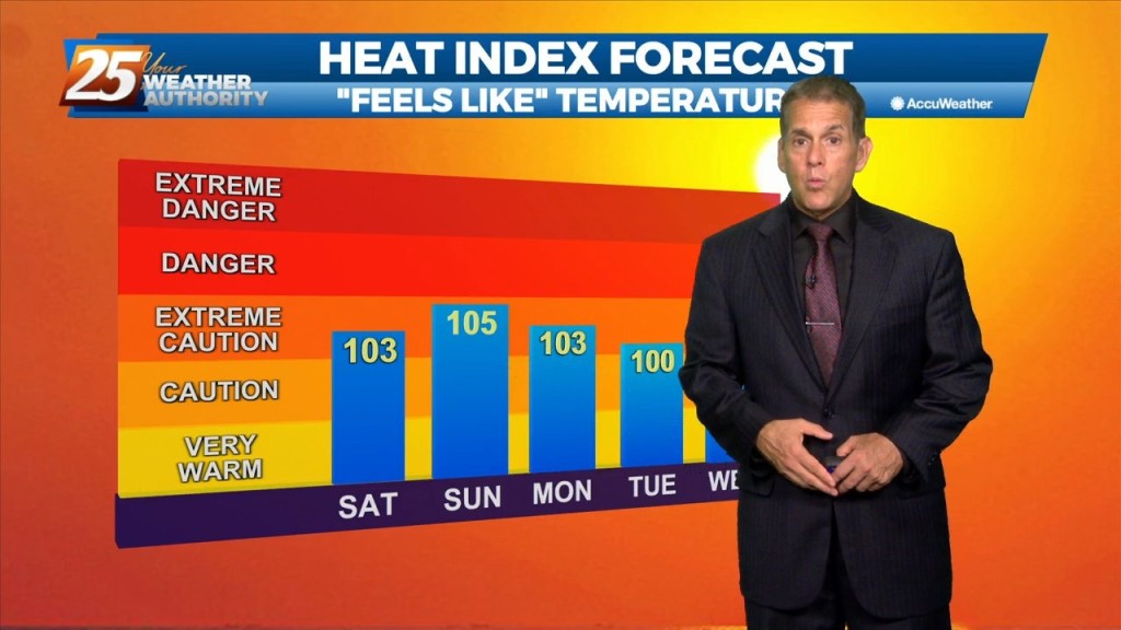
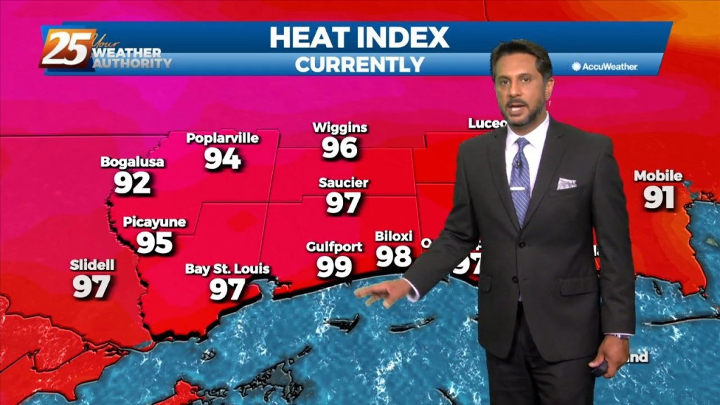
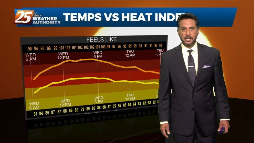
Some relief from the heat is coming Friday, but it won’t last very long. Friday afternoon heat index temps peaked at 114 in Pascagoula and…
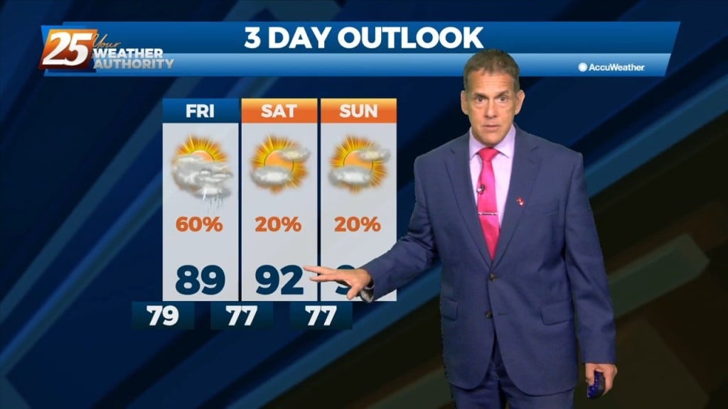
The good news is that the heat peaks today and backs off a bit going into the weekend. The so-so news is that it…
High pressure centered over southwest builds east today and dominates the weather pattern through the short term bringing more normal summer conditions of rain…
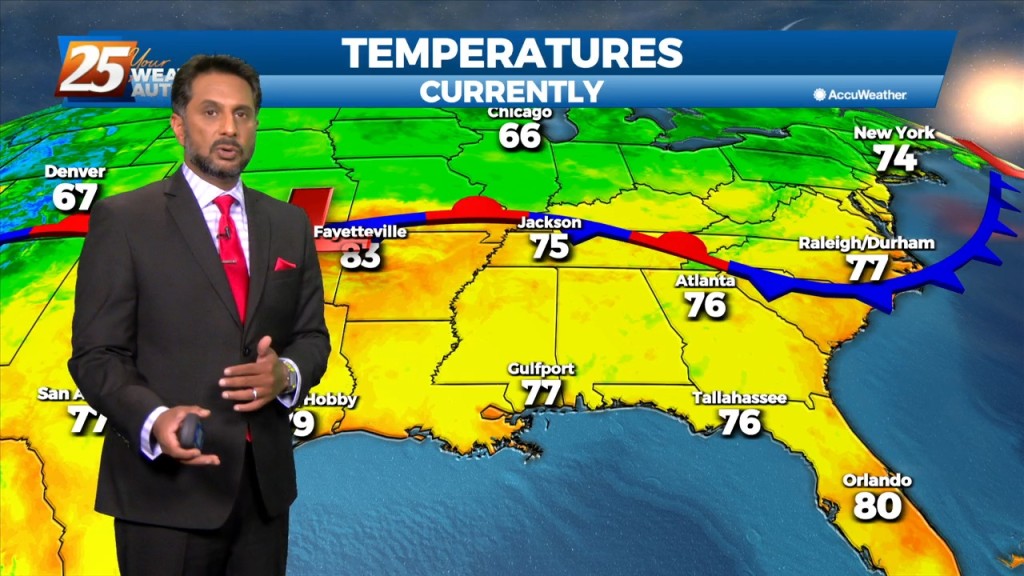
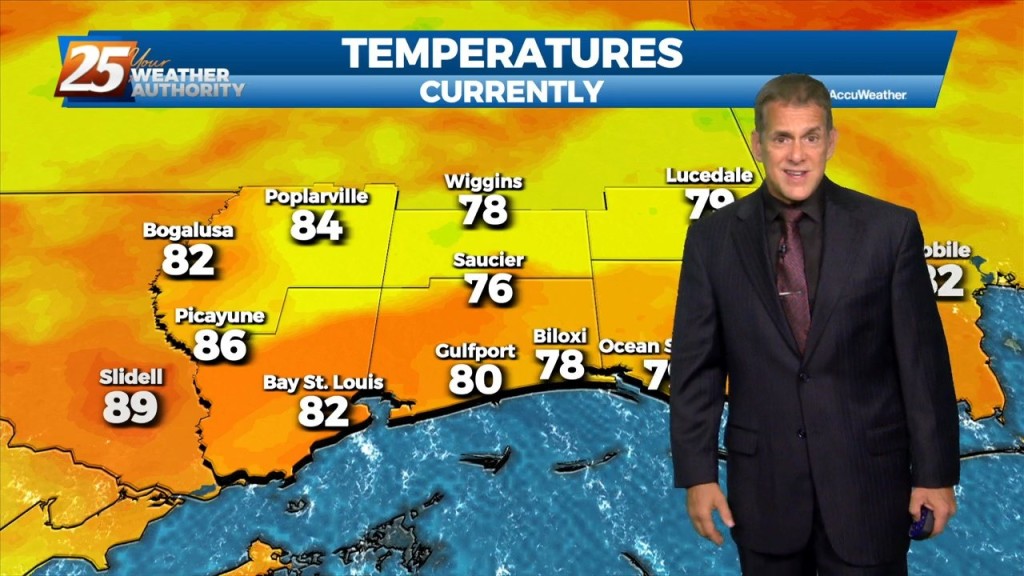
Last night Gulfport/Biloxi Airport tied a record-warm overnight temperature, and it’s more of the same in the short term. We won’t stray too far from 80 degrees…
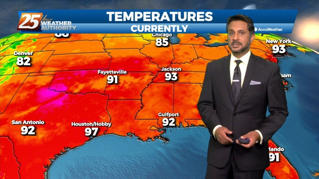
Pascagoula again led the way with a heat index (real-feel) temperature of 112° at noon before the sea breeze and its cloud cover cooled things off…
A Heat Advisory is in effect... The upper level high pressure will gradually continue to get stronger from west to east across the region. That and a continued…
The focus early in the forecast will be the topic of heat. Heat Advisories were needed yesterday as compressional heating gradually increased, especially over the western tier.…
Some cloud cover kept a lid on temperatures today, but we might not be as fortunate tomorrow. That being said, Pascagoula still hit a real-feel temp…
Pascagoula again led the way with a real-feel temp of 110 at 1 PM today. Heat advisories were up for Pearl River/Hancock counties, and will repeat…