11/12 – Rob Knight’s “Possible Severe” Monday Morning Forecast
The most impactful weather will occur over the next couple days…with a cold front stalled along the northern Gulf of Mexico, just south of the Mississippi coastline. This feature will be the main focal point for severe potential today. A surface low moving closer to the area will pull the warm sector north.
There’s a slight risk for severe storms in that warm sector with the main threats tornadoes and wind damage.
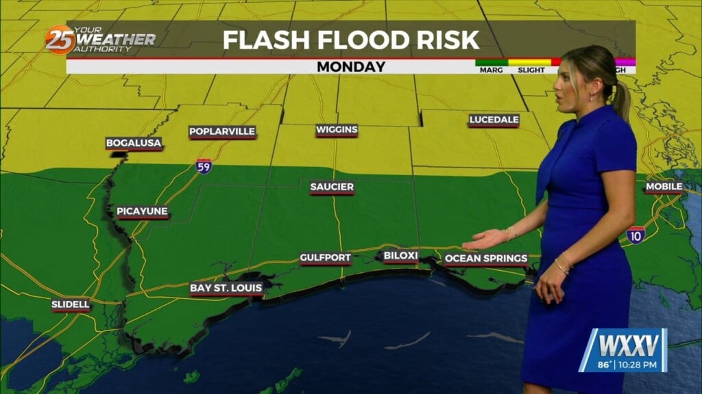
A secondary, albeit lower, threat will be heavy rainfall today. Some storms will be capable of producing relatively high rainfall rates. The good news is that most will be moving at 40+mph. If a couple storms train back to back, could be in a situation where a flash flood warning is needed. Otherwise, 2-3 inches will be possible today with a cold front coming through later in the evening. Tuesday will bring cold and rainy conditions.
Rain chances will be ending from west to east on Wednesday as the upper level low moves across extreme northern Louisiana and Southern Arkansas. High temps will struggle to get out of the mid 40s and lows will be close to freezing in northern portions of the area. These temps of 25 to 30 degrees below normal may be approaching record territory at a few locations.


Leave a Reply