09/26 Ryan’s “Fall Front” Friday Forecast
We're getting our first front since fall started, bringing lower humidity and clear skies for the weekend.
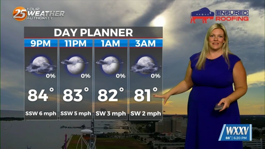
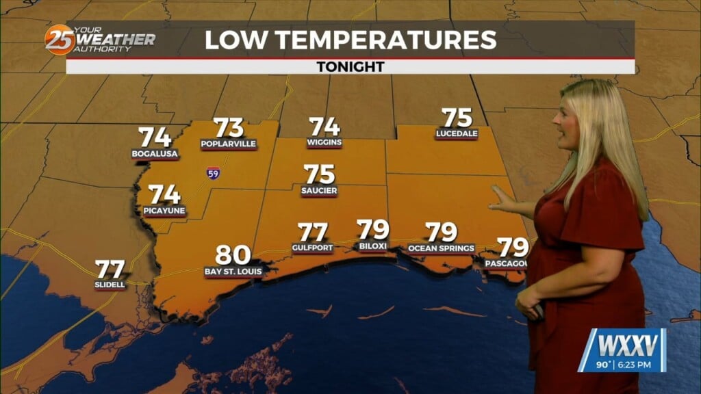
Yesterday’s front was the first since fall began on Monday, and it’ll bring us some much more “fall appropriate” weather as we head into the weekend. It won’t cool much compared to recent highs in the upper 80s and low 90s only falling to our late September normal of 86 today, with highs in the upper 80s expected over the weekend. Mornings are a different story though as lows drop noticeably into the mid-to-upper 60s for the next several days. The real star of the show will be the considerably lower humidity we’ll enjoy through the weekend and into next week. It’s not going to be a shocking change, but things will definitely feel more “seasonal” out there for the weekend and tonight’s games under the Friday night lights.
Tropics: Hurricane Gabrielle has become post-tropical, slowly transitioning into a more typical frontal system as it approaches Spain/Northwest Africa. Humberto became a hurricane, and will strengthen into a major hurricane over the weekend. Thankfully it looks like there will be no direct impact from this storm at full strength. Invest 94 will likely become a depression later today, possibly becoming Tropical Storm Imelda by tomorrow. This storm does look like it may impact the East Coast near South Carolina, but confidence will remain low until the center is fixed as it organizes further.