09/15 Ryan’s “Most Cloudy” Monday Forecast
We're in for a lot more sun this week, but today will likely be the most cloudy.
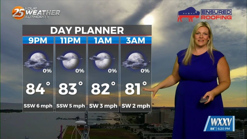
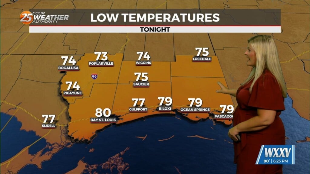
Today has long looked like the most cloudy of the last couple of weeks, which won’t be all that hard considering how dry and sunny it’s been. Still only expecting to get up to “partly sunny” skies after a “mostly sunny” start, meaning about a 50/50 mix as we head into the afternoon. As I mentioned earlier, it isn’t impossible a short-lived shower tries to develop, but chances are lingering in the single digit percent range so I wouldn’t plan your day around it. It will still be hot, a degree hotter than our mid-September “normal” with a high of 89 degrees. The humidity will still play nicely, being noticeable but not overly muggy or oppressive. Winds will start light and northerly, but will shift southerly in the afternoon, remaining light around 10 mph.
The tropics are still quiet, with no active storms and only one area of potential development. That one area has a high chance though, now up to 80% by the end of the week. It’s not likely to do much today or tomorrow thanks to dry, stable air in the neighborhood, but will almost assuredly become “Gabrielle” by Thursday or so.