2/27 – Trey’s “Above Average Temperatures” Tuesday Evening Forecast
Meteorologist Trey Tonnessen
Currently the area is under upper level southern branch flow with
Troughing over the central plains. As the trough moves east an
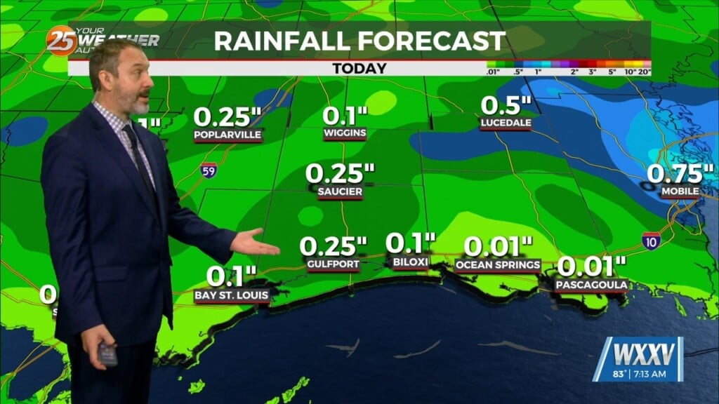
Associated front drops into the area on Wednesday. This front
Brings pops in the 30% range over the ne portion of the area but with
Very little if any accumulation. The significant impact will be decreased winds ahead of the front and higher and gusty winds
Generated by p gradient behind the front. Inland and coastal
Waters will see winds high enough that we`ve put out a small craft
Advisory for Wednesday evening through Thursday night. Behind the Front we will see high pressure dominating the area until a
Shortwave moves into the central midwest and pulls gulf moisture
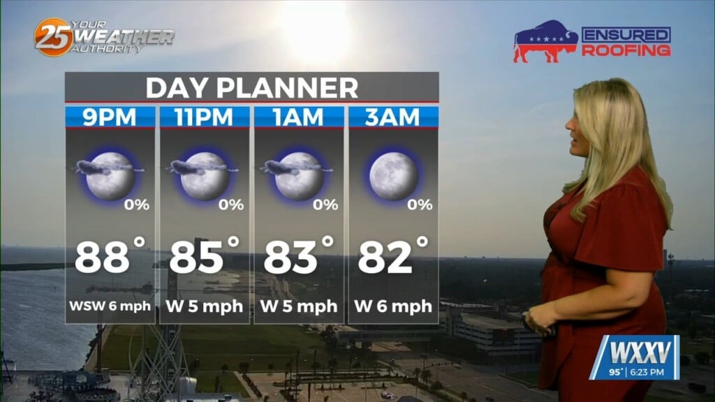
Into the area leading into Friday and the weekend. High temperatures will be in the upper 70s tomorrow but drop into
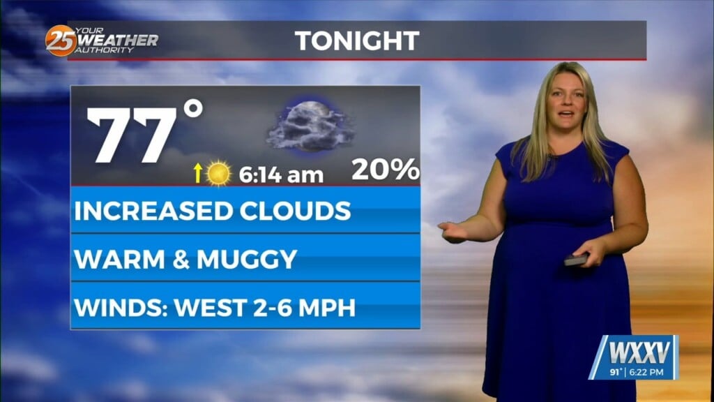
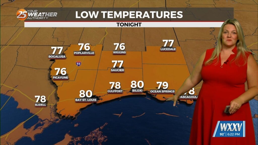
The low 60s behind the front. Lows tonight are expected to be in
The upper 60s and drop into the 50s with the front for Wednesday
And Thursday nights.
As always: A cloudy day is no match for a sunny disposition. Be nice to each other.
-Meteorologist Trey Tonnessen