8/14 – Jeff’s “Rain Chances/Some Changes Ahead” Monday Night Forecast
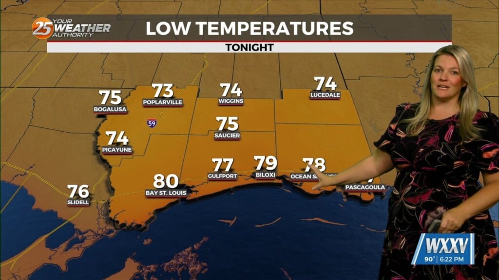
Temperatures will struggle to cool off overnight as the warm and very humid pattern remains in place. Skies will be clear for the start of your Tuesday. It will start off very hot and humid as it has for the recent stretch. An Excessive Heat Warning will be in effect for Hancock, Harrison and Jackson County from 11 AM – 7 PM, Pearl River County is under a Heat Advisory from 10 AM – 7 PM. George and Stone County are under a Heat Advisory from 10 AM – 7 PM. Tomorrow’s main issue will still be the heat so be sure to take necessary precautions.
There will be relief on the way in the form of a “cold” front. It will be in our area tomorrow and it will help provide for rain chances Tuesday afternoon. That being said, it is a 40% chance of scattered thunderstorms at best. The front will clear the area overnight Tuesday into Wednesday. Humidity will drop off to tolerable levels.
Skies will clear through the first portion of Wednesday. A welcomed break from extreme heat and oppressive humidity will be around. The pattern will gradually revert back to this summer’s norm by the weekend. The tropics are beginning to slowly wake up. At the moment, there are no active named storms and no threats to South Mississippi.