8/14 – Jeff Vorick’s “Still Very Hot” Monday Evening Forecast
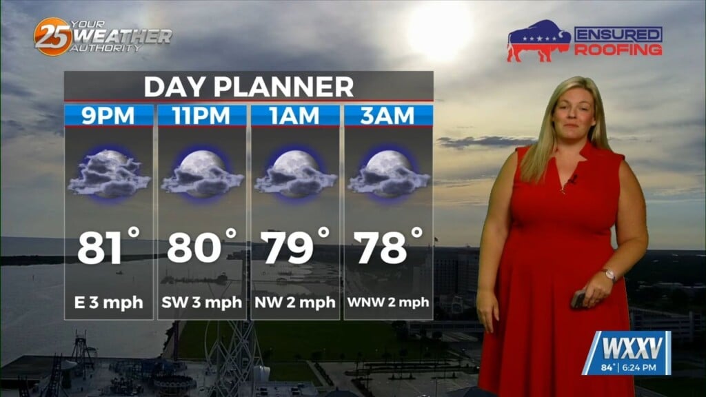
We have ushered in a new week and it still remains very hot. An Excessive Heat Warning is in effect until 7 PM for all 6 of our counties. Temperatures remaining in the mid and upper 90s along with humidity will have it feeling like over 110 at times. Expect clearing skies this evening and warm/humid conditions to continue overnight.
Tomorrow brings some differences, but it will still start off very hot. A “cold” front will be moving into the area tomorrow and through our counties by overnight Tuesday into Wednesday. For the first part of the day up until early to mid-afternoon, it will heat up quickly and heat alerts will be necessary. Rain chances increase to around 40% for the afternoon and evening hours.
The front will clear the area by the pre-dawn hours Wednesday. Skies will clear out during the early portions of the day and humidity will drop. For what it’s worth, there will be near-average temperatures and there will be a very welcomed break from oppressive humidity and dangerous heat indices. The pattern will gradually change by the weekend.