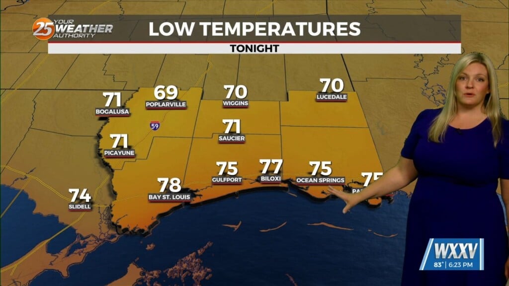
7/24 – Chris’s “Average Highs Expected Today” Monday Afternoon Forecast
This afternoon a stalled stationary front just north will push to the south bringing subtle changes. This will also keep most of the shower and thunderstorm activity over the marine areas of the northern gulf but there will still be some activity inland, both west and east of the area. The front will become active again as it moves north late in the day Tuesday. This will also lead to a very normal summer like showers/t-storms pattern starting Tuesday and through the workweek. Any severe storms will be on an isolated basis but best chances of these will be over marine areas.
As the dew-points boundary makes a rapid retreat to the north late Tuesday through Wednesday, the area will fall back into a normal routine of diurnal showers/t-storms through the end of this showers/t-storms or at least through the weekend before anything really changes we should see marine storms during early morning and an inland during the heat of the day. The only other issue with the extended will be approaching the weekend. The stacked SW CONUS high pressure does move near the OK/TX panhandles by the end of the week and there is some indication that this could extend east just enough to cause high temperatures to move back into advisory range possibly as early as Friday but more likely over the weekend.