6/12 – Jeff’s “Very HOT Week Ahead” Monday Night Forecast
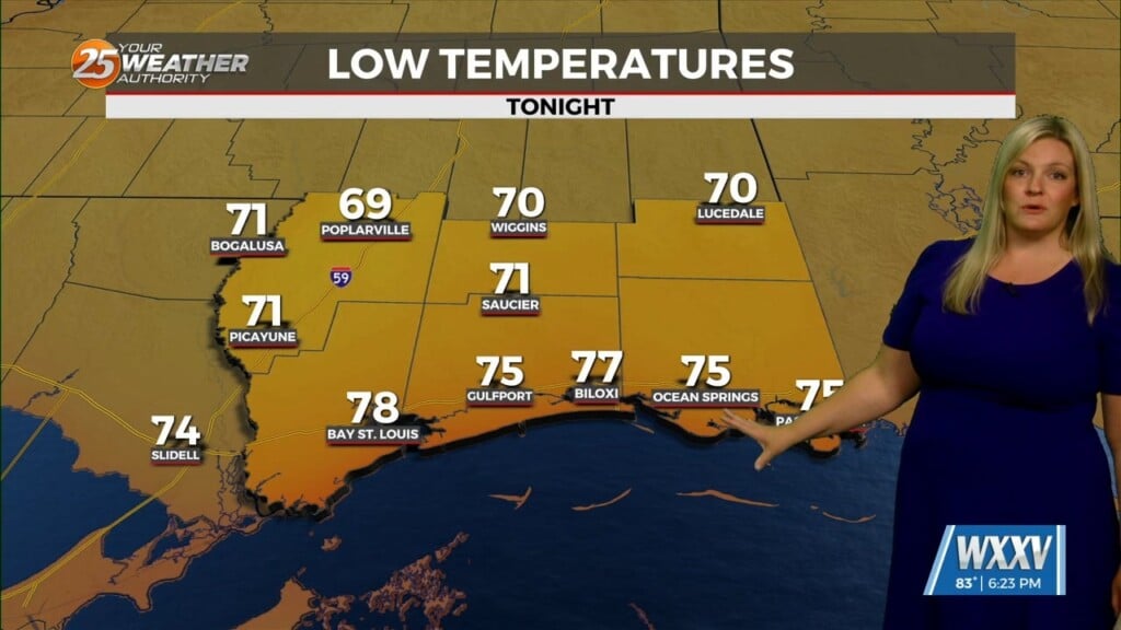
Other than very isolated shower/thunderstorm chances, the threat for severe weather has ended. Temperatures will remain warm overnight as humidity won’t allow for much cooling off. This very hot pattern has the potential to bring very dangerous heat this week.
As far as the storm track goes, points north of Hattiesburg will see the most rain potential through midweek. The storm track will sag somewhat south for Thursday and Friday. That will bring the potential for thunderstorms those days.
The heat will provide for a heat index exceeding 105 degrees this week. Take any and all necessary precautions to protect yourself and others. There does not look to be much relief in sight for the coming week or so.