9/16 – The Chief’s “Warmer Start” Friday Morning Forecast
High pressure has weakened a bit over the last 24 hours with the flow becoming more zonal across the middle of the country. Shortwaves were noted along the Atlantic Coast, over Kansas and near Las Vegas. At the surface, high pressure extended from the Great Lakes to eastern Texas with the old frontal boundary that has been over our coastal waters trying to drift a bit northward.
As upper and surface high pressure shifts eastward over the next 36 hours, moisture levels increase somewhat today over the lower portions of the area, but anything much more than an isolated shower or storm is probably ambitious as moisture flow barely get above an inch. Low level moisture is somewhat better on Saturday to the south of Interstate 10.
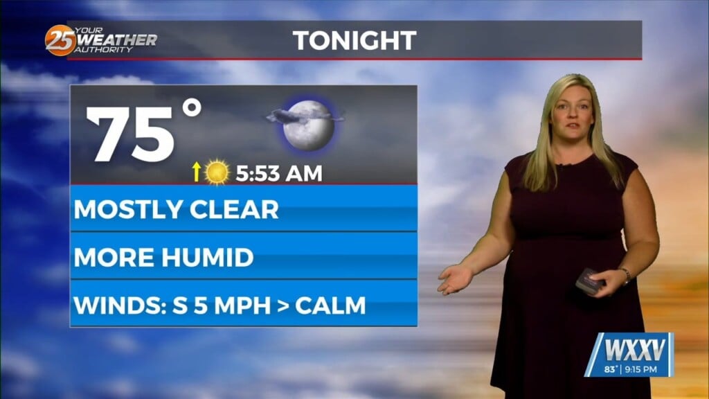
Increased moisture levels will mean somewhat warmer overnight lows Saturday night. I can’t rule out an early evening or late night shower/storm near the coast. Will maintain a chance of showers/storms across the southern 2/3 of the area on Sunday as moisture levels remain close to what we see on Saturday. High temperatures shouldn’t stray too much from Saturday’s numbers.