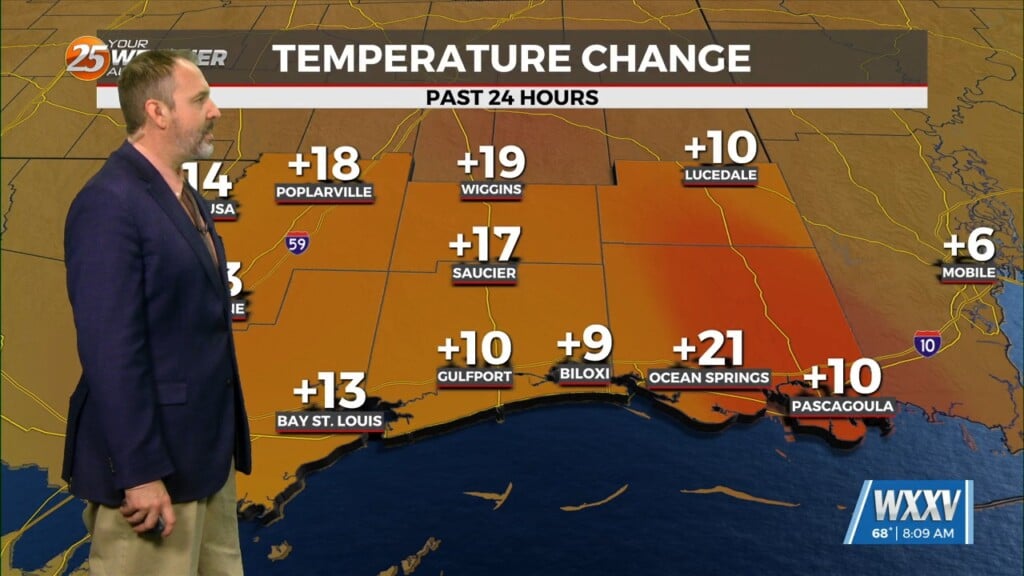
10/24 – The Chief’s “Warm & Dry” Tuesday Morning Forecast
The biggest impact of the short-term is the fog potential this morning. With the east-southeasterly surface winds promoting low-level moisture, the areas where the winds have been able to shut off is where fog has developed tonight. The fog should mix out by 10am as thermal mixing takes place. Otherwise, high pressure over the Gulf will keep imposing its dominance on the region and prevent rain much less clouds from forming over us. Fog potential seems even lower tonight into Wednesday morning due to the slight increase in surface winds.
We will stay under the influence of the high pressure through Friday and promote more warmer-than-average temps, although we could see more clouds on Wednesday and Thursday due to the increased low-level moisture. This could help temps cool down a degree or two, but with the upper-level high pressure still expected to be in place, the upper-level will remain too warm for the clouds to develop into rain/t-storms and we will remain high and dry through the long term.
A very persistent upper level high pressure extending across the GOMEX and the Gulf South will remain in place through the entire long term period. This deep layer ridge axis will keep a highly subsident airmass in place across the region, and this will lead to mostly clear skies, dry weather, and warmer than average temperatures. Temperatures will warm into the mid to upper 80s each day, and some record highs may be tied or broken. Model analysis also indicates mostly favorable boundary layer conditions for additional rounds of radiation fog development in the early morning hours each day. Boundary layer winds of 10 to 15 knots are forecast on Friday and Saturday morning, and these winds are light enough to allow a surface based inversion and fog to develop. By Sunday and Monday, boundary layer flow is expected to fall below 10 knots and highly favorable conditions for fog development should be in place.


