07/28 Ryan’s “Pre-Front” Friday Night Forecast
Today was absolutely dry and sunny, but as we head into the evening “pre-front” conditions will begin and even a few showers are expected overnight. Cloud cover will continue to increase through the night, and we’ll begin tomorrow mostly cloudy if not overcast. Showers and thunderstorms are expected to increase around the late morning/early afternoon, but the front itself won’t push through until around 9 PM if it doesn’t slow any more. No severe weather is forecast at this time, but it’s always good to be aware of your surroundings as storms move in regardless.
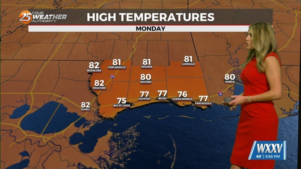
Slightly cooler, but much drier air will move in quickly behind the front, and Sunday is expected to be dry, sunny, and hot. By Tuesday though we’ll begin seeing moisture levels increasing, and rain chances/cloud cover will increase as the weekend rolls around. Nothing major here, just getting back to that summertime afternoon shower pattern.
The disturbance we were tracking in the Gulf has dissipated, and no new areas of development are expected within the next 5 days.


Leave a Reply