07/26 – Brantly’s “More Rain Coming” Sunday Night Forecast
Lows tonight will then be in the lower 70s. Highs tomorrow will likely be cooler than we’ve seen recently due to cloud cover and showers and storms. Temperatures will likely be in the lower to mid 80s over South Mississippi, with highs in the upper 80s elsewhere. Some areas may reach 90 degrees over interior portions of the viewing area.
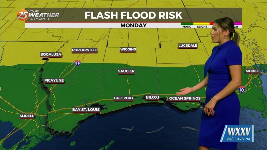
By around midnight, we will probably start to see a regeneration of showers and storms with increasing coverage with time early to mid-morning. This would also be quite similar to the past 24 hours. Moderate to heavy rainfall will be the biggest impact with nuisance street flooding possible. At the moment, it’s not looking like flash flooding will be a huge issue, but some small scale problems could arise due to fairly decent rainfall totals from the last couple of days rain soaking the grounds. The general forecast doesn’t look like it will change much through at least the middle of next week.
In the tropics, Hanna and Gonzalo have dissipated, but we are already watching our next area of interest in the central Atlantic. This system, now being called Invest 92, is expected to strengthen into a tropical storm or even a hurricane in the next few days. Once it becomes a named storm, it will be called Isaias. We have a long way to go with this system as it is several days away, but most models indicate it will become a hurricane and move generally westward or west-northwestward over the next few days.


Leave a Reply