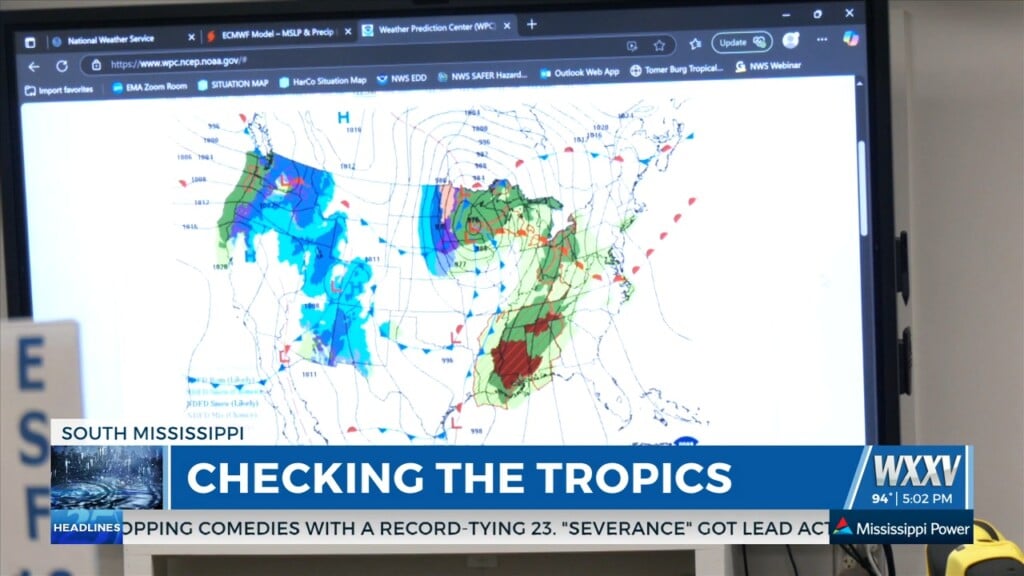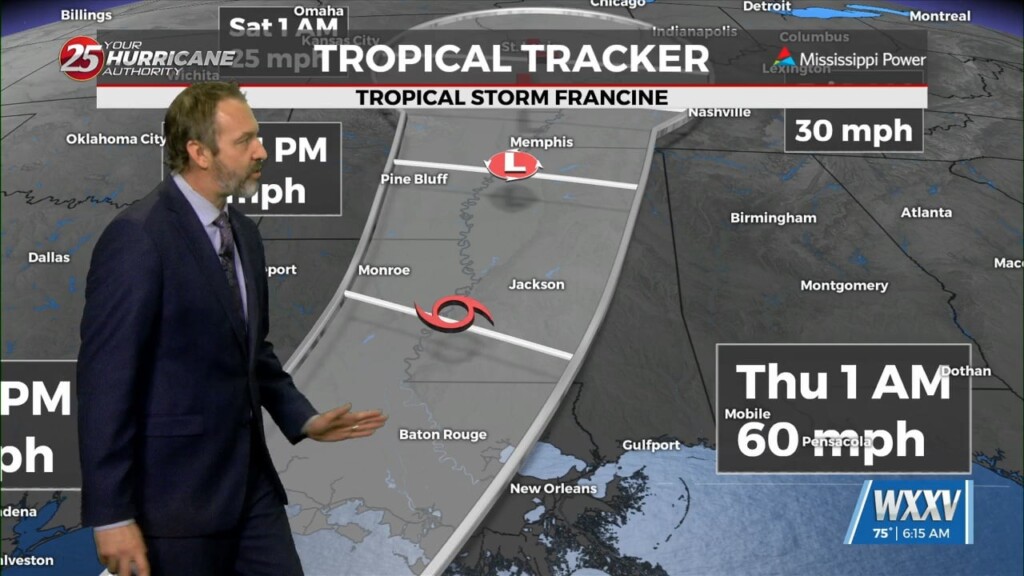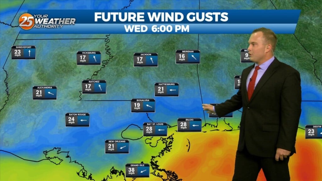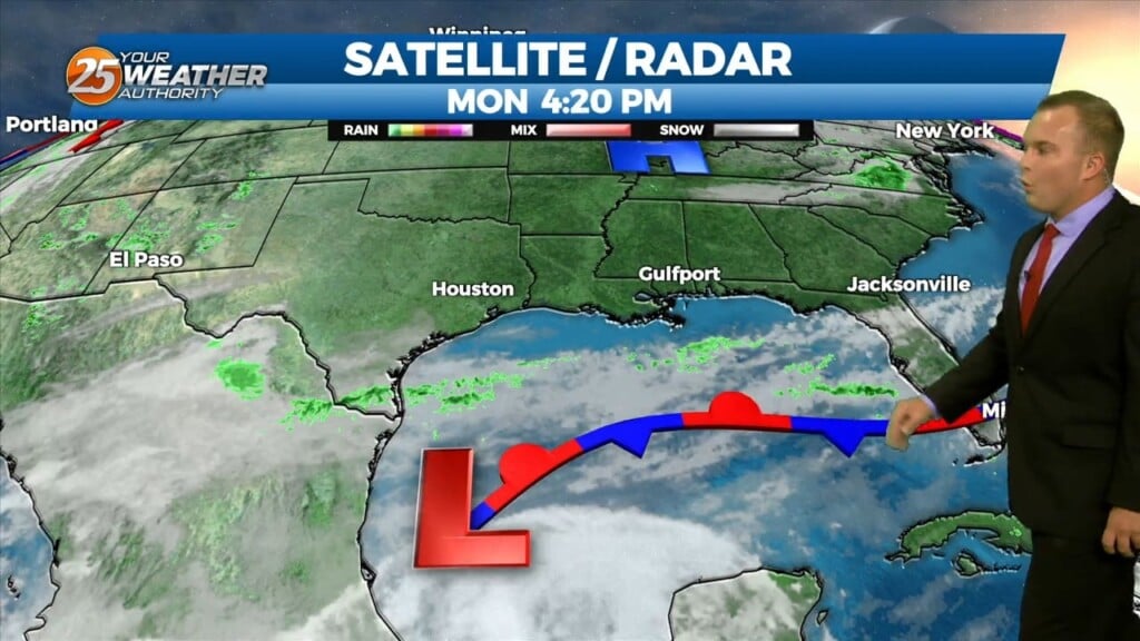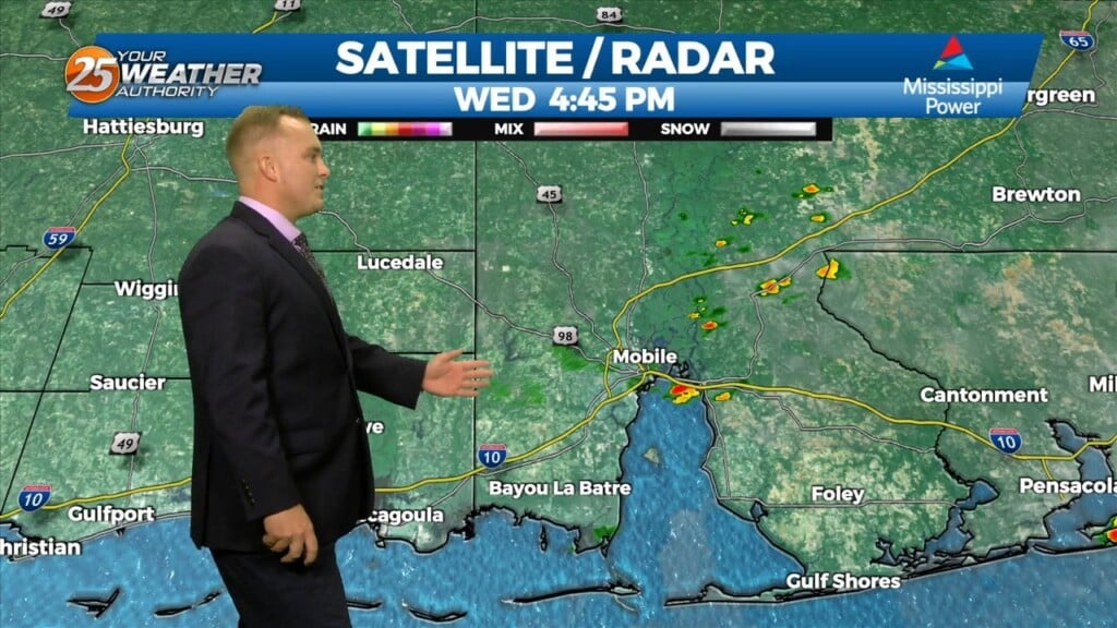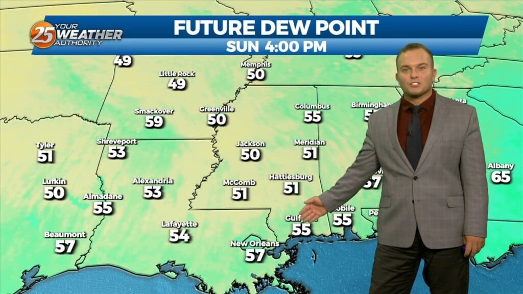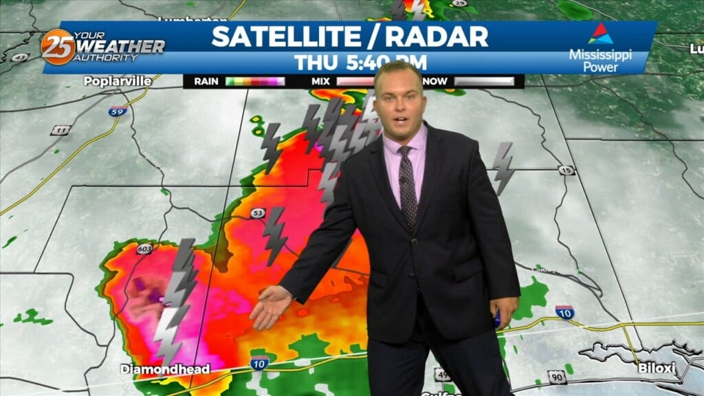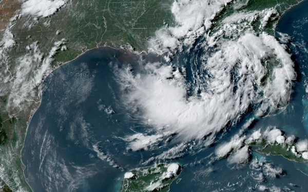
Tropical depression nearing US Gulf Coast set to become a tropical storm, forecasters say
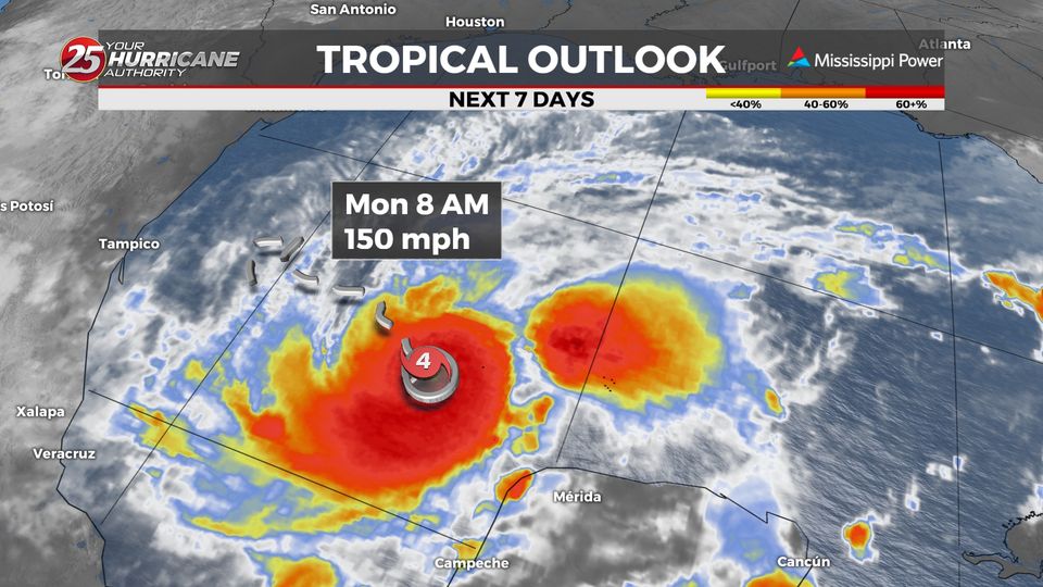
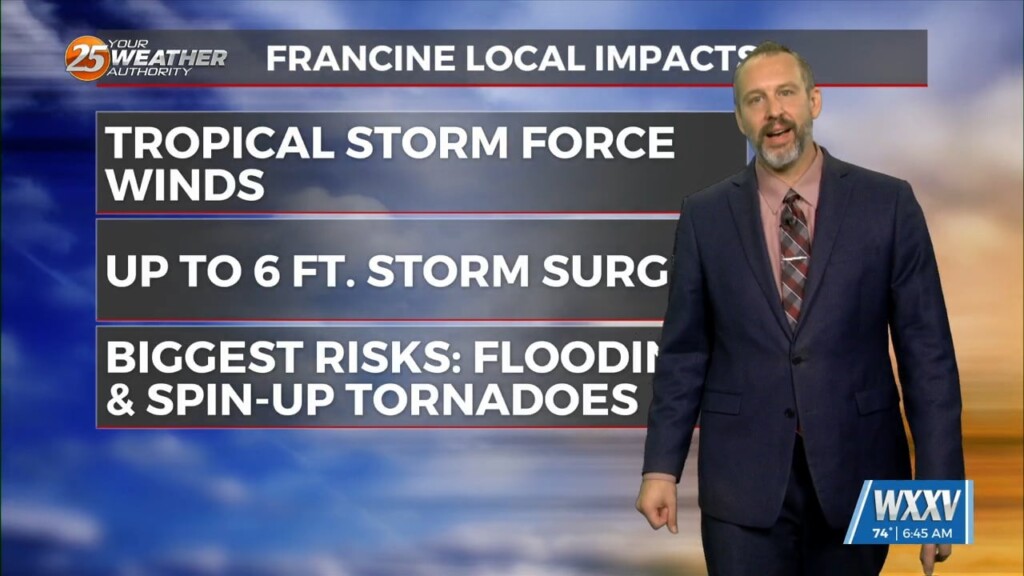
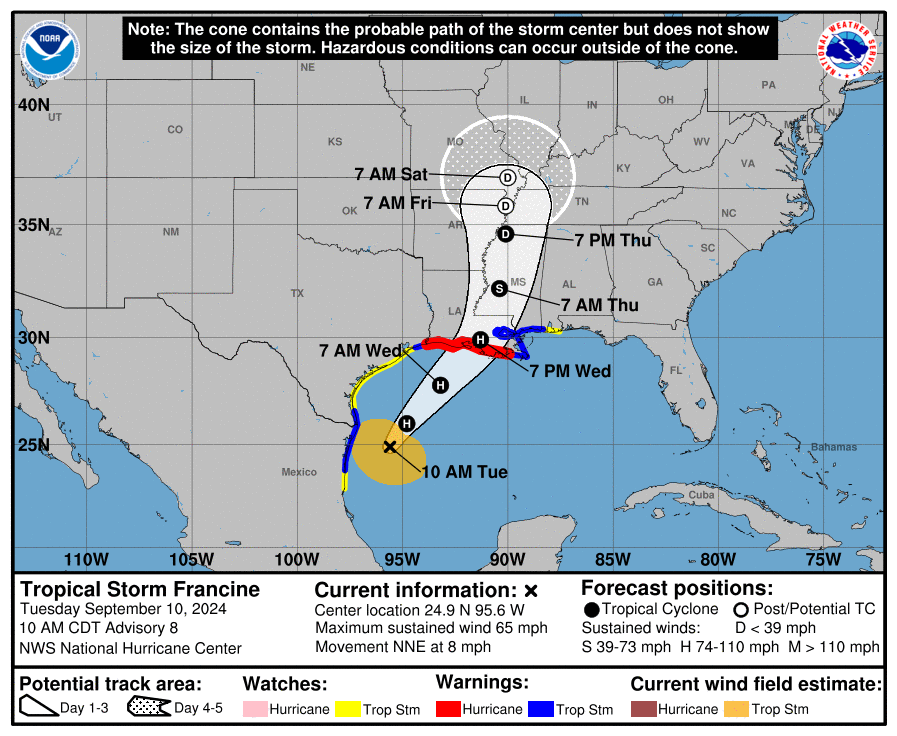
NEW ORLEANS (AP) — A tropical depression drifting erratically in the northern Gulf of Mexico is expected to strengthen later Monday with rain that could trigger flooding and winds capable of downing trees and power lines in several states this…