Wet Weekend Ahead for South Mississippi
Meteorologist Sam Lucey has a look at the forecast
Showers and thunderstorms are likely again tonight, and could continue into the early morning hours on Saturday. Low temperatures will be around 73 degrees, with rainfall amounts generally between a quarter and half an inch.
Saturday will remain unsettled, with showers and thunderstorms likely throughout the day. Highs will only reach the lower 80s, and rainfall totals of 1 to 2 inches are expected with locally higher amounts possible.
The rain continues Saturday night, with another 1 to 2 inches possible as showers and thunderstorms remain in the forecast. Some locations could see heavier pockets of rain, especially where thunderstorms develop.
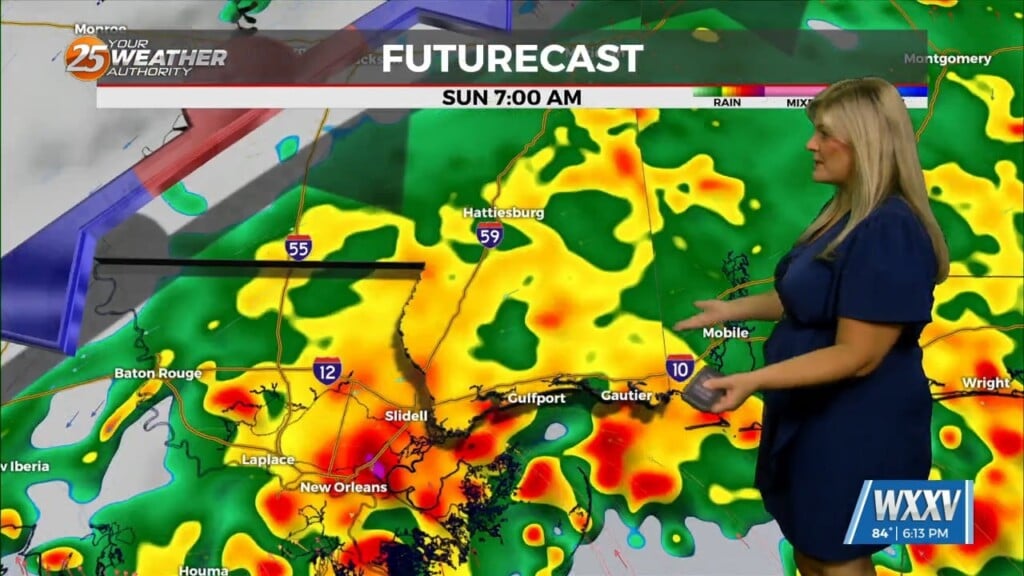
Sunday looks to be the wettest part of the weekend, with showers and thunderstorms likely again throughout the day. We have a slight risk for excessive rainfall as storms could produce heavy rain moving over the same areas. While exact totals will depend on where the heaviest rain develops, an additional 1 to 3 inches or more will be possible Sunday.
Overall, 2 to 5 inches of rain could fall across portions of South Mississippi from Saturday through Sunday, with locally higher amounts of 6 to 8 inches possible. The heaviest rainfall will not be evenly distributed, so some areas could receive considerably less while others pick up several inches.
Rain chances decrease somewhat Monday and Tuesday, but scattered showers and thunderstorms will remain possible until the front clears the area. Monday will likely stay mostly cloudy with a high near 84, while Tuesday will be partly sunny with a high near 84.