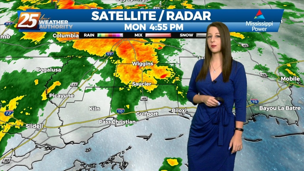
6/10 - Sam Lucey's "Rinse and Repeat" Tuesday Evening Forecast
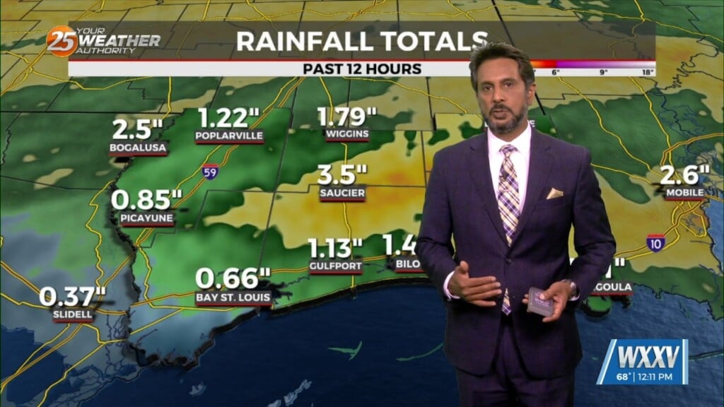
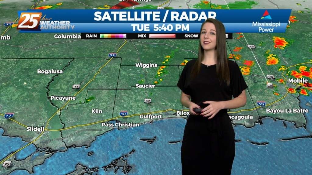
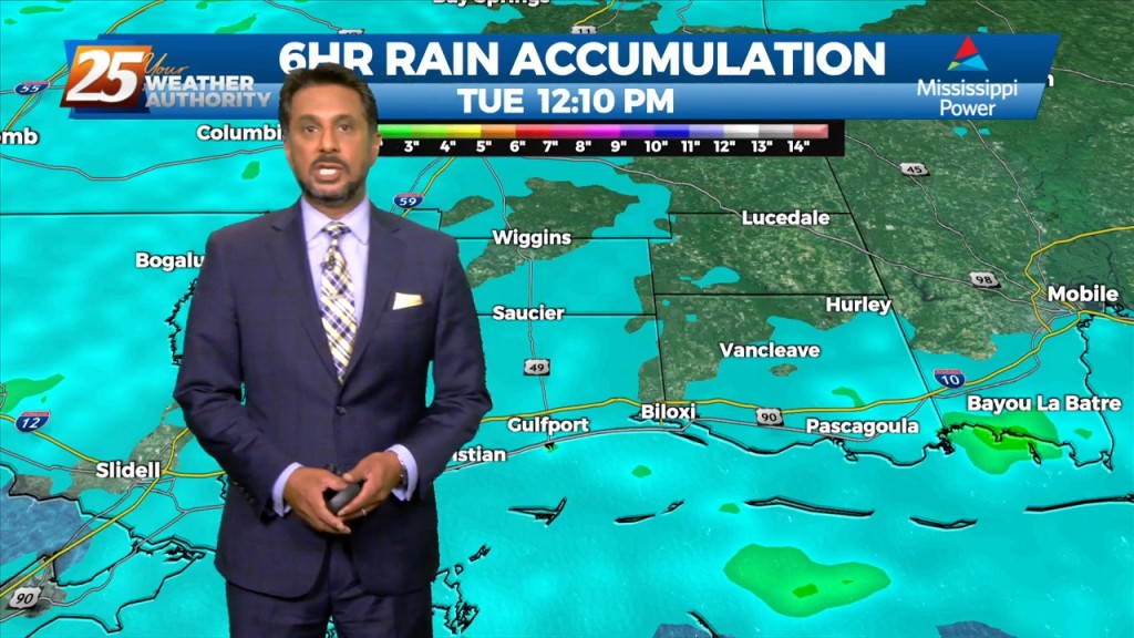
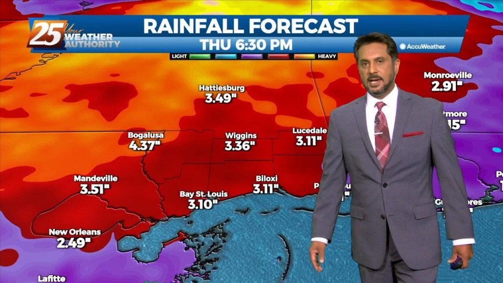
Another evening of rain across south Mississippi with rainfall totals over the last 24 hours reaching 3 to 5 inches, and more of the same can be expected. For your Tuesday…
Another evening of rain across south Mississippi with rainfall totals over the last 24 hours reaching 3 to 5 inches, and more of the same can be expected. For your Tuesday…
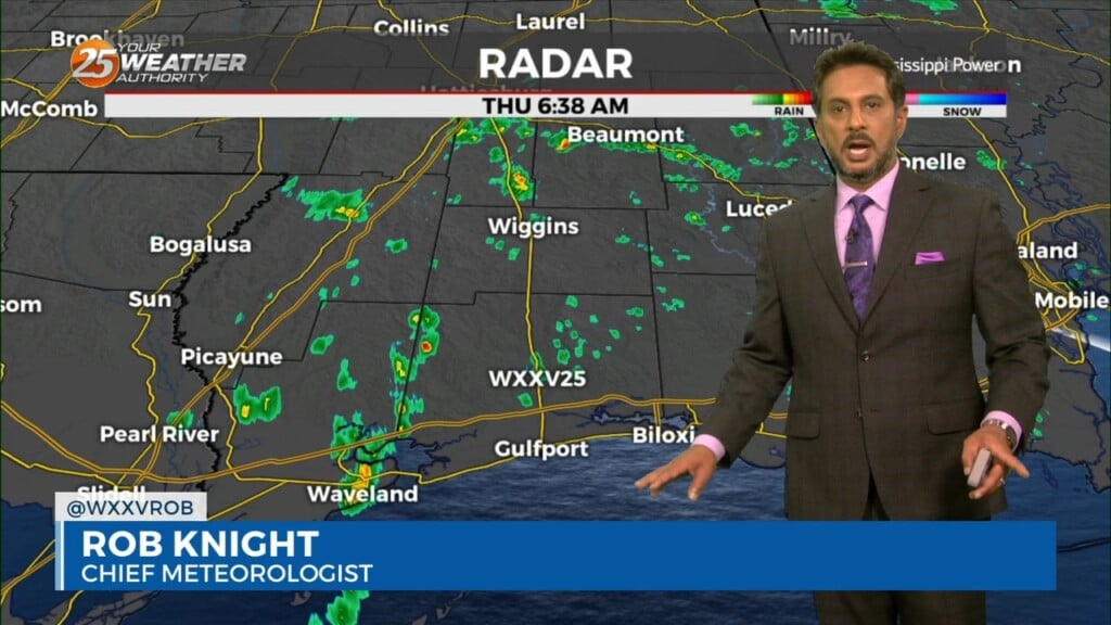
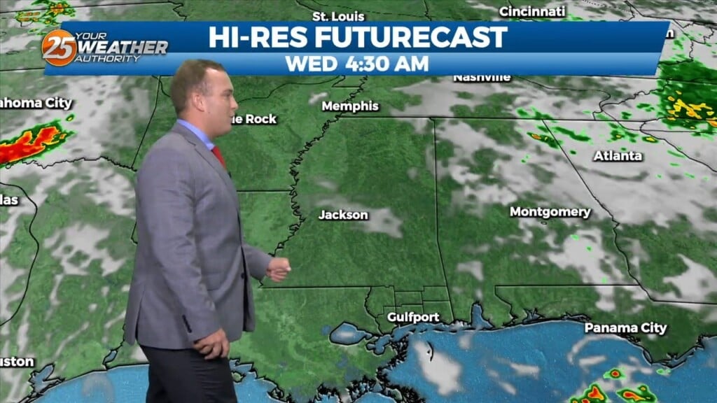
Potential for flooding across south Mississippi overnight and Wednesday having several rounds of heavy rainfall. A few showers passed tonight but into Wednesday morning will have…

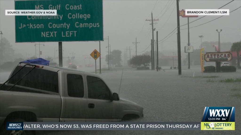
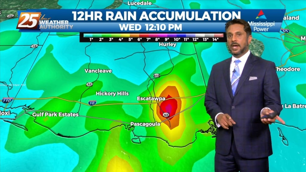
Local law enforcement reported people trapped in vehicles on flooded roads near Jean Street in Latimer and several other water rescues across Jackson County. Between 6 and 8 inches of rain have fallen. Additional rainfall amounts of 1 to 3…
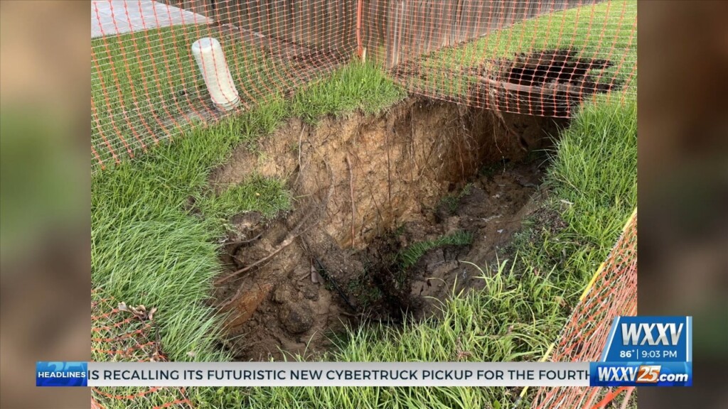
Residents have been worried as the hole was here prior to Monday's weather but with all that heavy rain we experienced it has grown in size. Caution tape has been placed around…
Deep moisture is expected to remain in place today. Expect widespread scattered precipitation today, which will produce locally heavy downpours (2 inches per hour possible). This…

An area of high-pressure is currently centered over the Carolinas this morning, with a weakness along the southern plains. This is combining with the Central American flow to…
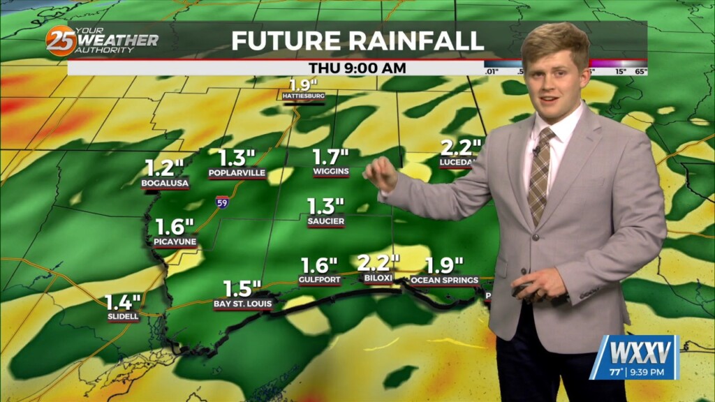
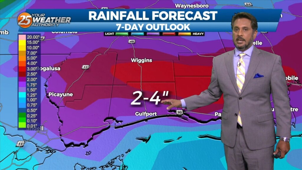
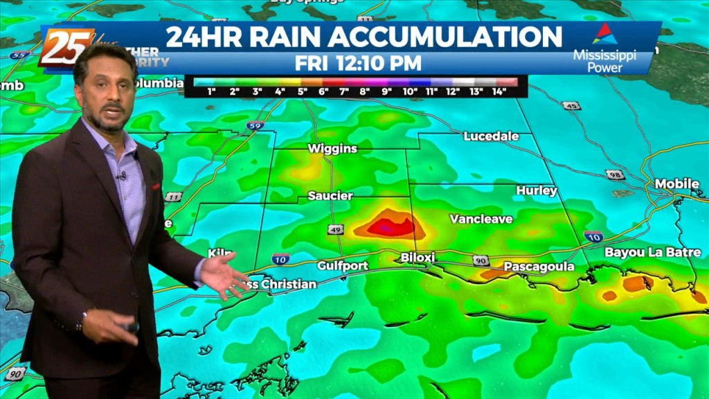
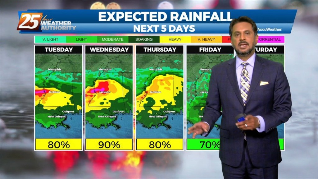
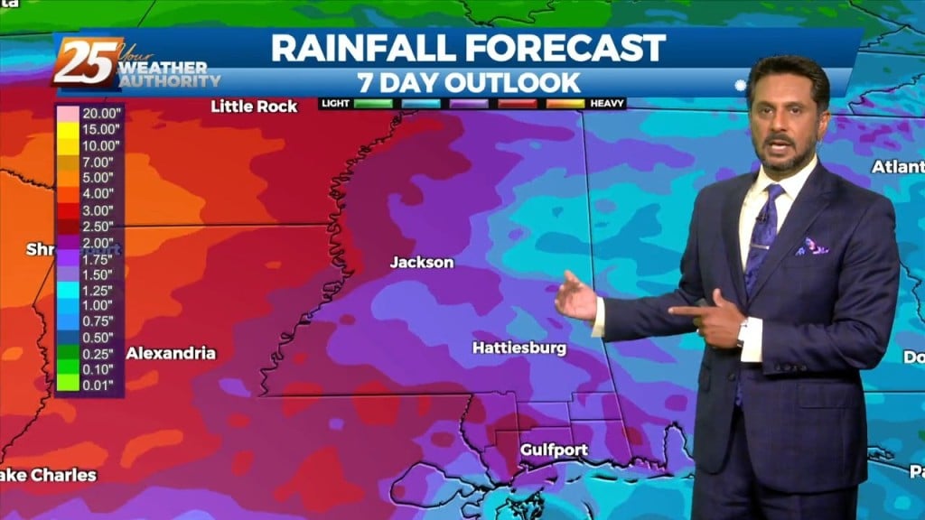
THREAT FOR HEAVY RAINFALL AND SEVERITY. The Flood Watch will remain as rainfall amounts are still coming in from 3 to 6 inches with the…

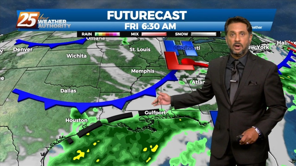
With a stalled frontal boundary overhead and moisture surge from the GOM, another round of showers/t-storms will move in around mid-morning. Moisture values will support…
The primary concern through Saturday morning will be the threat of additional flash flooding from heavy rainfall and high rainfall rates. This concern is driven…
This morning there is an area of low pressure situated over the AR/LA/TX region with a decaying stationary front north of our area. Out ahead of…
There is a disturbance in the pattern located in our area this morning. This disturbance will move SW just a bit and should be located…

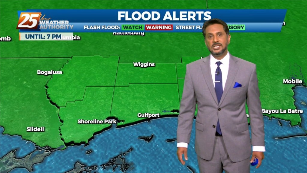
The Flash Flood Watch for our area will be allowed to expire at 10 PM. South Mississippi will be drying out gradually from the heavy rainfall earlier.…
Coverage of showers and thunderstorms will gradually lessen over the next few hours. A Flash Flood Watch for our area will expire at 10 PM. Gradual…
The main focus of the forecast will be the activity we'll see tonight. Tonight will hold a 90-100% chance for showers and thunderstorms in advance of an approaching…
Eyes on the skies again today after torrential rains across Southern states, including South Mississippi. We saw so many scenes dealing with the weather across the Gulf Coast, like…
FLOODING ALONG RIVERS; WOLF, BILOXI AND TCHOUTACABOUFFA... A weaker surface low pressure and attendant boundary near or just offshore this afternoon will be the focus for…
FLASH FLOOD WATCH IN EFFECT - 7 PM... Today through Saturday will continue with the wet pattern. A flash flood watch has…
Rainfall tallies could be robust the farther north one moves though. This will be due to a surface low over east Texas and trough extending…
High precip chances will remain the topic along with an environment conducive for waterspouts. Rainfall tallies could be robust the farther north one moves though. This…
Tonight through Wednesday Night, little change in the ongoing pattern is expected through Wednesday night as a broadly diffluent westerly upper level pattern, a weak shortwave trough, and favorable…
A broad upper disturbance across the eastern half of the country doesn’t really go anywhere over the next several days. As minor disturbances move through the…
This afternoon will continue to bring showers/t-storms to the area. The main concerns over the next few days will be the threat of thunderstorms. Heavy rain…
Today the flow will shift more northerly as a weakness along the coast continues to amplify activity. At the surface, a weak frontal boundary…
The threat for heavy rain and pockets of FLASH FLOODING continues this afternoon. While it is very likely that some areas see heavy rainfall, the somewhat…