Warm night ahead with the rain chance returning Tuesday
Meteorologist Sam Lucey has a look at the forecast for south Mississippi
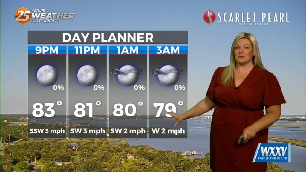
Tonight stays clear and warm with lows in the mid to upper 70s.
Expect mostly sunny skies and a high near 96 degrees on Tuesday. While most of the day will stay dry, a few showers and thunderstorms could develop along a seabreeze to our east and move west into the area after 5 p.m. The bigger story will be the slightly-above-average heat, with feels-like temperatures reaching as high as 110 degrees.
A few spotty storms remain possible Tuesday night before rain chances increase to around 50% on Wednesday. Afternoon showers and thunderstorms will help trim temperatures slightly, with highs closer to 92 degrees.
By Thursday and Friday, rain chances decrease again as highs remain in the lower 90s under mostly sunny skies.
Looking ahead to the 4th of July holiday, expect another hot afternoon with highs near 93 degrees. A few scattered showers and thunderstorms could develop during the afternoon and evening, but many locations will stay dry.
If you have outdoor plans, keep an eye on the radar and be prepared to head indoors if storms develop.