1/2 - Rob's "Arctic Air Mass" Afternoon Forecast
After another FRIGID start to the day with temps in the upper teens...they are slowly warming into the upper 30s...

After another FRIGID start to the day with temps in the upper teens...they are slowly warming into the upper 30s...
Another BITTER COLD start to the day with the wind chill making temperatures feel like single digits...
An ABSOLUTE FRIGID start to the day/new year as temps are in the 20s...but wind chill makes it even COLDER...

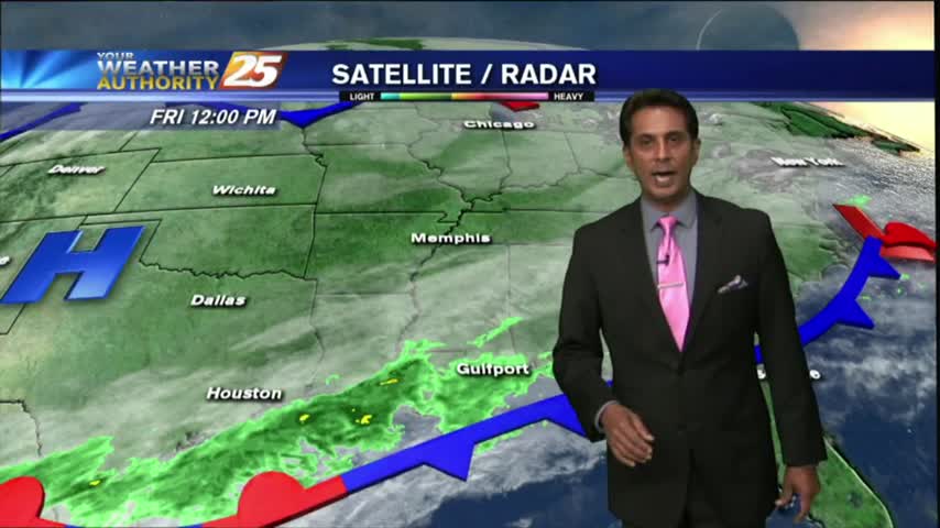
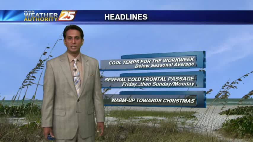
After a FRIGID start to the final Friday of the year, temperatures continue to warm under mostly clear skies...
Another COLD start to the day for the final Friday of the year...BUT, it is rain-free under mostly clear skies.

It's another cold and cloudy start to the day with light/spotty rain moving across the viewing area...
Light rain continues to move across the viewing area, under cloudy skies and cold conditions...
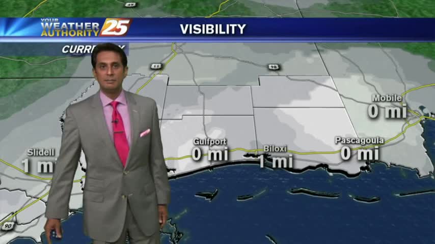
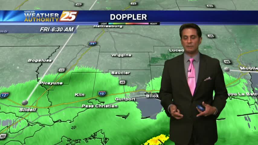
A disruptive start to the day with areas of patchy fog and light rain moving across the viewing area/region...
Gray/gloomy conditions continue with more in the way of cloud coverage than rain, but it will come....
A VERY cold start to the day as clouds are increasing from the west as a warm front south of the area slowly moves east...
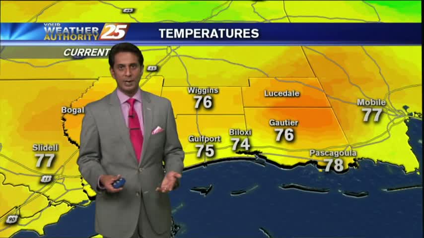
Fog is out of the area as temps continue to warm into the mid/upper 70s under partly/mostly cloudy skies...

After a fogy start, beautiful blue skies dominates the viewing area as temps continue to warm...
Clear skies overnight led to what is known as "Radiational Cooling", where temps dropped all the way to the dew-point. This has developed areas of PATCHY FOG...
Light rain lingers through the viewing area as the cold front overhead moves to the east and begins to become more of a stationary boundary...
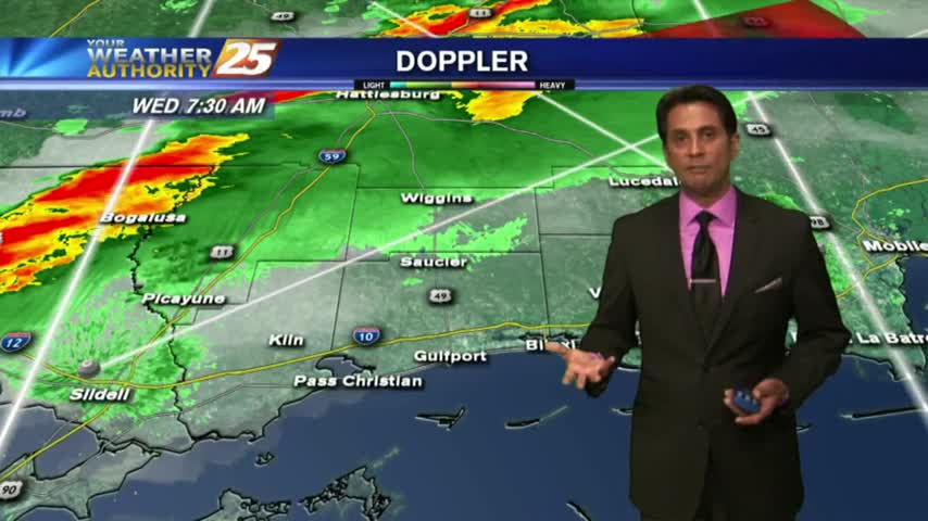
As a cold front approaches the area...the THREAT FOR SEVERITY continues...SLIGHT/MARGINAL...
FOGGY with T-STORMS moving into the area from the west with the associated cold front. The area is under a MARGINAL THREAT for SEVERITY...
A VERY WARM/HUMID start to the workweek with rain and DENSE FOG, along with an ADVISORY in effect through mid-morning...
Light rain continues to move across the area towards the NE, most of it not making it to the surface...
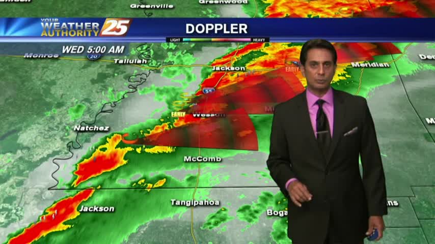
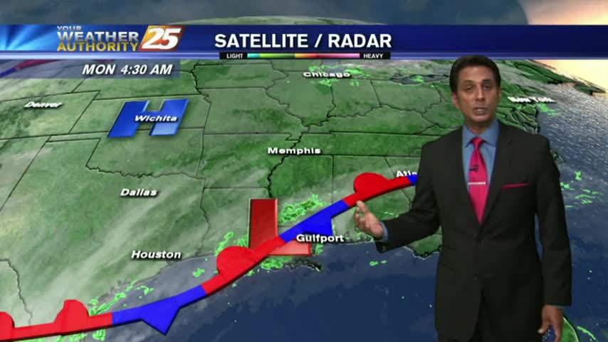
Warming temps continue to move into the region. A cold front is now to the south of the viewing area...with rainfall moving NE into south Mississippi..
A MUCH WARMER start this morning compared to the VERY FRIGID conditions just 24 hours ago...
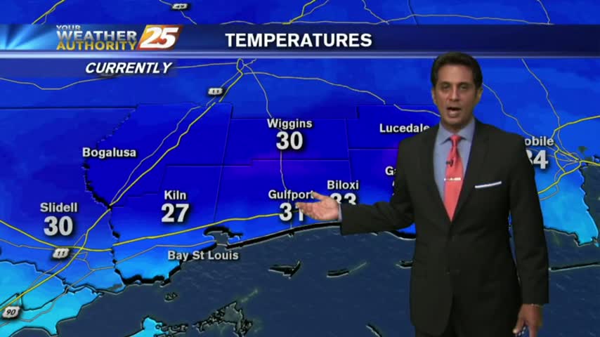
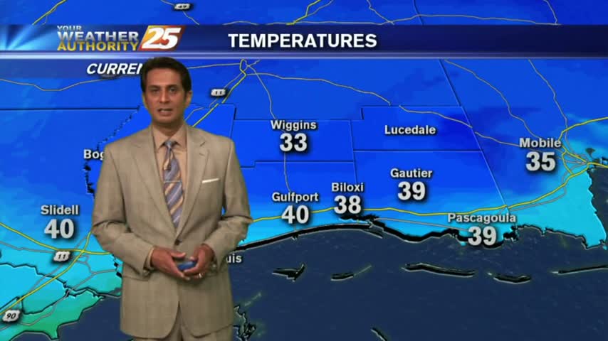
A VERY COLD start to the day with many locations below freezing, even in the mid/upper 20s...
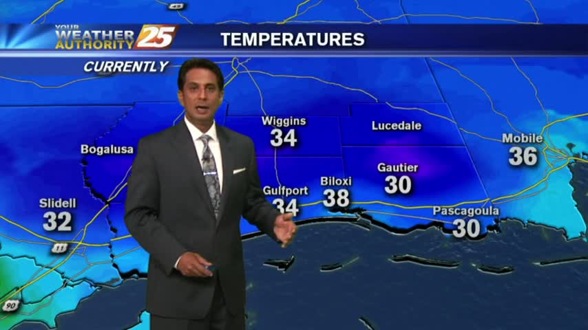
From yesterday morning with low temps in the low 30s...to the upper 40s this morning as a cold front is overhead moving SE...
Bundle up heading outside this morning, its' another VERY COLD start to the day with several locations below freezing...

After a very disruptive morning with WINTER WEATHER in the area, the activity continues...