11/16 Ryan's "More Seasonal" Monday Night Forecast
Last week looked beautiful, but was warmer and more humid than normal, which this week corrects!
Last week looked beautiful, but was warmer and more humid than normal, which this week corrects!
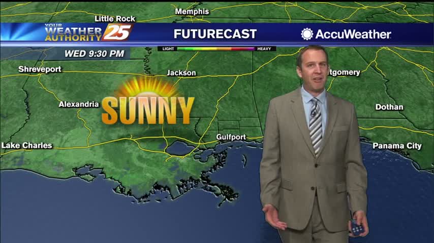
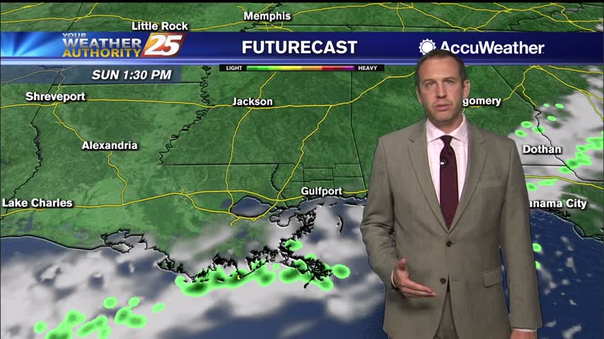
We're off to a nice start after a weak weekend front, and change will be slow to move in....
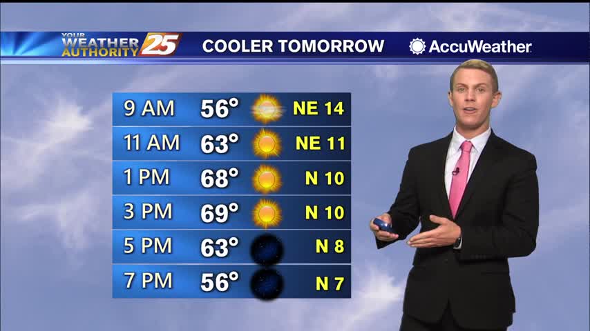
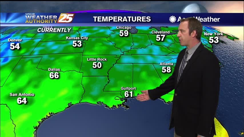
Highs will generally be in the upper 60s to the lower 70s through Wednesday as a re-enforcement of the Canadian dry air sweeps through Tuesday afternoon and evening. Lows the next couple of nights should easily reach the lower to…
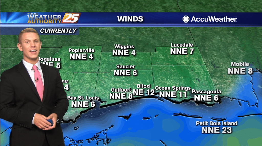
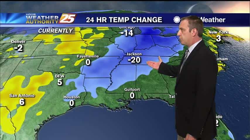
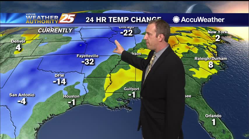
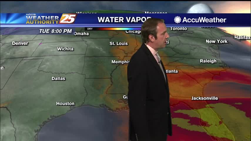
A cold front continues to push through the region along and near coastal waters with very dry continental air moving into the area. Lows the next couple of nights should easily reach the lower to mid 40s inland and the…
Cold front moved through yesterday, but we'll have already begun warming again by tomorrow....
Cold front moved through yesterday, but it won't really be chilly until much later tonight....
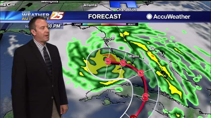
The National Hurricane Center says Tropical Storm Eta made landfall near Cedar Key on the West Coast of Florida at 3:00 AM. Northerly to northwesterly surface wind flow continues across our local area early this morning well to the west…
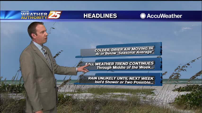
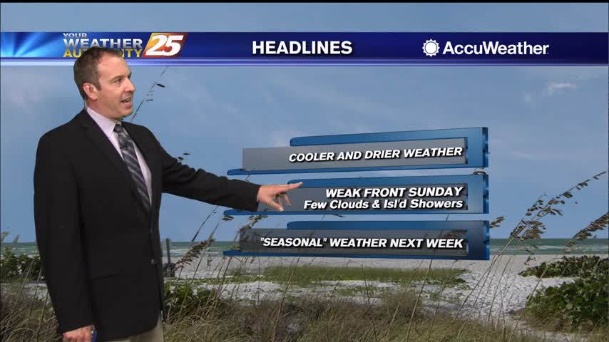
Not too different yet, but cooler and drier air is on the way in after today's cold front.
Downright swampy today with warmer temperatures and high humidity in place, but a cold front is bringing some changes....
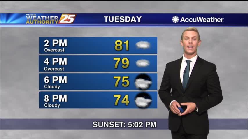
An approaching cold front will bring continued cloud coverage as well as a few morning showers then a few early afternoon t-storms. High temps should easily reach low 80s across the area with a few locations touching mid-80s. Not expecting…
Even warmer and more humid today with a few showers, but some drier air is moving in soon...just won't be all that much cooler.
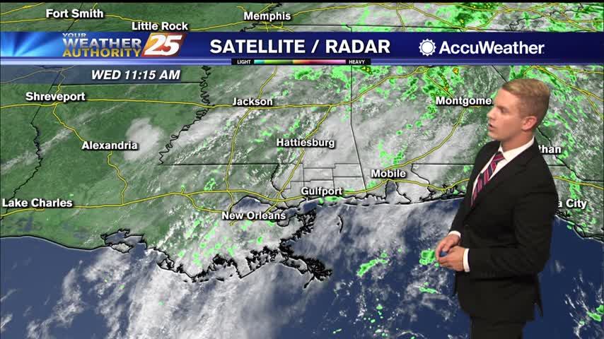
Overcast skies with light scattered showers will continue through the afternoon and early evening along the Gulf Coast. Temperatures are staying well above seasonal normals, with highs topping out in the lower 80s. Typically, this time of the year, high…
Still on the warm and humid side of things in South MS, something that won't change much this week....

Still on the warm and humid side compared to the seasonal average, but not too bad...especially as things cool down later this week.
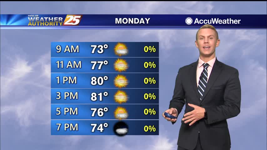
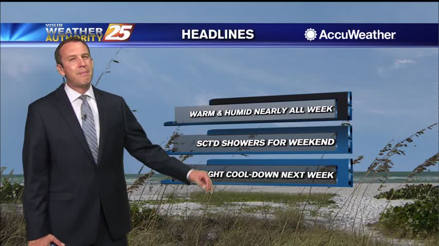
We start off the work week with warm temperatures here across the Gulf Coast. Highs today will be above normal once again, topping out in the lower 80s. Tonight should be rather warm as well with lows only getting down…
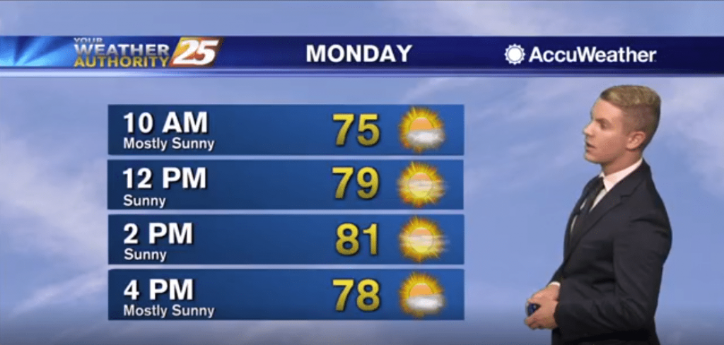
After a warm day, expect temperatures to be mild overnight with lows dropping to the lower 60s inland and mid 60s along the coast. Skies will be partly cloudy. Clouds will start to clear out early Monday morning. We start…
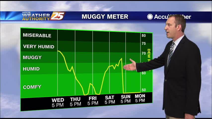
It has been warming each day since Tuesday afternoon, and things are much more humid as well.
The warming trend continues as the humidity also rises into the weekend.
Steadily getting warmer and more humid, with rain just around the corner....
Wednesday through Friday, high pressure will be building over the region. Conditions will be dry and cool. Easterly to northeasterly surface winds will help to push some moisture into the area, so expect humidity levels to rise gradually in the…
Finally seeing a shift in our clear and dry weather pattern, but it'll still take a few days before any dramatic changes.
It's steadily warming for the next few days, but the humidity remains low...for now.
Cooler, drier air remains, but we will continue to warm steadily through the week.
Cooling has stopped, so now warming can begin as we head into the rest of the week and the weekend.